|
FA2001.7:-
|
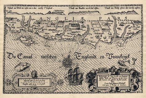
Chart, uncoloured engraving, Beschrijvinghe der Zee Custen van Engelandt
tuschen Wicht ende Doveren - Map of the Sea Coast of England between Wight and
Dover, scale about 1 to 470000, 7 or 8 miles to 1 inch, engraved by Johannes van
Doetecum, 1583, published in Die Spieghel der Zeevaeri - the Mariners Mirror, by
Lucas Janszoon Waghenaer, Enchuisen, Netherlands, 1584.
|
|
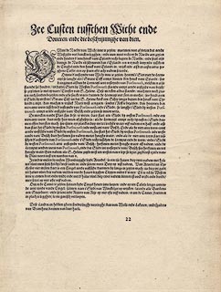
This example of the chart has descriptive text in Dutch on the reverse. Notice
that the scale lines are dutch and spanish miles; Spain ruled part of the
Netherlands at this time though the Dutch were attempting to found an
independent Holland, and that the Spanish Armada was in 1588.
|
|
The Hampshire places on the chart include Lemton - Lymington, Hampton -
Southampton, and Porsmout - Portsmouth.
|
|
map feature:-
|
not coloured & title cartouche & strapwork cartouche & compass rose
(and rhumb lines) & up is N (about NNW by N) & scale line (spanish and
dutch miles) & sea waves & sea monsters & ships & depth
soundings & sandbanks & anchorages & coast appearance & rivers
& settlements (along the coast) |
|
inscription:- |
printed -on- title cartouche
Beschrijvinghe der Zee Custen van Engelandt / tuschen Wicht ende Doveren,
met die princi: / pale havenen ende gedaenten des selu~e Landts. / Doer / Lucas
Jansz Wagenaer va~ Enchuijse~. / Cum gratia et Privilegio as decennium.
|
|
inscription:- |
printed -on- lower left
Io~es a Doetecu~
|
|
dimension:- |
wxh, sheet = 53x39.5cm |
|
wxh, map = 505x321mm |
|
scale = 1 to 470000 ? (crude estimate using the positions of Portsmouth and
Dover) |
 |
|

|
Map Group -- Waghenaer 1583 -- with Research Notes
|
 |
|
|
town names:-
|
|
Portchester
|
Hampshire
|
|
map name
|
modern name
|
|
Portchester
|
Fareham
|
|
Lemton
|
Lymington
|
|
Portsmout
|
Portsmouth
|
|
Hampton
|
Southampton
|
|
 |
|

| top of page |
| MN: 4.10.2001 |


