 |
more images |
|
FA2001.8:-
|
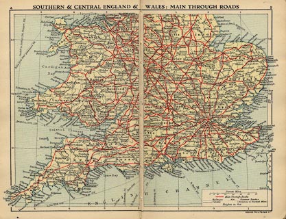
Road book, road maps, Philips' Road Atlas-Guide to Great Britain, map scale
about 1 to 630000, 10 miles to 1 inch, published by George Philip and Son, The
London Geographical Institute, 32 Fleet Street, London, 1920s-30s.
|
|
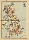
The road book has an index map to the road map sheets, a general map of Great
Britain in 3 sheets, and 25 double page road maps for England, Scotland and
Wales, plus 2 street maps of London; there is a gazetteer of places of tourist
interest for each double page of road map, with a small location sketch map,
giving place name, county, map page and square, population, short description,
early closing and market days.
|
|
Hampshire is mapped on pages 14/15 and 16/17; the gazetteers for these map pages
are on pp.70-74 and 74-79.
|
|
map feature:-
|
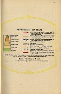
colour printed & sea tinted & index grid (A..,1.., on each page) &
up is N & scale line (on header sheet) & table of symbols (on header
sheet) & rivers & relief & layer colouring & county &
settlements & roads (graded by colour, with Ministry of Transport numbers on
A roads) & road distances (ticks at 2 mile intervals on roads) &
railways |
|
inscription:- |
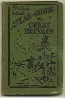
printed -on- cover
Philips' / ROAD / ATLAS-GUIDE / TO / GREAT BRITAIN / GEORGE PHILIP & SON,
LTD. / 32, FLEET STREET, E.C.4.
-- black on green; road sign and view of a village street |
|
inscription:- |
printed -on- title page
PHILIPS' / ROAD ATLAS-GUIDE / TO / GREAT BRITAIN / Edited by / GEORGE
PHILIP, F.R.G.S. / 64 PAGES OF COLOURED ROAD MAPS / Together with / A GAZETTEER
OF 92 PAGES CONTAINING / INFORMATION OF INTEREST TO TOURISTS, / MOTORISTS,
CYCLISTS AND SPORTSMEN, / SPECIALLY PREPARED BY E. T. BROWN. / GEORGE PHILIP &
SON, Ltd. / The London Geographical Institute, 32 Fleet Street, E.C. / Philip,
Son & Nephew, Ltd., 20 Church Street, Liverpool / All rights reserved / PRINTED
IN GREAT BRITAIN BY GEORGE PHILIP AND SON, LIMITED, LONDON
|
|
dimension:- |
wxh, book = 12.5x18.5cm |
|
scale = 1 to 630000 ? (nominal) |
 |
|

|
Map Group -- Philip 1920s
|
 |
|
|



|
 |
|

| top of page |
| MN: 23.2.2001 |


