|
FA2001.92:-
|
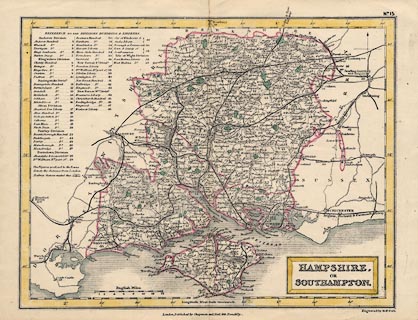
Map, hand coloured engraving, Hampshire or Southampton, and the Isle of
Wight, scale about 8 miles to 1 inch, engraved by Sidney Hall, 1830s, published
by Chapman and Hall, Piccadilly, London, about 1870s.
|
|
A version of the 1831 map with added railways.
|
|
The railways shown are - Andover and Redbridge Railway, Basingstoke and
Salisbury Railway, Berkshire and Hampshire Railway, Bishops Waltham Railway,
Bishopstoke to Gosport branch railway, Chichester to Portsmouth branch railway,
Eastleigh to Salisbury branch railway, Fareham to Cosham branch railway, Hayling
Railway, London and Southampton Railway, Lymington Railway, Mid Hants Railway,
Petersfield Railway, Portsmouth Railway, Reading, Guildford and Reigate Railway,
Ringwood, Christchurch and Bournemouth Railway, Salisbury and Dorset Junction
Railway, Southampton and Dorchester Railway, and the Stokes Bay Railway and
Pier.
|
|
map feature:-
|
hand coloured (county boundary and parks only) & coast shaded & county
& hundreds & scale line & lat and long scales & north point
& settlements & roads & railways & distances from London &
relief & hill hachuring & parks & table of hundreds & title
cartouche |
|
inscription:- |
printed -on- title cartouche
HAMPSHIRE, / OR / SOUTHAMPTON.
|
|
inscription:- |
printed -on- bottom
London, Published by Chapman and Hall, 193 Piccadilly.
|
|
scale line:-
|
14 miles = 43.7 mm |
|
dimension:- |
scale = 1 to 520000 ? (1 to 515579 from scale line assuming modern mile) |
|
longitude, Winchester = 1d 21.5m W (approx) |
 |
|

|
Map Group -- Hall 1833 -- with Research Notes
|
 |
|

| top of page |
| MN: 4.10.2001 |


