|
FA2001.186.1:-
|
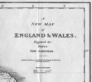
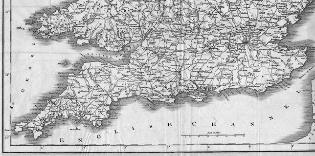
Map, uncoloured engraving, A New Map of England and Wales, scale about 21
miles to 1 inch, engraved for Potts' New Gazetteer, published for Scatcherd and
Letterman, Ave Maria Lane, London, 1809.
|
|
map feature:-
|
not coloured & up is N & scale line & lat and long scales &
coast shaded & rivers & county & settlements & roads |
|
inscription:- |
printed -on- title
A / NEW MAP / of / ENGLAND & WALES, / Engraved for / POTTS' / NEW GAZETTEER.
/ Published Novr. 1st. 1809 ...
|
|
scale line:-
|
70 miles = 86.0 mm |
|
dimension:- |
wxh, sheet = 47x57.5cm |
|
scale = 1 to 1300000 ? (1 to 1309931 from scale line assuming modern mile) |
|
longitude, Winchester = 1d 12m W (approx) |
 |
|

|
Map Group -- Potts 1809 -- with Research Notes
|
 |
|
|
town names:-
|
|
Hampshire
|
Hampshire
|
|
map name
|
modern name
|
|
Alton
|
Alton
|
|
Andover
|
Andover
|
|
Basingstoke
|
Basingstoke
|
|
Bishops Waltham
|
Bishops Waltham
|
|
Christ Church
|
Christchurch
|
|
Fareham
|
Fareham
|
|
Fordingbridge
|
Fordingbridge
|
|
Gosport
|
Gosport
|
|
Havant
|
Havant
|
|
Kingsclere
|
Kingsclere
|
|
Lymington
|
Lymington
|
|
New Alresford
|
Alresford
|
|
Odiham
|
Odiham
|
|
Petersfield
|
Petersfield
|
|
Portsmouth
|
Portsmouth
|
|
Ringwood
|
Ringwood
|
|
Romsey
|
Romsey
|
|
Southampton
|
Southampton
|
|
Stockbridge
|
Stockbridge
|
|
Whitchurch
|
Whitchurch
|
|
Winchester
|
Winchester
|
|
 |
|

| top of page |
| MN: 5.8.2002 |


