|
FA2002.30:-
|
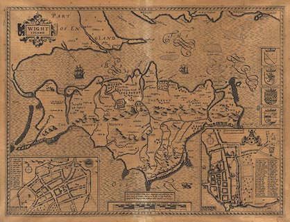
Map, uncoloured engraving, Wight Island ie Isle of Wight, scale about 1.5
miles to 1 inch, with inset town plans of Newport, Isle of Wight and
Southampton, Hampshire, by William White and John Speed, London, about 1611.
|
|
Published in the Theatre of the Empire of Great Britain, 1611.
|
|
map feature:-
|
not coloured & title cartouche & strapwork cartouche & labelled
borders (in English) & up is N & scale line & coat of arms &
inset map (town plans) & sea moire effect & sea monsters & ships
& coast shaded & sandbanks & coastal defence & castles &
rivers & bridges & relief & hillocks & mills & windmills
& beacons & woods & forests & parks & county &
settlements |
|
inscription:- |
printed -on- title cartouche, upper right
WIGHT / ISLAND
|
|
inscription:- |
printed -on-
Described by Wiliam White Gent. Augmented and published by John / Speed
Citizen of London. And are to be solde in Popes head alley / against the
Exchange by John Sudbury and G. Humbell Cum Privelegio.
|
|
scale line:-
|
7 miles = 134.6 mm |
|
dimension:- |
wxh, plate = 517x389mm |
|
wxh, map = 512x384mm |
 |
|

|
Map Group -- Speed 1611 -- with Research Notes
|
 |
|

| top of page |
| MN: 22.10.2002 |


