|
B1990.1123.2:-
|
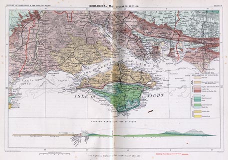
Geological map, Geological Map - Southern Section, Hampshire, scale about 4
miles to 1 inch, by John G Bartholomew, Edinburgh Geographical Institute,
Edinburgh, Lothian, for The Victoria County History, 1899.
|
|
Published in the Victoria County History of the Counties of England, Hampshire
and the Isle of Wigth, volume 1.
|
|
map feature:-
|
colour printed & up is N & scale line & lat and long scales &
lat and long grid & sea plain & depth contours & sandbanks &
foreshore & rivers & woods & forests & parks & county &
settlements & roads & railways & canals & geology & table of
strata & geological section |
|
inscription:- |
printed -on- top
HISTORY OF HAMPSHIRE & THE ISLE OF WIGHT / GEOLOGICAL MAP - SOUTHERN SECTION
/ PLATE II.
|
|
inscription:- |
printed -on- bottom
The Edinburgh Geographical Institute / THE VICTORIA COUNTY HISTORY OF THE
COUNTIES OF ENGLAND / J. G. Bartholomew
|
|
scale line:-
|
8 miles = 50.0 mm |
|
dimension:- |
wxh, sheet = 38x26.5cm (approx) |
|
wxh, map = 365x238mm |
|
scale = 1 to 260000 ? (1 to 257495 from scale line assuming modern mile) |
 |
|

|
Map Group -- VCH 1899
|
 |
|

| top of page |
| MN: 4.12.2002 |


