|
FA2002.511:-
|
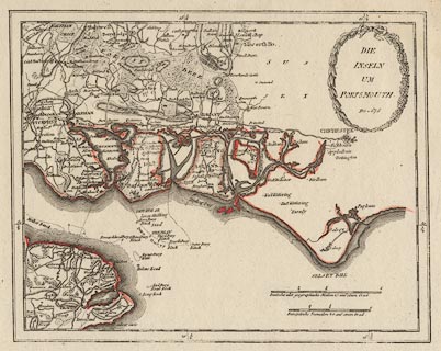
Chart, hand coloured engraving, Die Inseln um Portsmouth, The Islands at
Portsmouth, Hampshire, scale about 2 miles to 1 inch, or 2 inches to 1 league,
by Franz Johann Joseph von Reilly, Germany, about 1789?
|
|
map feature:-
|
hand coloured & title cartouche & up is N & lat and long scales
& scale lines & sea plain & sandbanks & buoys & coast form
lines & harbours & castles & fortifications & rivers &
relief & hill hachuring & forests & trees & parks & county
& settlements & roads |
|
inscription:- |
printed -on- title cartouche
DIE / INSELN / UM / PORTSMOUTH / Nro = 678
|
|
scale line:-
|
1 mile (league) = 50.8 mm |
|
dimension:- |
wxh, sheet = 37.5x28.5cm |
|
wxh, plate = 287x230mm |
|
wxh, map = 261x207mm |
|
scale = 1 to 110000 ? (1 to 109440 from scale line) |
 |
|

|
Map Group -- von Reilly c1789 -- with Research Notes
|
 |
|

| top of page |
| MN: 13.12.2002 |


