|
FA2002.512:-
|
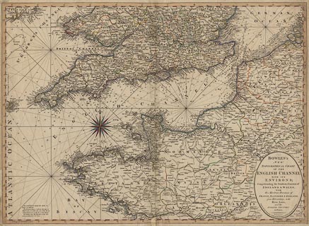
Cart, hand coloured engraving, New Topographical Chart of the English
Channel, scale about 19 statute miles to 1 inch, by Carrington Bowles, 69 St
Pauls Churchyard, London, 1780.
|
|
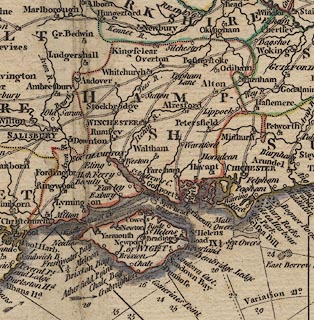
The chart includes the coasts and inland topography of southern England and
Wales from Cardigan Bay to Orfordness; Scilly Isles; a tiny bit of Ireland;
northern France from Nantes; Flanders, and part of Zeeland, Netherlands.
|
|
map feature:-
|
title cartouche & oval cartouche & compass rose & magnetic variation
& up is N & rhumb lines & lat and long scales & sea plain &
depth soundings & tides & sandbanks & coast shaded (and tinted)
& harbours & rivers & country & county & settlements &
roads |
|
inscription:- |
printed -on- title cartouche, lower right
BOWLES'S / NEW / TOPOGRAPHICAL CHART / OF THE / ENGLISH CHANNEL / WITH IT'S
/ ENVIRONS; / Comprehending the Southern Counties of / ENGLAND & WALES, / WITH /
The Maritime Provinces of / FRANCE, FLANDERS, & ZEELAND, / from Helveotsluys, to
the / River Loire, / and the INLAND COUNTRY to PARIS. / LONDON: / Printed for
the Proprietor CARINGTON BOWLES, No.69 in St. Pauls Church Yard.
|
|
inscription:- |
printed -on- lower right
Published as the Act directs, 2 Mar. 1780.
|
|
dimension:- |
wxh, sheet = 70x51.5cm |
|
wxh, map = 685x496mm |
|
scale = 1 to 1200000 ? (1 to 1208747 from 3d lat = 276.1 mm) |
 |
|

|
Map Group -- Bowles 1780 -- with Research Notes
|
 |
|

| top of page |
| MN: 23.11.2002 |


