 Map Group BOWLES 1773


The map studied is in a private collection.
These notes have a strong bias towards Hampshire interest.


map maker

Printed upper left is:-
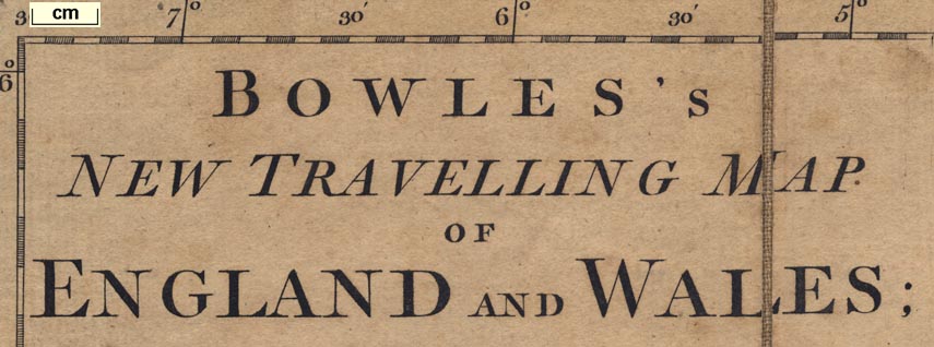
BOWLES'S NEW TRAVELLING MAP OF ENGLAND AND WALES; Exhibiting all the DIRECT, AND PRINCIPAL CROSS ROADS; with the Distances from Town to Town according to the Mile stones, and other exact Admensurations. Printed for CARINGTON BOWLES, No.69 in St. Pauls Church Yard, LONDON.Printed at the bottom border is:-
Published as the Act directs, 2 Jany. 1773.
up is N
25 miles to 1 inch

Printed in the map borders are scales of latitude and longitude for a trapezoid projection; chequered at 5 minute intervals, labelled at 30 minute intervals.

Looking closely at the engraved degree marks for latitude, left and right, they appear slanted. It is possible to imagine that a conical projection is being suggested. As there is no graticule it is not easy to test this.
The map includes from about 2d E to 7d W, 49d 45m to 56d 0m N; England and Wales with part of southern Scotland, and the east coast of Ireland, with routes marked. There is also a tiny corner of France.
The prime meridian runs through central London, perhaps, only guessing, St Paul's Cathedral. The bottom longitude scale is labelled:-
Long. East from London.
Long. West from London.
sea plain
sandbanks
lighthouses
ENGLISH CHANNELA few sandbanks are drawn by a dotted outline, and might be labelled, eg:-

Goodwin SandsA lighthouse might be shown, eg:-

Eddistone / Light Housea tower on its rock.
coast form lines
headlands
harbours

The coast line is emphasized by form lines. Some headlands are labelled, eg:-
St. Albans Hd.
Spit Hd.
Selsey BillHampshire's harbours are not labelled, but can be recognised.
castles

Colshet Cas.of Hampshire's several coastal defence castles is noticed by the map.

The county boundary is a dotted line. County areas are labelled, eg:-
HAMP / SHIREThe detached part of Hampshire in Sussex is not noticed.

WINCHESTER

Alton
Alresf.Except:-
SOUTHAMPTONin italic block caps.

Lippock
Sutton [Sutton Scotney]
road distances

Roads are drawn by a double line. Road distances from town to town are marked along the routes. At this scale only major routes are shown.
A MAP of the NAVIGABLE CANALS now making in ENGLAND.These are listed as:-
His Grace the Duke of Bridgewater's
From the Trent to the Mersey
From the Trent to the Severn
Droitwich Canal
Birmingham Canal
Coventry Canal
Oxford Canal


Alton
Andover
Basingstoke
Waltham
Christ Ch.
Farham
Fordingbridge
Gosport
Havant
Kingsclear
Lymington
Alresf.
Odiam
Petersfield
Portsmouth
Ringwood
Rumsey
Southampton
Stockbridge
Whitchurch
Winchester


from London; through Bagshot, Surrey; then Blackwater, Hertley Row, Basingstoke, Whitchurch, Andover, Hampshire; then the Hutt [Lopcopmb Corner] and Salisbury, Wiltshire; and west to Lands End.
branch from Andover, Hampshire; through Ambresbury, Wiltshire; and west.
branch from Basingstoke, through Sutton [Scotney], Stockbridge, Hampshire; then Downton, Wiltshire; across a corner of Hampshire; Cranborn, and on to Pool, Dorset.
branch from Stockbridge, Hampshire to join the Lands End road at the Hutt [Lopcomb Corner], Wiltshire.
branch from Blackwater, Hampshire; through Swallowfield, Berkshire; to Kingsclear, Hampshire.
branch from Bagshot, Surrey; across a corner of Hampshire; through Farnham, Surrey; then Alton, Alresf., to Southampton, Hampshire; AND from Southampton, through Rumsey, Hampshire; to Salisbury, Wiltshire, and west.
branch from Alresf. through Winchester, to Southampton, Hampshire.
branch from Winchester, through Rumsey and Ringwood, Hampshire; to Pool, Dorset; AND from Pool, Dorset; to Christchurch and Lymington, Hampshire.
from London; through Godalming, Surrey; them Lippock, Petersfield, Harnden, Cosham, to Portsmouth, Hampshire.
branch off the Lippock-Petersfield road; through Rogate to Midhurst, Sussex.
from Winchester, through Waltham, Cosham, and Havant, Hampshire; to Chichester, Sussex, and beyond.
from Winchester, to Petersfield Hampshire.
from Oxford, Oxfordshire; through Newbury, Berkshire; then Kingsclear, Basingstoke, Alton, Petersfield, Hampshire; to Chichester, Sussex.


