 Map Group DOWER 1838


HAMPSHIRE: ITS PAST AND PRESENT CONDITION AND FUTURE PROSPECTS; BY ROBERT MUDIE, ESQ. AUTHOR OF 'THE BRITISH NATURALIST,' 'FEATHERED TRIBES OF THE BRITISH ISLANDS,' 'MAN,' 'THE FOUR SEASONS,' 'THE FOUR ELEMENTS,' 'ASTRONOMY,' ETC. ETC. WITH MANY ILLUSTRATIONS ON STEEL AND WOOD. VOL. II. ... WINCHESTER: PUBLISHED FOR THE PROPRIETOR, JAMES ROBBINS, COLLEGE STREET BY D. E. GILMOUR, HIGH STREET. LONDON: ORR AND CO., PATERNOSTER ROW.


map maker
engraver
publisher

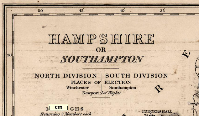
HAMPSHIRE OR SOUTHAMPTONPrinted at the bottom is:-
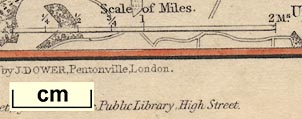
Drawn and Engraved for 'MUDIE'S HISTORY OF HAMPSHIRE,' by I. DOWER, Pentonville, London. Winchester: Published for the proprietor, Jas. Robbins, College Street, by D. E. Gilmour, Public Library, High Street.
up is N
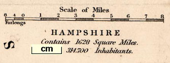
scale
population
area

Scale of Miles8 miles = 46.7mm gives a scale 1 to 275691 assuming a statute mile, ie the map scale is about:-
1 to 280000
4 miles to 1 inch

Printed in the map borders are scales of latitude and longitude for a rectangular projection; chequered at 1 minute intervals, labelled at 5 minute intervals. The bottom scale is labelled:-
Longitude West from GreenwichThe scales are chequered at 1 minute intervals, labelled at 5 minute intervals. The bottom scale is labelled:-
Longitude West from GreenwichCrude calculations from the positions of the scale marks show that the ratio of latitude to longitude scales is about 1.57. This is equal within errors to the value 1.585 correct for the latitude of Hampshire (51 degrees N) to give a 'square' plot. The meridians are vertical, the parallels are horizontal on the page. The graticule is rectangular.
lat and long measurements
The map includes from 0d 42m to 1d 53m W, from 50d 31m to 51d 23m N; the whole of Hampshire with the Christchurch area of Dorset, and the Isle of Wight.
HAMPSHIRE Contains 1628 Square Miles, 314700 inhabitants.
Boundary of Boroughs [dashed line]
Division of the County [dash dot dot dot line]
[Boundary of] County [dash x line]
Boundary of Division [dash small dot line](The word 'division' means more than one thing.)
Boundary of Hundreds [fine dotted line]

There is also an explanation:-
The Figures to the Towns shew the distance from London in Miles. those along the Roads from Town to Town.
sea shaded
ENGLISH CHANNEL
SPITHEAD
SOUTHAMPTON WATER
harbours
headlands
lighthouses

The coast line is plain.
Besides clearly drawn estuaries some harbours are explicitly labelled, eg:-
Key Haven
PORTSMOUTH HARBOURSome headlands are noticed, eg:-
Stans Ore Point
Gillkicker Pt.On Hurst Spit there is labelled:-
Lightand another on Tennyson Down above the Needles on the Isle of Wight.
castles
fortifications

Hurst Castle
Calshot Castle
Netley Castle
South Sea CastleAnd artillery style fortifications are drawn around the Royal Naval Dockyard, Portsmouth and Gosport:-

bridges
ponds

River Enborne
R. Stour
Lymington R.
Anton or Test RiverBridges are fairly clearly indicated where roads cross and interupt streams. A bridge might be labelled, eg:-
Timsbury Br.
Rumbridge

Post BrThe last is Ports Bridge. I think the 2 rivers ought to have shading between them ie they are 1 broader river.
Ponds might be drawn as an outline, perhaps labelled, eg:-

Fleet Pondwith the railway engraved over it. Alresford Pond is shown but not labelled.
hill hachuring

Longstock Hill
Catherington Down
Tower Hillthe last W of Over Wallop.
At least one 'pass' is noticed and labelled:-
Hampshire Gapbetween Quarley Hill and the hills W of Over Wallop.
Popham Beacon
Beacon Hill F.the second is a farm north of Exton.
forests
trees
NEW FOREST
Forest of Berethe second being East Bere Forest.
A tree might be labelled, eg:-

Royal Oaksouth west of Fritham.

Rotherfield ParkHackwood Park is larger and contains ?tree symbols. Some parks have a dot for a house.

The county boundary is a dash x line. Adjacent counties are separated by boundary lines, and labelled, eg:-
SUSSEXThe detached part of Hampshire, North to South Ambersham, is drawn and labelled:-
PART OF HAMPSHIRE
distances from London
town

WINCHESTER / 62

ALTON / 49
FAREHAM / 74The figures are the distance from London.

Lower Wallop
Sherfield English
East Dean
farms

Middle Wallop
Upr SombournQuite a number of farms are marked in this way, besides other features.
distances from start
distances from London

Roads are drawn by double lines; more important roads light bold, smaller roads narrower light light. Many roads are shown.
Road distances are given along some routes, for example from Winchester, marked every two miles, 2, 4, 6 etc, towards Basingstoke. This is presumably an indication that this route is slightly more important?

In 1838 there no railway had been completed in Hampshire, but the London and Southampton Railway, later the London and South Western railway, LSWR, was being built. Its Act passed in 1834, so its route was known and is shown on this map by a double line with cross bars. It is labelled:-
Southampton and London RailroadAlthough the branch to Gosport was known in 1838 it is not suggested.
In places the railway looks as of it is added, it is engraved over other features, elsewhere a label is fitted to the line of rail, suggesting the label came after the railway.

Canals are drawn by a curvy triple line, light bold light, perhaps labelled. The following canals are noticed:-
Basingstoke Canalthe tunnel labelled:-
Tunnel
Andover C.
Southampton Canal
Salisbury and Southampton Ca.
Arundel Canal
Canal
Spire wellE of East Tytherley

Race Cou.also labelled is:-
Stockbridge Race Gr.


Printed in spare space upper left is basic electoral data:-
NORTH DIVISION | SOUTH DIVISION
PLACES OF ELECTION
Winchester | Southampton
Newport (I. of Wight)
BOROUGHS Returning 2 Members each
Andover Lymington Portsmouth Southampton Winchester Newport (I. of Wight)
1. Member each
Christchurch Petersfieldand a list of polling places.
Printed lower left and lower right are tables:-
REFERENCE TO THE DIVISIONS.and:-
HUNDREDS AND LIBERTIES as Settled at the Easter Sessions 1834.
These tables build a concordance between the 13 electoral divisions and the hundreds, liberties, boroughs. Areas are keyed to the map by number. An electoral area might be made up of hundreds, or part hundreds, or liberties, towns, etc. For example:-
Romsey Division
Thorngate L. 1/2 H. ... 26
Kings Sombourne Do. ... 27
Redbridge Hundred ... 28, 29, 30
Romsey Town ... 31L. 1/2 H. means Lower half Hundred.


| B1990.1692 | book, not in map collection | not included |
| FA1999.97 | county map (uncoloured) | scanned |
| B1990.1132.1 | county map (coloured) | scanned |
| B1990.1692 (in book) | environs of Portsmouth | not scanned |
| FA1999.144 | environs of Andover | scanned |
| FA1999.145 | environs of Christchurch | scanned |
| FA1999.146 | environs of Southampton | scanned |
| FA1999.158 | environs of Petersfield | scanned |
| FA1999.159 | environs of Winchester | scanned |


