 Map Group HALL 1820


'The proprietor has availed himself of the talents of Mr. Sidney Hall to project a series of correct maps, ...'
The map size is: wxh, sheet = 9x14cm; wxh, map = 73x121mm.


plain cartouche
map maker
engraver
publisher

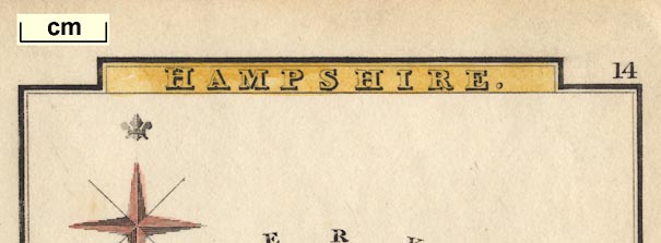
HAMPSHIRE.Printed at the bottom, left and right:-
Pub. by S. Leigh, 18, Strand / Sidy. Hall. sculpt.
compass rose
up is N

Printed upper left is a compass rose; tinted red or pink, no circle, star points for the cardinal directions, lines for the half cardinal, North marked by a fleur de lys. The map is printed with North at the top of the page.
scale

Printed lower centre is a scale line of:-
English Mileschequered in miles to 5 miles, then 5 then at 10 miles intervals, labelled at 5, 10, 20, 30. The 30 miles = 40.3 mm gives a scale 1 to 1198023; the map scale is about:-
1 to 120000
19 miles to 1 inch
sea shaded
coast shaded
harbours

The coast line is shaded more densely for emphasis, and tinted blue. The shading is continued into harbour areas; Southampton Water, Portsmouth Harbour, and Langstone Harbour, can be recognised, but are not labelled.
bridges

Auborn R.
Avon R.Some bridges are labelled on the road network, eg:-

Red Br.
Ford Br. [Chandlersford?]
Cadnam Br.These do not all have a stream to cross.
New Forest
Bere Forest [East Bere Forest]

Hackwood Pk.
New Park [New Forest]
Chawton Park

The county boundary is a dotted line. The whole county area is tinted yellow - makes for a gaudy map. The boundary is tinted with a different colour for each adjacent county, which is labelled:-
DORSET [green]
WILTS [red/pink]continuing with Berkshire green, Surrey bold yellow, and Sussex pink. The juxtaposition of yellow and yellow was not necessary.
A few places outwith the county are shown for continuity of roads.
electoral data
distances from London

Winchester 65 [2 stars]

Andover 63 [2 stars]
Alton 47Except:-
SOUTHAMPTON 77 [2 stars]marked by a group of blocks; labelled in upright block caps.

Mid Wallop
Bordean
The number with the place name is its distance from London.

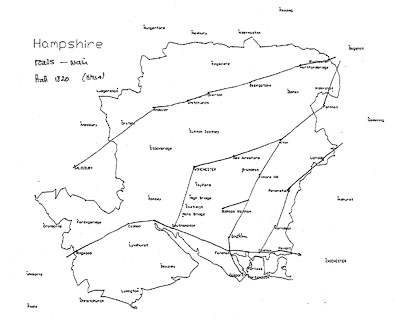
A network of roads is shown by double or single lines, for main or lesser roads. The main roads are:-
[London to Lands End] from Surrey, probably Bagshot; through Blackwater, Hartford Br., Basingstoke, Overton, Whitchurch, Andover, Mid Wallop, Hampshire; to Salisbury, Wiltshire and westward.
[London to Southampton Road] from Surrey, probably Bagshot; across a corner of Hampshire; through Farnham, Surrey; then Alton, Chawton, Alresford, Winchester to Southampton, Hampshire.
from Southampton across Red Br. then Cadnam and Ringwood, Hampshire; into Dorset, probably to Poole.
from Southampton through Bursledon, Titchfield, Fareham, Cosham, and Havant, Hampshire; into Sussex 'To Chichester'.
branch from Chawton on the London to Southampton Road, through Wickham and Fareham, to Gosport, Hampshire.
short branch from the London to Gosport Road, to Bishops Waltham, Hampshire.
[London to Portsmouth Road] from Surrey, probably Godalming; through Liphook, Petersfield, Horn Dean, and Cosham, to Portsmouth, Hampshire.Mostly the road destinations outwith the county are not given, but see:-
To Chichesteron the road from Southampton. Other road are extended to Farnham, Salisbury, Newbury ...


Canals are shown by a bold curvy line, but are not labelled. It is possible to recognise the Andover Canal and Basingstoke Canal.

Anchor Inn [between Chawton and Alresford]
George Inn [N of West Meon]
Raven Inn [between Hartford Bridge and Basingstoke]
Hart Inn [between Hartford Bridge and Basingstoke]


Published in 'Leigh's New Atlas of England & Wales. Sy. Hall sculpt. London Published by Samuel Leigh, 18, Strand. With Leigh's New Pocket Road-Book of England, Wales, and part of Scotland ... London: Printed for Samuel Leigh, 18, Strand, 1825.'
Published in 2nd edition 1826, 3rd edition 1831
Published in 4th edition 1833, 'Published by M. A. Leigh, 421 Strand'
Published in 5th edition 1835
Published in 6th edition 1837, no longer with Hall's name on plate.
Published in 7th edition 1839, 8th edition 1840
Published in 9th edition 'Leigh's New Pocket Atlas of England and Wales. New Edition. London: G. Biggs. Successor to Leigh & Son, 421, Strand, ...' 1842.


