 Map Group -- LLOYD 1573


The map covers England and Wales, with the Isle of Man. Parts of Scotland and Ireland are shown in outline with a few places.
The map size is wxh, folded sheet = 27.5x43cm, wxh, map = 470x361mm. Mostly, only Hampshire is considered, ignoring the rest of the map.
The reverse of the map has descriptive text in Latin:-
ANGLIA.
ALBONIS insulae pars Meridionalior, quam vulgus Latinum & exteri fere omnes Angliam vocant, ...There does not appear to be anything particularly relevant to Hampshire in the short text.


The map has a border engraved to look like wooden picture framing.
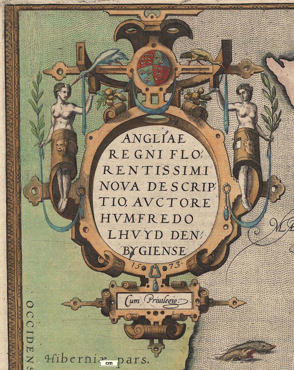
strapwork cartouche

Printed upper left is a strapwork cartouche supported by naked goddesses, decorated with a few fruits and birds. The title is:-
ANGLIAE REGNI FLORENTISSIMI NOVA DESCRIPTIO, AUCTORE HUMFREDO LHUYD DENBYGIENSIS 1573 Cum Privilegio
labelled borders
up is N

The map is printed with north at the top. The four map borders are labelled:-
Septentrio.short for Septentriones,
Oriens.
Meridies.
Occidens.North, East, South, West.
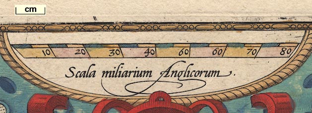
scale

Scala miliarum Anglicorumwith 80 miles, chequered at 5 mile intervals, labelled at 10 miles intervals. The length of the scale line is uncertain, the ends are slanted!
To calculate the scale from the scale line would need the size of the "milarium Anglicorum". The reference book about Ortelius's maps gives the scale as 1 to 1150000.
An estimate from considering the position of a few major towns, gives a map scale about:-
1 to 1500000
24 miles to 1 inch
sea pecked
ships
sea monsters

The sea is engraved with a pecked pattern

and is decorated with ships - carracks, and a few monstrous fish. Sea areas are labelled, eg:-
OCEANUS BRITANNICUSFor the English Channel.
coast shaded

The coast is shaded for emphasis.

River Avon (labelled 'Avon Flu.')
River Stour
River Bourne (near Shipton Bellinger)
River Test
River Dever
River Itchen
Candover Stream
River Hamble
River Meon
Wallington River
River Rother (labelled 'Arun Fl.')
River Wey (northern)
River Hart
River Enborneetc
hillocks

The map has hillocks to indicate relief, but none in Hampshire.
forests

Tree symbols in groups indicate forests. The only one in Hampshire is:-
Newe forest


Settlements are positioned by a dot and circle. Each has a tower or towers, but these bear little or no relation to the importance of the place; Winchester has one tower, Wherwell has two. All places are labelled in italic lowercase text.
Places in Hampshire and the part of Dorset which was Hampshire are:-
Alton
Andover
Beauley
Calshot [Calshot Castle]
Cheringthon [Catherington]
Christeschurch
Dipdon [Dibden]
Elyng
Falley [Fawley]
Faranc [Fareham]
Fordy~gbridg
Hallyng
Havant
Herfordbridg
Kyngscler
Lenyngton
Mean [West Meon]
Milton
Mychelden [Micheldever]
Netley
Newton [Newtown]
Odyham
Overton
Peterfeld
Ringwod
Rumsay
Scepley [Sopley]
Soburn [Kings Somborne]
South hampton
Southwik
Tichfeld
Upham
Waltham [Bishops Waltham]
Wherwell
Whytchurch
Wikam
Wynchester


