 Map Group ROCQUE 1746


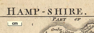
The map title is printed across the top:-
HAMP-SHIRE.
compass rose

The map has a compass rose, upper left, with star points for the cardinal and half cardinal directions. North is marked by a fleur de lys.
scale

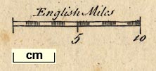
English MilesSix miles chequered at one mile intervals. 6 miles = 24.6 mm, assuming a modern mile this gives a scale 1 to 392522. The map scale is about:-
1 to 390000
6 miles to 1 inch
sea plain
sandbanks
ENGLISH CHANNELThe sea area from the mouth of the Test to the sea is:-
Hampton WaterAlso see
Spit HeadThe foreshore mud or sand flats and some sandbanks are shown by a dotted outline, some labelled, eg:-
Brambles
Middle
coast shaded
headlands
harbours
islands

The coast line is emphasised by shading which extends into harbours and up river estuaries.
Some headlands are labelled, eg:-
Hengistbury Head
Stanes Ore Point
Rams HeadHarbours are not labelled.
As well as the three large islands, Portsea, Hayling, Thorney, a few smaller islands are drawn in Portsmouth and Langstone Harbours.
coastal defence
Hurst cast.
Calshol Cast
Netly C.
St. And [C.]
South Sea Castle
bridges

Rivers are drawn by wiggly lines tapering inland from their estuary. They are mostly unnamed, but see:-
Avon R.The major river systems in the county are drawn, main streams and tributaries, as can be fitted in at this scale.
Bridges are mostly implied where a road crosses a river, and interupts its course. A couple of bridges are drawn more explicitly by a segment of road, ie a double line, detached from the more important road system, as at Boulder - connecting a hamlet circle either side of the Lymington River, and at Redbridge - joining Redbridge to Totton to Eling over the River Test etc.
hillocks

Downes
forests

Woodland is shown by groups of tree symbols, some labelled, eg:-
The New Forest
Bere Forest / East Bere For
Alisholt Forest
Wulmer For
Pamber For
Buckholt For.
Chuteham Forest
New Parkin the New Forest, which, like Marwell Park, lacks its fence palings. This 'error' is copied from an earlier map.
A park might be named by an included settlement or house, eg:-

Dogmersfield

The county boundary is a dotted line emphasised by horizontal shading. Contiguous conties are labelled, eg:-
WILT SHIRE
PART OF DORSET SH.A little is drawn in the surrounding counties, Salisbury, Chichester, Farnham, Downton and some rivers and parts of roads.
The boundaries between the outside counties are not drawn except a dotted line between Surrey and West Sussex. The detached part of Hampshire in West Sussex is not included.

Hundred boundaries, dotted lines, are drawn on the map but the hundreds are neither labelled by name or by any key to a table. (I think they are hundred boundaries.)

WINCHESTER

Alesford
RingwoodThe size of the text is sometimes reduced to fit the name in a space on the map. Thus 'Farnham', a mispelling of Fareham, is quite small text tho' the symbol is clearly for a town.
larger towns have two towers (Winchester has three), eg:-
SouthamptonAnd towns returning members to Parliament have stars showing the number of representatives; for instance Southampton has 2 stars, as has Winchester, etc.

Exton
W.WordelamVillages are not differentiated from hamlets.
There are some nice spelling mistakes - I'm assuming they are errors - like Middlemarsh for Michelmersh where the word shape is the same suggesting an engraver's or copyist's best attempt to read a poor manuscript. Other different spellings are not so easily explained away.
road distances

The map has a system of roads drawn by double lines connecting places. Mostly the lines are solid, but dotted lines are used, presumably to show an unfenced road, for example across Woolmer Forest on the road from London to Portsmouth. A solid/dotted road runs from Petersfield to beyond Bramdean.
All Ogilby's routes are included, plus a few others.
There are some detached pieces of road; see described under bridges, above, and from the Hampshire border to Chichester in West Sussex. Roads are extended beyond the county boundary to show their destination or onward route. For example the road through Farnham, and the roads to Downton. Other roads outside Hampshire might be labelled, eg:-

to Pool
to Salisbury
to BagshotThese labels are added to the map upside down on the left (west) side - suggesting copying from Moll's version of Morden's small county map of about 1708.
Occasionally there are figures printed across a segment of road, the distance from one settlement to another. For example a
7half way between Horndean and Cosham. The engraving of the numbers is confused by the road lines underneath. It is not always obvous what endpoints are meant for the distance. A lot of segments have no distance.
Iron Mines

Salt Works
alum works
Boscomb Copperas H.
Allom H.marking the place of either mines or works for these chemicals.


Published in 'The English Traveller: Giving A Description Of those Parts of Great-Britain Called England and Wales. Containing I. A particular Survey, both Geographical and Historical of every County in the Same. II. An Ample and Accurate Account of all the Cities, Borough,s, market-Towns, Villages, Rivers, Royal-Palaces, Noblemen's and Gentlemen's Seats. III. The Fairs, Trade, Commerce, and Product of each County; of the Rarities both natural and artificial; of the eminent persons born, or who have resided in them, and of the extraordinary Events that have happened in the same. IV. A Map of every County, from the best and latest Observations; wherein are marked the Number of measured Miles, and the usual Roads from one Post-Town to another, after the designs of Herman Moll. V. Of the Isles of Wight, Mana, Jersey, Guernsey, and other British Isles, with the Maps of the same. Vol.[ ] London: Printed for T. Read, in Dogwell Court, White-Fryars, Fleet-street. MDCCXLVI.' ie 1746.
Published in 'The Small British Atlas: Being a new Set of Maps of all the Counties of England and Wales: to which is added a general Map, with Tables of Length, Breadth, Area, Cities, Boroughs and Parishes in each County. Likewise a Parliamentary map of England, with Tables of the Produce of the Land-Tax. A Scheme of the Proportion the several Counties paid to the three Shilling Aid, 1699, compared with the Number of Members they send to Parliament. Publish'd according to Act of Parliament, by John Rocque, Chorographer to His Royal Highness the Prince of Wales, near Old Round Court in the Strand.' and on the facing title page 'Le Petit Atlas Britannique: Ou receuil des Provinces d'Angleterre & de la principaute de Galles ... Publie par Jean Rocque, Chorographe de son Altesse Roiale Monseigneur le Prince de Galles, dans le Strand, a Londres.' about 1753.
Published in another edition 'The Small British Atlas ... London Published according to Act of Parliamt. 1753. By John Rocque ... near Old Round Court in the Strand.' and a title page in French 'Le Petit Atlas Britannique ...'.
Published in another edition 'The Small British Atlas ... London Published according to Act of Parliamt. 1753. By John Rocque ... near Old Round Court in the Strand, and Robert Sayer, Map and Printseller, at the Golden buck, opposite Fetter Lane, Fleet-Street.' and a title page in French.
Published in 'The Small British Atlas ... Published according to Act of Parliamt. By John Rocque ... near Old Round Court in the Strand 1762.'
Published in 'The Small British Atlas ... Published according to Act of Parliamt. By John Rocque ... near Old Round Court in the Strand 1764.'
Published in 'England Displayed. Being a New, Complete, and Accurate Survey and Description of the Kingdom of England, and Principality of Wales. Containing, I. A full and ample Account of whatever is remarkable in every County, City, Town, Village, hamlet, and Parish in England and Wales. II. Description of the various Manufactures and other useful Arts established in different Parts of this Kingdom. III. Accounts of the Nature and Produce of the various Kinds of Land, with a complete History of the modern Improvements in Agriculture, Gardening, &c. IV. An historical Account of all the Forts, Castles, Roman Military Ways, Docks, Harbours, Creeks, Bays, &c. with the Particulars of their ancient and present State. V. A full Description of all the natural and artificial Curiosities of this Kingdom; such as Rocks, Mines, Caverns, Lakes, Grottos, Fossils, Minerals, Abbeys, Cathedrals, Churches, Palaces, and the Seats of the Nobility and Gentry. VI. A faithfull Narrative of all Improvements made in the Roads, Rivers, and canals of this Kingdom. for the Convenience of Travelling, and the Benefit of Inland Navigation. The whole forming such an accurate and comprehensive Account of this Country, as has never yet been published, and will be equally entertaining and instructive. By a Society of Gentlemen: Each of whom has undertaken that Part for which his Study and Inclination has more immediately qualified him. The Particulars respecting England, revised, corrected, and improved, By P. Russell, Esq.; and those relating to Wales, By Mr. Owen Price. ... London: Printed for the Authors, by Adlard and Browne, Fleet-Street: And sold by S. Bladon, No.28. T. Evans, No.54, and J. Coote, No.16, in Pater-noster Row; W. Domville, and F. Blythe, at the Royal Exchange. MDCCLXIX.' ie 1769.


