 Map Group WYLD 1839


Included on the map is a section showing elevation and gradients.
The map size is: wxh, sheet = 54x17.5cm; wxh, map = 514x151mm.
The guide book size is 9.5x15cm.


map maker

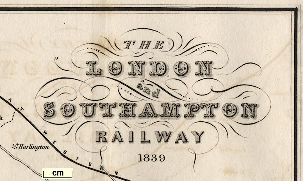
THE LONDON and SOUTHAMPTON RAILWAY 1839and bottom centre:-
Published by Jas. Wyld Geographer to the Queen Charing Cross East.
north point
up is NW

Printed upper left is a north point, N-S line, E-W line, North marked by a spear point. To accommodate the railway, running west from London, to beyond Basingstoke, then turning south south west, the map is printed as a wide strip with north west at the top of the sheet.
scale

SCALE OF MILESchequered and labelled in miles. The 6 miles = 37.5 mm gives a scale 1 to 256810. The map scale is about:-
1 to 260000
4 miles to 1 inch
coast form lines
foreshore

There isn't much coast on the map, just a bit at Southampton. The coast line is emphasised by form lines. The foreshore is indicated, with its own form lines.
bridges
ponds

The estuary of the River Itchen is drawn with form lines and foreshore, as the coast. The River Thames at London is a broad river with from lines. Inland, rivers are drawn by a wiggly line, tapering upstream. The ?only river labelled is:-
RIVER THAMESThe rivers shown in Hampshire include the River Itchen, River Dever, Candover Stream, Rivers Loddon and Lyde, River Hart, River Wey, Blackwater, and many tributaries. Quite detailed braiding is shown, for example at Winchester on the Itchen.
Bridges are implied where a road crosses and interrupts a river. Some are labelled, eg:-

High Br.Ponds are shown in outline with form lines, eg:-

Fleet Pondswhich are crossed by the railway.
gradient diagrams
Worthy Down
Kilmeston Down
Battersea RiseAlong the bottom of the sheet there is a gradient diagram:-
SECTION OF THE LONDON AND SOUTHAMPTON RAILWAYThe horizontal scale is marked in miles, labelled at 5 miles intervals. From 0 at:-
LONDONon the right, to 76 3/4 at:-

SOUTHAMPTON / 1 in 1985 / Level / 1.440 / 1.400 / ...on the left. At the left end is a:-
Vertical Scale / Feetlabelled at 100 ft intervals from 0 to 400 ft. At the bottom is:-
Datum 100 feet below Trinity High Water LondonI am not clear why this is chosen. Along the diagram each section of line is drawn with its slope labelled, eg:-
1 in 250
Level
1/250some of the figures crammed into a very short length. The steepest gradient seems to be a short length of 1 in 150 at about 70 1/2 miles from London. Position ed as it is it is easy to follow the ups and downs of the line on the map: BUT beware, the railway on the map and the gradient diagram do not match position exactly from right to left.
vegetation
trees

Wooded areas are indicated by tree symbols, and might be labelled, eg:-
Butter Wood
Hook Wood
Bramley CopseCommon land, rough vegetation is shown by rows of dots, perhaps labelled, eg:-
Common
Eversley Com.
Abbotstone Down
Peat Moor [near Fleet]These are all enclosed.

Hackwood Pa.
Bramshill Pa.
Rose Hill Pa.
ParkSome of the areas might not be parks, or even old emparked areas. The parks might include other feature, for example:-
Windsor Great Parkhas an area of trees, rides or roads, Virginia Water lake, a Temple and a Statue.

County boundaries are a dash dot line. County areas are labelled, eg:-
HAMPSHIRE
Part of Wilts [2 detached parts]The railway starts in London, crosses Middlesex and Surrey, into Hampshire.
street map

WINCHESTER

Basingstoke
Alton

Chawton
RopleyOther features are also labelled in this style.
turnpike roads

Roads are drawn by double line, solid or dotted for fenced or unfenced. Larger roads are drawn broader with one line bold; smaller roads are drawn narrower. A comprehensive road network is shown either side of the railway.
At least one turnpike gate is noticed:-

T.P.at a junction on the Hursley road just west of Winchester.
bridges
Basingstoke CanalThe tunnel at Greywell is drawn by a dotted triple line, labelled:-

TunnelCanal bridges are shown both road bridges and accommodation bridges.
A section of the Wey Navigation is drawn as a canal, but not all, so that the canal system seems to be detached from the River Thames.
Near Romsey a section of the Andover Canal is drawn. The Itchen Navigation is not noticed.

STATIONThe route is, as well as I can read:-
from a London terminus at Nine Elms; stations at Wandsworth, Wimbledon, Surbiton, Ditton for Esher, Walton, Brookland [for Weybridge], and Woking, Surrey; then Farnborough, Shapley Heath for Hook, Basingstoke, Micheldever, Winchester, junction but no station at Bishopstoke, to Southampton and Southampton Docks stations, Hampshire.The line from Bishopstoke to wards Gosport is drawn, labelled:-
branch to GosportOne other railway is shown leaving London, the:-
GREAT WESTERN RAILWAY

Race Coursemarked by a dotted double line in a long oval.

Telegraph

This is the Surrey Iron Railway; the first public railway ever, intended to be a route from London to Portsmouth, but never made it.

Dean Gate Innat Dean on the road west from Basingstoke, incidentally suggesting a turnpike gate? And:-
Red Lion Innon the road north from Basingstoke near Stratfield Turgis.
water mills

Andwell Mill
Preston Milleast of Basingstoke.
Matthews Castlein a bend of the canal.


WYLD'S SOUTH WESTERN / LONDON AND SOUTHAMPTON RAILWAY GUIDE / PORTSMOUTH, ISLE OF WIGHT, & THE CHANNEL ISLANDS
THE LONDON AND SOUTHAMPTON Railway Guide, CONTAINING A TOPOGRAPHICAL, ANTIQUARIAN, AND GEOLOGICAL ACCOUNT OF THE COUNTRY AND OF THE TOWNS AND VILLAGES WITHIN TEN MILES OF THE RAILWAY; WITH A GUIDE TO THE ENVIRONS OF SOUTHAMPTON, THE ISLES OF WIGHT, JERSEY, AND GUERNSEY, AND THE OPPOSITE COAST OF FRANCE.
LONDON: PUBLISHED BY JAMES WYLD, GEOGRAPHER TO THE QUEEN, CHARING CROSS EAST, FOUR DOORS FROM TRAFALGAR SQUARE 1839.
London and South Western Railway
To Cross the Channel


