
|
Research Notes
 Map Group INGLIS 1898
|
 |
|
Inglis 1898
|
|
|
|
|
Continuous Strip Maps, of roads including routes across Hampshire, by Harry R
G Inglis, published by Gall and Inglis, 25 Paternoster Square, London and 20
Bernard Terrace, Edinburgh, Lothian, from about 1898; published 1898-1909 at
least.
|
|
|
The Southampton and New Forest Road Map has been seen in photocopy. No other Continuous Strip Maps have been seen, the
information given here is from advertisements in the Contour Road Book
series published by Gall and Inglis. Items are in a private
collection.
|
| |
|
A typical cover has the title in a shield upper left, and a
cyclist on an early safety bicycle upper right. The text is black
on dark red.
|
| |
 |
THE SOUTHAMPTON AND NEW FOREST ROAD MAP |
 |
ROADS IN HAMPSHIRE |
 |
ADVERTISEMENT 1898 |
 |
ADVERTISEMENT 1899 |
 |
ADVERTISEMENT 1900 |
 |
ADVERTISEMENT 1908-09 |
 |
REFERENCES |

| top of page |
 |
|
| THE |
SOUTHAMPTON AND NEW FOREST ROAD MAP |
|
The text on the cover:-
STRIP MAP No.4 ... LONDON by WINCHESTER to SOUTHAMPTON and
BOURNEMOUTH / The Southampton & New Forest Road Map By H. R. G.
INGLIS. [With Measurements and descriptive Letterpress, and a
large scale Contour Plan of the Road, Scale Half an Inch to a
Mile. GALL & INGLIS. 25 Paternoster Square, London, E.C. And
Edinburgh.]
|
|
The title page reads:-
|
|
THE 'SOUTHAMPTON AND NEW FOREST ROAD' MAP A Map of the Road from
London to Southampton and Bournemouth, &c. Compiled by Harry R.
G. Inglis. With Description, Measurements, Objects of Interest,
&c., and a Large Scale 'Contour' Plan of the Road. / London: GALL
AND INGLIS, 25 PATERNOSTER SQUARE; AND EDINBURGH.
|
|
There is a retailer's label pasted on the title page:-
|
|
ALFRED DUNHILL, LTD. 'Dunhill's Motorities' Number Two, Conduit
St., W. Everything but the Motor.
|
|
The booklet has a page with an index of place names and their
distance in miles from London, and a triangular table of
distances, to accompany the map. The map is a continuous strip
about 1.5 m long, 14 cm wide. To accomodate gross changes in
direction of the road the map has some breaks. The scale is about
2 miles to 1 mile, and a strip about 8 miles wide is shown.
Parallel to the map is a gradient diagram of the route, vertical
scale about 35 feet to 1 cm. There is a general description of
the route:-
|
|
THE 'SOUTHAMPTON AND NEW FOREST ROAD' MAP. Compiled by Harry R.
G. Inglis. SCALE: HALF AN INCH TO A MILE.
|
|
Description.- Class I. The favourite road from London. The road
is paved as far as Wandsworth; after that the surface is fairly
good as far as Kingston, where it becomes bumpy as far as Ditton.
From Ditton right on to Guildford the road has magnificent
surface with every slight undulations. The hill out of Guildford
is steep at first - hardly dangerous - but after the first two
miles the surface is magnificent until cose to Farnham, where it
is bumpy, but immediately afterwards it improves, and is very
fine to Alresford. There are two raods from Alresford to
Winchester, the least hilly being by the Itchen valley, thus
avoiding the steep descent to Winchester on the other road. From
Winchester to southampton the surface is very good, but the road
is somewhat hilly. There is a much more level route by Eastleigh,
but the surface is often very loose, and it is not nearly so
pretty. The main road to Winchester and Southampton is by
Bagshot, but that road is very hilly, and the surface inferior to
this route.
|
|
After Southampton the road has a splendid surface throughout, as
a general rule, but very liable to be loose and flinty to
Christchurch, whence good, but apt to be bumpy on through
Bournemouth to Poole.
|
|
The road by Romsey and Ringwood to Poole, though shorter, is
steep and hilly between Winchester and Romsey.
|
|
Gradients.- At 8 3/4 m. 1 in 23; 10 3/4 m. 1 in 25; 11 1/4 m. 1
in 22; 21 3/4 m. 1 in 22; 30 1/4 m. 1 in 14; 30 3/4 m. 1 in 12-17
(dangerous); 37 1/2 & 52 m. 1 in 24; 52 3/4 & 54 3/4 m. 1 in 18;
63 1/4 1 in 21; 70 1/4 1 in 18; 70 3/4 m. 1in 21; 71 1/2 m. 1 in
22; 72 1/2 m. 1 in 20; 74 m. 1 in 18; 76 m. 1 in 17; 85 1/2 m. 1
in 20; 90 1/4 m. 1 in 17; 93 1/4 m. 1 in 18; 94 1/4 m. 1 in 17;
96 1/2 & 105 3/4 1 in 19; 107 m. 1 in 18; 112 m. 1 in 16.
|
|
Milestones.- Measured from Royal Exchange, London, to Farnham,
whence measured from London via Bagshot to Southampton,
thereafter from Southampton to Lyndhurst, after which measured
from High Street, Christchurch.
|
|
Principal Objects of Interest.- 10m., Ricjmond Park. Kingston:
Court House, King's Stone, Church. Esher: Sandown Park, Wolsey's
Well, Claremont. Cobham Street: Painshill Park. Ripley: Okham
Park, Newark Priory. GUIDLFORD: Castle, Guildhall, St. Mary's
Church, Abbott's Hospital. Splendid view from the 'Hogs Back.'
FANHAM: Castle, Moor Park, Waverley Abbey. Alresford: Tichborne
Park. WINCHESTER: Cathedral, College, Castle, Guildhall, Cross,
Westgate, Barracks. 38 3/4 m., St. Cross Hospital. Compton:
Church. SOUTHAMPTON: Holy Rood Church, Hartley Institute, All
Saints Church, Bar Gate, Town Walls, St. Denys Priory, Netley
Hospital and Abbey. Lyndhurst: Queen's House, Church.
CHRISTCHURCH: Abbey Church. BOURNELOUTH: Pier, Chines, Gardens,
&c. POOLE: Public Park. A charming road through the New Forest.
|
|
Hotels or Inns at places marked [asterisk], and at Bishops
Sutton, Itchen Abbas, Redbridge, Totton, Rumbridge, Lyndhurst
Road Station, Boscombe, and Parkstone.
|

| top of page |
 |
|
| ROADS IN |
HAMPSHIRE |
|
Advertised in The Contour Road Book of England, South East Division published by
Gall and Inglis, London and Edinburgh, Lothian, 1898. The advert is towards the
back of the volume headed by 'LIST OF Gall and Inglis' Cycling and Touring Maps
and Road Books 1898'. The advert includes one route which crosses
Hampshire:- |
|
'EXETER ROAD MAP, London to Salisbury and Exeter, 1/-' |
|
An advertisement in 1899 is a little confusing. It lists as 'new':- |
|
The 'Southampton Road' Map |
|
The 'Ripley Road' Map |
|
The 'Brighton Road' Map |
|
The last two being supplied together. Elsewhere the list includes only the
Exeter and Ripley roads across Hampshire. |
|
An advertisement in 1900 lists several routes crossing Hampshire:- |
|
No.3 London to Brighton, and London to Portsmouth |
|
No.4 The Southampton Road |
|
No.5 The Exeter Road |
|
The same maps are offered in 1909. |

| top of page |
 |
|
1898
|
ADVERTISEMENT |
|
The Contour Road Book of England, South East Division, 1898
has pages of advertising towards the back of the volume, header
page:-
|
|
LIST OF Gall and Inglis' Cycling and Touring Maps and Road Books
1898
|
|
The list includes a page offering:-
|
|
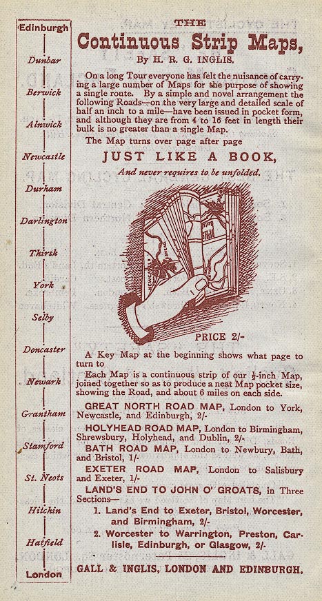
|
|
THE Continuous Strip Maps By H. R. G. INGLIS.
|
|
On a long journey everyone has felt the nuisance of carrying a
large number of Maps for the purpose of showing a single route.
By a simple and novel arrangement the following Roads - on the
very large and detailed scale of half an inch to a mile - have
been issued in pocket form, and although they are from 4 to 16
feet in length their bulk is no greater than a single Map.
|
|
The Map turns over page by page JUST LIKE A BOOK, and never
requires to be unfolded. PRICE 2/-
|
|
A Key Map at the beginning shows what page to turn to
|
|
Each Map is a continuous strip of our 1/2 inch Map. joined
together so as to produce a neat Map pocket size, showing the
Road, and about 6 miles on each side.
|
|
GREAT NORTH ROAD MAP, London to York, Newcastle, and Edinburgh,
2/-
|
|
HOLYHEAD ROAD MAP, London to Birmingham, Shrewsbury, Holyhead,
and Dublin, 2/-
|
|
BATH ROAD MAP, London to Newbury, Bath, and Bristol, 1/-
|
|
EXETER ROAD MAP, London to Salisbury and Exeter, 1/-
|
|
LAND'S END TO JOHN O' GROATS, in Three Sections -
|
|
1. Land's End to Exeter, Bristol, Worcester, and Birmingham, 2/-
|
|
2. Worcester to Warrington, Preston, Carlisle, Edinburgh, or
Glasgow, 2/-
|
|
GALL & INGLIS, LONDON AND EDINBURGH.
|
|
Part 3 of the John o' Groats route is not listed.
|

| top of page |
 |
|
| 1899 |
ADVERTISEMENT |
|
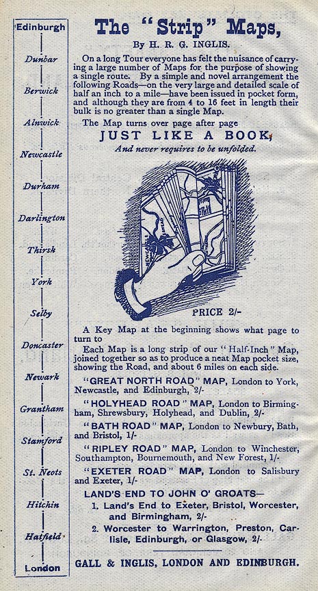
|
|
A similar advert appears in the road book for Scotland, 1899,
with the addition of:-
|
|
'RIPLEY ROAD' MAP, London to Winchester, Southampton,
Bournemouth, and New Forest, 1/-
|
|
Quote marks have appeared round each of the road names in the
list.
|

| top of page |
 |
|
| 1900 |
ADVERTISEMENT |
|
The header page for the advertising section has some
additional text instructing customers about ordering by
telegraph:-
|
|
Parties requiring to Telegraph for Maps and Road Books should
wire to 'Gall, Edinburgh.' It is only necessary to give the
telegraph name of the series, the name or number of the sheet,
and state whether on paper or cloth, thus:- 'Chaffinch, 36, 37,
42, 43, cloth.' For the road books the words 'Contour North,
India,' or 'Cheap,' is quite sufficient.
|
|
and this page also has a postal address:-
|
|
GALL & INGLIS, 25 Paternoster Sq., London, E.C.; & 20 Bernard
Ter., Edinburgh.
|
|
The continuous strip maps are now called just 'Strip'
Maps:-
|
|
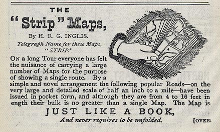
|
|
THE 'Strip' Maps, By H. R. G. INGLIS.
|
|
Telegraph Name for these Maps' 'STRIP.'
|
|
The introductory text is the same, then maps are listed:-
|
|
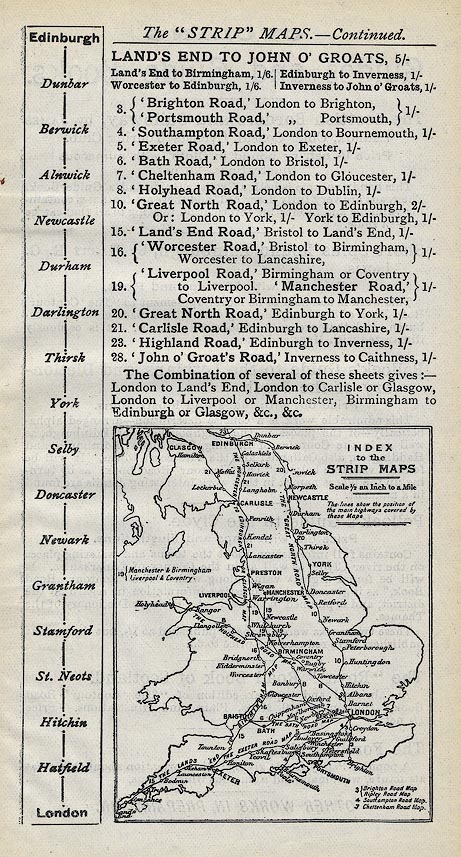
|
|
LAND'S END TO JOHN O' GROATS, 5/-
|
|
Land's End to Birmingham, 1/6. Worcester to Edinburgh, 1/6.
Edinburgh to Inverness, 1/-. Inverness to John o' Groats, 1/-.
|
|
3. 'Brighton Road,' London to Brighton, / 'Portsmouth Road,'
[ditto] Portsmouth, 1/-
|
|
4. 'Southampton Road,' London to Bournemouth, 1/-
|
|
5. 'Exeter Road,' London to exeter, 1/-
|
|
6. 'Bath Road,' London to Bristol, 1/-
|
|
7. 'Cheltenham Road,' London to Gloucester, 1/-
|
|
8. 'Holyhead Road,' London to Dublin, 1/-
|
|
10. 'Great North Road,' London to Edinburgh, 2/1 / Or: London to
York, 1/- York to Edinburgh, 1/-
|
|
15. 'Land's End Road,' Bristol to Land's End, 1/-
|
|
16. 'Worcester Road,' Bristol to Birmingham, Worcester to
Lancashire, 1/-
|
|
19. 'Liverpool Road,' Birmingham or Coventry to Liverpool.
'Manchester Road,' Coventry or Birmingham to Manchester, 1/-
|
|
20. 'Great North Road,' Edinburgh to York, 1/-
|
|
21. 'Carlisle Road,' Edinburgh to Lancashire, 1/-
|
|
23. 'Highland Road,' Edinburgh to Inverness, 1/-
|
|
28. 'John o' Groats Road,' Inverness to Caithness, 1/-
|
|
The combination of several of these sheets gives :- London to
Land's End, London to Carlisle or Glasgow, London to Liverpool or
Manchester, Birmingham to Edinburgh or Glasgow, &c., &c.
|
|
And the advert includes an index map to the sheets.
|

| top of page |
 |
|
| 1908-09 |
ADVERTISEMENT |
|
The 1908 edition of the road book advertises maps for 1909.
The header page has an extra warning for customers:-
|
|
Excepting from regular customers, no attention can be paid to
telegrams unless accompanied by telegraphic money order.
|
|
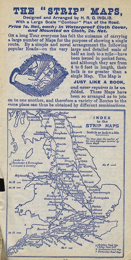
|
|
The advertisement introduction has been edited:-
|
|
THE 'STRIP' MAPS, Designed and Arranged by Harry R. G. INGLIS.
With a Large Scale 'Contour' Plan of the Road. Price 1s. Net,
each; in Waterproof Cloth Cover, and Mounted on Cloth, 2s. Net.
|
|
On a long Tour everyone has felt the nuisance of carrying a large
number of Maps for the purpose of showing a single route. By a
simple and novel arrangement the following popular Roads - on the
very large and detailed scale of half an inch to a mile - have
been issued in pocket form, and although they are from 4 to 8
feet in length their bulk is no greater than a single Map. The
Map is JUST LIKE A BOOK, and never requires to be unfolded. These
Maps have been so arranged as to join on to one another, and
therefore a variety of Routes to the same place can thus be
obtained by different combinations.
|
|
The index map is printed larger:-
|
|
and the maps are described in more detail:-
|
|
CONTENTS OF THE 'STRIP' MAPS.
|
|
No.3 - London to Brighton and Portsmouth gives in one Map the
roads to these two places, as well as the cross road from
Brighton to Portsmouth and Southampton, thus joining on to No.4
at the latter place.
|
|
No.4 - The Southampton Road gives two routes to Winchester, and
thence the two roads through the New Forest to Bournemouth (and
Weymouth), and on to Exeter by Dorchester and Bridport, joining
No.5.
|
|
No.5 The Exeter Road; London to Salisbury by Stockbridge or
Andover, on to Exeter and Torquay, by Yeovil or Sparkford,
joining No.6. The parallel road by Stonehenge is also shown.
|
|
The continuation to Land's End, etc., is shown in No.15.
|
|
No.6 - The Bath Road; London to Bath and Bristol, with the branch
routes to Weston-Super-Mare, Cheddar Cliffs, Wells, Taunton, and
Exeter, joining No.5.
|
|
The continuation to Land's End, etc., is shown in No.15.
|
|
No.7 - The Oxford Road; London to Oxford direct by Dashwood Hill,
or by Windsor; thence to Cheltenham, Gloucester or Malvern, with
the parallel route by Woodstock to Worcester and Malvern.
|
|
Map No.16 is joined at Gloucester or Worcester.
|
|
No.8 - The Liverpool and Manchester Road; London to Rugby,
Coventry, Birmingham, Lichfield, Chester, Liverpool, Manchester,
or Warrington, with the routes connecting Birmingham and
Wolverhampton with the same places.
|
|
The continuation to North Wales and Holyhead by Shrewsbury or
Chester is shown in Map No.18: to Preston, The Lakes, Carlisle,
and the North, is shown in No.21.
|
|
No.9 - The Midland Road; London to Northampton, Leicester (with
the route by Bedford), Derby, Nottingham, Matlock, Buxton,
Manchester; or Sheffield and Leeds, by Chatsworth or
Chesterfield. This Map gives a different road to Manchester from
No.8, and to Leeds and Nottingham from No.10. The branch road
from Birmingham to Derby being also shown, this Map makes the
through connection from the West of England to Sheffield and
Leeds, and joins the North Road as shown in No.20.
|
|
No.10 - The Great North Road, Part I; London to Peterborough,
Grantham, Doncaster, Leeds, Harrogate,or York, with the branches
to Bedford and Nottingham. This Map shows the Trunk Road and
Railway from London to the North, with its more important
branches. Map No.9 runs parallel with it, and shows the
alternative routes to Nottingham and Leeds. Nos.10 & 20 give the
East Coast Route to Edinburgh; Nos.8 & 21 give the West Coast
Route.
|
|
The continuation to Newcastle and Edinburgh is shown in No.20;
from Leeds to the English Lake District and Carlisle is shown on
No.21.
|
|
No.15 - The Land's End Road; This, the first section of the road
from Land's End to John o' Groats, gives the main road from
Bristol to Exeter, and thence the parallel routes to Land's End
via Plymouth, or via Okehampton and Launceston.
|
|
The continuations North are Nos.16, 21, 23, and 28.
|
|
No.16 - The Bristol to Lancashire Road covers a network of
routes: and provides for the connecting lines from Bristol to
Liverpool (by Shrewsbury or Worcester), Manchester or Birmingham:
and from Liverpool to Chester, Shrewsbury, Hereford and the Wye
Valley; or the Severn Valley by Bridgnorth to Gloucester or
Cheltenham.
|
|
The continuation Northwards is No.21. The continuation Southwards
to Exeter and Land's End is No.15.
|
|
No.18 - The North Wales Roads cover a network of routes, and give
the roads from Liverpool, Manchester, Coventry, Birmingham, etc.,
to Chester, Llangollen, Bangor, Carnarvon, Holyhead, Rhyl, and
Llandudno. No.8 adds the connection from London; No.16 from
Bristol; No.21 from Carlisle and the North; Nos.7 and 16 from
Oxford.
|
|
No.20 - The North Road, Part II.; Edinburgh to York is the
continuation of No.10 from London to Edinburgh. It gives the road
and railway from York to Newcastle, Alnwick, Berwick, and
Edinburgh, and also shows the more direct hill road by Jedburgh.
The West Coast Route to Edinburgh is shown by Nos.8 and 21.
|
|
The continuation North to Perth and Inverness is No.23.
|
|
The continuation South to London is No.10; to Sheffield, Derby,
and Birmingham is No.9.
|
|
No.21 - The Carlisle Road shows the road from Liverpool,
Warrington, Manchester, or Leeds, to the English Lakes and
Carlisle; thence to Dumfries, Glasgow, or Edinburgh. In addition
to the popular route through Windermere and Keswick, the main
highway by Penrith is also shown, and the two parallel routes to
edinburgh by Hawick or Moffat are given.
|
|
The continuation Northwards is No.23. The continuations
Southwards are - to London, Birmingham, Coventry, etc., No.8; to
Derby, etc., No.9; to Shrewsbury, Worcester, or Bristol, No.16;
to North Wales, No.18.
|
|
No.23 - The Highland Road; Edinburgh or Glasgow to Perth and
Inverness. Two routes from Edinburgh to Perth are given: the
Ferry routes by Queensferry or Burntisland, and the longer round
by Stirling. An inset strip also gives the connecting road from
the 'Carlisle' Road (No.21), direct to Stirling on the main route
from Land's End to John o' Groats.
|
|
The continuation Northward is No.28. The continuations Southward
are:- To Carlisle and the West Coast, or to Leeds, No.21;
Newcastle and the East Coast, No.20.
|
|
No.28 - The John o' Groats Road; Inverness to Caithness, via
Tain, Bonar Bridge, Helmsdale and Wick to John o' Groats, forming
the fifth section of the Map from Land's End to John o' Groats.
|

| top of page |
 |
|
| REFERENCES |
|
|
|
Inglis, Harry R G: 1898: Contour Road Book of England (South East Division):
Gall and Inglis (London and Edinburgh, Lothian) |
|
Inglis, Harry R G: 1899: Contour Road Book of Scotland: Gall and Inglis (London
and Edinburgh, Lothian) |
|
Inglis, Harry R G: 1900: Contour Road Book of England Western Division): Gall
and Inglis (London and Edinburgh, Lothian) |
|
Inglis, Harry R G: 1908: Contour Road Book of England: Gall and Inglis (London
and Edinburgh, Lothian) |

| top of page |
|
 |
All Old Hampshire Mapped Resources |

 Map Group INGLIS 1898


