|
private collection:-
|
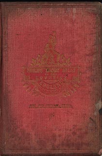
Atlas, Handy Atlas of the Counties, England, by George Philip and Son, 32
Fleet Street, London, new edition, 1886.
|
|
Includes maps of north and south Wales, Channel Islands, and the Isle of Man.
|
|
inscription:- |
embossed & printed -on- cover
PHILIP'S HANDY ATLAS / OF THE / COUNTIES / ENGLAND / NEW AND IMPROVED
EDITION / 5/-
-- gold on red; with Britannia, a shield with the Union Flag, acorns, etc |
|
dimension:- |
wxh = 13x19cm |
 |
|

|
Map Group -- Philip 1886 -- with Research Notes
|
 |
|

| top of page |
| MN: 16.12.2002 |


