|
private collection:-
|
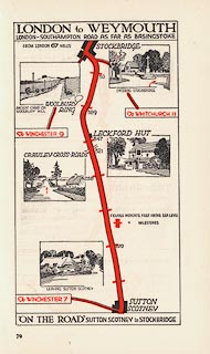
Strip map, colour printed road map p.79, London to Weymouth, scale about 1.5
to 2.5 miles to 1 inch, published for Dunlop in On the Road vol.2, by E J
Burrow, Cheltenham, Gloucestershire, 1920s?
|
|
p.79 London to Weymouth - from Sutton Scotney, to Stockbridge, Hampshire.
|
|
The strip map has vignette scenes with an arrow to show which way to go at
junctions, roads are marked with milestones, and altitudes.
|
|
map feature:-
|
title cartouche & vignettes & up is destination & rivers &
relief & hill hachuring & settlements & roads & road distances
& distances from London & altitudes |
|
inscription:- |
printed -on- title cartouche
LONDON to WEYMOUTH
|
|
dimension:- |
wxh, sheet = 11.5x18.5cm |
|
wxh, map = 83x155mm (roughly) |
|
scale = 1 to 100000 ? (variable) |
 |
|

|
Map Group -- Burrow 1920s -- with Research Notes
|
 |
|

| top of page |
| MN: 16.12.2002 |


