|
private collection:-
|
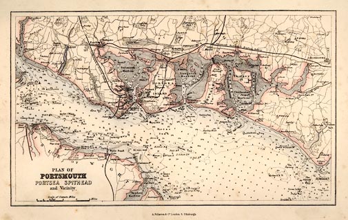
Map, partly coloured engraving, Plan of Portsmouth, Portsea, Spithead and
Vicinity, scale about 2.5 miles to 1 inch, from the Imperial Gazetteer, by
Archibald Fullarton and Co, London and Edinburgh, Lothian, about 1856.
|
|
map feature:-
|
up is N & scale line & sea plain & depth soundings & sandbanks
& buoys & lighthouses & foreshore & harbours & coastal
defence & castles & fortifications & rivers & bridges &
relief & hill hachuring & parks & settlements & roads &
railways |
|
inscription:- |
printed -on- title
PLAN OF / PORTSMOUTH / PORTSEA SPITHEAD / and Vicinity.
|
|
inscription:- |
printed -on- bottom
A. Fullarton & Co. London & Edinburgh.
|
|
scale line:-
|
4 miles = 37.9 mm |
|
dimension:- |
scale = 1 to 170000 ? (1 to 169714 from scale line assuming modern mile) |
 |
|

|
Map Group -- Fullarton 1856
|
 |
|

| top of page |
| MN: 16.1.2004 |


