|
more images |
|
private collection:-
|
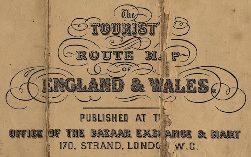
Road map, The Tourist Route Map of England and Wales, published by the Bazaar
Exchange and Mart Office, 170 Strand, London, about 1890.
|
|
map feature:-
|
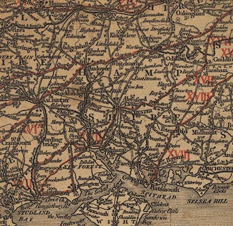
sectioned for folding & mounted & compass rose & up is N & scale
line & lat and long scales & sea shaded & coast shaded & rivers
& county & settlements & roads & turnpike roads & road
distances & distances from London & electoral data & railways &
canals |
|
inscription:- |
printed -on- title
The / TOURIST / ROUTE MAP OF / ENGLAND & WALES. / PUBLISHED AT THE OFFICE OF
THE BAZAAR EXCHANGE & MART / 170, STRAND, LONDO[N] W.C.
|
|
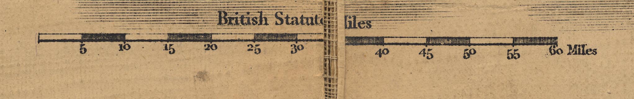
scale line:-
|
60 miles = 99 mm (roughly) |
|
dimension:- |
wxh, sheet = 64x76cm |
|
scale = 1 to 1000000 ? (estimates) |
 |
|

|
Map Group -- Bazaar 1890 -- with Research Notes
|
|
|
|

|
|
|

| top of page |
| MN: 16.12.2002 |