|
private collection:-
|
Road book, Survey of the High Roads of England and Wales, published by Edward
Mogg, 51 Charing Cross, London, 1816-17.
|
|
The maps are in pairs on each page numbered odd/even, for example 29/30, 31/32
etc, up to 163 which has a single map on the page, after that the pairs are
numbered even/odd, for example 164/165. This volume has an extra series of maps,
roads across Suffolk and Norfolk, which are numbered starting from 1 again.
|
|
The north part was never done.
|
|
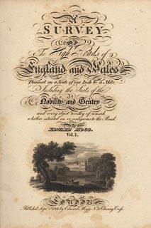
inscription:- |
printed -on- title page
A / SURVEY / OF / The High Roads of / England and Wales / Planned on a Scale
one Inch to a Mile. / Including the Seats of the / Nobility and Gentry / and
every object worthy of remark, / whether situated on or contiguous to the Road.
/ BY / EDWARD MOGG, / Vol.1. / LONDON / Published Septr. 1st. 1816 by Edward
Mogg, No.51 Charing Cross.
-- vignette scene of a park, with house, lake, etc |
|
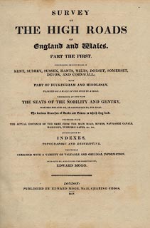
inscription:- |
printed -on- title page, second
SURVEY / OF / THE HIGH ROADS / OF / England and Wales. / PART THE FIRST. /
COMPRISING THE COUNTIES OF / KENT, SURREY, SUSSEX, HANTS, WILTS, DORSET,
SOMERSET, / DEVON, AND CORNWALL; / WITH / PART OF BUCKINGHAM AND MIDDLESEX. /
PLANNED ON A SCALE OF ONE INCH TO A MILE. / EXHIBITING AT ONE VIEW / THE SEATS
OF THE NOBILITY AND GENTRY, / WHETHER SITUATED ON, OR CONTIGUOUS TO, THE ROAD. /
The various Branches of Roads and Towns to which they lead. / TOGETHER WITH /
THE ACTUAL DISTANCE OF THE SAME FROM THE MAIN ROAD, RIVERS, NAVIGABLE CANALS, /
RAILWAYS, TURNPIKE GATES, &c. &c. / ACCOMPANIED BY / INDEXES, / TOPOGRAPHIC AND
DESCRIPTIVE. / THE WHOLE / ENRICHED WITH A VARIETY OF VALUABLE AND ORIGINAL
INFORMATION. / ARRANGED BY, AND UNDER THE DIRECTION OF, / EDWARD MOGG. / LONDON:
/ PUBLISHED BY EDWARD MOGG, No.51 CHARING CROSS. / 1817.
|
|
dimension:- |
wxh = 21x26cm |
 |
|

|
Map Group -- Mogg 1814 -- with Research Notes
|
 |
|

| top of page |
| MN: 25.8.2003 |


