|
private collection:-
|
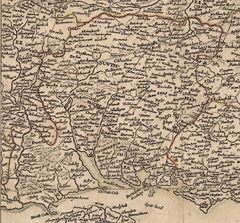
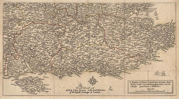
Map, hand coloured engraving, one sheet of Kingdome of England and
Principality of Wales, SE England, scale about 6 miles to 1 inch, engraved by
Wenceslaus Hollar, 1644, as published by John Garrett, by the Royall Exchange,
London, 1688.
|
|
Known as the Quartermaster Map. First published by Thomas Jenner, London, 1644,
during the Civil War.
|
|
map feature:-
|
title cartouche & plain cartouche & compass rose & up is N &
scale line & sea plain & coast line & rivers & relief &
hillocks & woods & forests & trees & county & settlements
& roads |
|
inscription:- |
printed -on- plain cartouche, lower right
A MAPPE OF KENT, SOUTHSEX, SURREY, MID: / dlesex, Barke and Southampton
Shire & the Ile / of Wight, part of Essex & Wiltshire etc.
|
|
inscription:- |
printed -on- lower middle
Printed Coloured and / Sold by John Garrett at the South Entrance / of the
Royall Exchange in London.
|
|
scale line:-
|
20 miles = 84.8 mm |
|
dimension:- |
wxh, sheet = 53x33.5cm |
|
wxh, map = 508x272mm |
 |
|

|
Map Group -- Hollar 1644 -- with Research Notes
|
 |
|
|
town names:-
|
|
Southampton Shire
|
Hampshire
|
|
map name
|
modern name
|
|
Aulton
|
Alton
|
|
Andover
|
Andover
|
|
Basingstoke
|
Basingstoke
|
|
Bishops Waltham
|
Bishops Waltham
|
|
Christ Church
|
Christchurch
|
|
Faram
|
Fareham
|
|
Forthingbridge
|
Fordingbridge
|
|
Gosport
|
Gosport
|
|
Havant
|
Havant
|
|
Kingesclere
|
Kingsclere
|
|
Lemington
|
Lymington
|
|
Alresford
|
Alresford
|
|
Odyam
|
Odiham
|
|
Petersfeld
|
Petersfield
|
|
Portesmouth
|
Portsmouth
|
|
Ringwood
|
Ringwood
|
|
Rumsey
|
Romsey
|
|
Southampton
|
Southampton
|
|
Stokebridge
|
Stockbridge
|
|
Whitchurch
|
Whitchurch
|
|
Winchester
|
Winchester
|
|
 |
|

| top of page |
| MN: 9.9.2003 |


