|
private collection:-
|
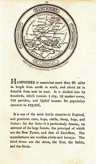
Map, uncoloured engraving, Hampshire, about 37 miles to 1 inch, plate 14 in
the New Pocket Atlas and Geography of England and Wales, published by John
Luffman, 28 Little Bell Alley, Coleman Street, London, 1803.
|
|
Below the map on the sheet is descriptive text, a basic geography of the county.
|
|
inscription:- |
printed -on- title cartouche
HAMPSHIRE.
|
|
inscription:- |
printed -on- bottom
Sold by J. Luffman, 28, Little Bell Alley, Coleman Street, London.
|
|
scale line:-
|
10 miles = 6.9 mm |
|
scale:-
|
1 to 2300000 (1 to 2332383 from scale line assuming a statute mile) |
|
dimension:- |
diam, map = 61mm |
 |
|

|
Map Group -- Luffman 1803 -- with Research Notes
|
 |
|

| top of page |
| MN: 21.5.2004 |


