|
private collection:-
|
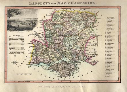
Map, hand coloured engraving, Langley's New Map of Hampshire, scale about 8.5
miles to 1 inch, published by Langley and Belch, 173 High Street, Borough,
London, 1817.
|
|
Upper left is a vignette scene of Portchester castle, with Portsmouth and
Gosport in the distance.
|
|
map feature:-
|
compass rose & scale line & lat and long scales & table of symbols
& sea plain & coast shaded & rivers & relief & hill
hachuring & parks & county & hundreds & settlements &
vignettes |
|
inscription:- |
printed -on- top
LANGLEY'S new MAP of HAMPSHIRE.
|
|
inscription:- |
printed -on- bottom
Printed and Published by Langley & Belch, No.173, High Street, London, June
1st. 1817.
|
|
scale line:-
|
12 miles = 35.2 mm |
|
dimension:- |
wxh, sheet = 36x23cm |
|
wxh, plate = 340x213mm |
|
wxh, map = 265x175mm |
|
scale = 1 to 550000 ? (1 to 548640 from scale line, assuming statute mile) |
 |
|

|
Map Group -- Langley 1818
|
 |
|

| top of page |
| MN: 23.5.2004 |


