|
private collection:-
|
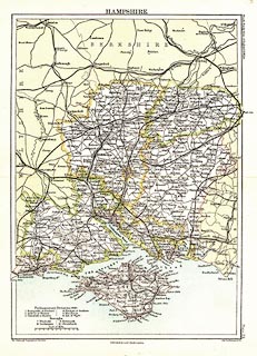
Map, colour printed, Hampshire, scale about 8, by John Bartholomew and Co,
Edinburgh Geographical Institute, Edinburgh, Lothian, published by A and C
Black, London, 1892.
|
|
Plate 23 from Black's Handy Atlas of England and Wales.
|
|
inscription:- |
printed -on- top
HAMPSHIRE
|
|
inscription:- |
printed -on- side
Black's Handy Atlas of England & Wales Plate 23
|
|
inscription:- |
printed -on- bottom
The Edinburgh Gepgraphical Institute John Bartholomew & Co. / Published by
A. & C. Black, London.
|
|
scale line:-
|
10 miles = 31.4 mm |
|
dimension:- |
wxh, sheet = 20.5x27.5cm |
|
wxh, map = 171x240mm |
|
scale = 1 to 510000 ? (1 to 512530 from scale line, assuming statute mile) |
 |
|

|
Map Group -- Bartholomew 1892
|
 |
|

| top of page |
| MN: 23.5.2004 |


