|
private collection:-
|
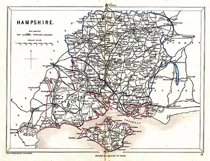
Map, hand coloured engraving, Hampshire, scale about 8 miles to 1 inch, by
John Emslie, published by J Reynolds, 174 Strand, London, 1848.
|
|
map feature:-
|
north point & up is N & scale line & table of symbols & sea
plain & coast shaded & rivers & parks & county & settlements
& roads & railways |
|
inscription:- |
printed -on- upper left
HAMPSHIRE
|
|
inscription:- |
printed -on- bottom
Drawn & Engraved by J. Emslie. / Published by J. Reynolds, 174 Strand.
|
|
scale line:-
|
14 miles = 43.3 mm |
|
dimension:- |
wxh, sheet = 26x20cm |
|
wxh, map = 236x174mm |
|
scale = 1 to 520000 ? (1 to 520342 from scale line, assuming statute mile) |
 |
|

|
Map Group -- Reynolds 1848 -- with Research Notes
|
 |
|

| top of page |
| MN: 23.5.2004 |


