|
private collection:-
|
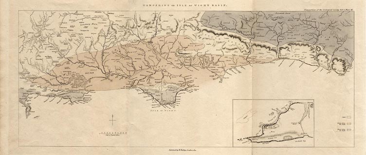
Geological map, Hampshire or Isle of Wight Basin, chalk etc, scale about 6
miles to 1 inch, published by W Phillips, London, 1814.
|
|
Parts of Dorset, Wiltshire, Hampshire, and West and East Sussex, showing three
strata - the chalk, above the chalk, and below the chalk; published in the
Transactions of the Geological Society.
|
|
map feature:-
|
north point & up is N & scale line & table of strata & sea plain
& coast line & rivers & relief & hill hachuring &
geology |
|
inscription:- |
printed -on- top
HAMPSHIRE OR ISLE OF WIGHT BASIN. / Transactions of the Geological Society
Vol.2, Plate IX.
|
|
inscription:- |
printed -on- bottom
Published by W. Phillips, London, 1814.
|
|
scale line:-
|
10 miles = 41.2 mm |
|
dimension:- |
wxh, sheet = 56.5x26.5cm |
|
wxh, map = 516x209mm |
|
scale = 1 to 390000 ? (1 to 390617 from scale line, assuming statute mile) |
 |
|
|
reference:- |
: 1814 (about):: Transactions of the Geological Society: vol.2: pl.9 |

|
Map Group -- Phillips 1814 -- with Research Notes
|
 |
|

| top of page |
| MN: 23.5.2004 |


