
 Return to list of Features

NB: typical illustrated examples are described, NOT ALL examples.
absence of evidence is not evidence of absence
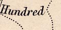
Although hundreds remained a useful? administrative unit only 5 of Saxton's 34 county maps show them. This sheet does NOT show the hundreds.
There is an unexplained area delimited by a red dotted line near around Cheriton, Kimston, Beauford, and Tichborn. This is not printed in black, and might have been inserted by the colourist.
There are errors in the labelling of hundreds which are referenced by numbers to a table of hundreds. The errors are different from the errors on the 1607 version.
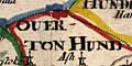
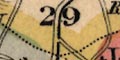
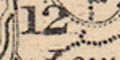
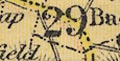
Overton Hundred should be 29, is labelled 13 (Titchfield).
Bosmore is not labelled, it should be 9.
The area around Netley is labelled 14, Mansbridge Hundred, which is more likely correct than the 1607 version.
The detached part of Hampshire around Amersham is labelled 36, Holdshot Hundred.
Titchfield is correctly labelled 13.
Buntesboro is correctly labelled 31.

Printed in a strapwork cartouche upper left is a table:-
HUNDREDES In hamshire 40The count number is added. The table lists the hundreds against a key number, eg:-
1 Crundall hundred
2 Odiam
3 Alton
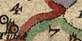
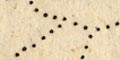
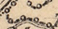
...The numbers are marked in areas on the map. The hundred boundaries are dotted lines.
The hundred boundaries are shown by dotted lines, and the areas numbered to a key at the side of the map. Beware that some hundreds have detached parts. The key is just a list, eg:-
HUNDREDES
Crundall hundred -- 1
Odiam -- -- -- -- - 2
Alton -- -- -- -- - 3
Norden has put Bosmere over the top of what is now Bermondspit. Bosmere, today, is Hayling Island which has no number on the map, plus part of Portsdown.
Norden has 13 on the map where it should be 31 in central Hampshire.
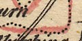
Someone has coloured the hundred boundaries on this copy of the map, opinion is that this is comparatively recent, wrongly in places - be careful how you follow the lines.
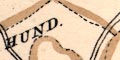
The hundred boundaries are dotted lines. They are labelled in block caps, eg:-

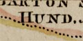
CRUNDALL HUND.
PART of EVINGER HUND
Hundred boundaries are dotted lines, the areas labelled, eg:-
FAWLEY HUND
PART OF EVINGER HUND
RINWOOD HUNDREDThe larger hundred called 'Andover Hundred' is Andover Without Hundred or Andover Extra Hundred. The label:-
Withoutis on the map attached to a hamlet symbol - an error copied from an earlier map.
The hundred boundaries within a county are tinted the same as the county's boundary colour.
The hundred boundaries are dotted lines. The hundred areas are linked to a reference list by numbers.
Printed upper left is:-
A Table of the Hundreds
1 Crundall
2 Odiam
3 Alton
...
40 FordingbridgeHundred boundaries on the map are confused; it is not alwys possible to follow the boundary of a particular hundred, and some unnumbered areas are difficult to identify. One unnumbered area, around Alresford, is probably Alresford Liberty, not in the table of hundreds. The map colourist has been confused, and has added more confusion where colouring doesn't follow the boundaries.

hundred boundaries are slightly finer dotted lines. The hundred areas are numbered, keyed to a table of hundreds:-
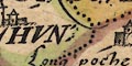
Hundreds in Hant= Shire
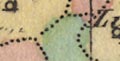
Hundred boundaries are drawn by fine dotted lines (the county boundary on the original made bolder to be different). The areas are labelled, eg:-
BUDDLESGATE HUN:
Part of Odiam hun:
Bosmere & Halyng hunHundred names are listed below. I have not attempted to check the boundaries and names in detail. The hundred names are tucked in between other matter on the map, usually broken up, sometimes badly dissociated. They are mostly in italic block caps and in a different hand, but it is not easy to pick them out, there may be errors! In some instances the spellings below are an amalgam of labels, and have been tidied up a little.
Alton Hundred
Andover Hundred
Barmanspit Hundred
Barton Stacy Hundred
Basingstoke Hundred (also ...stock)
Bosmere and Halyng Hundred
Buddlesgate Hundred
Buntesboro Hundred
Chuteley Hundred
Crundall Hundred
East Meon Hundred
Evinger Hundred
Extra Hundred (ie Andover Extra)
Fawley Hundred
Finchdeane Hundred
Fordingbridg Hundred
Hambledon Hundred
Holdshot Hundred
Horwell Hundred
Kings Somborne Hundred
Kingscler Hundred
Mansbridge Hundred
Meanestoke Hundred
Mychelldeavour Hundred
New Forrest Hundred
Odiham Hundred
Pastrae Hundred
Portsdowne Hundred
Redbridg Hundred
Ringwood Hundred
Selbourne Hundred
Sutton Hundred
Thorngate Hundred
Titchfield Hundred
Waltham Hundred
Wherwell HundredWhile there are some similarities the hundreds are not a simple copy from Speed. Shapes and spellings differ. I do not propose to study these in detail.
Hundred boundaries are added, with the hundred names in the areas on the map.
The hundred boundaries are shown by dotted lines. Beware that some hundreds have detached parts, and some dotted lines do not seem to make sense? but perhaps mark liberties or other areas? Areas are labelled in block caps, eg:-
THORNGATE HUNDRED
WALTHAM HUND
WHORWELL HUNDRED
Hundred boundaries are indicated by dashed lines, the hundred labelled with a number referring to a table upper left:-
Hundreds in Hamp Shire

Hundred boundaries are dotted lines. The hundreds are keyed to a table of hundreds by letters, A..Z, a..n (Jj and Uu are not used). This is unusual, and seeing how awkward letters are for this task, surprising. Confusingly italic letters a..g, NOT corresponding to the main letter sequence, are used for parts of hundreds. Thus:-
A Andover
B Bastrae [should be Pastrae or Pastrow]
C Evinger
D Bartonstacy
... ...
a. Christ Church
...
a. Part of Evinger Hundred
Hundred boundaries, dotted lines, are drawn on the map but the hundreds are neither labelled by name or by any key to a table. (I think they are hundred boundaries.)
Hundred boundaries are dotted lines. The areas are not labelled or numbered.
The hundreds boundaries are dotted lines, tinted. Hundreds are labelled within their areas, eg:-
BARTON STACEY HUND.
EAST MEAN HUNDRED
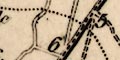
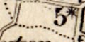
ALTON HUND:Small detached parts are numbered, eg:-
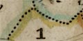
1
10refering to a table of parts of hundreds, in which:-
1. Part of Budlesgate Hundred
10. ... ... Sutton. ...
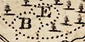
Hundred boundaries are dotted lines. The ares are labelled with a letter which keys them to a table of hundreds printed upper left:-
Hundreds.
A. Pastrow
BBB. Evinger
C Kingsclear
...The list runs A..Z without J and V, a..p without j. The multiple letters indicate in a hundred in so many parts; Evinger is in 3 parts for instance.
Hundred boundaries are dotted lines. The hundred areas are labelled, eg:-
MICHAELDEVER HUNDRED
BISHOPS SUTTON HUNDParts might be labelled with a number, eg:-
4south of Selborne, which refers to a list printed upper left:-
...
4. Pt. of Barton Stacey
...
Hundred boundaries are dotted lines. The hundred areas are labelled, eg:-
CHRIST CHURCH HUNDRED
WHERWELL HUND.
FORDINGBRIDGE HUNDetached parts might be labelled by a number referring to a partial table of hundreds printed on the right:-
1. Pt. of Budlesgate Hund.
2 2. Pt. of Evingar
...The 2 2 is 2 twice not 22, there are two detached parts.
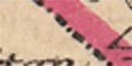
The hundred areas are tinted; green, blue, pink, yellow. (Ringwood and a detached part of Odiham have been missed.) Beware that the colouring of detached parts is not the same as the parent hundred, which can be significant if only four colours are available. A worse error in colouring is found in Bosmere Hundred, the mainland part labelled 'BOSMERE' is tinted pink, the part on Hayling Island labelled 'HUN' is tinted yellow.
Hundreds are not shown.
Hundred boundaries are fine dotted lines. the hundred areas are keyed by numbers to a table of hundreds:-
REFERENCES TO THE HUNDREDS
A hundred boundary is a dotted line; and each hundred is labelled, eg:-
EVINGAR HUNDRED
Pt. of Barton Stacey Hundred
Hundred boundaries are dotted lines. The areas are labelled with a number that keys it to a table of:-
HUNDREDS
1 Pastrow
2 Evingar
3 Kingsclear
...printed lower right.
Hundred boundaries are fine dotted lines, emphasised by a tint. The hundred ares have the same tint, paler, and are labelled with a number which keys to e table of hundred s printed lower right:-
REFERENCE to the HUNDREDS.
1 Alton.
2 Andover.
...
38 Wherwell.including the 2 hundreds on the Isle of Wight.
The detached part of Hampshire is numbered as part of East Meon Hundred.
Hundred boundaries are a dot dash line. The hundred areas are labelled, eg:-
PASTRO HUNDwith detached parts labelled as:-
IN EVINGAR HUNDREDThe size of lettering is adjusted to fit the available space.
Hundred boundaries are shown by a light dotted line. The areas are keyed to a table of hundreds by number, except the part areas which are labelled explicitly, eg:-
PART of OVERTON
Hundred boundaries are fine dotted lines, each tinted a different colour. The hundred areas are keyed by number to a table of hundreds printed upper left:-
REFERENCE to the HUNDREDS
1 Alton
2 Andover
3 Barton Stacey
...
36 Wherwell
Hundred boundaries are light dotted lines, tinted for emphasis on this copy of the map. Hundred areas are labelled with a large number which keys to a table of hundreds printed lower left:-
REFERENCE to the HUNDREDS
Andover ... ... 1
Alton ... ... 2
...
Wherwell Forest ... 40The 40 hundreds include 2 on the Isle of Wight.
Hundred boundaries are dashed lines, and might be tinted. The hundred areas are labelled in upright block caps, eg:-
ODIHAM HUND.
FAWLEY HUNDREDDetached parts of hundres are labelled in lowercase, eg:-
Bishops Sutton Hundredon the east boundary of the county.
Hundred boundaries are dotted lines. The areas are labelled with a number keying it to a table of hundreds printed lower left:-
REFERENCE to the HUNDREDS
Pastrow ... 1
Evingar ... 2
Kingsclere ... 3
...Be careful reading the numbers. The hundred numbers are a little larger, but easily confused with town distance and road distance numbers.
Hundred boundaries are dotted lines. The hundred areas are labelled with a number referring to a table of hundreds printed upper left:-
REFERENCE TO THE DIVISIONS HUNDREDS & LIBERTIES
Andover Division
Andover Hundred ... 1
Wherwell ... Do. ... 2
Thorngate ... Do. ... 3
King's Sombourn ... Do. ... 4
Barton Stacey ... Do. ... 5
Kingsclere Division
Chutely Hundred ... 6
Evingar ... Do. ... 7
Kingsclere ... Do. ... 8
Overton ... Do. ... 9
Pastrow ... Do. ... 10
Basingstoke Division
Basingstoke Hundred ... 11
Bermondspit ... Do. ... 12
Crondall ... Do. ... 13
Holdshott ... Do. ... 14
Odiham ... Do. ... 15
Mitcheldever ... Do. ... 16
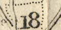
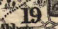
Alton Division
Alresford New Liberty ... 17
Alton Hundred ... Do. ... 18
Bishop's Sutton ... Do. ... 19
Selborne ... Do. ... 20
East Meon... Do. ... 21
Finch Dean ... Do. ... 22
Fawley Division
Bountisborough Hundred ... 23
Buddlesgate ... Do. ... 24
Fawley ... Do. ... 25
Mainsborough ... Do. ... 26
Mansbridge ... Do. ... 27
Portsdown Division
Alverstoke & Gosport Liberty ... 28
Bps. Waltham Hd. (part of) ... 29
Bosmere Hundred ... 30
Fareham ... Do. ... 31
Hambledon ... Do. ... 32
Havant Liberty ... 33
Meon Stoke Hundred ... 34
Portsdown ... Do. ... 35
Titchfield ... Do. ... 36
New Forest Est. Divisn.
Beaulieu Liberty ... 37
Bps. Waltham Hd. (part of) ... 38
Dibden Liberty ... 39
Lymington Do. ... 40
New Forest Hundred ... 41
Redbridge ... Do. ... 42
Ringwood ... Do. ... 43
New Forest Wst. Divisn.
Breamore Liberty ... 44
Christchurch Hundred ... 45
Fordingbridge ... Do. ... 46
Ringwood ... Do. ... 47
Westover Liberty ... 48
City of Winchester & Stoke Liberty ... 49
Borough of Portsmouth ... 50
Town & County of Southampton ... 51
Isle of Wight Division
East Medina Liberty ... 52
West Medina ... Do. ... 53Note: Ringwood Hundred twice? 'Do.' with Alton not wanted, Winchester, Southampton and Portsmouth presumably not in a division?
The great division of the county into:-
NORTH DIVISION
SOUTH DIVISIONis not shown in this table of electoral data, but is labelled on the map (if you look hard); its boundary is a dot dash line, tinted pink/red for emphasis. This division dates from the first Reform Act 1832.
Hidden in all the other detail are dash and circle boundaries around each of the boroughs:-
Andover, Christchurch, Lymington, Petersfield, Portsmouth, Southampton, and Winchester. The boundaries are sometimes close in to the town, and sometimes far out; they are not at all obvious, and I would they were supported by a list of boroughs.
Hundreds are bounded by dotted lines; the areas numbered. The key list for the numbers is not printed on the map sheet.
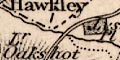
The hundred boundaries are fine dotted lines. The hundred areas are labelled, eg:-
Odiham HundredLabelling is missing in some detached parts of hundreds, otherwise the part is labelled just as the hundred itself. There are occasional boundary errors; the boundary between Overton and part of Chutely hundreds is missing, a boundary is drawn dividing Holdshott into two. The hundred's 'shapes' have not been checked.
A dot dash line, divides the county into South and North Divisions, electoral areas.
Fine dotted lines divide the county into hundreds. The hundred areas are keyed by arabic numbers to a table of hundreds in two series:-
REFERENCES / to the / HUNDREDS & LIBERTIESThe numbers run in two series, 1..24 in the North Division, 1..23 in the South Division (asking for confusion), and:-
This sign [asterisk] denotes that that part of the Hundred belongs to the Hundred having the same sign and figure although in a different Division.For example:-
5 [star]north of Exton labels this area as part of Barton Stacey Hundred in the Northern Division.
This map was first published 1838 when the public was probably still very conscious of reforms in the system of parliamentary elections. Various boundaries for electoral divisions, hundreds, and boroughs, are explained in the table of symbols:-
Printed in spare space upper left is basic electoral data:-
NORTH DIVISION | SOUTH DIVISION
PLACES OF ELECTION
Winchester | Southampton
Newport (I. of Wight)
BOROUGHS Returning 2 Members each
Andover Lymington Portsmouth Southampton Winchester Newport (I. of Wight)
1. Member each
Christchurch Petersfieldand a list of polling places.
Printed lower left amd lower right are tables:-
REFERENCE TO THE DIVISIONS.and:-
HUNDREDS AND LIBERTIES as Settled at the Easter Sessions 1834.These tables build a concordance between the 13 electoral divisions and the hundreds, liberties, boroughs. Areas are keyed to the map by number. An electoral area might be made up of hundreds, or part hundreds, or liberties, towns, etc. For example:-
Romsey Division
Thorngate L. 1/2 H. ... 26
Kings Sombourne Do. ... 27
Redbridge Hundred ... 28, 29, 30
Romsey Town ... 31L. 1/2 H. means Lower half Hundred.
Hundred boundaries are fine dotted lines, which are rather lost in the clutter. The hundred areas are numbered:-
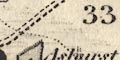
33referring to a table of hundreds lower right:-
REFERENCE to the HUNDREDS
Andover ... 1
Alton ... 2
...
Redbridge ... 33
...
Wherwell Forest ... 40The 40 including 2 on the Isle of Wight; Andover extra is not numbered separately. Parts of hundreds seem to be unnumbered?
Hundred boundaries are doted lines. The hundred areas are labelled with a number keying to a table of hundreds:-
REFERENCES to the HUNDREDS
1 Alton
2 Andover
...
38 Wherwell
Hundred boundaries are dotted lines. The hundred names are in large light block caps across the map, eg:-
WHERWELL HD.
ALTON HUNDRED
PART OF ODIHAM H.
Printed lower towards the right is an:-
EXPLANATION
The Police Divisions are distinctly coloured.
The broad blue belt is the boundary of the Northern and Southern Divisions.
The thin blue lines are the Boundaries of the Parliamentary Boroughs.
Railways & Stations [bold line, circles beside line]The Police Divisions have dashed boundaries which are tinted differently. The areas are numbered, keyed to a table of data:-
THE PETTY SESSIONAL & POLICE DIVISIONS
are coloured distinctly, and the LARGE FIGURES near the centre of each correspond with the FIGURES in the following List if these Divisions, so that their names may be readily ascertained on the Map.
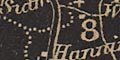
1 Alton
2 Andover
3 Basingstoke
4 Droxford
5 Fareham
6 Kingsclere
7 New Forest and Lymington
8 Odiham
9 Petersfield
10 Ringwood
11 Romsey
12 Southampton
13 Winchester
14 Isle of Wight
The 38 HUNDREDS and 12 LIBERTIES into which Hampshire is divided were amalgamated and arranged in the above named DIVISIONS in 1834.Printed on the right is more descriptive text and tables:-
HAMPSHIRE AND THE ISLE OF WIGHT had 405,370 inhabitants in 1851: they extent over 1070,200 acres: the rateable annual value of their lands and buildings is about L1,514,100.
PARLIAMENTARY DIVISIONS & BOROUGHS
The broad blue belt extending across the county is the boundary of the NORTHERN and SOUTHERN DIVISIONS, each of which sends two Members to Parliament. THE ISLE OF WIGHT sends one member as a separate county or division. The BOROUGHS are WINCHESTER CITY, PORTSMOUTH, SOUTHAMPTON, ANDOVER, LYMINGTON and NEWPORT each sending two, and Christchurch and Petersfield each sending one member.
COUNTY POLLING PLACES.
NORTHERN DIVISION
WINCHESTER, Alton, Whitchurch, Andover, Bishopstoke, Bishops Waltham, Kingsclere, Odiham, New Alresford, Petersfield
SOUTHERN DIVISION
SOUTHAMPTON, Fareham, Gosport, Havant, Lymington, Portsmouth, Ringwood, Romsey
FOR THE ISLE OF WIGHT,
Newport, Cowes and Ryde.
The boundary between thirteen parliamentary divisions is a dot dot dot dash line. The two main divisions are labelled:-
NORTHERN DIVISION
SOUTHERN DIVISIONcoloured pale green and yellow respectively. A red circle under the name of the division indicates the number of members returned to Parliament. The divisions are divided into hundreds, by a dotted line; note that parts of a hundred might be in different divisions. The hundred areas are labelled by a number referring to a table printed lower left:-
The LARGE FIGURES in body of Map refer to the DIVISIONS, HUNDREDS, and LIBERTIES, thus;-
ODIHAM DIVISION.
Crondal ... 1
Odiham (part of) ... 2
Holdshot do. ... 3
Bermondspit do. ... 4
Bentley ... 5
BASINGSTOKE DIVISION.
Holdshot ... 6
Barton Stacey ... 7
Overton ... 8
Chuteley ... 9
Basingstoke ... 10
Bermondspit ... 11
Odiham ... 12
KINGSCLERE DIVISION.
Evinger ... 13
Chuteley ... 14
Kingsclere ... 15
Basingstoke ... 16
Overton ... 17
Pastrow ... 18
ANDOVER DIVISION.
Andover Hund. ... 19
Pastrow ... 20
Thorngate ... 21
Kings Sombourn ... 22
Buddlesgate ... 23
Wherwell ... 24
Barton Stacey ... 25
ROMSEY DIVISION.
Thorngate ... 26
Kings Sombourn ... 27
Buddlesgate ... 28
Mansbridge ... 29
Redbridge ... 30
New Forest ... 31
WINCHESTER DIVISION.
Buddlesgate ... 32
Barton Stacey ... 33
Micheldever ... 34
Mainsboro' ... 35
Bountisboro' ... 36
Fawley ... 37
Bishops Waltham ... 38
ALTON DIVISION.
Fawley ... 39
Bishops Sutton ... 40
Shaldon ... 41
Alton ... 42
Selbourn ... 43
PETERSFIELD DIVISION.
Barton Stacey ... 44
Fawley ... 45
East Meon ... 46
Alton ... 47
Odiham ... 48
Finch Dean ... 49
FAREHAM DIVISION.
Portsdown ... 50
Bosmere ... 51
Havant Lib. ... 52
Fareham Hd. ... 53
Gosport & Alverstoke ... 54
Titchfield ... 55
DROXFORD DIVISION.
Bishops Sutton ... 56
Fawley ... 57
Meon Stoke ... 58
Hambledon ... 59
Bishops Waltham ... 60
SOUTHAMPTON DIVISION.
Mansbridge ... 61
Bishops Waltham ... 62
Baddlesgate [sic] ... 63
Dibden ... 64
Beaulieu .. 65
LYMINGTON DIVISION.
Christchurch ... 66
Ringwood ... 67
New Forest ... 68
RINGWOOD DIVISION.
Christchurch ... 69
Westover ... 70
Ringwood ... 71
Fordingbridge ... 72
New Forest ... 73
Breamore ... 74
ISLE OF WIGHT.
West medina ... 75
East do. ... 76Boroughs, towns sending members to parliament, are bounded by dotted line and tinted pink (I think).
hundreds |
|||||||||||||||||||||||||||||||||
| hundreds |  |
 |
 |
|
|
 |
|
|
|
|
|
|
|
|
|
|
|
|
|
|
|
|
|
|
|
|
|
|
|
|
|
|
|
| areas labelled |  |
|
|
|
|
|
|
|
|
|
|
|
|
 |
|
|
|
|
|
|
|
|
|
|
|
|
|
|
|
||||
| areas numbered | |
|
|
|
|
|
|
|
|
|
|
|
|
|
|
|
|
|
|
|
|
|
|
|
|
|
|
|
|
|
|
||
| dot or dash boundary | |
|
|
|
|
|
|
|
|
|
|
|
|
|
|
|
|
|
|
|
|
|
|
|
|
|
|
|
|
|
|
|
|
| chain dotted boundary | |
|
|
|
|
||||||||||||||||||||||||||||
