
 Return to list of Features

NB: typical illustrated examples are described, NOT ALL examples.
absence of evidence is not evidence of absence
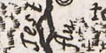
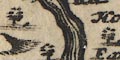
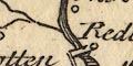
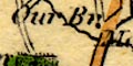
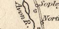
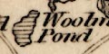
Twenty rivers are drawn [can be recognised?] in the British Isles. Winchester stands by the:-
fl ene.
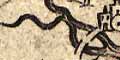
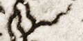
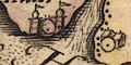
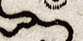
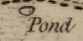
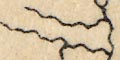
Rivers are drawn by a broad double line painted green(ish) like the sea. At the head of each is a circular lake; there was a medieval 'idea' that all rivers started at lakes.
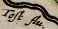
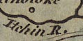
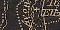
It is possible to make guesses, good or bad, about what rivers are shown in Hampshire; only the Test is labelled, unhelpfully:-
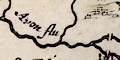
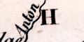
flThe Avon is labelled:-
fl avonThe following are possible identifications:-
Stour [joins Avon just by the sea]
Bourne [?; joins Avon at Sarum]
Avon [by Salisbury]
Test [by Romsey and Southampton]
Anton [perhaps, tributary to the Test]
Itchen [through Winchester; wrong side of Southampton]
Hamble [perhaps, between Botley and Bishops Waltham]
Wey [more than one, by Alton etc]
Loddon [? wrong side of Basingstoke]
Some larger rivers are drawn by a double line. The european rivers are boundaries between countries. The Thames is shown passing through London.
Rivers are drawn by double wiggly lines tapering inland; mostly unlabelled but notice:-
TAMESIS Fetc; as mentioned in the descriptive text.
Rivers relevant to Hampshire are:-
Stour
Avon and tributary Bourne
Test
Itchen
Enbourne ?
Loddon
WeyThe Test comes from Andover, where today this is regarded as a tributary, the Anton; and emerges into the sea instead of into Southampton Water. The Itchen emerges into Southampton Water on the wrong side of Southampton.
Rivers are drawn by a double wiggly line tapering to a point. Rivers relevant to Hampshire can be recognised, but none are labelled:-
Avon, River
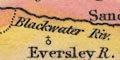
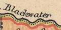
Blackwater River [perhaps]
Dever, River
Hamble, River
Hart, River [incorrect?]
Itchen, River
Loddon, River [incorrect?]
Meon, River
Rother, River
Stour, River
Test, River
Wallington River
Wey, River [Wey, Northern, only from Farnham]None are accurate by today's standards; some are less accurate than others!
Rivers are drawn with wiggly lines, broad with form lines tapering to a thin line inland. Hampshire has its major river systems, rivers and some tributaries, mostly not labelled. Going round the county they are:-
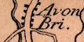
River Avon (labelled 'Avon Flu.')
River Stour
River Bourne (near Shipton Bellinger)
River Test
River Dever
River Itchen
Candover Stream
River Hamble
River Meon
Wallington River
River Rother (labelled 'Arun Fl.')
River Wey (northern)
River Hart
River Enborneetc
Rivers are drawn tapering from their mouth, there is no excessive wiggliness but it clear that rivers are represented; some are named. Some bridges are shewn, some with names. A couple of ferries are labelled.
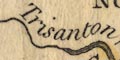
A few rivers are drawn with wiggly lines; labelled at their sea mouths. The Hampshire area has:-
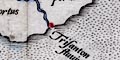
Alaunis flu:
Trisanton fluviusthough not in their expected positions.
Rivers are drawn by a double wiggly line tapering inland. A few rivers are labelled. The rivers relevant to Hampshire which can easily be recognised are:-
Stour = Stowr flu:
Avon = Avon flu:
Bourne (tributary of Avon)
Lymington River
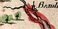
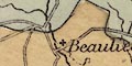
Beaulieu River
Test
Anton (tributary of Test)
Itchen
Hamble
Meon
Wallington River
Rother
Criddell Stream (tributary of Rother)
Wey = Loddon flu (wrongly labelled)
Blackwater River
Loddon
Hart (?)
EnborneAll of which have tributary streams whose identification is less certain.
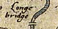
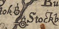
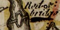
Bridges are drawn by a double line crossing a river. The bridges shown in Hampshire are at:-
Christchurch
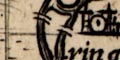
Ringwood
Redbridge
Romsey
Stockbridge
Winchester
Rivers are drawn with a double wiggly line tapering to a single line inland. A number of them end in a lake, a stylistic feature reminiscent of the Gough map.
Rivers relevant to Hampshire are:-
Stour
Avon [running inland to 'Sarisbere']
Test [through 'Ransy' ending in a non-existent lake]
Itchen
Hamble ?
Meon
Wallington
Enbourne
Loddon ?These are not at all definite identifications!
Rivers are painted dark blue-green like the sea. They are crudely wide judged as cartography, though from a design stance they are fine.
In Hampshire it is possible to recognise the Stour and Moors River, Avon, Lymington River, Beaulieu River, Test with a muddle of tributaries perhaps including the Wallop and Anton, Itchen, Hamble, Meon, the start of the Wallington River, the Rother which does not reach into the county, Wey, Blackwater, perhaps the Hart, Loddon and Lyde, and the Enborne.
Rivers are drawn by wiggly lines; a double line with some shading at the mouth, tapering to a single line inland. Rivers are mostly not named, but see:-
Tamessis fluA number of bridges are clearly shown by double line across a river. For example across the Thames in London; here perhaps meaning there is/are crossing/s rather than meaning there is one bridge? There are more bridges on the Thames; Staines, Feltenham, Henley. And some in Hampshire, eg:-
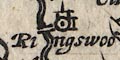
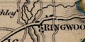
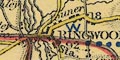
at Ringwood.
The main river systems are drawn:-
Stour
Avon
Test
Itchen
Meon
Rother
Blackwater, Loddon
Enborneeach with tributary streams. None are labelled.
Bridges can be seen at:-
Christchurh (2 over Stour and Avon)
Iford (Stour)
Ringwood (Avon)
? (near Stoneham, Itchen)
Winchester (Itchen)
Fareham ( )
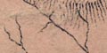
Rivers are drawn by broad wiggly lines tapering inland. Ateam might have a pond at its head, an echo of a medieval convention? The lower parts might be shaded and have stream or form lines, for example in the Itchen. Braiding might be shown. Rivers are not named. The braiding of the stream near Cove in the north east of the county:-
is probably Eelmoor Marsh
Some bridges are drawn, by a double line arched over the stream, for example at Ringwood:-
and at Fordingbridge on the Avon, and Newtown on the Enborne.
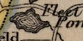
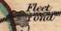
Some lakes and ponds are shown, for example at Highclere and Fleet.
Rivers are drawn by wiggly lines tapering inland, not labelled. Hampshire has:-
Stour
Avon with Bourne tributary
Test
Hamble
Meon ?
Wallington
Loddon ?
Blackwater River ?
Wey
Rivers are shown by wiggly lines tapering in from the river mouth, the lines stay quite wide and bold. Most are not named, but see:-
Test flu
Some bridges are indicated, at Romsey, Stockbridge, and out of the county.
Rivers are drawn but not named.
Braiding might be suggested, for example south of Stockbridge. The rivers that are shown can mostly be indentified, and include the major rivers of the county. Bits of some streams look as if they have been detached and joined to others?
A few bridges are marked. For example at Fordingbridge.
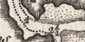
The river system at Winchester is more complicated:-
and the stream emerge from the city walls.
Rivers are drawn by a wiggly line and are generally unlabelled. The larger river mouths might be labelled, eg:-
Severn flu.
Thames mouth
Aestuarium Fyrth(In case your lost the last is the Forth.)
Judging by Hampshire the coverage is not bad. All its major river systems are shown with some tributaries. Errors of drawing do put some rivers out of the county!
A few bridges are marked by a double line across a river. For example, looking at Hampshire, at Stockbridge.
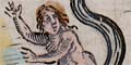
Rivers are drawn as grossly broad wiggly lines, form lines emphasize their meaning.
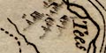
The major rivers are included, each with a naked naiad, a nymph of the stream bathing in its waters, named:-
Stowre
Avon
Test
Itchin
Hamble
Tychfelde riverThe last is the Meon.
Other rivers are shown, Beaulieu, Lymington, etc, as are tributaires, but have neither naiad nor name. (A couple of tributaries in Dorset have a small naiad bathing at the head, pouring out the stream from a jar.)
Rivers are shown by wiggly lines tapering inland. Hampshire has:-
River Stour
River Avon
River Bourne
River Test
River Itchen
River Hamble
River Wey [northern]
Blackwater River
River Loddon
River Enborneas well as can be judged. Not all are drawn in correct relationship to the county boundary.
Rivers are marked by a bold wiggly line tapering inland, with some hint of form lines on the wider stretches. Some braiding is shown, for example south of Stockbridge. All the major river systems are shown, with some tributaries; rivers are not labelled. The Stour and Avon are shown entering the sea separately and are engaved far more lightly than others.
Two bridges are drawn, by a double line across the river, at Stockbridge and Andover.
Rivers are drawn by wiggly lines, but seem to be omitted where they would interfere with the purpose of the map. Hampshire has the Avon and Stour, the Loddon system, and the northern Wey. The last is labelled:-
Loddon fl.
Rivers are drawn as wiggly lines. Only one:-
Avon fluis labelled. It is possible to identify others. Braiding in the Test is shown south of Stockbridge.
A bridge can be seen at Winchester over Itchen. But, unusually, no bridge is shown across Ports Creek to Portsea Island.
Quite a lot of landward detail is shown on the chart, including some rivers and settlements.
Hampshire rivers, not labelled, are thought to be:-
Stour
Avon, and the tributary Bourne at Shipton Bellinger
Test, and tributaries Anton and Dever
Itchen
Rother
Wey, northern and southern
Blackwater River
Loddon and Hart
Enborne
Rivers are drawn by a double, narrowing to a single, wiggly line tapering inland. A few rivers are labelled, eg:-
Avon flu.
Test riverAll Hampshire main rivers are shown, with a number of tributaries.
The original map had no bridges, but this later edition has some bridges drawn by a double line across a stream. Bridges do not relate to the roads, which are also later additions to the map.
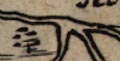
Rivers are shown by a wiggly double line, broad at the mouth, tapering upstream; lower parts shaded. Rivers are mostly not labelled. But see:-
Tost flu.Braiding is shown at Fordingbridge, for example.
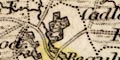
A lake is shown in Highclere Park. This is drawn at the head of the River Enborne; the stream here is only a tributary the remaining Enborne is lost. Fleet Pond? is also shown near Elevetham.
River estuaries are shaded, as the coast line. Rivers are continued inland by a tapering wiggly line. Larger streams have a double line first, with a suggestion of form lines where broad enough. Some rivers are labelled, eg:-
Avon flu
Enborne
Loddon fludMost of the main streams, and tributaries seem to be shown.
The map has no roads, but it does show some bridges, clearly drawn by a double line crossing a river. There are examples east and west of Fareham, at Redbridge, etc. A bridge might be named, eg:-
Knight bridge(it could be 'Kinght bridge') over the Enborne.
A pond or lake is drawn at Highclere Park on the tributary to the Enborne, Fleet Pond is drawn, etc.
Rivers are drawn with wiggly lines. There is little attempt to taper inland. Bariding might be suggested as shown south of Stockbridge on the Test. The rivers are not named, though many can be identified. All the major river systems are shown with some tributaries.
A tributary leaves the Test near Brodlands running in from the 'west' side, slightly higher up this tributary crosses! the Test. Rivers do not do that.
The Alre seems to have been added as an afterthougt.
A lake is shown at Highclere park.
A number of bridges are indicated, eg:-
Iforde
Fordingbridgeetc, look carefully!
Rivers are drawn by wiggly line tapering inland; drawn not too accurately. In Hampshire it is possible to recognise the tour, Avon, Test, Itchen, Hamble and Meon. Only the:-
Thames flu.at its estuary, is labelled.
Major rivers, not all, are shown by a solid wiggly line leading inland from the river mouth. None is named. The following are shewn:-
Avon
Test
Wallop
Itchin
Hamble
Meon
Rother
Hart ?
The map in its first state showed little but settlements and routes. Rivers were added later, wiggly lines, with form lines where wider. Most of Hampshire's river systems are represented; some are named, eg:-
Itchin flu.
Test fl.Some bridges are drawn.
Rivers are drawn by wiggly lines. Most of the main Hampshire river systems are shown. Some bridges are clearly drawn by a double line across a river. There are Hampshire examples at Ports Bridge and at Fareham where the southerly crossing is shown, the northerly crossing is just implied by a single line road across the river.
Rivers are shown by wiggly lines tapering inland. An estuary might be shaded, for example the reaches towards Fareham, or have form lines, for example in the Beaulieu river. The drawing of estuaries is not at all to scale. River braiding is shown, for example on the Test south of Stockbridge. Most rivers are not labelled. Labelling on the map is poorly positioned, so:-
Kings Brookenear a stream at Up Somborne, may refer to the stream or to the two hamlet symbols nearby.
The relationship between rivers and roads can only be described as 'messy' engraving.
It is possible that two bridges are drawn at Beaulieu, and 1 more certainly at Fordingbridge - neither is there for a road. There is a clearly drawn bridge on the upper part of the Lymington River. There is also a clear bridge across the Enborne at Newtowne; the road from Kingsclere towards Newbury crosses elsewhere.
Rivers are drawn by wiggly lines. A few large rivers are labelled in their estuaries, eg:-
Test Rlabelling Southampton Water.
Rivers are mostly shown just by their estuary. The Thames and the Seine are drawn further inland, by a wiggly line. The beginning of the Test is drawn by a double line.
Mostly as original, but:-
River estuaries, which were pecked like the sea, are now engraved with form lines, or, at least, with some stream lines over the shading.
Allum Chine Brook :-
(allocated name) is drawn from the coast just W of Allom house, making the county boundary.
Avon, River :-
braiding added between Christchurch and Sopley; a tributary NE from above Christchurch bridge is added; the bridge at Fordingbridge, which was an addition to our copy of Saxton, is now clearly shown.
Bourne, River :-
From Salisbury the Avon is now continued N becoming the Bourne, crossing a corner of Hampshire at Shipton Bellinger.
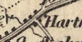
Hart, River :-
a label
Herford bridgis added as well as the stream's name:-
New mil flu:
Itchen, River :-
At the head of the river, about Cheriton or Hinton Ampner, is what could be a pond or lake, unlabelled. There is such a pond at North End by Cheriton.
Meon, River :-
A second bridge is added, above Titchfield, level with the park.
Stour, River :-
the course is redrawn: 'Iver bridge' which was an addition to our copy of Saxton's map, is removed; the river now turns NW through Iford etc and has a tributary:-
Moors River :-
added as a tributary to the Stour
Test, River :-
braiding S of Stockbridge reduced.
Wey, River :-
is now labelled (E of Alton):-
Wey R.Where roads, added remember, cross rivers there is no attempt to 'interrupt' the river, the new double line just crosses the river's engraving lines. Where there is already a bridge the new road engraving is 'bent' to use it.
Rivers are drawn by a wiggly line tapering a little inland. There are no river names (?). The following rivers can be recognised in Hampshire:-
Stour, River
Avon, River
Beaulieu River
Test, River
Itchen, River
Hamble, River
Meon, River
Rother, River
Blackwater
Loddon, River
Enborn, RiverAll with tributaries that might be recognised.
Rivers are extended into the land very little, and mostly not named, except:-
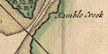
Hamble Creek
Titchfield Lake
Gamer pondThe long landing stage for
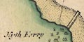
Hyth Ferryis drawn out from the hamlet. And the landing stage for:-
Itching Ferryis shown.
The coast shading extends into river mouths. From there, rivers are drawn with a wiggly line tapering at the head. Some bridges are drawn by a double line crossing a river; this might or might not interupt the line of the river. There are no roads on the map. For examples see west of Fareham, at Ringwood, and at Burgate (by Fordingbridge).
Rivers are drawn by double or single wiggly line, getting narrower upstream.
Not all crossings of road and river are marked with a bridge; it is not likely that all crossings were by bridge! Besides the crossings indicated on the road descriptions, there are bridges drawn at:-
Amersham :-
River Rother
Titchfield :-
River Meon
S of Titchfield :-
River Meon
Stockbridge :-
River Test
Beaulieu :-
Beaulieu River, twin bridges
Fordingbridge :-
River Avon
If there was a bridge there was likely a road?
The label:-
New Mill fluis added to the River Hart.
Rivers are shown by wiggly lines, tapering inland, perhaps starting as a double line, perhaps shaded in broad reaches. Braiding is shown south of Stockbridge and in other places. Some rivers are named, eg:-
Stour R
Test R ol Anton
Itchin R or AlreA lake is shown at Highclere.
Bridges are shown here and there. Their inclusion is confused by the possible addition of roads by Moll, 1708. (The earlier version is not available in the Map Collection for comparison.) Some are marked more neatly than others.
A dotted double line is drawn across
Hampton Watercontinuing the line of a road. Considering how it defaces other marks this probably added by Moll? The ferry is named:-
Hith Ferry
Rivers are drawn by wiggly lines, maybe labelled, eg:-
Itchin RHampshire has the Stour, Avon, Test, Itchen, northern Wey, and Loddon systems with little detail. The Stour and Avon are drawn wrongly (which may be a help in tracing sources or copies). The Stour is shown running to Christchurch from the west, and the Avon is shown running south through Salisbury to join the Stour well to the west of Christchurch. Both are labelled. A separate unlabelled river is shown running south through Fordingbridge and Ringwood to Cristchurch.
Rivers are not shown, except by a hint of an estuary at the coast. The great river estuaries are labelled, eg:-
Thames R.
Severn R.Southampton Water, the Test Estuary, is recognisable.
Most of the main river systems of Hampshire are shown, by wiggly lines, except the Enborne.
Rivers are shown by a double, tapering to a single, line. THe estuary may be shaded as like coast line. A river might be labelled, for Hampshire:-
Itching flu
Avona fluThe Test and (perhaps) the Loddon are also shown in Hampshire.
Rivers are clearly drawn all along the coast. The estuary shaded on the inland side, with a channel marked through foreshore ooze, sometimes depth soundings, ... The river might be labelled with a name or where it came from, eg:-
up to Blandford [Stour]
up to Salisbury [Avon]
R. Bowley [Beaulieu]
to Rumsey [Test]
up to Winchester [Itchen]
Hamble RiverNote that Jacques Bellin's translation of the River Bowley, mispelt by today's measure, is Beauley.
Bridges are recognisable where a road crosses and interrupts a stream, and might be labelled, eg:-
Ivy Bridge [Iford]
Hermitage Br. [at Emsworth]Or a bridge might be drawn and labelled, without the approach roads, eg:-
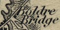
Boulder BridgeAt Warsash the:-
Ferry
is labelled. In other places the layout of roads approaching a river from each side suggests there might have been a ferry.
Rivers are shown by a wiggly line. Hampshire has the Stour and Avon, Test, Itchin, and perhaps the Rother. Rivers are not labelled, but see:-
Tamesis Fl.
Sabrina AEstariumat these great river mouths.
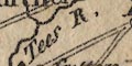
Rivers are shown by wiggly lines narrowing upstream, the broad part near the coast shares the coast shading with the sea. Some rivers are named, eg:-
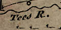
Tees R.
Itchin R.The lake at Alresford is drawn, shaded, but not labelled.
A few bridges are clearly shown. Examples: at Redbridge over the Test and Eling over the Bartley Water; and at Boldre over the Lymington River. Others are implied by a road crossing; a few bridges are labelled, eg:-
Ivy Br.in Christchurch, and :-
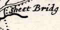
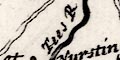
Sheet Bridgat Petersfield.
Ferries at Hythe and over the Itchin are ignored, but the:-
Ferrynear Hamble over that river is labelled.
very few rivers are shewn.
Rivers are not drawn inland and not even shown by an estuary, excepting the great rivers.
Rivers are shown by broad wiggly lines, tapering inland, some are labelled, eg:-
Avon
Test RAnd some are not too accurate, at the NE county boundary for instance, where the Blackwater is missing and the Loddon etc not well placed.
Bridges are implied where roads cross rivers, by the way the two are drawn. Two (?) other bridges are shown, at Redbridge, and perhaps over the Test near Eastleigh
Wiggly lines are used to draw rivers from the coast or continue them from an estuary. The major rivers are drawn with some tributaries. Some are labelled:-
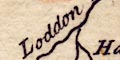
Loddon R.
Tees R
Wallop R.
Itchin R.Bridges are mostly not drawn, but suggested by the crossing of a road over a river.
Portsey Bridgis labelled on one or other of two roads that cross to Portsea Island.
Three bridges are drawn, detached from any principal road. Two across the River Meon, about Titchfield, one across the Wallington River at Fareham.
A road drawn from Lymington goes through Beaulieu and ends at the coast opposite Southampton. This suggests the existence of a ferry, the Hythe Ferry.
Rivers are drawn by wiggly lines tapering inland from their estuary. They are mostly unnamed, but see:-
Avon R.The major river systems in the county are drawn, main streams and tributaries, as can be fitted in at this scale.
Bridges are mostly implied where a road crosses a river, and interupts its course. A couple of bridges are drawn more explicitly by a segment of road, ie a double line, detached from the more important road system, as at Boulder - connecting a hamlet circle either side of the Lymington River, and at Redbridge - joining Redbridge to Totton to Eling over the River Test etc.
Rivers are shown by a tapering wiggly line beyond their mouth. At a glance they are a fairly comprehensive set for the size of map, and reasonably accurately drawn. They are mostly unlabelled, but see:-
Tese R.
Itchin R.bridges are not shown.
Rivers are drawn by a double line, with form lines where there is room, tapering to a single wiggly line inland. Most of Hampshire's river systems are represented; the Blackwater on the NE boundary seems to have been missed. Accuracy is not all it could be - indeed the whole map feels a little sloppy.
Some bridges are marked by a double line across a river, for example at Redbridge where the bridge over the Test is clearly marked, but not linked to any road. The road is drawn just below, broken by the river. In other places it might be assumed that a road crossing a river implies a bridge. The engraving is very sloppy, a road might be shown 'under' or 'over' a river.
Rivers are drawn greatly out of scale, much too gross. Hampshire's chief rivers are labelled, eg:-
Test R.
Itchin R.
Avon R
Rivers are shown by wiggly lines tapering inland fron their estuary. Some are named, eg:-
Itchin R.
Avon R
Tees R.All the main rivers are shown, with some tributairies:-
Stour, River
Avon, River (braiding at Ringwood, etc)
Lymington River
Beaulieu River
Test, River (braiding at Stockridge, and Wallop Brook, River Anton, Micheldever stream etc)
Itchen, River (with Candover stream, and headwaters from ponds near Bighton, not from Hinton Ampner)
Hamble, River
Meon, River
Wallington River
Ems, River
Rother, River (and Cridell Stream)
Wey, River (two arms)
Blackwater River
Hart, River
Whitewater, River
Loddon, River (and Lyde)
Enborn, RiverBridges are mostly implied by a road interupting the river at a crossing. To the east of Havant the minor road, a single line, crosses the Ems by a bridge, drawn by a double line arching over the river. Similarly the single line of minor road crosses the Meon at Wickham by a double line bridge.
There is another example at Fareham:-
Major rivers are shewn, tapering upstream. Some are named, eg:-
Avon R.
Tees R.A few lakes are shown, eg at the head of the Swarraton stream.
Bridges are implied by road crossings, ie not for sure.
Rivers are shown by wiggly lines tapering inland. Some rivers are labelled, eg:-
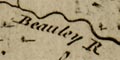
Beauley RBraiding might be shown, for example south of Stockbridge:-
and ponds might be shown, eg:-
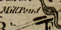
Mill PondBridges are implied by roads crossing and interupting a stream. Some are labelled, eg:-
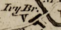
Ivy Br.
Red bridge
at Christchurch, the road narrowing over the bridges.
clearly showing two crossings over the 'Tees R' ie River Test. A bridge might be shown without there being a road, eg:-
Rivers are drawn by wiggly lines tapering inland. Some are labelled, eg:-
Stour R
Tees R.
Itchin R.The major river systems are shown in part, with some tributaries. A little braiding is shown. Bridges are not drawn; in the drawing rivers tend to overrun roads where they cross! see, for example, at Ringwood.
Rivers are drawn by wiggly lines, and might be labelled, eg:-
Tees R. [Test]
Wye R. [northern Wey]Hampshire has the Stour, Avon, Lymington River, Beaulieu River, Test, Itchen, Rother, and northern Wey.
River estuaries are clearly drawn, with foreshore shallows and navigable channels; the Beaulieu River for example. Depth soundings might be given for a way up the estuary. Beyond the river is drawn as a double line, then a single wiggly line tapering inland. Some rivers are named, eg:-
Hamble R.
Titchfield Riviere [River Meon]
Riviere d'Avon
Riviere BeauleyThis last is a nice english spelling of a french word which we now reject!
Bridges might just be implied by a road crossing and interrupting a stream. But looking carefully, in some places the bridge is slightly more boldly engraved, for example at Fordingbridge. And a bridge might be shown by a short section of road detached from the road network, as at Itchin north of Bitterne. Not many bridges are labelled, but see:-
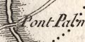
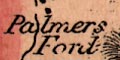
Pont Palmerover the River Avon, and:-
Pont d'YviIford Bridge, over the River Stour.
In some places roads come to a river on each side, suggesting a ferry, as at Bursledon. And some ferries are labelled, eg:-
Bacat Warsash, the Hamble Ferry. And Hythe Ferry:-
Heith ou il y a un Bac
Rivers are drawn by wiggly lines, perhaps double with from lines near their estuary, then single tapering upstream. Some rivers are labelled, eg:-
Tees R.
Itchen R.Braiding might be shown, as on the Avon around Ringwood, and the Test below Stockbridge. Most of the county's river systems are shown, with a few tributaries.
Bridges are implied by a road crossing and interrupting a stream, but few are labelled, eg:-
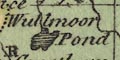
Knights BridgeA pond might be drawn in outline and shaded. It might be labelled, eg:-
Wullmoor PondFleet Pond is drawn but not labelled.
Same as Kitchin; broader parts of rivers tinted.
Same as Kitchin.
Rivers are drawn by a double or single wiggly line, tapering inland. The major rivers of the county are shown, with braiding and tributaries. Some are labelled, eg:-
Itchen R.
Avon R.
Tees R.Some ponds are drawn, and might be labelled, eg:-
Fleet Pondor not, for example Alresford Pond.
Bridges are implied by roads crossing rivers, and perhaps being named, For example:-
Knights Bridge
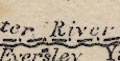
Eversley Bri.
London BridgeRoad exits on the northern borders of the county.
Except for the larger river estuaries:-
Severn R.
Thames Riverbig enough to be labelled, rivers are not shown on the map. By Hampshire 'Spithead' rather than a river name is given.
A few rivers are drawn by wiggly lines, but not labelled. In Hampshire it is possible to recognise the River Avon, Limington River, Beaulieu River, River Test, River Itchen, River Hamble, and River Meon.
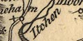
Rivers are shown, as a wiggly line, where they are crossed by a road. The river might be named, eg (plate 20 scroll 6 mile 12):-
Itching R.near Winchester, and:-
(plate 20 scroll 1 mile 71)
Brambridge WaterAt Stockbridge three braids of the Test are drawn, all unnamed. A river might be drawn alongside the road, for example (plate 20 scroll 1 mile 71-78) where the
Itchin R.approaches Southampton. Tributary streams cross under the road to join the river.
Bridges are mostly just implied by a road crossing over a river or rill. Some are named, for example (plate 20 scroll 4 mile 104):-
Ham Bridgeat the Hampshire Dorset boundary. And:-
High Bridge
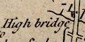
(plate 20 scroll 1 mile 71)A pond might be drawn, for example, with shading:-
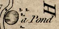
(plate 20 scroll 3 mile 77)
a PondThe ferry over the Itchen is marked at Southampton:-
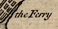
(plate 20 scroll 1 mile 78)
the Ferry
Rivers are drawn by a wiggly line; a double line with form lines where it is broad, then a single line, tapering inland. Some rivers are labelled, eg:-
Avon R.
Tees R.
Itchen R.All of the main river systems are shown, with some tributaries. Braiding and meanders are decoratively drawn.
Some ponds are drawn in outline with shading. They might be labelled, eg:-
Wullmoor PondOther ponds shown include Fleet Pond and ponds in Dogmersfield Park
Bridges are implied where a road crosses and interrupts a stream; ?none are labelled. A ferry might be suggested where a road approaches each side of a river, as at Hamble on the River Meon.
Rivers are drawn by a bold wiggly line tapering inland. Braiding might be indicated, for example south of Stockbridge. All the major river systems seems to be drawn quite well, with tributaries, but ?none are labelled.
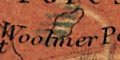
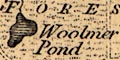
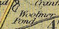
Some ponds are drawn, for example at Woolmer, with shading.
Bridges are suggested only by a road crossing and interrupting a river.
The:-
River Anton or Testis followed by the canal to Fullerton, from where it follows the River Anton, which is drawn but not labelled.
A small unlabelled tributary of the Test is shown at Nursling, which drains the Ashfield area, crossing the canal to the river. The:-
Titburn Brookis shown as a tributary to the Test coming through Romsey from the east, crossing the canal in the town. The larger River Dun is drawn as an insignificant tributary from the west between Kimbridge and Mottisfont - but it is probably not relevant to the hydrology of the canal. The stream through Kings Somborne is drawn crossing under a bend of the canal to a bend in the river. The Wallop Brook at Bossington is not shown; it comes from the west and does not cross the canal.
The small tributary to the Anton:-
Pillhill Brookis shown and labelled at Upper Clatford, crossing under the canal with ponds looking as if they are made by the canal embankment, to the west.
Braiding of the Test and other streams is shown in some detail; but I have not attempted to check the truth of its mapping. The detail of the streams is simplified.
Some of the river bridges are shown, on the River Test, and some of them are labelled:-
Skidmore Bridge [S of Romsey]
Great Bridge [N of Romsey]
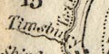
Timsbury Bridge [N of Romsey]
Horsebridge [by Houghton]
Kitcomb Bridgeand on the Pillhill Brook:-
Little Ann BridgeThere are many other unlabelled bridges over the rivers and streams.
Rivers are drawn by wiggly lines. At this scale the map only shows major rivers. In Hampshire it is possible to recognise: Stour, Avon, Test, Itchen, Meon, and Wey, amongst the roads. None is labelled. Large river estuaries might have a river name, eg:-
Thames R
Severn R
Rivers are not shown except estuaries. The large estuaries might be labelled, eg:-
Thames R
Rivers are only shown by their estuaries. It is possible to recognise the Avon, Test, and Itchen estuaries on the Hampshire coast.
Rivers might be drawn by a wiggly line crossing under the road. None on this sheet is labelled.
A pond or lake might be shown by an outline with shading as at mile 101-102:-
Sherewater head
Rivers are drawn by wiggly line, and might be labelled, eg:-
River Deepford
River Lodonat the head of which ponds are drawn with form lines, labelled:-
Newram Springs
Fleet Pondis also drawn with form lines filling its area, and the ponds in Dogmersfield Park are shown. Several of the Hampshire rivers are crossed by the canal on its contour route. The River Wey is larger and is drawn wider with form lines, labelled:-
Wey RiverThere are no mills shown in Hampshire; there are some in Surrey.
Rivers are drawn by wiggly lines tapering inland. A river might be labelled, in Hampshire for example:-
Tees R.
Itchin R.
Avon R.
Bourn R. [tributary of Avon]
Rivers and harbours are clearly indicated. Small streams reaching the coast are just wiggly lines, tapering inland. The important streams are shown with their channel through the foreshore mudflats, and have reaches labelled, as on the Lymington River, above, or as examples:-
Oxsey Lake
Penington LakeDepth soundings are shown up these channels, and achorages, and markers.
The bridge at Lymington is drawn clearly.
Rivers are shown as wiggly lines, tapering in from their mouth. Most rivers are shown just as they cross the road, but the Wey and Itchen are shown alongside the road. Some rivers are labelled:-
(page 103/104 scroll 3 mile 58)
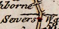
Sewers Water
Itchin R.As the course of a whole river is generally not shown braiding is not clearly depicted, but it is suggested just east of Salisbury by multiple crossings of a river.
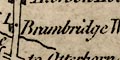
Bridges are suggested, by not drawn, where the road crosses and interupts a river. Example where Sewers Water crosses west of New Alresford. A bridge might be labelled, eg:-
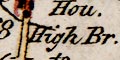
(page 103/104 scroll 4 mile 68)
High Br.near Otterbourne.
East of New Alresford is:-
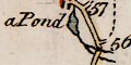
(page 103/104 scroll 3 mile 56-57)
a PondNotice how one branch of the river goes under a bridge and the other suggests a ford - which follows earlier road mapping.
At Southampton, over the Itchen, is:-
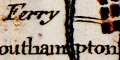
(page 103/104 scroll 4 mile 75)
the Ferryindicated just by the label, but notice the approach road from Southampton.
Rivers are drawn by wiggly lines, broad at the mouth, tapering inland. Braiding might be shown, for example on the Test. Some rivers are labelled, eg:-
Avon R.A lake is shown at Farnborough.
Roads on the map generally interupt rivers, loosely implying a bridge. A clear example, see Eling. But the engraver is not careful; at Christchurch the river and road both continue through the intersection implying a ford, but I do not believe this is interntional. At Bursledon or Hamble? the river interupts the road, implying a ferry? Again I think it is a lack of care.
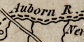
Rivers are drawn as wiggly lines tapering inland from their estuary. Baridin might be shown, and the river might be labelled, eg:-
Avon R.
Beauley River
Crockford Water
Auborn Riv
Bourne RiverThis Bourne is the River Bourne by South Tidworth.
TestHigher up the Test the tributary now known as the Bourne Rivulet is labelled the Anton, the Anton running into Andover is unnamed, and the head of the river is labelled:-
Source of the Hanton Riv.between Ashe and Steventon.
Ponds are drawn in outline with form lines, and perhaps labelled, eg:-
Fleet Pond
Sowley Pond
Blackmore PondThis last near Bramshott.
Bridges are suggested by the roads crossing and interupting a river. A few bridges are named, eg:-
Broken Bridge [near Brokenhurst]
Our Br.
Kitcomb Bridge [by Fullerton]A ford is labelled at:-
Jouldins Fordnorth of Eversley.
Rivers are shown as a double wiggly line with form lines, narrowing to a single line tapering upstream. The larger rivers are labelled, eg:-
Auborn R
Itchen RA river starts at Eastrop by Basingstoke and flows east and north to Hartley Wespall; a river starts at Mapledurwell and flows north east; these meet head on, going no where!
Some ponds, or lakes, are marked, Alresford Pond for example, some are labelled, eg:-
Fleet PondBridges are implied by the roads interupting the rivers. These are mostly unlabelled, but see, for example:-
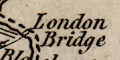
London Bridge [at Blackwater]
Red Br
Gr. Bridge [N of Romsey]
Knights Br [Berks border]Ferries are neither marked or labelled. However, the road layout by Bursledon is very suggestive of a river crossing by ferry.
Above their mouths, rivers are shown by a wiggly line tapering a little upstream. Some rivers are named, eg:-
Avon River
Beauly RiverThe problem of what headwater is the true headwater and what is a tributary is demonstrated by the labelling of the Bourne Rivulet as 'Anton River' ie the Test. What is the Anton, into Andover, is labelled 'Test River'. However, the head of the branch of the Test east of Overton is labelled:-
Source of the Hanton RiverThere is some confusion here! Braiding is shown, eg in the Avon at Ringwood. A headwater of the Beaulieu River is labelled:-
DecoySome ponds are marked and labelled, eg:-
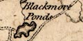
Blackmore Pondsor just marked, eg at Alresford, or just labelled, eg:-
Gomer Pondat Alverstoke. On the road west out of Stockbridge, about mile 73 from London, is marked:-
Watering Pondwhich is presumably descriptive rather than nominative (demonstrating how leading capital letters wrongly used can be a snare.)
Bridges are not depicted very well. Rivers cut over roads even where a bridge is actually named, eg at:-
Post Bridgeover Ports Creek. A number of bridges are named on the map (separately from the name of a town, like Stockbridge), eg:-
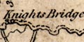
Knights Bridge [on Enborne]
Eversley Bridge [on Blackwater]Some fords are labelled, eg:-
Joulding Ford [on Blackwater]The pattern of roads east of Southampton suggests the ferry across the Itchin, which is labelled:-
Ferrya little inland.
River estuaries have form lines continued from the coast. Inland river are drawn by wiggly lines. None? are labelled. The Meon, Wallington, and Ems can be recognised, with a number of smaller streams and tributaries. The engraving of rivers appears to be a little careless in the way roads and rivers cross?
Bridges might be implied by roads crossing and interrupting streams. For example the two bridges at Fareham over the Wallington River are clearly marked; roads west to Southwick, and to Portchester past Cams Hall. Ports Bridge is not apparent. A bridge near Waltham Chase is labelled:-
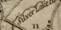
Silver Lake Br.
Hampshire main rivers are drawn tapering from their mouth by wiggly lines, with some indications of braiding. The main rivers are named:-
Stour R.
Avon R.
Test R.
Itchen R.
Auborn.The last being the Enborn. Shown, but not labelled are:- the tributary to the Enborn from Highclere, the River Meon, and the Blackwater at the NE of the county. The esturaies of the Lymington River, Beaulieu River and River Hamble are also clearly drawn, but unlabelled.
Rivers are hardly shown on the map. Estuaries of Stour and Avon, Test, Itchen, and Hamble are drawn but none are extended inland. The map is basically a route map, not intended as a topographical map, and perhaps by this late date rivers are of small concern. There is nothing for rivers in the table of symbols. Rivers elsewhere, eg on the north and east borders of the county are not drawn. Bridges seem to be taken for granted; or at least the feasibility of crossing rivers is. At various places a road is interupted by a river estuary, eg at Redbridge and at Christchurch. But, it seems to be assumed that this is not a barrier in the route.
Rivers are not drawn any further inland than their estuaries.
Rivers are drawn by wiggly lines tapering inland. Some are labelled, eg:-
Avon R.
Test R.The Blackwater is labelled:-
Loddon R.Most of the main river systems are shown, but with no great accuracy or detail of tributaries. Bridges are not particularly noticed, but are implied by roads crossing rivers.
Rivers are drawn by a wiggly line tapering inland from an estuary which has form lines continued from the coast. Only the rivers listed by Ptolemy are shown, but the inland course is made up by the map maker, Ptolemy gives only the location of the river mouth, marked on the map by a circle.
Of Hampshire interest are:-
Alaunis Fl.
Trisanton Fl.
From their estuary rivers are drawn by wiggly lines tapering inland. The larger rivers are labelled, eg:-
Stour R.
Anton or Test RiverThe last is labelled with the joint name at the bottom; then divides as the Anton R through Andover and the Test R coming from the north east; then the Bourne Rivulet is labelled Test and the eastward arm, now called the Test is labelled Anton. This sort of uncertainty is not unusual.
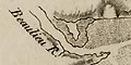
The wide lower course of the Beaulieu River is labelled:-
Beaulieu Riverthen, still below the village:-
River ExRivers are continued upstream some way and drawn with tributary streams, some of which are labelled, eg:-
Blashford Brookoff the Avon north of Ringwood.
Some ponds are drawn in outline, with from lines if big enough, and perhaps labelled, eg:-
Pondby the road 1 mile west of Stockbridge, or drawn more grandly:-
Fleet Pond
Pondat Alresford.
Some ferries are labelled, eg:-
Ferry [at Hythe]
Ferry [at Hambledon]Bridges do not have a special symbol but are perhaps implied where road interrupts a river. Some are labelled, eg:-
Br.at Avon on the River Avon, though you have to look carefully to see that it is on a side road out of the village, the village being all one side of the stream. Other bridges have fuller names, eg:-
Silver Lake Br. [1 mile east of Botley]
Aldern Br. [Enborne]
High Br. [Itchen]A small road north of Hurstbourne Priors crosses the Bourne Rivulet at:-
Chapmans Ford
Rivers and harbours are drawn in detail with the same features as sea areas; banks, sandbanks, islands, depths, tidal streams, etc etc. The detail continues up to what I presume is judged to be a limit of navigation; ending at a bridge or narrows or shallow water? Above this the river is either ignored or drawn as the usual wiggly line. The river may be named, eg:-
Bowley River
Titchfield CreekThe dockyard at Portsmouth is labelled:-
DockBridges are shown across rivers where they mark an end to navigation. They might be named, eg:-
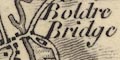
Boulder Bridge
Rivers are only indicated by their estuaries, some labelled:-
Beaulieu R.
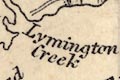
Lymington Creek [Lymington River]
Southampton River [Southampton Water=Test+Itchen]
Some of the county's [Hampshire's] main rivers are shown. For what appears to be a map of the physical geography of the county and region, relief, rivers, soils, there are some glaring errors. There is no River Itchen. The Loddon/Lyde system looks wrong. Test and Meon are cut short. ...
Rivers are generally not named.
Major rivers are drawn by wiggly lines tapering upstream. In Hampshire it is possible to recognise the Stour, Avon, Test, Itchen, Meon, Rother, Blackwater, Hart and Loddon, and Enborne, plus some tributaries like the Wallop and Anton.
The map shows neither rivers nor relief.
Rivers are drawn by wiggly lines from their estuary with form lines, then a double line, then single tapering inland. Some rivers are labelled, eg:-
Test R.
Itching R.Not all the major river systems are shown. The Stour is detached from the Avon; the Bourne near Shipton Bellinger is included - unusual; the Enborne, Blackwater, Rother are all missing.
Bridges are not shown, but are implied by a road interrupting the river it crosses
Most of the major rivers are drawn by wiggly lines. Some are labelled:-
Avon R.
Auborn R.
Loddon R.The Auborn is the Enborn; Loddon wrongly marks the Blackwater. The Rother and Ems, in particular, are missed.
Bridges are not drawn, but are perhaps implied by roads interupting the river where they cross.
Rivers are shown by a wiggly line tapering upwards; in the wider parts there might be form lines. The river may be labelled, eg:-
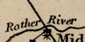
Rother River [near Midhurst]
River AntonBridges are implied by the road crossing and interupting the line of a river. The bridge might be labelled, eg:-
Portsea Bridgeby Cosham. Or just:-
BridgeThe river might not be drawn, for example at:-
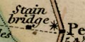
Stain bridge [near Petersfield]
Sheet Bridgeby Petersfield.
The crossing from portsmouth to Gosport is labelled:-
Ferry
River estuaries are drawn boldly; beyond this the rivers are a thin wiggly line. Most rivers are not labelled, but notice:-
Crook[ford] Waterbetween Lymington and Beaulieu rivers, off Sowley Pond? A lot of streams are drawn but accuracy is not all it could be. The Test is continued to Whitchurch but not further eastward although the Bourne Rivulet is drawn. The Itchin is continued north from Alresford then ENE towards Alton!
Bridges are implied but not stated, a river is interrupted by a road. A few are labelled:-
Our Br [Ower]
Kilcomb Bridge [nr Chilbolton]
Broken bridge [nr Denny Lodge]or implied:-
Gr[ ] Bri Mill [N of Romsey]At least one pond is labelled, though not drawn:-
Bistern Pondand Fleet Pond is drawn but not labelled.
Rivers are drawn by wiggly lines tapering inland. The major river of Hampshire are mostly included with some tributaries. Looking closely they are not as accurate as they might be. For instance: the Test has the Wallop and Dever tributaries, and is shown coming down from the St Mary Bourne direction, ie what is now called the Bourne Rivulet; the Test through Whitchurch etc is missing. The Wallington River is missed. The Loddon system looks less 'complete' than it might be. The treatment of the Meon at its mouth has two sizeable estuaries side by side. Unusually, the Bourne that crosses the NW corner of the county is shown. Some rivers are labelled, for Hampshire:-
Stour R.
R. Avon
R. Bourne
Wey R.
Rivers are shown by a double wiggly line if they are navigable. In practice the tapering line becomes a single line. Most are labelled, eg:-
Itching R.
Rivers are drawn with a double line sometimes with form lines, perhaps suggesting their true width? with the west bank engraved bolder, a shadow to the east or south east. Where narrower the river is drawn by a single wiggly line tapering upstream. Large and moderate size meanders should be plotted accurately at this scale; but remember that rivers are dynamic systems, and meanders do just that. Braiding is shown. Many rivers are labelled, eg:-
The Anton or Test R.
RIVER ITCHEN
Beaulieu River
Town Brook [Basingstoke]and some river mouths are labelled, eg:-
Bourne Mouthwhich is pretty near uninhabited at this date.
Above Stockbridge the Test/Anton is labelled Test; the river through Andover is labelled Anton; the stream through St Mary Bourne is labelled Test. This is not an unusual muddle.
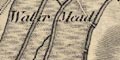
A river flood plain might be engraved, perhaps by a roulette? to suggest tussocky meadows. Below Bossington a flood plain engraved like this is labelled:-
Water MeadThe map shows the complicated streams and artificial channels of the water meadows south of Downton, on the Avon.
Some springs are noticed, eg:-
Springs [S of East Meon]
Newram Springs [ESE of Basingstoke]Some ponds are drawn in outline and labelled, eg:-
Sowley Pond
Creech PondAn unlabelled pond might be unrecognised, it's just another shape. A pond in the flood plain of the Itchen, level with North Stoneham is labelled:-
Decoywhere there was a duck decoy for hunters.
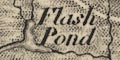
Flash Pondon Beaulieu Heath uses a local word for a marsh or pond. On the stream 2 miles ENE of Southwick Park is a:-
SheepwashBridges are implied where a road crosses and interrupts a stream. Some are labelled, eg:-
Boldre Bridge [Lymington River]
Skidmore Bridge [Test]A ferry might be noticed, eg:-
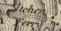
Itchen Ferry
Rivers are drawn by wiggly lines tapering inland. Some are labelled, eg:-
Beauley River
Avon R.All the major river systems are shown with some tributaries, but not all are named.
Rivers are drawn by wiggly lines tapering a little inland. A few rivers are named, eg:-
R. Test
Beauley River
Itching R.All the major rivers from the coast are shown, with little detail of tributaries. Several of the other river systems are missed, no Rother, Wey, Blackwater, or Enborne. The Bourne, near Tidworth, is shown, which is less usual.
Bridges are implied by roads interrupting rivers. But are generally unlabelled, except by a settlement name, eg:-
Sheet BridgeAt least one pond is drawn in outline, labelled:-
Frensham Pondin Surrey.
Rivers are drawn by wiggly lines tapering upstream. The Thames, larger, has form lines alongside its wiggly line to up above Abingdon. Some rivers are labelled, eg:-
Blackwater Riv.
Avon R.Most of Hampshire's river systems are noticed; the Basingstoke area lacks some streams, and the Rother is missing.
Coast shading extends up river estuaries, which are drawn wide, after which rivers are drawn by a wiggly line tapering inland. Braiding might be suggested. A few rivers are labelled, eg:-
Avon R.
Anborn River [Enborn]All the main river systems in the county are represented, some with tributaries.
Bridges are implied where a road crosses and interrupts a stream, and a few are labelled, eg:-
Knights Bridge
Eversley BridgeA pond might be drawn in outline, perhaps with indeterminate form lines or shading as at:-
Fleet PondA tiny pond is drawn in Dogmersfield Park at the head of a stream. And:-
Sowley Pondis labelled.
Rivers are drawn by wiggly lines tapering inland. few are labelled, in Hampshire for example:-
Avon R.Also as:-
MOUTH OF THE THAMES
Rivers are drawn by a wiggly line tapering upstream. Some rivers are labelled, eg:-
Itching River
Test River
Lymington Creek [over the foreshore]All the main river systems are noticed, with some tributaries.
Some ponds are drawn in outline and labelled, eg:-
Fleet Pond
Woolmer PondBridges are implied where a road crosses and interrupts a stream. Some bridges are labelled, eg:-
Thornford Br. [N of Kingsclere]
Iford Brid.
Brook Bri. [W of Cadnam]By Hythe:-
Hyth Ferryis labelled, but its route across the water is not indicated.
Rivers are drawn by wiggly lines tapering upstream. All the major rivers are shown, with a few tributaries. This is only a little map. A couple of rivers are labelled, eg:-
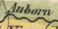
Auborn R.
Avon R.Some bridges are labelled on the road network, eg:-
Red Br.
Ford Br. [Chandlersford?]
Cadnam Br.These do not all have a stream to cross.
There are two tables printed on the right of the map, a list of:-
RAILWAYSwhich at this early date is short, and has nothing in Hampshire. And:-
A LIST OF THE CANALS & NAVIGABLE RIVERS SHEWING THE PRINCIPAL ARTICLES OF MINERAL TONNAGEwhich includes, for Hampshire:-
Canals ... ... ... ... Article of Tonnage
...
Andover ... w ... ... ... Coal
...
Basingstoke ... w ... im ... Coal
...and:-
...
Avon R. (Salisbury) 50M. ... Coal, Gun Flints
...
Itching R. ... 15M. ... ... Coal
...
Rivers are drawn by wiggly lines tapering inland from their estuary. Most of Hampshire's major rivers from the coast are shown, with a few tributaries. The inland rivers are less well represented. Rivers are mostly labelled, eg:-
R. Itching
River Avon
Loddon R. [wrongly labelling the Blackwater]Bridges are mostly just implied by a road interrupting a river. At Stockbridge in Hampshire the bridge is clearly drawn (there is no road drawn there).
Rivers are shown by wiggly lines tapering upstream. Some braiding is suggested in a limited way. Some rivers are labelled, eg:-
Avon R.
Beauley R.
Itching R.
Test R.The Itchen ends at Winchester; the Test doesn't reach Whitchurch; the Enborne is missing; etc. It's not a well planned selection even tho' it is for a small map.
A river name is added:-
R. Bolder
Rivers are shown by wiggly lines. It is possible to identify:-
Anton R. [River Test]
River Stour
Avon R.
Lymington River
River Itchin
River Meon
River Wey (northern)
River estuaries and broad reaches of river are drawn by a double line, suggesting their true width, the line to the north west perhaps bolder suggesting the shadow of the bank. Higher up rivers are drawn by wiggly line tapering upstream. Most rivers in the county, their braiding, tributaries, etc, are shown. Some are labelled, though this might be hidden in form lines, eg:-
Lymington River
River Avon
White Water
Emborne RiverThe mouth of the Stour and Avon at Christchurch is labelled:-
AVON MOUTHThe Test is labelled:-
River Testnorth of Mottisfont, and again about Longstock. The Anton is labelled:-
River Antonabout Goodworth Clatford. The Bourne Rivulet and River Dever are not labelled; but the Greenwoods seem to have got the names of these rivers 'right', or at least matching today's accepted terms, in contrast to the Ordnance Survey.
A river plain might be dotted, perhaps by a roulette, to indicate meadowland.
The streams drawn north of Ringwood suggest the artificial lades of water meadows.Ponds are drawn in outline with from lines, perhaps labelled, eg:-
Fleet Pond
Woolmer PoolThe meadow area around the latter is labelled:-
Peat MoorAlresford Pond is drawn but not labelled. On Beaulieu Heath is the:-
Flash PondThe inclusion of this detail, also shown by the OS, is the sort of thing that suggests copying; the better naming of the Test parts suggests independent work.
Bridges are indicated by a road crossing and interrupting a stream, some are labelled, eg:-
Boldre Bridge
Wash Bridge [Enborne]
Knights Bridge [Enborne]
Iford BridgeWhile not reliable (what map ever is?) as a gazetteer of bridge names, the map is a rich source for them. Which is so for other features.
Fords are not clearly recognisable.
Potters Fordmight be a settlement [that was by a ford] or a ford, east of Lyndhurst.
Chapman Fordseems to have one stream crossing over the road.
The pier at Hythe is drawn clearly, and that on the east bank of the Itchen near Southampton. But the routes of these ferries are not marked, nor are they labelled.
Rivers are shown by wiggly line, broad at the mouth, tapering upstream. Braiding is indicated, for example at Winchester. Some rivers are labelled, eg:-
Riv Wey
Avon RiverDrawn in putline near Farnborough is:-
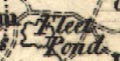
Fleet PondThe lake in Stratfield Park is shown; some other large ponds and lakes are not.
Bridges are implied by a road crossing a river, rather than shown by a symbol.
Rivers are drawn by wiggly lines tapering up from the coast, some are labelled, eg:-
River Avon
Boldre Water
Lymington CreekBraiding might be shown.
Some ponds are shown:-
Fleet Pond
Woolmer PondBridges are implied, perhaps, by roads crossing rivers. A few are labelled eg:-
Badge Bridge
Hartford Br.
Rivers are drawn by a wiggly line tapering inland; braiding might be suggested. Some rivers are labelled, eg:-
Riv. Stour
Wily RiverThe second of these is the River Avon, to which the River Wylye is a tributary joining at Salisbury.
All of Hampshire's main river systems are drawn, with some tributaries. Bridges are not noticed, only implied where a road crosses and interrupts a stream.
Rivers are drawn by a wiggly line tapering inland. An estuary has shading continued from the coast, for examples the Hamble and Itchen. Wider rivers are drawn with a double line plus form lines, for example the Avon up to Ringwood. Braiding might be indicated. Not all rivers are labelled, but see:-
Avon R. [by Lymington]
Test R.
Beaulieu Riv.Most of the main river systems are shown, with some tributaries. Without a detail study I feel that some rivers are not dealt with as well as others - the upper parts of the Itchen, the Rother, and where is the Wallop?
Bridges are not particularly noticed; they are implied where a road crosses and interrupts a river. They are not much labelled, but see:-
Bridgeover the Test near Uphill; and on the Hart:-
Hartford Br
Bakers BrElsewhere, at Hamble for example, roads either side of a river suggest (no more) a ferry.
A few ponds are drawn in outline with form lines, perhaps labelled, eg:-
Fleet Pond
Woolmer Pond
Rivers are drawn by wiggly lines tapering upstream. A few are labelled, eg:-
R. Avon
R. Test
R. ItchingThe main coastal rivers are all drawn. Some of the inland rivers - Wey, Blackwater and Enborne - are drawn but others - Rother, Loddon etc, are missing.
Bridges are implied by a road crossing and interrupting a stream. None are labelled (?).
Rivers are shown by wiggly lines. Beyond the river's estaury the line is quite thin, except the major rivers which have form lines on one side of the single wiggly line. Some braiding is indicated. Some rivers are labelled, eg:-
Anton or Test RiverAn example of a pond, this with form lines, is:-
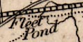
Fleet Pondwith the railway, added to a later edition of the map, engraved through the middle.
Some bridges are shown by the road interupting the course of the river.
An aqueduct is suggested under the Basingstoke Canal NW of Odiham.
Only river estuaries are shown, no river inland.
Rivers are drawn by a fine wiggly line. Some rivers are labelled, eg:-
Test R.
Itching R. The River Test is shown with some tributaries; the Dun? but not the Wallop, the Bourne Rivulet and the Dever, but not the upper branch of the river through Whitchurch. The Enborne, Loddon system, Rother ... are missed.
Rivers are shown by wiggly lines tapering upstream from their shaded estuary. Rivers may be labelled, eg:-
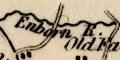
Enborne R.
Beaulieu Riv.
Itching R.
Boldre W.Braiding may be shown, for example the complicated streams of the Avon south of Ringwood:-
In a few rivers the navigable channel is indicated, for example in the estuary of the Itchen up to South Stoneham, where the navigation cuts begin.
All Hampshire's main rivers are shown, with some tributaries.
Alresford Pond is drawn, but not labelled. But:-
Woolmer Pond
Fleet Pondare more clearly drawn in outline, and shaded. Other ponds are shown, for example in the park at Dogmersfield.
Bridges are mostly implied where roads cross, and interrupt, rivers. A few bridge places are named, eg:-
Red bridge [might be the settlement]
bridge [Test, S of Timsbury]
Pot Br. [N of Odiham]
Rivers are drawn by a wiggly double line narrowing to a single line tapering upstream. Braiding might be suggested, as on the Avon around Ringwood. Some rivers are labelled, eg:-
R. Test
Blackwater R.Most of the Hampshire river systems are represented, without much detail.
Rivers are drawn by a wiggly line tapering inland. Some braiding is shown. A few rivers are labelled, eg:-
Avon R
Test R
Blackwater R.Printed white on black, it is not easy to follow river courses, or even to find rivers. Not all the main river systems of the county are shown; no Rother, no Enborne, for examples.
Rivers are not shown except by the shape of their estuary.
Rivers are drawn by a wiggly line tapering upstream. None are labelled. All the major river systems of the county seem to be represented, with numerous tributaries.
Rivers are drawn with a fine wiggly line inland from their estuary. The larger streams, Avon, Test, and Itchen, are drawn with a double line, and braiding shown, for example at Fordingbridge. Some rivers are labelled, eg:-
R. Avon
R. Test
Blackwater R.but river names are crowded out by other place names.
Bridges are implied where a road crosses, and interupts, a river. Some are labelled, eg:-
St. Leonards Bridge
Hartford Br.Ponds are drawn as outline with shading, examples, near Fleet, in Paulton's Park, in Hurstbourne park by Whitchurch.
A ferry might be labelled, eg:-
Ferryover the Beaulieu River from Ginns to Exbury. The ferry over the Itchen at Southampton is not shown.
Rivers are drawn by wiggly lines, broad and shaded at the lower ends, tapering to a thin line upstream. Some brading is shown. Some rivers are labelled, eg:-
River Enborne
R. Stour
Lymington R.
Anton or Test RiverBridges are fairly clearly indicated where roads cross and interupt streams. A bridge might be labelled, eg:-
Timsbury Br.
Rumbridge
Post BrThe last is Ports Bridge. I think the 2 rivers ought to have shading between them ie they are 1 broader river.
Ponds might be drawn as an outline, perhaps labelled, eg:-
Fleet Pondwith the railway engraved over it. Alresford Pond is shown but not labelled.
Rivers are drawn by wiggly lines tapering upstream. There is some attempt to show the size of the stream by the size of the drawing. Braiding, south of Stockbridge and north of Winchester for examples, is shown by what looks like a narrow pond with from lines. Some river are named, eg:-
Boldre R.
Enborn Riv.
Avon R.The last being the water between Milford and Lymington. Most of the county's major rivers are shown, with some tributaries.
A pond might be drawn in outline, with form lines, for example:-
Fleet PondBridges are not drawn but are implied by a road crossing and interrupting a river. Most are not labelled, but see:-
Hartford Br.
Bakers BrThe first being a settlement as well as the bridge; the second being a bridge nearby.
Rivers are drawn by a double wiggly line, which becomes a bold or less bold single line further inland. Braiding and islands are indicated. Many rivers are labelled, eg:-
Riv. Avon
River Itchin
River Anton, or TestBridges are indicated by an interuption to the river where a road crosses; the registration is sufficiently good (remember that roads are shown reversed out ie white on colour from the litho stone for the county area colour, and do not have engraved edges) to match roads to crossings. A bridge might be labelled, eg:-
Hartford Bre.A pond might be drawn in outline, with blue shading, and labelled, eg:-
Woolmer Pond
Fleet Pond
Rivers are only noticed as channels in the foreshore or estuaries. Some are labelled, eg:-
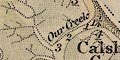
Our Creek
Titchfield River
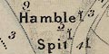
Riv. Hamble
The River Hamble has a series of posts marking the channel.
Ports Creek is clearly drawn, unlabelled, the bridges of road and railway both shown. The long bridge over the channel separating Hayling Island is labelled:-
Hayling Bridge.On the west tip of Hayling Island is a:-
Ferry
Rivers are drawn by bold wiggly lines with some indications of braiding. Tributaries are included fairly carefully, but no river is named. A few ponds are shown, for example at the head of the Candovers Stream.
BRidges are not drawn, but where roads cross rivers they interupt the drawing of the river.
Rivers are drawn by wiggly lines, fairly thin above their estuaries. None are labelled. There are some very confused river lines in the Blackmoor area.
Fleet Pondis labelld and drawn; some other ponds are labelled, eg:-
Blackmoor Ponds
Frensham Pond
Rivers are drawn by a wiggly line tapering inland from their estuary. The river or estuary might be labelled, eg:-
Lymington Creek
Anton River
Itching R.
Holly Water [at Woolmer]All the main river systems of the county are represented, with some tributaries.
A few ponds are drawn in outline and labelled, eg:-
Fleet Pond
Woolmer Pondbut not the great pond at Alresford.
Bridges might be labelled, eg:-
Knights Bridge
Thornford Br.on the Enborne, but might otherwise only be implied by a road crossing and interrupting a river.
Rivers are drawn with a wiggly line tapering inland from their estuary. Few are labelled, eg:-
Beaulieu R.
Anton R.The latter labelling the Test.
Most of the main river systems are represented, but without any detail of tributaries etc.
Bridges are implied where roads interrupt a river, but are not specifically indicated or labelled.
Rivers are not shown beyond their estuaries.
Rivers are drawn by wiggly lines tapering inland from their estuaries which have shading continued in from the coast. Broader parts of rivers are drawn with a double line. A few rivers are labelled, eg:-
Avon R
Crockford Water [east of Boldre]
Blackwater River
Ex or Beaulieu River
Dark Water [near Stans Ore Point]Some of the river names are less common on other maps. An upper part of the Test, about Whitchurch, is labelled:-
Anton Rbut so is the tributary of the Test from Andover. The tributary usually called the Bourne Rivulet, through St Marty Bourne, is labelled:-
Test R.Just what firm test can be used to determine which branch at a junction is the tributary and which the main stream!
Braiding is drawn, for example at Breamore on the Avon. And all the river systems are drawn with many tributaries.
Some ponds are marked, and might be labelled, eg:-
Woolmer Pond
Gomer Pond (near Browndown)The pond at Alresford is drawn but not labelled. Two ponds are shown at Fleet, named only by the adjacent:-
FLEET POND STATIONon the railway.
A pond might be shaded, as at Woolmer, or not, as at Alresford.
Bridges are mostly indicated by a road interrupting a river. Some are named, eg:-
Avon Bri. [over the Avon at Avon]
Iford Br.
Kitcomb Br [near Leckford]Other bridges are suggested by place names, such as Fordingbridge, Stockbridge, Horse Bridge Station, etc. There is a gap in the river drawn at:-
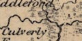
Palmers Ford
Rivers are drawn by wiggly lines tapering upstream. Braiding might be shown, as in the Avon near Ringwood. Some rivers are labelled, eg:-
R. Blackwater
R. ItchenThe Bourne Rivulet is labelled as the Test; this is not an unusual difference of opinion about which stream is the Test headwater.
A pond might be drawn in outline, shaded with blue and its boundary tinted blue as:-
Fleet PondThere are other, unlabelled, ponds as in Paultons, Hackwood and other parks.
The sea inlet between Exbury and Lymington is labelled:-
Sowley PondBridges are not particularly marked, but are implied by a road crossing and interrupting a river. A few are labelled, eg:-
Kilecombe Br [Kitcombe]
Hern Bridge [Hurn]
At Hythe the pier into Southampton Water is drawn and the Hythe Ferry crossing marked by a dotted line.
Rivers are drawn by wiggly double lines, perhaps with form lines, narrowing upstream to a single tapering wiggly line (!). As well as rivers, numerous channels, 'lakes', are shown in foreshore areas and harbours. Braiding is shown; there is a splendid lot of this at Ringwood.
All the major river systems are shown, with numerous tributaries. Some rivers are labelled, small as well as large (but not all the large rivers), eg:-
Dark water Brook
River Test
RIVER ENBOURNE
BLACKWATER RIVER
Bramshaw Brook
Holy Water [Woolmer]Where appropriate, rivers are continued outwith the county area.
A number of ponds are shown, with form lines. These might be labelled, eg:-
Woolmer Pond
Sowley PondBridges do not seem to be marked especially, but might be labelled, eg:-
Knights Br.
Eversley Bre.
Ram bridgeOthers are implied by roads or railways crossing, and interrupting, streams, for example see Northam Bridge.
Rivers are drawn by a double line where broad, the Thames in London for example, and by a wiggly line tapering upstream where narrow. Braiding might be shown, as north of South Stoneham on the Itchen. Some rivers are labelled, eg:-
Loddon R.
R. Itchin
The Anton or Test R.Bridges are not particularly noticed but are implied where a road crosses and interrupts a stream.
A pond might be drawn in outline and labelled, eg:-
Fleet Pondwhich is crossed by the railway. Three small ponds are drawn near Basingstoke, labelled:-
Newram Springs
Rivers are drawn by a wiggly line tapering inland from their estuaries. A couple are labelled:-
AVON RIVER
Dark Riv [which seems to be Beaulieu River]Most of Hampshire's river system from the coast are drawn, with tributaries. Other river systems are less well treated.
A rectangular pond, crudely shaded, is drawn and labelled:-
Fleet Pondand there are possible ponds or lakes elsewhere, for instance at Bishopstoke?
Rivers are drawn with a double line shaded horizontally until it narrows to a wiggly line. The broad reaches far inland, not just the estaury; for instance, the Test is broad up to Leckford.
Rivers are mostly unlabelled, but see:-
R. AvonBridges are not drawn, but implied by roads crossing and interrupting rivers.
Rivers are drawn by a wiggly line tapering upstream. Some rivers are labelled, eg:-
R. Avon
R. ItchingNot all the county's main rivers are shown. It is possible to find the Stour, Avon, Lymington, Beaulieu, Test, Itchen, Hamble, Meon, Blackwater, Enborne, and a few tributaries.
Rivers are drawn by a double line with form lines, narrowing to a wiggly line tapering upstream. Some rivers are named, eg:-
River Stour
Beaulieu R.called the Exe in the descriptive text, and:-
Anton or Test R.listed separately as chief rivers, and:-
R. RotherAll the county's main river systems are shown, with tributaries.
A pond might be drawn in outline with shading, labelled, eg:-
Fleet PondThere are some tiny ponds at the stream heads in Woolmer Forest. Alresford Pond is clearly marked, but the River Alre is not shown, and part of the Itchen is missing from about Ovington to the join of the Candovers Stream.
Bridges are not much noticed, but see:-
Bursledon Br.
Boldre BridgeVarious other bridges are implied by roads or railways crossing and interrupting streams.
A ferry might be labelled, eg:-
Ferryacross from Hamble on the River Hamble.
Some rivers are drawn by a wiggly line, perhaps labelled, eg:-
Anton [River Test]
Itching R
Rivers are drawn with a thin wiggly line, tapering inland. They might be labelled, eg:-
R. Anton, or Test
R. HambleBraiding might be shown, for example at Ringwood.
Some ponds are drawn in outline, and might be labelled, eg:-
Fleet PondAlresford and Woolmer ponds are drawn but have no name.
Bridges are only implied by roads interupting the stream. Some are labelled, eg:-
Knight's Br.SW of Ringwood there is:-
Shepherd's Spring
Rivers are drawn by a wiggly line tapering inland. Some rivers are labelled, eg:-
Avon R.
R. ItchenIn Hampshire the following rivers can be recognised: River Stour, River Avon, Avon Water, Lymington River, Beaulieu River, Rivers Test, Dun, Anton, and Dever, River Itchen and Candovers Stream, River Hamble, River Meon, Wallington River, River Rother, two parts of the River Wey, Blackwater River, River Hart, Rivers Loddon, Lyde, etc, and the River Enborne. This is all the major rivers and some tributaries.
Rivers are drawn by wiggly line tapering upstream. Some are labelled, eg:-
Lymington R.
Beaulieu or Exe R.
R. Test or Anton
R. Titchfield
R. ItchenNearly all the main river systems of Hampshire are shown, with some tributaries. The head of the Itchen is missing.
A pond might be drawn in outline and labelled, eg:-
Fleet Pd.The Alresford Pond is drawn but unlabelled, and might not be recognised.
Rivers are drawn by a wiggly line tapering upstream. Braiding might be suggested, as at Ringwood. Some rivers are labelled, eg:-
Anton R. [Test]
Blackwater River
River EnborneAll the major river systems seem to be represented, with some tributaries.
Bridges are implied where a road crosses and interrupts a stream. At Christchurch the bridge over the Avon seems to be missing, or is completely masked by the shading in the river estuary.
A few bridges are labelled, eg:-
Palmers Br [SW of East Wellow]
Steaford Brover the Slea by Headley Pond.
Some ponds are noticed. Fleet Pond is drawn in outline, unlabelled. One of the ponds at Woolmer is drawn in outline with shading, perhaps labelled:-
Headley PAnother:-
Woolmer Pondis labelled, but not drawn.
Newram Springs
are labelled, south of Basingstoke.
Rivers are drawn by a wiggly line tapering inland. Braiding might be shown, for example north and south of Ringwood on the Avon. Some rivers are labelled, eg:-
Avon River [Salisbury Avon]
Anton or Test River
Enborne
Itching River
Avon Water
R. StourAll the main rives of the county and many tributaries are shown. Following rivers is difficult in this densely drawn map.
Some bridges are noticed, eg:-
Knights Bri.on the Enborne.
Some ponds are labelled, eg:-
Woolmer Pond
Tanners Pond [N of Kings Sombourn]
Rivers are shown by wiggly lines and might be labelled, eg:-
Lymington R.
R. TestAll the major river systems of the county are shown and labelled, with some tributaries.
Rivers are incised lines, tapering inland. Two are labelled:-
R. STOUR
R. AVONIn Hampshire it is possible to recognise the River Stour and Moors River, River Avon, Lymington River, Beaulieu River, Bartley Water, River Test, and River Itchen. There are a few smaller streams as well.
Rivers are drawn by a wiggly line, perhaps with some braiding, and perhaps labelled, eg:-
Riv. Avon
R. Itching
R.TeseThe last is called the Anton nearer the coast. Most of Hampshire coastal rivers are noticed, but the inland rivers are less well treated.
Rivers are drawn by wiggly lines tapering at their heads. All the main river systems of the county are shown, with quite a number of tributaries. Many rivers are labelled, eg:-
Riv. Enbourne
Wallop Brook
R. Titchfield / R. Meon
Dead WaterSome ponds are shown in outline. Some are labelled. They might be shaded blue like the sea:-
Sowley Pondshaded but overprinted by the electoral area colouring, like the unlabelled pond at Blackmoor - one of the Woolmer Ponds, or not shaded, but overprinted as:-
Fleet PondBridges are not particularly noticed, but are implied by roads crossing, and interrupting, streams. Notice particularly Northam Bridge over the Itchen.
Rivers are drawn in outline, tinted blue. Narrows and braiding are shown. They might be labelled, eg:-
Wallop Brook
R. AntonPonds or lakes are drawn in outline, tinted blue.
Bridges are implied by the road crossing and interrupting a stream. Some are labelled, eg:-
Blackwater Bri.
Major rivers are drawn by a wiggly line, and might be labelled, eg:-
R. Avon
R. TestHampshire has the Avon, Test, Itchen, Wey, Loddon, Blackwater, and Enborne (?).
Rivers are drawn by wiggly lines, some labelled, eg:-
Alre [the Meon]
Itchen
Anton or TestIn Hampshire, all the main river systems are shown with their important tributaries.
No rivers, relief or woodland is shown.
Only very few non railway details are shown, eg:-
SALISBURY PLAINlabelled and drawn by a shaded red area. A bold dotted circle is labelled:-
STONEHENGEIn Hampshire the:-
NEW FORESTis labelled, but there are no tree symbols.
Above their estuaries, which are printed blue with the sea, rivers are drawn by a wiggly line tapering upstream. Some rivers are labelled, eg:-
Test
ItchenThe rivers shown in Hampshire include all the major streams; Stour, Avon, Lymington, Beaulieu, Test, Itchen, Hamble, Meon, Rother, Wey, Blackwater, Hart, Lyde, Loddon, Enborne, and a few tributaries.
Rivers are drawn by a wiggly single or double line, and might be labelled, eg:-
R. MOLEThe Thames is drawn wide enough to have its label between its banks.
A pond might be drawn in outline and labelled, eg:-
HEATH POND [Petersfield]
FOLLY POND [SW of Liphook]Bridges are implied by roads crossing and interrupting a stream, generally none are labelled. Two Thames bridges in London are drawn as bridges with several arches, one labelled:-
WESTMR. BR.
Some rivers are drawn by wiggly line, tapering inland. Only:-
AVONis labelled. The Stour, Avon, Test, Itchin, Meon, and Rother can be recognised.
Rivers are printed in the darker blue, showing the stream's course and width, and braiding, in reliable detail. Every river that might show up at the scale is shown on the maps, many labelled, eg:-
Wallington River
RIVER ITCHEN
Cove BrookIn river estuaries, as the river widens, the darker blue gives way to the lighter blue of the sea, with darker blue shading, done with a pattern of spots, at the edges. Further down still the foreshore is printed as described above:-
Johnston 1920:-
... In the new maps the rivers and streams are drawn solid, whereas on the old maps they retained their engraved form. ...Bridges are drawn with a recognisable bridge symbol under a road, or railway. Some bridges are named, eg:-
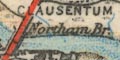
Northam Br.A ford might be drawn across a road, eg:-
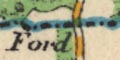
Fordacross the Sandhurst to Darby Green road crossing the Hampshire boundary.
Ponds are drawn in outline, tinted blue, eg:-
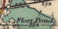
Fleet Pond
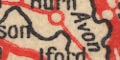
Rivers are drawn by a black wiggly line, and might be labelled, eg:-
R. Test
R. ItchenIn Hampshire there are only the Stour, Avon, Test, Itchen, and Meon, and no tributaries. A few other estuaries are recognisable, such as the Beaulieu River.
Most rivers are drawn by a wiggly line; the Thames which is drawn at its width. Braiding is shown, for instance on the Itchen near Winchester. River names are given for many of the streams, eg:-
Lyde River
River Loddon
River Test
Source of River Teston page 14, Basingstoke to Whitchurch.
The major river systems are marked, their wiggly lines emphasised by the surrounding relief.
rivers |
|||||||||||||||||||||||||||||||||
| wiggly lines |  |
|
|
|
|
|
|
|
|
|
|
|
|
|
|
|
|
|
|
|
|
|
|
|
|
|
|
|
|
|
|
|
|
Bury, Henry: 1927=1931: Rivers of the Hampshire Basin: ProcHFC: vol.10
Doherty, J & Pilkington, J: 1983: Rivers and Wetlands: Hampshire CC:: ISBN 0 900908 76 9
Shore, T W: 1890=1893: Springs and Streams in Hampshire: ProcHFC: vol.2
Shore, T W: 1894=1897: Hampshire Valleys and Waterways: ProcHFC: vol.3
