
 Return to list of Features

NB: typical illustrated examples are described, NOT ALL examples.
absence of evidence is not evidence of absence
Richard Gough said:-
... the greatest merit of this map is, that it may justly boast itself the first among us wherein the roads and distances are laid down ...
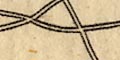
Roads are drawn by straight lines from settlement to settlement, in red ink. The direction of the road is generally correct.
Road distances are given from place to place, in red ink in roman figures. Over the whole map there is some tendency to give whole numbers rounded off to 5s, not unusual for medieval times. The distances seem to be crow flight distances; the unit of measurement is probably an 'old english mile' of 10 or 11 furlongs.
It is suggested that a comparison of the distances to the 'computed' distances guven by John Ogilby, 1675, might be interesting. This is hardly worthwhile within the single county of interest here.
The road pattern is of roads radiating from London, plus some secondary roads across the country. Sir Frank Stenton believes that the map maker did not include all the roads he knew, only those for which he knew distances. It may be that he selected those he felt were important.
The 5 routes radiating from the capital are:-
London to St Ives
London to Bristol
London to St David's
London to Carlisle
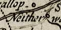
London to the NorthThe Exeter and Lands End route crosses Hampshire:-
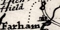
from London; through Kingston, Guildford and Farnham, Surrey; then vii miles to Alton, vii to Alresford, vii to Winchester, Hampshire; xx miles to Salisbury, Wiltshire; Shaftesbury, Dorset; Honiton and Exeter, Devon; on to Cornwall. This has, in the past, been interpretted as partly being the Pilgrims' Way, Winchester to Canterbury. I do not feel this to be a useful or necessary interpretation; not everything relates to religion. The route seems to be just one of a group of London centred routes.A south coast route is drawn:-
from Southampton, through Havant, Hampshire; xxii miles to Chichester, West Sussex; and on to Canterbury, Kent.
Although the title page of the 1676 edition of the atlas mentions roads on the county maps, these do not appear on this general map of the country.
Roads were not drawn on the original map. Editions from about 1675 (when John Ogilby published his road book) have roads added. They are, not very neatly engraved, drawn by double or single lines for greater and lesser roads. While the Lands End and the Barnstaple roads, and the Portsmouth Road are similar, but not the same, to John Ogilby's routes, other main routes are different. The main routes relevant to Hampshire are:-
from London; via Staines, Middlesex; (north of Bagshot, Surrey); then (north of Blackwater), Basingstoke, Steventon, (south of Whitchurch), Andover, Quarley, (north of the Wallops), Hampshire; to Salisbury, Wiltshire; and westward to ?Lands End.
branch from Andover, through Weyhill, Hampshire; to Amesbury, Wiltshire; continues as a lesser route.
branch from Basingstoke to Alresford, Hampshire.
from London; via Staines, Middlesex; across a corner of Surrey; across part of Berkshire; to Basingstoke, Hampshire, entering the county north of Heckfield.
from London; via Kingston, Surrey; then Winchfield, to Basingstoke, Hampshire, entering the county near Frimley.
from London; via Guildford and Godalming, Surrey; then Petersfield, (Horndean and Cosham not marked on map), to Portsmouth, Hampshire.
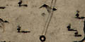
The three banners carried by cherubs are clearly engraved, readable.
The 1st scroll is a strip road map titled:-
The Road from LONDON TO BARWICKLondon is at the bottom with a road northeast to Harwic[ ]. The road north goes through Shorditch, Kingsland with turnings to Islington and Hackney, Newington, to Tottenham with its high Crosse, just over 5 miles into Middlesex. The miles from London are marked.
A compass rose on the scroll has star points for cardinal and half cardinal directions; North marked by a fleur de lys. Up the scroll is roughly north.
The 2nd scroll has a street map of:-
LONDONwith Westminster, Lambeth and Southwark labelled. This is orientated with North roughly at the top, the scroll held sideways. There is a simple compass rose, lines for the cardinal directions; fleur de lys for North, a cross for East.
The 3rd scroll has a road map of the area of:-
YORKSHIREand surrounding counties, parts of Westmorland, Lanc[ ]shi, Lincolnshire, etc. The map is a road map of the area, but not a strip map. This map is orientated with North at the top.
There is a scale line of:-
English milesThis is [surely] not meant as a serious scale to the map. Its 40 miles = 15.3mm gives a scale about 1 to 4200000, 66 miles to 1 inch. Measuring the positions of York, Lincoln and Durham does not reveal anything interesting, it wasn't likely to!
Roads are drawn by a double line, solid or dotted for direct or cross roads. Printed upper right is:-
A Catalog of the Roadsunder four headings. The roads which cross Hampshire are:-
Exprest in ye Mapp by a Double Black Line
Independents
...
London to ye Lands end
...
London to Portsmouth
...
Dependents
London to Barnstable
...
London to Southampton
...
London to Weymouth
...
Exprest by a Double prickt line
Principal Cross Roads
...
Oxford to Chichester
...
Oxford to Salisbury
...
Accidentals
...
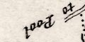
London to Pool
...The roads are not labelled on the map by name, nor do they have a plate number, so the map does not function as an index map.
Roads are what makes this set of cards exciting; this is the first road map of Hampshire.
The roads are pretty poor! They correspond in part to Ogilby routes, but only in part.
Roads are what makes this map exciting; this is the first road map of Hampshire. The roads are pretty poor! They correspond in part to Ogilby routes, but are not a copy of those routes in Hampshire.
Roads are marked with a double line or a single line, indicating their importance? Their engraving is inconfident, and could be judged to have been made at a late stage in map making; perhaps an afterthought; roads run through place names.
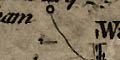
The sheet map is clearer than the reproduced playing card (partly because of the 'antiquarian choice' of a mid/pale brown to print the reproduction, a Margary taste I do not share) so it is easier to list the roads, (an = for a double line, a - for a single; modern spellings):-
(from Reading? Berkshire) = Basingstoke = Overton = (passing Whitchurch) Andover = (Wiltshire, towards Salisbury)
(from Reading? Berkshire) - Alton
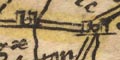
(from Farnham? Surrey) = Alton = Alresford = (crosses a bridge into) Winchester = Southampton
Winchester - Bishops Waltham
Southampton - Romsey
Southampton (across Southampton Water) - Ringwood
Southampton (across Southampton Water) - Dibden - Lymington
(Surrey) = Petersfield = Portchester
Petersfield - (West Sussex, probably Chichester)
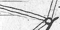
The joins from settlement to settlement show distances from place to place; on each join there is a cartouche with the crow flight distance between the places in computed miles or measured miles and furlongs. Joins are not made just for close neighbours, which might represent routes, but also show direct joins between places further apart. The resulting confusion of lines and distance figures has to be seen to be fully appreciated: this is not a road map. However: at a local level the map is quite readable; and it is not difficult to follow a track and to add distances. The map works, but the reader must stay aware that road distances are always longer than direct distances.
The post roads are specially picked out by a dotted line between the double line. The Hampshire routes, with computed and measured distances, are:-
The London to Lands End road:-
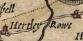
from London; through Bagshot, Surrey; 8 / 9'1 to Hartley Rowe, 9 / 10'0 to Basingstoke, 11 / 11'4 to Whitchurch, 7 / 6'7 to Andover, 6 / 6'4 to Midle Wallop, Hampshire; 10 / 10/7 to Salisbury, Wiltshire, and on to the west.The London to Southampton road, branching off this:-
Hartley Rowe 5 to Odiham, 5 to Alton, 10 / 9'6 to Alresford, 8 / 7'4 to Winchester, 12 / 12'2 to Southampton, Hampshire.and a less usual London to Portsmouth route branching from this:-
Alton, 2 / 2'7 to Farindon street, 8 / 9'6 to Petersfield, 6 / 7'3 to Harnden, 4 / 5'7 to Cosham. 4 / 5 to Portsmouth, Hampshire.
The major roads radiating from London are drawn by double lines out from the capital, which is in the lower right part of the map. Places are listed along the straight line route, with distances given between them. Some bits of route, which do not fit, are drawn alongside their parent route. County names are given alongside the route. The post-town symbol (+) is used with villages and towns, representing a post stage.
A network of post roads, other great roads, and small roads is shown by double and single lines as explained in the table of symbols. Notice the use of a dotted+solid double line to denote the 'other' great roads - this symbol more often indicates a fenced/unfenced road.
This map is an early derivative of the large straight line distance map by Robert Adams, 1677. Adams made his own reduced, two sheet, map in 1679. The cartouches used by Adams round place names, and circles round distances, are not copied, making a lot more space available for data and producing a more readable map. Rodney Shirley notes that the distances are often different from the Adams distances, and suggests that Walton and Morden used other sources, such as Ogilby 1675, and Morden's map 1678.
This is one the earliest maps of the county to show roads.
Roads are drawn by a double line; the spacing is variable, the lines get tangled in rivers and text labels, etc. It may be that they were engraved last, or were even a late addition. Many of the road segments which are expected on a map of this period are shown; but not all. For example, while the London to Lands End road manages to find its way across the county, the London to Portsmouth road does not.
Several road segments are labelled with a number in a circle, which could be the road distance in miles. It is not made clear where the segments begin and end.
The routes shown, modern place names, are:-
from Surrey, about the Golden Farmer; then Blackwater, Hartfordbridge, Basingstoke, Whitchurch, Andover, Over Wallop, Hampshire; into Wiltshire. [Ogilby plates 25, 26; Lands End road]
branch from Andover, Hampshire; into Wiltshire. [Ogilby plate 32; Barnstable road]
branch from Basingstoke, through Sutton Scotney, Stockbridge, Hampshire; then Lopcombe Corner, Wiltshire and beyond. [Ogilby plate 53; Weymouth road]
branch from Basingstoke, through Kingsclere, Hampshire; into Berkshire. [part of Ogilby plate 81; Oxford to Chichester road, missing from Alton onwards]
branch from Surrey, about the Golden Farmer; across a corner of Hampshire; Farnham, Surrey; then Alton, New Alresford, Twyford, to Southampton, Hampshire AND from Southampton, through Romsey; into Wiltshire. [Ogilby plate 51; Southampton and Salisbury road]
from outside New Alresford, through Winchester, Romsey, Ringwood, Hampshire; into Dorset AND from Dorset through Christchurch to Lymington, Hampshire. [Ogilby plate 97; Poole road, and to Lymington, the section Southampton to Winchester missed]
from West Sussex; through Petersfield, Bramdean, to Winchester, Hampshire. [Ogilby plate 39; branch off Chichester road at Midhurst]
from Petersfield, through Horndean, Cosham, to Portsmouth, Hampshire. [part of Ogilby plate 30; Portsmouth road, missing road to Petersfield]
[Ogilby plate 83 missed, only crosses a corner of Hampshire by Shipton Bellinger]
Roads are drawn by double or single line, indicating main and smaller roads. Distances are given by figures between town and town.
An interesting addition to the map is roads, drawn by double or single lines. This is one of the early road maps of Hampshire.
Two main routes are shown:-
London to Lands End; from Bagshot, Surrey; through Blackwater, across Herfordbridg, then Hertleyrow, Newneham, BASINGSTOKE, Wotton, Malshanger, Polhampton, Laverstoke, Whtchurche, Hurseborn, ANDOVER, Midle Wallop, Hampshire; to SARUM, Wiltshire; and westward.
London to Portsmouth; from GYLFORDE, through GODALMYNGE, and Thursley, Surrey; fown the Hampshire Sussex border through Lippock, to PETERSFELDE, then Heat house, Harnden, across Portes bridge, through Kings T[own], to PORTESMOUTH, Hampshire.There is a whole network of minor roads, which do not copy the 'Ogilby' routes. Ogilby plates 25, 26, 30, 32, 51, 53, 81, and 97 are matched, perhaps not exactly; but not Ogilby plates 39 or 83; and there are a lot of other roads.
A network of roads, graded as larger or smaller roads by having a double or single engraved line.
Routes of journeys are drawn by straight lines between settlements. The routes are graded, explained in a table of symbols:-
Verkalringe
...
Dese dubbelde linien [double line] Postwege
Dese dubbelde stippen [double dotted line] groote wegen
Dese enkelde linien [single line] kleene wegenThe only post road in Hampshire is the route from Staines, Middlesex; entering Hampshire by Blackwater, then Basingstoke, Whitchurch, Andover; then off through Salisbury, Wiltshire.
Road distances, town to town, are given on each straight line segment, eg:-
Basingstoke - Stockbridge 27
Alresford - Winchester 6
It would be interesting to build a table of distances from the data.
Roads are not shown on the chart. The bridge giving access to Portsea Island is drawn by an arch, labelled:-
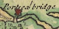
Portsea bridgeand guarded by more fortifications.
This is one of the earlier maps of Hampshire showing roads. Morden's earlier playing card map of the county in 1676 is too small, the roads are too indistinct, to be counted. Only a few principal road routes are shown; all correspond, roughly, to one of the routes in John Ogilby's 'Britannia', published 1675. Not all of Ogilby's choice of routes are marked.
The major addition to the map is a network of roads, drawn by a double line. Mostly the lines are solid, but between Kingsclere and Basingstoke one line is dotted, which became the convention for an unfenced road edge. The road engraving usually avoids interfering with existing engraving. Some roads are continued over the county boundary, in a couple of instances to a town outwith the county. Elsewhere the road stops abruptly inside the county. It is not always clear whether a road goes through or by a place.
The roads are:-
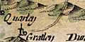
from the Surrey border south of Blackwater, through Herford bridg, Hertley Rowe, Basingstoke, through or by Overton, through Whitchurch, Husborne, Andover, Abbotsham, and passing between Quarley and Grateley, Hampshire; into Wiltshire.Equivalent to the Hampshire parts of John Ogilby's plates 25/26, the London to Lands End road; it should enter Hampshire at Blackwater, the map has the road's course about right, but Blackwater is plotted too far north.
from Surrey; through Lippocke, Petersfield, Beryton, Harneden and Oosham (sic), Hampshire, and across Ports Creek but no further.Equivalent to the Hampshire part of John Ogilby's plate 30, the London to Portsmouth road; it should continue to Portsmouth.
John Ogilby's plate 32 is not represented.
from Petersfield through Bramdean, to Winchester, Hampshire.Equivalent to the Hampshire part of John Ogilby's plate 39 a branch of the London to Chichester road; the section of road entering from Midhurst, Sussex, is not shown.
from Fernham, Surrey; through Alton, Alresford, Morested, Otterburne, to Southampton, Hampshire.
AND continuing from Southampton to Romsey, Hampshire.Equivalent to John Ogilby's plate 51, the London to Southampton road continued to Salisbury; the segment of road, crossing Hampshire, from about Bagshot, Surrey is not shown; the last part of the road is different, crossing the Itchen about Otterbourne, and south as part of Ogilby's plate 97; the continuing road from Romsey to Salisbury is not shown.
from Basingstoke through Sutton [Scotney], Stokbridg, and Broughton, to West Titherley.Equivalent to John Ogilby's plate 53, the London to Weymouth road; the continuation into Wiltshire is not shown.
from Berkshire; through Kingscler, Basingstoke, Alton, and Petersfield, Hampshire; then to Chichester, Sussex.Equivalent to the Hampshire part of John Ogilby's plate 81, the Oxford to Chichester road.
John Ogilby's plate 83 is not represented.
from about Alresford, through Winchester, Rumsey, and Ringwood, Hampshire.Equivalent to some of the Hampshire parts of John Ogilby's plate 97, the London to Poole road; the continuation into Dorset is not shown; a couple of side trunings are suggeste just before Ringwood, the road from Dorset through Christchurch to Lymington is not shown; the road from Southampton to Winchester is drawn as far as Otterbourne as noted above.
Some road distances are given in a little oval cartouche on the road, eg:-
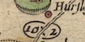
10:2between Winchester and Romsey. The end points of the segments are not clear. The match of distances to the mile positions given on John Ogilby's strip maps is not exact; it is not always easy to read his miles and furlongs. Very roughly:-
plate 25:-
Ogilby: Basingstoke 11'4 Whitchurch 6'6 Andover
Browne: Basingstoke 11'4 Whitchurch 6'7 Andoverplate 30:-
Ogilby: Petersfield 13'3 Cosham
Browne: Petersfield 20'2 Coshamor:-
Ogilby: Petersfield 17'7 Portsmouth
Browne: Petersfield 20'2 Portsmouthplate 39:-
Ogilby: Petersfield 18'2 Winchester
Browne: Petersfield 18'2 Winchesterplate 51:-
Ogilby: Alton 9'6 Alresford ... Southampton 8'2 Romsey
Browne: Alton 9'6 Alresford ... Southampton 8'3 Romseyplate 81:-
Ogilby: Kingsclere 9'2 Basingstoke 10'5 Alton 12'5 Petersfield Chichester
Browne: Kingsclere 9'1 Basingstoke 10'5 Alton 12'5 Petersfield 14'7 Chichester
Roads are shown by a double line. It is believed that some of the roads in this version of the map were added by Herman Moll about 1708, even though some were drawn by Morden about 1690s. The roads appear to be confused, perhaps from their dual authorship.
Roads are labelled to show where they go, out of the county; some of this labelling is upsidedown! eg:-
to Senan
to PoolThe labelling seems to have been started on the east side of the county, and the map rotated as each label was added: when the west of the map is reached, it is upsidedown.
The map shows main roads by double lines, road distances are given between places.
Roads are drawn by double lines in crude sweeps across the country outline. A few routes are labelled, eg:-
From London to PlymouthSettlements are labelled alongside the roads; road distances, declared to be reputed distances from place to place (not the advertised measured distances) are give by figures within the double line. You need to have a reasonable idea of what the distances should be in order to read them safely.
Hampshire roads are listed below.
Roads are drawn by single lines; town to town distances are given in figures.
A netword of roman military roads is drawn by double lines. The routes shown in Hampshire are:-
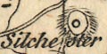
from Calleva - Henley, Berkshire; through Vindomis - Silchester, Venta Belgarum - Winchester, Clausentum - Southampton, to Regnum Vetum - Ringwood, Hampshire.
branch from Venta Belgarum - Winchester, Hampshire; to Sorbiodunum - Salisbury, Wiltshire, whence south and west.
A network of roads is drawn by double lines. These do not connect all across the coastal area. Some roads have destinations marked, eg:-
Road to London [at Southampton, Fareham, Cosham]
Road to Titchfield [at Fareham]
Road to Chichester [beyond Emsworth]
The itineraries are drawn as roads by double lines, tinted yellow. Each road is labelled, if you look carefully, with its number, eg:-
ITER XV.and might be named, eg:-
VIA ICENIANA / Ikening Street
Four of the itineraries cross Hampshire. Their interpretations by Stukeley and by Rivet and Smith are compared in the lists below (my punctuation). Rivet and Smith do have the advantage of 250 years of scholarship and excavation evidence. And still ideas are not settled; the whereabouts of Brige is not agreed, for one instance.
Itinerary 7 :-
Stukeley:-
ITER VII. - Londinium; Pontes / Stanes; Caleva Atrebatum / Farnham; Venta Belgarum / Winchester; Trausantum / Southampton; Regnum / Ringwood.Rivet and Smith:-
Iter VII - Londinio; Pontibus / Staines; Galleva Atrebatum / Silchester; Venta Belgarum / Winchester; Clausentum / Wickham or Bitterne, Southampton; Regno / Chichester.
Itinerary 13 :-
Stukeley:-
ITER XIII. - Isca Leg. II. Aug. / Caerleon; Burnium / Usk; Bescium / Old Town; Ariconium / Kenchester; Cicutio / Stretham; Glevum Colonia / Glocester; Durocorinium Dobunorum / Cirencester; Cunetio / Marleborough; Spina / Speen; Vindoma / Silchester.Rivet and Smith:-
Iter XIII - Isca / Caerleon; Burrio / Usk; Blestio / Monmouth; Ariconio / Weston under Penyard; Clevo / Gloucester; Corinio / Cirencester; Durocornovio / Wanborough; Spinis / Woodspeen; Calleva / Silchester.
Itinerary 14 :-
Stukeley:-
ITER XIV. - Isca Leg. II. Aug. / Caerleon; Venta Silurum / Caergwent; [cross the Sabrina / Severn]; Trajectus / Oldbury; Abona / Henbury; Aquae Sulis / Bath; Verlucio / Hedington; Cunetio / Marleborough; Spina / Speen; Vindoma / Silchester.Rivet and Smith:-
Iter XIV - Isca / Caerleon; Venta Silurum / Caerwent; cross the Severn; Abone / Sea Mills; Traiectus / ? ; Aquis Sulis / Bath; Verlucione / Sandy Lane; Cunetione / Mildenhall; Spinins / Woodspeen; Calleva / Silchester.
Itinerary 15 :-
Stukeley:-
ITER XV. - Isca Dumnoniorum / Exeter; Moridunum / Seaton; Durnovaria / Dorchester; Vindogladia / Winborn; Sorbiodunum / Old Sarum; Bragae / Broughton; Venta Belgarum / Winchester; Caleva Atrebatum / Farnham.Rivet and Smith:-
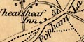
Iter XV - Isac Dumnoniorum / Exeter; Moriduno / Sidford; Durnonovaria / Dorchester; Vindocladia / Badbury; Sorbiodoni / Old Sarum; Brige / Ashley; Venta Belgarum / Winchester; Vindomi / Wheatsheaf Inn; Calleva / Silchester.
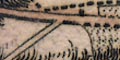
A network of main roads is marked by double lines, with at least one minor road by a single line, the Petersfield, Bramdean, Cheriton route that joins the Alresford to Morestead road. The double lines have either 2 solid, 2 dotted, or 1 solid 1 dotted lines , indicating fenced or unfenced edges. The influence of Ogilby's choice of routes is evident: Ogilby 25, 26, 30, 32 are shown; 39 is shown, but has a minor road from Petersfield to a junction beyond Bramdean; 51, 53, 81, 83, and 97 are all shown. Two extra roads are given: Winchester to Stockbridge; Winchester through Bishops Waltham, Fareham, to Cosham whence Portsmouth.
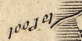
Destinations outside the county given, eg:-
to Pool
to BagshotNotice that these are upside down on the left; they read clockwise round the map, which style is seen on other maps.
Figures on the roads between settlements give distances from place to place. There might be a line drawn across the road as an intermediate distance point, eg from Wickham, 3 miles from Bishops Waltham, and:-
8 from Fareham. In most cases the end point of segments is taken for granted as to be settlement or a junction.
Roads are shown by a broad double line. These are drawn as a diagram, not intended to be an accurate represenation of the roads' routes across the country. They spread out from London going about the right direction. Some roads are named, eg:-
The Western Roadwhich is the London to Lands End road, not the London Bristol road which was often, till lately, referred as the Great West Road.
Other roads might be labelled with their destination, eg:-
to Southampton
Roads are drawn by broad double line in crude sweeps across the rough outline of the country. Routes are labelled, eg:-
to Portsmouth
The Western RoadSettlements are labelled along the sides of the roads. Road distances, declared to be computed miles between towns, are given by figures inside the double lines. Hampshire roads are listed below.
A selection of roads is indicated; at first glance these are the usual Ogilby selection.
The 'principal roads' in the county are drawn by a double continuous line. The routes displayed by Cowley differ from Ogilby's routes, although the important routes are still in evidence - London to Portsmouth, to Southampton, to Lands End, to Weymouth, and to Poole.
Destinations out of the county are labelled, eg:-
to London
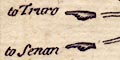
to Senan
to TruroA group of these labels, west of the county, is supported by a pointing hand symbol.
Road distances from place to place are marked beside the road. Thus Basingstoke to Alton is 8 miles, Alton to Petersfield 10, etc. The distance from Lymington to Southampton is given, 8 miles, on the road that needs a ferry at Hythe.
Distances outwith the county are not given.
The map has a system of roads drawn by double lines connecting places. Mostly the lines are solid, but dotted lines are used, presumably to show an unfenced road, for example across Woolmer Forest on the road from London to Portsmouth. A solid/dotted road runs from Petersfield to beyond Bramdean.
All Ogilby's routes are included, plus a few others.
There are some detached pieces of road; see described under bridges, above, and from the Hampshire border to Chichester in West Sussex. Roads are extended beyond the county boundary to show their destination or onward route. For example the road through Farnham, and the roads to Downton. Other roads outside Hampshire might be labelled, eg:-
to Pool
to Salisbury
to BagshotThese labels are added to the map upside down on the left (west) side - suggesting copying from Moll's version of Morden's small county map of about 1708.
Occasionally there are figures printed across a segment of road, the distance from one settlement to another. For example a
7half way between Horndean and Cosham. The engraving of the numbers is confused by the road lines underneath. It is not always obvous what endpoints are meant for the distance. A lot of segments have no distance.
Roads are shown by a double line. These are not well engraved; their spacing varies a lot.
Destinations of roads outside the county are indicated, eg:-
to GodlimainIn one case the road is continued, dotted, to its destination (Chichester).

A network of roads is drawn by double lines. It is not very clear, but main roads, perhaps turnpike roads, are distinguished by having one line bold. The quality of the engraving is poor; the double line width varies, line weight varies, junctions are a mess, ... Distances from town to town are sometimes indicated by a figure along the road; for example, Alton to Alresford has a '9'.
Some roads are extended outwith the county to a significant town, eg:- Chichester, Farnham, Salisbury, or Poole. Some other roads have their destination labelled, eg:-
29 to Staines
20 M to GodalmingThese labels are well inside the county boundary.
A road stretches down from the vantage point through Havant to Winchester, then via Southampton across the New Forest, to Christchurch and perhaps Poole. It is not drawn realistically.
Printed at the bottom of the map sheet is a list of distances of stages on the road from London to Poole:-
From Alton to Alresford 9.5. to Winchester 3.4. to Rumsey 12.1 to Ringwood / 17.5. to Pool 14. in all 56.7. from London 54 Miles.The distances are given in miles.furlongs, and the stages add up correctly as stated. But where is 54 miles from London?
These are not the distances along the road in the drawing.
Three grades of road are drawn about the county, explained in the table of symbols. The main roads include the Ogilby routes.
25/26 - Bagshot, Surrey; Blackwater, Basingstoke, Whitchurch, Andover, Hampshire; to Salisbury, Wiltshire.
30 - from London; Liphook, Petersfield, Horndean, Cosham, Portsmouth, Hampshire.
32 Andover; across Wiltshire border westwards.
39 - Midhurst, West Sussex; Petersfield, Winchester, Hampshire.
51 - Bagshot, Surrey; corner of Hampshire; Farnham, Surrey; Alton, Alresford, Southampton, Hampshire.
53 - Basingstoke, Stockbridge, Hampshire; across Wiltshire border south westwards.
81 - from Berkshire; Kingsclere, Basingstoke, Alton, Petersfield; to Chichester, West Sussex.
83 - across a corner of hampshire at North Tidworth.
97 - Alresford, Winchester, Romsey, Rngwood, Hampshire; towards Poole, Dorset; and Southampton, Winchester, Hampshire.There are additional routes.
At least 3 grades of road are shewn, explained in the table of symbols:-
Great or Direct Post Roads [bold and a light solid line]
Principal Cross Roads [2 solid lines]
Cross Roads [single solid line]
There are segments of dotted lines for roads, perhaps indicating unfenced parts of the way OR, more likely? indicating unclear parts of the way, eg across the heath west of Blackwater.
Roads are mostly shown by a double continuous line:-
but:-
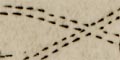
The Direct and principal Cross Roads are Marked where Open or Heathy thuswith a double dotted line
Across the middle of some road segments, within a circle, are road distances.
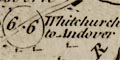
Distances between Market Towns thereon, are laid down in Measured Miles and Furlongs.There is often an indication of where the road is going, eg:-
6.6 Whitchurch to AndoverAt the bottom of the table of symbols is a handy reminder:-
NB A Furlong is the eighth part of a Mile.Roads out of the county might be labelled with their destination:-
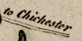
to ChichesterAll the Ogilby routes across the county are included, with, by this later date, extra main roads such as: Winchester to Fareham, Cosham Havant, Chichester; Petersfield to Havant; Winchester to Stockbridge etc; Romsey to Fordingbridge and west; Lymington to Southampton, via Lyndhurst and via Bealieu and Hythe, but both via Redbridge.
Roads are drawn by double lines, solid or dotted to indicate fenced or unfenced stretches. The roads include all the Ogilby routes plus a few bits more, missing the small piece of his route pl.83 that crosses the county near Shipton Bellinger. The extra routes are: Basingstoke to Winchester; Winchester to Stockbridge, but not onwards; Southampton to Lymington; Romsey to Fordingbridge; Winchester through Bishops Waltham, Fareham, Cosham, Havent to Chichester.
Routes out of the county are labelled with their destination, eg:-
to Oxford
to Salisbury
to Londonthough some routes are continued outside the county, for example to Poole, Chichester, and through Farnham. The out of county destinations are upside down on the left of the map, on their side across the top: they are all up the right way if you rotate the map anticlockwise from upside down!
Road distances between towns are given by figures alongside the road segment, eg:-
21 1/4for Basingstoke to Stockbridge. Some distances are missing; it is not always clear what distance is being given.
Roads are drawn by double lines, bold light, and single lines. Road distances are given between places by figures beside the road; read carefully to know what places the distances are between.
A network of roads is drawn by double lines. One of these is labelled:-
Chemins de Cranbornpresumably to show its destination off the chart.
A network of roads is drawn on the map by double lines, solid or dotted for fenced or unfenced. Side turnings are marked along some roads . The distances between tows might be given by a number in a circle on the road, eg:-
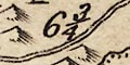
9.6between Alton and Alresford. There might be an explicit note of the end points, eg:-
Basingstoke to / Stockbridge 21.2otherwise it is not always clear where measurements are to and from. The distances are claimed to be 'Measured Miles'.
A road might be named, eg:-
Gravel Hillbetween Liphook and Petersfield. And a junction might be named, eg:-
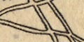
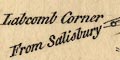
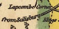
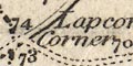
Labcomb Cornerjust into Wiltshire on the Exeter Road.
Road destinations outwith the county are given on a number of roads, eg:-
To Pool
to Reading
to StainesThis text might be upside down (To Pool for example) as found on Herman Moll's map, 1724.
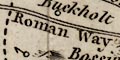
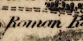
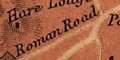
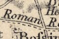
The road west from Winchester is labelled:-
Roman Road to Sarumand a road in the north west of the county, aligned with Salisbury and Silchester,is labelled:-
Roman Way
Same as Kitchin (but I have not checked thoroughly).
Exactly the same as Kitchin.
A network of roads is drawn over the county using double lines. These might be continuous or dotted, presumably for fenced or unfenced roads. Main roads are not distinguished. Most of the Ogilby routes are shown, but not completely; there are other main routes as well.
Destinations outwith the county are labelled, eg:-
to London
From Salisbury
From PoolAt least one road junction is named (in Wiltshire):-
Labcomb CornerSome roman roads are labelled:-
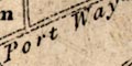
Port Way
Roman Way [Salisbury-Winchester]
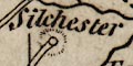
Ikenield WaySilchester roman town is drawn with a circle, outer ring, and hachuring, labelled in lowercase italic text:-
Silchester
The map has a network of roads drawn by a double line. At this scale only major routes are shown.
Most of the 'Ogilby' routes are shown, missing: a segment of Ogilby 51 between Alresford and Southampton, and the end segment of Ogilby 30 to Portsmouth. There are extra routes: Winchester through Stockbridge to Salisbury; Blackwater through Swallowfield to Kingsclere; and Winchester through Cosham to Chichester.
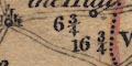
Road distances are marked in figures beside the road between towns (or villages). Whole miles or half and quarters are given, eg:-
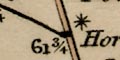
12
8 3/4The stretch of road from Andover through Lopcomb Corner to Salisbury is labelled:-
The Hull
Roads are what the maps are about. The road is drawn up the middle of the column, what was a scroll on Ogilby and some later imitators, showing bends and turnings within the narrow space. A double line is used; continuous or dotted lines presumably indicating fenced and unfenced roads.
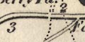
Distances along the route are marked by a dot and a figure at each mile; these are fairly, but not exactly, evenly spaced.
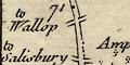
Turnings are shown, many of which have their destination labelled, to a near or far place, eg:-
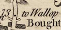
(plate 21 scroll 6 mile 73)
to Wallop
to SouthamptonA major turning is just beyond Basingstoke:-
to Andover & Lands EndThe Lands End road goes from Basingstoke through Whitchurch, Andover, etc.
A series of side turnings might be braced together with one destination label.
Alternative routes might be shown. For example just beyond Romsey leading into the heath land (plate 20 scroll 2 mile 9-11).
Roads are drawn by a double line. Solid and dotted lines are used, presumably indicating fenced and unfenced verges.
A road junction might be noticed, eg:-
Labcomb CornerThe destination of a road outwith the county is not usually given, but see:-
to Stainesat the NE of the county. Some roads west are continued to Salisbury, which is marked and labelled. (Farnham is ignored, though the road through it is drawn.)
Some roman roads are labelled, eg:-
Roman Road from Sarumon the route from Winchester towards Salisbury near Broughton; and:-
Roman Wayon the route aligned with Silchester and Salisbury to the north of Andover; and:-
Ikineld Wayrunning NW from Winchester.
A network of roads is drawn by double lines. Roads are not differentiated for size, nor for fenced and open roads.
Roads might be continued out of the county to a town etc, thus to Salisbury, Amesbury, Farnham, Midhurst, and Chichester. Or the road's destination might be given, eg:-
to London
From PoolMost of the old 'Ogilby' routes are represented, but no longer by simple lines of route. (route 83 is not included.)
Roads are drawn by a double line; these might be solid or dotted, perhaps indicating fenced and unfenced roads. There is an attempt to suggest road size by the width of drawing.
A network of roads is drawn by double lines for great or direct post roads and single lines for cross roads.
Roads are drawn by double or single line. The double appear to be direct roads, the single cross roads. Distances from place to place are given by the road.
Roads are drawn by a double line. Road distances from town to town are marked along the routes. At this scale only major routes are shown.
The road is drawn by a double line, solid for fenced, dotted for unfenced. The road runs up the middle of each strip, a rectangular 'scroll'. Distances from start, London for the main routes, is marked at 1 mile intervals by a spot in the road, and a figure.
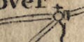
Junctions are drawn clearly, often labelled with their destination, large or small, eg;-
to Winchester
to Wallopand perhaps with the plate number of another strip map, eg:-
to Salisbury Pl.26at the junction half a mile on the west side of Andover.
Some side routes are noted at the bottom of the map:-
A Road goes from Warminster to Heytsbury 8 1/2 distant. & another to Shipton Mallet 10 1/2 distant. From Bruton a Road goes to Exeter and another to Tiverton.
Roads are drawn by a double line, solid or dotted, but only to where it crosses the canal, or to show the street plan of a settlement.
Roads are drawn by a double line; only major routes being shown at this scale. The routes through Hampshire are listed below.
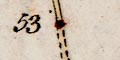
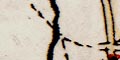
(page 103/104 scroll 3 mile 53)Roads are the defining element of these maps. Roads are drawn by a double line; this might be dotted, presumably indicating an unfenced road, for example across Longwood Down.
Junctions are clearly marked and labelled with the place they go to, eg:-
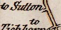
(page 103/104 scroll 3 mile 58-59)
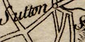
to SuttonSmaller roads might be shown by a single dotted line running to a nearby settlement, eg:-
(page 103/104 scroll 2 mile 44)
two side roads leading towards Binsted.An alternative route is occasionally shown, for example west of Romsey from mile 9 there is a 'short cut' of unfenced road across the heath.
The distance from the staring point of the route are marked alongside spots drawn in the road. These are often distances from London, measured from there, not from the start of the part of the route on the sheet. Distances from town to town are listed at the top of the sheet (already described).
Roads are drawn by a double line.
Three roads have dotted lines; the Portway, the roman road east from Winchester, and the road south from Silchester.
Roads are clearly drawn on the map by a double line, graded into two widths, the major roads having bold+light lines. The network of roads is extensive. The major roads include some but not all of the 'Ogilby' routes and shows routes which are now deemed to be significant.
Major roads crossing the county boundary have their destination, or start, labelled, eg:-
from Salisbury
4 Miles from Amesbury
to Newbury
Miles from Hyde Park Corner London R
to London thro' Guildford
Looking closely you will see little lowercase letters labelling the major roads at the county boundary. These are grouped by county.
Dorset border :-
a :- Christchurch - Poole
b :- Ringwood - Poole
c :- Ringwood - Wool Bridge, west
Wiltshire border :-
a :- Fordingbridge - Salisbury
b :- Cadnam - Salisbury
c :- Southampton, Ower - Salisbury
d :- Romsey - Salisbury
e :- Stockbridge or Andover - Lopcombe Corner and Salisbury
f :- Andover - Amesbury and west
g :- Andover - Ludgershall, Devizes
Berkshire border :-
a :- Andover, Highclere - Newbury
b :- Whitchurch - Newbury
c :- Kingsclere - Aldermaston, Reading
d & e :- Basingstoke - Reading
f :- Basingstoke - Reading
Surrey border :-
a :- Petersfield - Guildford; London
b :- Farnham to Guildford or Bagshot; London
c :- at Frimley - Bagshot; London
d :- at Blackwater - Bagshot; London
West Sussex border :-
a :- Liphook - across Sussex, Guildford
[b] :- Havant - Chichester
Perhaps these label joins of these major roads to their continuation on the relevant other county map. These letters are not printed on the 1787 edition of the map.
A few junctions are named, eg:-
3 Leg Cross [S of Hghclere]
Lopcombe Corner [in Wiltshire]A few roads have names, eg:
Chute Causeway
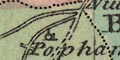
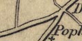
Popham Lane
Gravel Hill
Bradley Lane
New RoadThis last from near Eling towards Lyndhurst.
A label in the Lands End Road at Church Oakley:-
Dean Gatemay be a turnpike gate?
Ogilby routes :-
25/26, the Lands End Road, is shown.
30, the Portsmouth Road, is shown.
32, from Andover towards the west, is shown.
39, the branch from Midhurst to Winchester, now shown only by minor roads.
51, the Southampton Road, but no longer the same route, Cary shows the main route through Winchester not Twyford, the older route is shown by mminor roads.
53, Basingstoke to Salisbury, is shown.
81, Oxford to Chichester, is not shown as a contnuous route though it is all shown by a mixture of major and minor roads.
83, Oxford to Salisbury, shown by only by minor roads.
97, various parts still appear as major roads, but the route from Christchurch to Lymington is now only a minor road.
new routes :-
Some of the new routes worth noticing are (not always quite direct):-
Winchester, Whitchurch, Newbury.
Alton, Bishops waltham, Wickham, Fareham, Gosport.
Southampton, Wickham, Cosham, Havant, Chichester.
Salisbury, Fordingbridge, Ringwood, Christchurch.
Winchester, Stockbridge, Salisbury.
etc.
Roman roads are clearly marked and labelled:-
Roman Road from Old Sarum
Port Way
Roman Road [Winchester towards Silchester]
Icknield WayIt would be worth comparing these claims with what is accepted nowadays.
Silchester has its roman town marked by a ring of ?hatching with a central block.
A network of roads is drawn; the roads drawn by a double line, not differentiated by size etc.
Some routes leaving the county are labelled, eg:-
from Pool
to LondonAnd one junction is labelled:-
Labcomb Corner
Some roman roads are lebelled:-
Port Way
Ikenield way
Roman Way [Sarum-Winchester]At the end of one road is a circle surrounded by a ring of dots, for the roman town:-
Silchester
Roads are drawn in considerable detail using a double line. The 2 lines are bold/light for main routes. Continuous lines are used for fenced roads, dotted for unfenced.
Distances from London are marked along the main routes at mile intervals. On cross routes the distances are from the start of the route.
Route destinations on the more important roads leaving the county are given, sometimes with a distance, eg:-
30 Miles from Hyde Park Corner
to London
to Oxford 30 MilesSome roads, or stretches of road, are named, eg:-
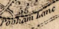
Popham Lane
Chute Causeway
Inhurst Lane
Roman roads might be labelled, eg:-
Port Way Roman Roador:-
Port Wayeand:-
Roman Road from Sarumgoing to Winchester.
Roads are drawn by double line, solid or dotted for fenced or unfenced. Larger roads are drawn broader with one line a little bolder; lesser roads are drawn narrower. A whole network of roads is shown.
I have not been able to check on what turnpike gates did exist, but I notice:-
New gate [N of Rowner]
Portsea Gate [N of Ports Bridge]
Hilsea Bar [at Hilsea]
According to the table of symbols the roads shown are turnpike roads. They are drawn with a double line. Some care is taken by the engraver to draw road junctions clearly. The destination of roads leaving the county is usually labelled, eg:-
to London
from Devizes'to' and 'from' do not seem to be used in a significant way? The labelling is missed in places, for example the road going to Chichester from Havant. Near Farnham none of the roads to it are labelled, but it is quite obvious where they point.
Some roman roads are shown, labelled:-
Port Way
Icknield Way
Roman WayThe last is that west from Winchester; the usage of capital letters at this period does not allow the assumption that this is a road name.
Roads are drawn by a single line. Going out of Hampshire to the west the roads continue on their way; going north or east, out of the range of the map, the destination of the road is labelled, eg:-
to London
from OxfordThe roads on this general map do not exactly match what is drawn on the county sheet.
A roman road might be labelled, eg:-
Roman Road [the Portway]
Roman Way [the Icknield Way]perhaps named, eg:-
Fosswayin Somerset.
Roads are drawn by double lines. Roads are differentiated by width, the wider roads mostly having bold and light lines which is often used to mark turnpikes at this period. As well as main routes there is a network of smaller roads.
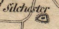
Silchester is marked by a block in a hachured ring, the roman town.
A very straight road is drawn aligned with Silchester and Salisbury, from about Ewhurst to near Quarley, labelled:-
Roman RoadThe main road from Winchester to Popham, continued as a small road towards Silchester to about Sherbourne, is labelled the same.
Roads are drawn by double lines; solid or dotted indicating fenced and unfenced roads. The county os covered by a network of routes. Major roads have one of the lines bold, and probably have road distances marked by a dot and a figure at mile intervals. The miles are measured from a local town; thus from Alton to Farnham, from Alton to Fareham, from Alresford to Alton, for examples. Read carefully, especially where routes join.
Destinations out of the county are given on a number of roads, eg:-
Great Road to London [Ogilby 25 route]
to Guildford and London
From London
from Sarum
from Salisbury
to NewburyA few roads and junctions have names, eg:-
Wickham Corner [by Wickham]
Ridge Lane [along Froxfield Hanger]
Lambs Corner [3m north of Lyndhurst]
Popham Lanebut not the famous Lopcombe Corner!
There is at least one turnpike road indicated by:-
Turnpike Gatemarked by a block for the toll house, and a line across the road, just west of Andover.
Oval outlines etc mark Danebury hillfort, labelled:-
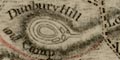
Dunbury Hill and Campon Longstoke Hill.
Quarley has two ovals and dots inside, labelled:-
Quarley Mount and Camp
Tidbury Hill Camphas nothing except the label. Etc.
Silchester roman town in drawn in outline with the supposed street pattern. An outside to the east:-
AmphitheatreA number of roman roads are labelled, eg:-
Port Way
Roman Road from Old Sarum to Winchester
Settlements are not important. Both Gosport and Portsmouth are drawn by areas of buildings and streets making a street map - I have not made any comparison to reality. Although a road is shown leading out of Gosport, drawn by a double line, very few roads are shown. The road across Ports Creek is not drawn, for example. Fareham is plotted as a few blocks for buildings on a road junction.
Roads are drawn by a double line. The routes shown in Hampshire are:-
from London; via Staines, Middlesex; across Surrey; through Basingstoke, Whitchurch, Andover, Hampshire; then Salisbury, Wiltshire; and west.
branch from Andover, Hampshire; then Ambresbury, Wiltshire; and west.
branch from Basingstoke, through Sutton [Scotney], Stockbridge, Hampshire; then Dunkton, Wiltshire; and west.
from London; via Staines, Middlesex; through Farnham, Surrey; then Alton, Alresford to Southampton, Hampshire; AND from Southampton, through Romsey, Hampshire; then Salisbury, Wiltshire; etc.
branch from Alresford, through Winchester, then Romsey, Hampshire; to Salisbury, Wiltshire; etc.
from London; via Godalming, Surrey; then Petersfield towards Portsmouth, Hampshire.
perhaps from Oxford, Oxfordshire; across Berkshire; through Basingstoke, Alton, Petersfield, Hampshire; to Chichester, West Sussex.
Roads are drawn by double or single line with the mail coach routes emphasised as explained in the table of symbols. The mail coach routes through Hampshire are:-
(London to Exeter) from London; via Staines, Middlesex; and Bagshot, Surrey; then Basingstoke, Whitchurch, Andover, Hampshire; on to Salisbury, Wiltshire; and Dorchester, Dorset; to Exeter, Devon.
(London to Southampton and Poole) branch from the Exeter road at Bagshot, Surrey; then across a corner of Hampshire; through Farnham, Surrey; Alton, New Alresford, Winchester, to Southampton, Hampshire; branching to Lyndhurst and Lymington, Hampshire; and to Ringwood, Hampshire; then to Poole, Dorset.
(London to Portsmouth) from London; via Godalming, Surrey; then Petersfield to Portsmouth, Hampshire.Across the margins in between the panels of map the roads are connected by straight dotted lines.
Double and single lines mark the roads; numbers key the routes to the itineraries in the road book.
Roads are drawn by double lines. More importnat roads are drawn wider with one line bold. Diagrams of main roads on the map, and roads in the itineraries in the book, have been drawn. Road distances from London are given by the towns.
Some of the major roads are drawn with blocks, for houses, all along. For example the road from London to Lands End, Blackwater, Basingstoke, Andover, etc.
At least one road junction is named:-
Lapcombe Cornerdrawn within the county, though it is not. In the accompanying itinerary in the book this is 'Lopton Corner'.
Destinations of roads outside the county are given, eg:-
from Salisbury
fr. Pool
to Reading
to LondonNote that the itineraries show a matching bias to think of the route to, not from, London.

Roads, believed to be post roads, are drawn by a double line, coloured yellow.
The map is a road map, and shows only a limited selection of routes. Although places on the map are plotted in their proper position (near enough) the roads are nearly all drawn with straight segments between the places.
Roads are graded by importance. More important roads are drawn with a double line; the two main routes from London to Portsmouth, and branching off at Godalming, to Chichester. Lesser routes are drawn by a single continuous line, and smaller routes by a single dotted line. There are lengths of double line with one or both sides dotted which denote 'Cross Mails':-
Some places are accompanied by a connecting label, eg at Alton:-
see p.5.Distances are given at places, not at regular miles along the roads. Distances are given to the nearest quarter mile from London Bridge on plate 3, from Hyde Park Corner on plate 5. For example at Petersfield:-
54 1/4from London Bridge.
Some of the minor routes have their length alongside the road, for instance the dotted route labelled:-
At least one junction is named:-
Petersfield to Alton 13 miles.
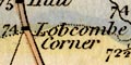
Lobcombe Cornerjust outside Hampshire, in Wiltshire on the Lands End Road.
There are miscellaneous references to turnpike; a square dot marking either a toll gate or the start of a stretch of turnpiked road? Examples
Fishbourn Turnpike
Cocking Turnpike
Vauxhall TurnpikeAnd also
Benge's GateAnd in Hampshire:-
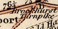
Brookhurst Turnpike [plate 5]
Roads are drawn with a double line; they are graded into major and minor roads by width. The major roads (nearly) all have one line bolder than the other, and are tinted pale brown or orange.
There are a few road names, eg:-
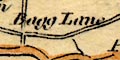
Bagg Lanebetween Lymington and Christchurch. The destinations of roads outside the county is sometimes given, eg:-
to Oxford
from Amesbury
from Blandford and Weymouth
to London
Some roman roads are labelled, eg:-
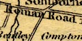
Roman Road from Sarumto Winchester.
The Portway is clearly drawn, but not labelled.
A network of roads is drawn by double lines. The network does not include all the older established routes, does include some of the newer roads, and has some unexpected gaps. Only a diagram can demonstrate this.
A detailed network of roads is shown over the whole map. Roads are drawn by double lines, solid or dotted for fenced or unfenced. A line at right angles to the road at the end of a dotted edge, indicates a field boundary delimiting unenclosed land. Roads are drawn with slightly different widths; broader roads with one line bolder are turnpike roads, narrower roads are minor roads. Tracks are drawn by a single dotted line.
How much smoothing of the routes is made has not been investigated, but it is clear that these roads are plotted to show how they lie; bends and junction realistically laid out within the limitations of the scale.
A few roads have names, eg:-
Hog Lane [NW of Kingsclere]
Cock Lane [W of Winchester]as are some junctions, eg:-
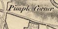
Pimple Corner [WNW of Bossington]
Lobcombe Corner
Five Lanes [W of St Mary Bourne]
Hampshire Cross [N of South Tidworth]
Three Legged Cross [5 ways, E of Ashmansworth]Some signposts are indicated, eg:-
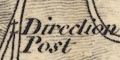
Direction Post [fork S of Twyford]with a drawing of a finger post.
Some turnpike gates are labelled, eg:-
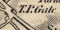
T.P. Gate
Worting T.P. Gate
Kempshot T. Pike
T. Pike
Port-lane T. PikeGates are not marked across the road. Notice that a term like:-
Whichers Gatenot on a turnpike, probably refers to an old park gate, or something!
Later editions of the map have spot heights along some roads, for example:-
.284 .372 .466 .446on the road from Basingstoke towards Popham Lane.
Road distances seem to be given by figures along some roads, but this is not regular, and no dot or milestone symbol marks where the distance figure belongs. Try following figures 68, 67, 66 back up the London road from Portsmouth - there are no more figures on sheet 11 as far as Petersfield. Numbering to the east of Fareham, towards Cosham, runs 13, 14, ... 17 then beyond Cosham 5, 6, 7, ... and beyond Havant 8, 7, 6, ... towards Chichester. This is not very helpful.
Quite a number of roman roads are noticed, eg:-
Roman Roadlabelled WSW of Freemantle Park, and more helpfully:-
Roman Road from Old Sarum to Winchester [S of Kings Sombourne]
Roman Road to Porchester [N of Morestead]The road is indicated by an embankment of hachures, perhaps partly including existing modern tracks or roads. One interesting example is seen where the fairly straight road from Winchester to Otterbourn turns away to the west. There is no track or embankment, but along the line to the south is labelled:-
from Bitternewhich was roman Clausentum.
The map has a network of roads drawn by double lines. The more important roads are drawn wider with one line bolder.
Roads are drawn by double lines, differentiated by width. The broader roads have bold light lines and are the turnpike roads. The mail coach roads have cross hatching, which is missing from the table of symbols. This makes them look like railways to a first glance, until you remember the date of the map and notice the routes.
By the date of this map the 'Ogilby' routes no longer dominate the network, though most are still major roads:- (25, 26, 30, 32, 51 but via Winchester, 53, 81 ,97); some are not shown at all (39, 83). There are other new main routes: direct roads like London to Gosport, from Alton; and cross roads like Winchester to Fareham.
The mail coach routes are:-
(from London) across Surrey; through Blackwater, Hartfordbridge, Basingstoke, Whitchurch, Andover, Hampshire; then Lopcombe Corner to Salisbury, Wiltshire etc.
(from London); across Surrey; across a corner of Hampshire; through Farnham, Surrey; then Alton, New Alresford, Winchester to Southampton, Hampshire. AND then on to Redbridge, Cadnam, Fordingbridge, Hampshire; to Poole, Dorset PLUS a branch from Cadnam to Lyndhurst and Lymington, Hampshire.
(from London) across Surrey; through Liphook, Petersfield, Horndean, to Portsmouth, Hampshire.The destination of roads out of the county is given, eg:-
from Salisbury
to LondonOne road junction is labelled:-
Lapcombe Cornerjust in Wiltshire.
The network of roads is drawn on this road map by double and single lines, for direct and cross roads. The main roads which are post roads have shading on the lines.
A junction might be labelled, eg:-
Lopton Cor.A road might be named, eg:-
Popham LaneNumbers beside a road are route numbers, referring the user to a numbered itinerary in the road book; the map is an index map. This indexing is not done for all routes; the direct and post roads are mostly not numbered, cross roads, which one assumes are less well known, are.
Roads are drawn by a double line, all solid lines. The network is graded into greater and lesser roads; main roads drawn wider with one line bold, lesser roads narrower. The light bold convention is sometimes used at this period to denote turnpike roads.
Road destinations outwith the county are labelled on main roads, eg:-
To London
to Newbury
from SalisburyRarely, a distance is given, eg:-
4 Miles from Amesbury
The road west from Winchester is labelled:-
Roman Road from Old Sarumand the road on a line between Silchester and Sarum is labelled:-
Port Way / Roman Road
A network of main roads is shown by double lines; 'Direct' roads have light and bold lines, 'Cross' roads light and light lines. Post roads, have an extra dotted line down the centre of the road.
Road distances are marked by figures by the road. It is not always easy to be sure where the end points of the given distance are.
The mail routes are:-
from London; through Bagshot, Surrey; then Hartford Bridge, Basingstoke, Whitchurch, Andover, and Wallop, Hampshire; on to Salisbury, Wiltshire, and west.
branch from Bagshot, Surrey; across a corner of Hampshire; then Farnham, Surrey; and Alton, Ropley, Alresford, Winchester, Otterbourn, to Southampton, Hampshire. AND fro Southampton, through Totton, Cadnam, and Ringwood, Hampshire; on to Poole, Dorset.
from London; ...; through Petersfield, Corsham, to Portsmouth, Hampshire.
Roads are drawn by a double line, a network over the whole county. Minor roads are narrower; turnpike roads broader with one line bold; post roads have an extra dotted line down the middle and are tinted red.
Distances along turnpike roads are given by a figure at 1 mile intervals outwards from a town.
Destinations of roads outwith the county are given, with distances, eg:-
from Basingstoke to Staines 28 3/4 Ms.
from Andover to Amesbury 14 1/4 Miles.the direction indicated by an arrow.
A junction might be labelled, eg:-
Lobcomb Cornerand a road might be named, eg:-
Popham LaneTurnpike gates might be labelled, eg:-
Merdon Turnp.
Hampshire Gate [?]
Breamore Gate
Some roman roads are labelled, eg:-
Roman Rd.on the road between Winchester and Popham Lane, aligned with Silchester.
Roman Roadon the road west from Winchester, roughly aligned with Old Sarum.
A network of roads is shown by double or single lines, for main or lesser roads. The main roads are:-
[London to Lands End] from Surrey, probably Bagshot; through Blackwater, Hartford Br., Basingstoke, Overton, Whitchurch, Andover, Mid Wallop, Hampshire; to Salisbury, Wiltshire and westward.
[London to Southampton Road] from Surrey, probably Bagshot; across a corner of Hampshire; through Farnham, Surrey; then Alton, Chawton, Alresford, Winchester to Southampton, Hampshire.
from Southampton across Red Br. then Cadnam and Ringwood, Hampshire; into Dorset, probably to Poole.
from Southampton through Bursledon, Titchfield, Fareham, Cosham, and Havant, Hampshire; into Sussex 'To Chichester'.
branch from Chawton on the London to Southampton Road, through Wickham and Fareham, to Gosport, Hampshire.
short branch from the London to Gosport Road, to Bishops Waltham, Hampshire.
[London to Portsmouth Road] from Surrey, probably Godalming; through Liphook, Petersfield, Horn Dean, and Cosham, to Portsmouth, Hampshire.Mostly the road destinations outwith the county are not given, but see:-
To Chichesteron the road from Southampton. Other road are extended to Farnham, Salisbury, Newbury ...
A few roads are included. In Hampshire these are (using some place names not on the map as well as those labelled):-
from London; through Staines, Middlesex; Bagshot, Surrey; Blackwater, Basingstoke, Whitchurch, Andover, Hampshire; Salisbury, Wiltshire, and west to Lands End
from London as before to Bagshot, Surrey, branching; across a corner of Hampshire; through Farnham, Surrey; then Alton Alresford, Winchester to Southampton, Hampshire
continued from Southampton through Redbridge and Ringwood, Hampshire; to Poole, Dorset
and continued from Southampton through Redbridge to Lymington, Hampshire
from London as before to Alton, then to Fareham and Gosport, Hampshire
from London through Kingston, Guildford, Godalming, Surrey; then Petersfield to Portsmouth, Hampshire
and a branch from Cosham to Havant; then Chichester, West Sussex
Roads are drawn with a double line; grading is explained in a table of symbols in a later edition. In this edition turnpike roads have a double continuous line; mail coach routes have the line on one side bolder; other roads are dotted - which does not imply an unfenced road as in other maps. Roads out of the county from the capital are labelled:-
to LondonSome other roads out of county are extended to the next place, marked and labelled. As a help, a section of the Great West Road, Reading to Hungerford, is drawn in Berkshire to the north of Hampshire.
At least on road junction is labelled:-
Lapcombe CornerDistances from London are given along the direct roads; and distances from start along principal cross roads. The distance figure is emphasized by a circle around it at towns, sometimes, but not always.
The bold light double line for post roads is replaced by having feathered edges to the double line. Feathering on a dotted line is difficult to see, but the mail coach route to Portsmouth is drawn that way. New roads are drawn and there is possibly some attempt to grade roads by size in the added narrow roads around Steep by Petersfield.
A network of roman roads is drawn connecting Silchester, Sarum, Portchester, Winchester and Southampton. These are drawn with a single line, labelled:-
Roman RoadThere, perhaps, rather more roman roads than justified by evidence?
Only mail coach and other post routes are drawn. There are 23 mail coach routes radiating out of London, numbered in roman numerals from I for the Essex road to Yarmouth, anticlockwise to XXIII.
The principal routes that concern Hampshire are XVIII, XIX and XX. Other main routes, cross routes, involving Hampshire are passing through Salisbury to beyond Chichester, and running south through the tip of Hampshire near Shipton Bellinger.
A number of minor routes are also drawn.
Roads are drawn by a double line, solid or dotted indicating fenced and unfenced edges. Broader roads, with one line bold, are turnpike roads; narrower roads are cross roads.
Toll gates are not marked across a road, but are labelled, eg:-
T.B.Road distances are given in figures alongside the most important roads. For example the London to Lands End road is numbered 15, 14, 13, ... from about Blackwater towards Basingstoke, then 1, 2, ... to Whitchurch, then 1, 2, .. from there to Andover, from there starting at 1 yet again westwards.
Road destinations outwith the county might be labelled, eg:-
to London
From Amesbury
From Salisbury
to Newburyusually to a well known place, but notice:-
From Horton Innusing a more vulgar way point.
Some road junctions are labelled, eg:-
Three Legged Crossfor a fiveways junction east of Ashmansworth, and:-
Lobcombe Cornerjust outwith Hampshire in Wiltshire.
A few roads have names too, eg:-
Hog Lane [NW of Kingsclere]
Park Lane [E of Silchester]and:-
Ladys Walkis noticed east of Andover.
South of Kingsclere is labelled:-
Roman Road to Silchesterand at the village the outline of the roam town, thew walls that still stand now, are drawn. South of Crondall, Upper Swanthrop, is a square labelled:-
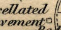
Tessellated Pavementsign of a roman villa.
Roads are drawn by a double line, solid or dotted presuamble indicating fenced and unfenced. Roads are differentitaed by breadth. The broader roads are turnpike roads and have one line bold; post roads have an extra dotted line down the middle:-

Distances from town to town are given by a figure across the road.
Roads are marked by a double line, graded into post roads, principal ie ?turnpike roads, and and cross roads. Principal roads are a double line, light bold; cross roads are a narrower double line, light light. The post or mail roads have a third line down the middle:-
Road distances between town are given by a figure across the road. These must be read with some care.
Some roman roads are labelled, eg:-
Roman Roadsouth of Stockbridge, crossing the Test near Kings Somborne.
A network of roads is drawn by double lines. Road are graded: major roads, perhaps turnpikes, broader and one line bold; minor roads narrower.
Roads are drawn by a double line, solid or dotted indicating fenced or unfenced. A comprehensive network of roads is shown.
Roads are differentiated as described in the table of symbols:-
Turnpike roads have one line bold; this convention is continued if dotted.
On the turnpike outside Basingstoke is the:-
Dean Gate Innwhich suggests a turnpike gate there. But beware, there is a hamlet called Hatch Gate, near Steventon, nowhere near a turnpike. Not all gates are turnpike gates.
Post roads have an extra light continuous line down the middle.
Some roads destinations outside the county are labelled, eg:-
To Staines 14Ms
From Wimborne 6 MilesRoad distances are given along turnpiked roads by a series of figures at mile intervals. For example the road from Petersfield north east is labelled 1, 2, 3 ... 6 towards Liphook; and the same road from Petersfield is number 5 .. 16 to Portsmouth. This labelling is a rather hit and miss.
Most of the obvious main routes appear to have been turnpiked. A few are not, examples: Petersfield to Midhurst, though this could be regarded as a branch route; and Christchurch to Lymington. The obvious source of comparison to check this map is Day's map published with a Parliamentary Report, 1852.
Post roads are few, and destinations outside the county have to be assumed:-
[from London]; through Staines, Middlesex; [Bagshot, Surrey]; then Blackwater, Hartfordbridge, Basingstoke, Overton, Whitchurch, Andover, Middle Wallop, Hampshire; [on to Salisbury, Wiltshire ...]
[from London]; through Staines, Middlesex; [Bagshot] and Farnham, Surrey; then Alton, New Alresford, Winchester, Southampton, Hampshire AND on from Southampton through Redbridge, to Ringwood, Hampshire; and to Wimborne, Dorset.
from Winchester, through Bishops Waltham, Wickham, Fareham, to Gosport, Hampshire.
[from London; through Godalming, Surrey]; then Liphook, Petersfield, Horndean, Cosham, to Portsmouth, Hampshire.
Roads are drawn by a double line, light bold. Only the main road network is shown, and the bold line might indicate turnpikes as it does on other maps.
Some road destinations outside the county are given, eg:-
To Stains and London
From Amesbury
Roads are shown by double lines. There seem to be three conventions in use to distinguish different types of road.
1. dotted line, instead of continuous, on one or both sides probably indicates unfenced roads.
2. narrow v. broad double line, to indicate importance.
3. lines of equal weight v. one light one bold, to mark particular roads.
All broad width roads have light/bold lines ie the system is partly redundant.
principal roads :-
broad double line, light bold; dotted if unfenced.
lesser roads :-
narrow double line, light light; dotted if unfenced.
A network of roads is drawn by double lines.
A comprehensive network of main roads (for this scale of map) is drawn, by double lines.
Destinations of roads outwith the county are generally given, eg:-
to London
to Amesbury
A comprehensive network of roads is shown by double lines. Four sorts of road are distinguished, explained in the table of symbols.
The greater roads, turnpikes, are drawn by broad double lines, light bold. Road distances from town to town are given by figures each mile, from a town - you might have to puzzle out which town, which way. Post roads have an additional dotted line down the middle. Other 'good' roads are drawn narrower, but with light and bold lines. Smaller 'bye' roads are narrow with light and light lines.
post roads :-
The post roads are:-
[London to Lands End Road] from Staines, Middlesex; across Surrey; then Blackwater, Hartford Bridge, Basingstoke, Whitchurch, Andover, and Middle Wallop, Hampshire; to Salisbury, Wiltshire, and west.
[London to Southampton Road] from Staines, Middlesex; across Surrey; across a corner of Hampshire; then Farnham, Surrey; through Alton, New Alresford, Winchester, to Southampton, Hampshire.
AND continued through Red Bridge, Cadnam, and Ringwood, Hampshire; into Dorset, towards Wimborne.
AND a branch off at Red Bridge, through Lyndhurst, to Lymington, Hampshire.
[London to Portsmouth Road] from Godalming, Surrey; through Liphook, Petersfield, Horn Dean, and Cosham, to Portsmouth, Hampshire.
Running west from Winchester towards Broughton is a:-
Roman Road
Roads are drawn with a double line, solid or dotted presumable indicating fenced or unfenced road boundaries. The roads are graded: major roads broader, one line bold, perhaps indicating a turnpike? minor roads narrower.
There is a network of roads drawn by a double line, light bold. On this small map these are probably all turnpike roads? Roads are extended outwith the county to nearby towns.
A basic network of roads is drawn by double lines.
Roads are drawn by a double line. They are all declared to be turnpike by the table of symbols, but this may not be so.
Roads are drawn with a double line. The lines may be continuous or dotted, presumably indicating fenced and unfenced. At least two widths of road are shown. Many (most? all?) of the major roads are drawn with light and bold line.
Roads are drawn by double lines; more important roads light bold, smaller roads narrower light light. Many roads are shown.
Road distances are given along some routes, for example from Winchester, marked every two miles, 2, 4, 6 etc, towards Basingstoke. This is presumably an indication that this route is slightly more important?
Roads are drawn by double lines; wide or narrow for major or minor roads, dotted on continuous for fenced or unfenced, an added line for a mail coach route. The convention is explained in the table of symbols. Turnpike roads have a bold and light line; the post roads, mail coach routes, have bold light light lines; minor roads are narrower.
Road distances are marked from some towns. For example from Basingstoke eastwards miles 2..14 are marked to near the county boundary; and westwards miles 2..10 are marked to Whitchurch, but no carried further. From Andover westwards miles 1..3 take the traveller to a junction from which the mile numbering continues 4..6 towards Ludgershall in Wiltshire, and 4..8 to the Wiltshire border, towards Amesbury, Salisbury, and Lands End. The system is not carried out consistently, or really usefully.
Destinations of roads outwith the county are given in a few instances, for example:-
To Staines 14 Ms.
From Wimborne 6 Miles
Roads are shown reversed out, white on tan on one of the lithograph plates; there are engraved double lines, but these are very feint. The registration between printings from the engraved and litho plates is moderately good but the small errors are made worse by the lack of exact agreement between what was engraved and what was drawn on the litho plate. The method of printing prevents the roads interfering with the clarity of other features. Roads are differentiated by width. An explanation printed under the title on the south sheet:-
... The Roads are indicated by the White Lines which cross the Map.It is possible to pick out major routes fairly easily:-
Blackwater, Basingstoke, Whitchurch, Andover, westwards towards Bath, Barnstable, or Lands End via Salisbury.
Basingstoke, Sutton Scotney, Stockbridge, westwards via Salisbury.
Basingstoke, Winchester, Southampton.
Southampton, Romsey, westwards.
Farnham, Alton, New Alresford, Winchester.
Winchester, Stockbridge, westwards.
Alton, Meon Valley, Gosport.
Alton, Petersfield, Horndean, Portsmouth.
(Surrey,) Petersfield, Horndean, Portsmouth.
Newbury, Basingstoke, Alton, Petersfield, eastwards.
Southampton, Fareham, Havant, eastwards via Chichester.ETC; this is a quick review, not a definitive list!
Some roman roads are labelled, eg:-
Roman RoadFor example between Silchester and Salisbury. Also labelled is:-
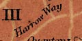
Harrow Way
Roads are drawn by double line, connecting settlements that are on the chart.
Roads are shown by a double line, in two grades; major roads with a broader light bold pair of lines, smaller roads narrower light lines.
A network of roads is shown; roads drawn by a double line.
Road are shone by double lines. This is varied to differentiate roads, as described in the table of symbols.
turnpike [double line, light and bold]
to be turnpiked [double line, medium bold]
bye road [narrower double line, light]Post roads are distinguished by having a row of dots down the middle.
There are a few road names, eg:-
Popham LaneAnd a junction might be named, eg:-
Lobcomb CornerA network of roads covers the whole county.
Some hillforts are noticed, eg:-
Qaurley Hill Campand between Winchester and Salisbury a:-
Roman Road
A network of roads is drawn by double solid lines. Roads are differentiated by width into major and minor routes; the major routes have bold and light lines.
The map shows turnpike roads, excluding most other roads. Double lines are used, solid and dotted might be taken to imply fenced and unfenced. All turnpike are tinted and labelled with a number keying to text and tables in the Turnpike Trusts, County Reports presented to Parliament in 1852. It is not clear what is meant by the untinted, unnumbered, dotted roads Some are turnpike roads based in another county; for example, from Thruxton towards Amesbury, continuing the Lands End route, the road was managed by the Amesbury Turnpike Trust, Wiltshire. This trust took the road on through Amesbury and Wylye to Willoughby Hedge, from where it was continued by the Wincanton trust. Other dotted sections are not understood.
The 'old' major routes appear not to have been turnpiked in a single scheme. While this is understandable it must have produced the sort of chaotic pattern of road quality that is familiar today. But note that the map is a snapshot of what was, in 1852. Considered alone, without the other roads that existed, some turnpikes appear to make less sense than they should. The Lands End road, for example within Hampshire, is turnpike no.7 to Basingstoke, no.3 from there to Andover and beyond to Thruxton, and is not yet turnpiked beyond. The development of turnpikes, though regulated by Parliament, was anarchic. They are responses to perceived local demand for better roads, and perceived opportunities to make money. These ideas may conflict.
Roads might be labelled with their destination outwith the county, eg:-
From Amesbury
To Newbury
Roads are drawn by a double line, solid or dotted presumably indicating fenced and unfenced edges. Two grades of road are shown, distinguished by width. The whole county is covered by a network of large and small roads; the larger roads including nearly all the 'Ogilby' routes and other of equal prominence. It is worth noting that the Ogilby route London-Southampton that ignored Winchester now takes an abrupt turn to the city across easton Down. The older route is still there, continuing through Morestead and Twyford by narrower roads.
Some routes are named. The London - Basingstoke - Andver - Salisbury road is:-
The Great Western RoadThe Andover - Amesbury continuation of the route is called the:-
Warminster RoadThe road across the county through Wickham and Cosham is:-
The Salisbury & Bath RdIn all this can be seen changes of perception of routes from those of Ogilby's period. It would be interesting to compare the route names with earlier sources; Ogilby's route titles, Cary's itinerary names, in particular.
Roads out of the county have their destination or start, given, perhaps with a distance. Eg:-
to Chichester from Havant 9M.
from Amesbury to Andover 14M.
from Cranborne
to NewburyA few roads have names, eg:-
Popham La
Gravel Hill (SW of Rake)A few junctions are named, eg:-
Lobcomb Cornerand
Cross Wayson Hinton Common north of Christchurch.
Two gates are labelled:-
Hatchet GateWSW of Beaulieu, and
Hampshire GateNNE of Tangley. These might be turnpike gates?
Some of the larger roads are marked with distances each mile, excepting where there is no space to engrave the number. The distances might be from London, for example on the road entering the county at Blackwater are numbers 31, 32, 33, etc on the route through Basingstoke. Where the route divides, at Basingstoke, the numbers continue correctly down each branch. Other roads have distances from a local start; thus the road from Stockbridge is numbered eastwards towards Basingstoke. This road's numbering starts again near Wonston. Following the numbering you can see that Cruchley does not think of the route from Popham corner being a route to Salisbury, but a route to to Winchester, to which the numbering leads (though the Salisbury route is named 'London Road' just NE of Wonston).
A number of antiquities are shown on the map, marked and/or labelled. There are also roads labelled:-
Roman Roadas just south of Dibden which may or may not be that. And roman roads like:-
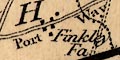
Port Way
A network of roads is drawn on the map by double lines. Major roads are broader and tinted brown; minor roads narrower, untinted.
A few road junctions are labelled, eg:-
Five Lanes End [north of Upton Grey]
St. Johns Cross [cross roads, south of Abbots Ann]Lopcombe Corner is not named.
Some roman roads are labelled, eg:-
Roman Roadsouth of Litchfield, part of the route from Silchester to Sarum. To the West of Winchester again:-
Roman Roadon the route from Winchester to Salisbury.
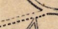
A comprehensive network of roads is drawn by double lines; solid or dotted for fenced and unfenced. Main roads are broader, and mostly have light bold lines; lesser roads are narrower.
Figures along some roads, at 2 mile intervals, give distances from town to town. You have to look carefully to know what town. This distance numbering is another clue to what the map maker regarded as the major road network.
There are clues to turnpike gates along some roads. Eg:-
Gate [at Vernhams Dean]A junction might be labelled, eg:-
Lobcombe Corner
Bordon Cross [SW of Froxfield]
Roads are drawn by double lines, solid or dotted presumable indicating fenced and unfenced roads. There are broader roads, with one line slightly bolder, and narrower roads in the network.
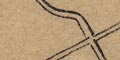
A network of roads is drawn by solid double lines. When you look closely you realise the network is not a satisfactory road map; roads end abruptly, some well known roads are missed, etc. A couple of roads are drawn dotted, near Grateley and near Gosport. This does not seem to mean an unfenced road, but might imply a road abuilding.
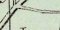
A network of roads is drawn by double line over the whole county. There are at least two grades of road: broad double line, bold light; narrow double line, light light. They are not perfectly easy to distinguish.
Roads are drawn by a double line, one line bold. At this period the light bold convention usually indicates turnpike roads.
Road destinations outwith hampshire are labelled at the borders, eg:-
To Staines and London
To Newbury
From SalisburyThe flow of travel is towards the capital.
Roads are drawn by double line, solid or dotted indicating fenced and unfenced edges. More important roads are drawn broader and have one line bold; probably indicating turnpike roads. Lesser roads are drawn narrower. A detailed network of roads is shown.
Destinations outwith the county might be drawn; for example, the road from Winchester through Romsey is continued out of the county to Salisbury, which is marked by blocks and labelled. Roads are extended to the sheet edges, where they stop with no further clues.
Road or junction names are few; notice:-
Balls Cornerby Alice Holt, and:-
Brook Lanenorth of Warsash. South of Hursley, at a junction, is a:-
Direction Postlabelled, not drawn. Toll gates do not seem to be noticed, the turnpike system was out of use by this date?
Segments of roads lined up between Silchester and Old sarum are labelled:-
Port Way / Roman RoadThe road east of Winchester is labelled:-
Roman Road
A network of main roads is drawn by double lines, and some minor roads by single lines.
The map has a network of roads drawn by double lines. Solid lines and dotted lines are used, presumably indicating fenced and unfenced stretches of road. More important roads are wider and have a bold and light line; lesser roads are narrower.
Roads out of the county are labelled with their destination at the edge of the sheet, perhaps after passing through a town in an adjacent county. Examples:-
To Staineson the London road from Andover, Basingtsoke, leaving the county at Blackwater, passing by Bagshot.
From Heytesburyon one continuation of the same road, coming up from the West Country, through Amesbury, towards Andover.
Junctions are not generally labelled, Locomb corner is not, but see:-
Hoblers Cornernorth of Lymington.
A roman road, west of Winchester, is labelled:-
R o m a n R o a dAnother is labelled similarly, running south west from Silchester, passing north of Andover, ie the Portway.
Roads are drawn by a double or single line, for greater and lesser roads. Some of the main routes have one of the two lines bold; this is a convention used to mark more important routes, like post routes, or turnpikes, on earlier maps. In Hampshire the London to Lands End road, the London to Southampton and thence to Poole road, and the London to Portsmouth road are distinguished in this way.
Although the cover title says this is a road and rail map, it is apparent that railways are a prior interest.
Roads are drawn by a double line. The expected main roads and some others are shown.
Roads are drawn by a double line, solid or dotted presumably indicating fenced or unfenced roads. Roads are graded into major and minor, broader and narrower double line.
Some of the major roads have one line bolder; on some maps this indicates turnpikes or post roads, but what it means here is not stated. A turnpike gate might be noticed, eg:-
Penerley Gate [near Beaulieu]but 1875 is after the heyday of the turnpike system.
At least a couple of road junctions are named:-
Lobcombe Corner
Balls Corner [E of Binsted]
Settlements are marked by blocks or groups of blocks, differentiated by style of lettering, and a number of added elements.
city :-
group of blocks at the confluence of roads; labelled in upright block caps:-
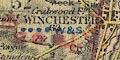
WINCHESTER / 63Winchester has a red maltese cross for a cathedral city; is underlined by four blue dots to show it is a post town; has a red sword as a place where county courts are held; has a red square for a place where quarter sessions are held; has two red dots indicating it is a parliamentary borough returning two members to Parliament; and has blue letters for market days:-
W & SWednesday and Saturday.
The figure is the distance from London. The various added elements are not always easy to read, getting lost in the detail on the map.
town :-
group of blocks; labelled in upright block caps, eg:-
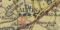
Alton / 47with four blue dots for a post town; red sword for county courts; and letter:-
Tufor Tuesday market day.
SOUTHAMPTON / 74has four blue dots, two red dots, a red sword, letter F? for Friday market day; and is underlined in blue to show it has a population over 50,000.
PORTSMOUTH / 70has four blue dots, red sword, two red dots, market days:-
Tu Th & Sand is underlined in red for a population above 100,000.
village :-
block or group of blocks and a cross (+) for the church; labelled in upright lowercase text, eg:-
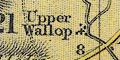
Upper Wallop
hamlet :-
block or two; labelled in italic lowercase text, eg:-
Middle WallopItalic lowercase is used to label all sorts of features on the map.
Roads are drawn by a double line, solid or dotted for fenced and unfenced edges. The roads are broad or narrow, some have a light and bold line, some are tinted yellow. It is not really clear how the various conventions add up. The yellow tint is declared for 'main roads' but can include a narrow as well as the includes broad roads:-
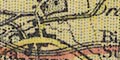
Dangerous hills are marked by a red dot and bar:-
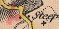
The figures beside roads are distances, marked each two miles from a town towards another.
Some road junctions are labelled, eg;-
Lobcombe Cornerand less usefully:-
A Cross Rds.on Cranbury Common.
By some roads there are labels like:-
Vernham Dean Gate
Botley Gatewhich may refer to turnpike gates?
A stretch of road north of Farleigh Chamberlayne is labelled:-
Roman Roadon the line between Winchester and Salisbury. South of Kingsclere another piece of road is labelled the same, on the route from Silchester to Sarum.
A network of roads is drawn by double lines. There is no differentiation of the main roads, but there are some smaller roads drawn with a single line. Roads are continued out of the county to nearby towns and to the edge of the map.
A circle of slightly bolder hachures is used to mark some hillforts, labelled, eg:-
Deanbury Hill
Old Windmill Hill
Quarley HillThere is one:-
Roman Roadshown from Winchester towards Kings Somborne.
Printed lower left is an:-
EXPLANATION
Turnpike Roads ... [double line]
Principal Cross Roads ... [single line]
Market Towns in Roman Print ... [upright lowercase] Grantham
The Figures attached thereto denote their distance from the Metropolis.
The Lines and Roman Figures printed in RED refer to the Table of Road Routes.
Most roads are drawn by a double line, turnpike roads according to the explanation. These make a comprehensive looking network over the Hampshire; I have not checked to see how comprehensive. A few roads are drawn by a single line, explained as principal cross roads.
Distances along roads are given, eg:-
Win. to Ba. 17
P. to P. 18The places are usually clear from the route.
Some roads are tinted red, with a route number in large red roman characters, eg:-
XVIfor the Lands End road. The number refer to tabulated itineraries.
Printed either side of the map are tabulated:-
ROAD ROUTES
FROM LONDON
(Marked in Red on the Map)
REVISED AND CORRECTED, FROM VARIOUS AUTHORITIES, BY HARRY HEWITT GRIFFIN,
R. for ROUTE.The routes that cross Hampshire are given below. The state of the map leaves many of them unreadable, words implied form other parts of the map are contained in square brackets, as usual for transcriptions.
...
[ROUTE XV.]
[ ]
[(From Marble Arch.)]
...
... ... ... ... ... MILES
Go[lden Farmer] ... 27 1/2
Basing[stoke] ... 45
Whitchu[rch] ... 56 1/2
Andover ... 63 1/2
Amesbury ... 77 1/2
...
...
Bidefor[d] ... 200
... ...
ROU[TE] XVI.
Lan[d's] End.
... ... ... ... ... MILES
Andov[er (by R. ] XV. ... 63 1/2
Salisb[ury] ... 81
...
...
Penzan[ce] ... 281
...
Land's [End] ... 291 3/4
... ...
ROUTE XV[II.]
Southampton,
New Forest, and Bourn[e]
mouth.
... ... ... ... ... MILES
Golden Farmer (by R. XV.) ... 2[7 1/2]
Farnham ... [ ]
Alton ... [ ]
Alresford ... [ ]
Winchester ... [ ]
Junction of Roads ... [ ]
Southampton ...
___
Totton ... [ ]
___
Lyndhurst ... [ ]
Christchurch ... [ ]
___
Ringwood ... 96[ ]
Christchurch ... 105[ ]
Bournemouth ... 11[ ]
... ...
ROUTE XVIII[.]
Portsmouth,
From Hyde Park Corner
... ... ... ... ... MILES
...
Godalming ... [ ]
Liphook ... [ ]
Petersfield ... [ ]
Cosham ... [ ]
Portsmouth ... [ ]Looking at the map itself the routes in Hampshire are:-
route XVI - from London; through Staines, Middlesex; and Bagshot and the Golden Farmer, Surrey; then Blackwater, Hartford Bridge, Basingstoke, Overton, Whitchurch, Andover, Mid Wallop, Hampshire; on to Salisbury, Wiltshire, and westward; AND from Andover through Weyhill, Hampshire; then Amesbury, Wiltshire, and westward.
route XVII - from the Golden Farmer, Surrey; across a corner of Hampshire; then Farnham, Surrey, and Alton, Alresford, Winchester, to Southampton, Hampshire; AND on ward through Redbridge, Lyndhurst, Hampshire; to Christchurch, Dorset; AND a branch from Lyndhurst to Lymington, Hampshire, then to Christchurch, Dorset; AND an alternative route from Redbridge through Cadnam and Ringwood, Hampshire; to Christchurch, Dorset.
route XVIII - from London; through Godalming, Surrey; then Liphook, Petersfield, Horn Dean, Cosham, to Portsmouth, Hampshire.
Roads are implied by the routes of the mounted and foot postman's walks in rural areas. The routes are diagrammatic, smoothed-out lines in most examples. Delivery by:-
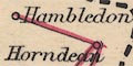
mail coach or mail cart,
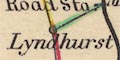
stage coach or omnibus,
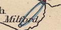
mounted rural postman,
rural postman on foot,
and tricycle.
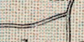
A comprehensive network of roads is drawn by double lines; light bold for major roads, light light for minor roads - the widths do not appear much different. Roads are extended outwith the county to nearby towns, Salisbury, Amesbury, Pewsey, etc etc.
Roads are drawn by double lines, differentiated by width to show importance, or perhaps size. The main route is broad and clear with a bold edge line, tinted pale brown. The edge line might be solid or dotted, presumably for fenced or unfenced road.
Milestones are marked by a block, labelled as:-
M.S. 26 miles from London
The twelve routes are:-
London to Dover
London to Folkestone
London to Hastings
London to Eastbourne
London to Brighton
London to Worthing
London to Portsmouth
London to Southampton
London to Bristol
London to Oxford
London to Cromer
London to Ipswich
This is a road book, and roads are the main feature of the general map. The map is an index to the itineraries in the book. The major routes are shown by a double red line, minor route by a single red line. Each route is labelled with the number of the itinerary in the book.
NB the numbering of the general map is not entirely in agreement with the itineraries. For instance route 17 on the map is itinerary 12; itinerary 17 is missing from the map.
The network of roads is drawn by solid red lines, broad and narrow for main road and cross roads (a surprisingly old fashioned term?). Distances between towns are marked beside roads by red figures. You have to be careful how distances are understood, from which place to which?
The major routes across Hampshire are:-
from London; through Bagshot, Surrey; then Blackwater, Basingstoke, Whitchurch, Andover, Hampshire; Amesbury, Wiltshire; and west to Exeter, devon; and Lands End, Cornwall.
branch from basingstoke, through Sutton Scotney, and Stockbridge, Hampshire; then Salisbury, Wiltshire; and west.
branch from the Basingstoke-Stockbridge road, through Popham to Winchester, Hampshire AND from Winchester through Romsey, Lyndhurst, Hampshire, then Christchurch to Poole, Dorset; and beyond.
from London; through Bagshot, Surrey; across a corner of Hampshire; through Farnham, Surrey; then Alton, New Alresford, Winchester, to Southampton, Hampshire AND from Southampton, Hampshire; to Salisbury, Wiltshire AND a link to Lyndhurst etc.
from London; through Guildford and Godalming, Surrey; then Liphook, Petersfield, Horndean, Cosham, to Portsmouth, Hampshire.
from Southampton, through Fareham, Cosham, Havant, Hampshire; to Chichester, West Sussex; and beyond AND a branch from Fareham to Gosport, Hampshire.
from Oxford, Oxfordshire; through Newbury, Berkshire; then Whitchurch to Winchester, Hampshire.The pages after the road maps have gradient diagrams, road profiles, of a number of the main routes. The horizontal scale is about 8 miles to 1 inch; the base line marked and labelled at 5 mile intervals. The vertical scale is about 1100 feet to 1 inch; there are horizontal rules at 100, 250 and 500 feet, and the 'land' below the road line is layer coloured. Various places, settlements on hill tops, are labelled along the route. Each road profile is titled.
The road profiles that cross Hampshire are:-
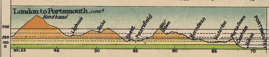
LONDON TO PORTSMOUTH - from London, through Guildford and Godalming, and climb over Hindhead, Surrey; then Liphook, over hills via Rake to Sheet and Petersfield, up over War Down, down through Horndean and Waterloo, up over Portsdown, down to Cosham, Hilsea and Portsmouth, Hampshire.
LONDON TO SALISBURY - from London; through Bagshot, Surrey; over low hills to Blackwater, Hartford Bridge, Hartley Row, Hook, Nately Scures, Basingstoke, Worting, Oakley Sta, Overton, Whitchurch, Hurstbourne Priors, Andover, Middle Wallop, Hampshire; then up over downs to Salisbury, Wiltshire.Page 105 illustrates types of four road sign:-
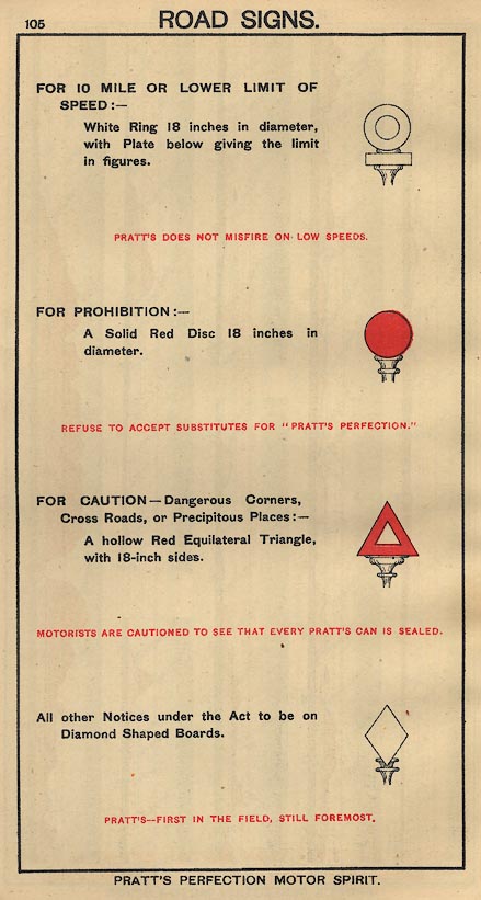
White ring; for a 10 mile per hour speed limit, or less.
Red disk; prohibition.
Red triangle; caution.
White diamond for other 'Notices under the Act'.These signs are the first official road signs, defined by government legislation, the Motor Car Act 1903. There was a general speed limit of 20 miles an hour in 1903, so the lower speed restriction was all that was needed.
Page 106 gives a table giving the speed in miles per hour against the time for 1 mile. The times are in minutes and seconds from 1 min. 0 sec. in steps of 1 second, to 6 min. 0 sec, a range of speeds from 60 mph to 10 mph. This is particularly useful if there was still a general speed limit of 20 miles per hour!
The road's route is:-
from London; via Guildford and Godalming, Surrey; then Liphook, Petersfield, Horndean, to Portsmouth, Hampshire.Roads are drawn by double line. The width indicates the importance of the road.
Dangerous ascents and descents are marked by an arrow.
Road distances from London and from Portsmouth are given in figures beside a drawing of a milestone. For example at the cross roads at Cosham:-
(4 3/4 M.) 68 1/4 M.and SW of Petersfield:- (18 M) 55 M.
The Portsmouth distance is always in brackets. Neither milestones or distances are given at regular intervals, certainly not each mile.
Roads are drawn by a double line, differentiated by width for bigger and smaller roads, by colour, and with solid or dotted lines for fenced and unfenced road boundaries. The conventions use the classifications set up in the:-
Ministry of Transport Act 1919and are described in the contemporary handbook to the OS small scale books:-
... 1st class roads red, 2nd class roads (fit for ordinary traffic) brown, 3rd class roads (indifferent or winding) chequered brown. Minor roads in uncoloured outline. ...For example (sheet 132):-
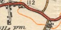
roads west of Fair Oak: red, brown, brown/white chequered, white, solid and dotted, and a spot height.
Johnston 1920:-
... the Road Classification stands out in a very marked degree. There is no mistaking the first-class roads, and users of motor cars can easily pick out roads available for their use. ...and in questions after his paper, Col Whitlock:-
The roads where considered by a committee of representatives from the War Office, Road Borda, the Automobile Association, and an officer from the Ordnance Survey, and their recommendations ... the main roads are easily seen, and I think that the map is one that will appeal to motorists and cyclists and other people who use the road. ...
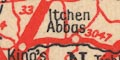
AS explained in the table of symbols three sorts of road are shown, each by red lines which dominate the map. Broad lines are A roads; medium lines are B roads; narrow lines are minor roads. Roads are labelled with their Ministry of Transport road number.
Roads are drawn between the places in a way that suggests the directness or wiggliness of the route. Each road segment is labelled with a number which keys it to the itinerary in the body of the road book.
Roads are drawn by double line. They might be labelled with Ministry of Transport road numbers.
A roman road, for example:-
ROMAN A.34 ROADcoming into Winchester from Worthy Down.
roads |
|||||||||||||||||||||||||||||||||
| roads |  |
|
|
|
|
|
|
|
|
|
|
|
|
|
|
|
|
|
|
|
|
|
|
||||||||||
| post roads |  |
 |
|
|
|
 |
|
|
|
|
|
|
|
|
|
|
|
||||||||||||||||
| turnpike roads | |
|
|
|
|
|
|
|
|
|
|
|
|
|
|
|
|
||||||||||||||||
| road distances | |
|
|
|
|
|
|
|
|
|
|
|
 |
|
|
|
|
|
|
|
|
|
|||||||||||
| mile marks | |
|
 |
|
|
|
|
|
|
|
|
|
|
|
|
|
|
|
|
|
|
||||||||||||
| Ogilby routes | |
|
|
|
|
|
|
|
|
|
|
|
|
|
|||||||||||||||||||
| lots of routes | |
|
|
|
|
|
|
|
|
|
|
|
|
|
|
|
|
||||||||||||||||
| strip map | |
|
|
|
|
|
|
|
|
|
|
|
|
|
|
|
|
|
|||||||||||||||
Hawkes, C F C: 1927: Old Roads in central Hampshire: ProcHFC: vol.9: pp.324-333
Shore, T W: 1908=1911: Old Roads and Fords in Hampshire: ProcHFC: : pp.48-54
Viner, David J: 1969: Industrial Archaeology of Hampshire Roads, a Survey: ProcHFC: vol.26: pp.155-172
