
 Return to list of Features

Typical illustrated examples are described, NOT ALL examples.
The mile on the scale line of early maps is not a statute mile but the map itself can be used to estimate the "Old English Mile" used.
NB absence of evidence is not evidence of absence
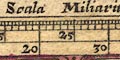
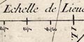
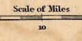
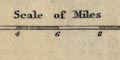
Printed in the lower right border is a:-
Scala Miliario[ ] Italiagraduated in 10s and 100s labelled in 100 miles. The 700 miles = 120 mm giving a scale:-
148 italian miles to 1 inch
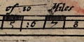
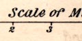
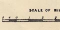
Printed lower right is a scale of:-
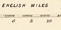
MILLIARIA200 miles chequered in 5 mile intervals, labelled at 20 mile intervals; be careful how you read the scale, the figures belong at the end of the interval, not the middle where they are printed.
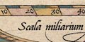
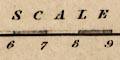
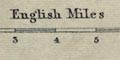
Printed lower centre is a scale line:-
Scala miliarum Anglicorum50 miles graduated in miles, labelled in 10s. The map scale (from Shirley) is about:-
14 miles to 1 inchThe south coast of England is about 15% too long.
The museum label at Duisburg states a scale about:-
1 to 920000
14.5 miles to 1 inch
Printed upper right is:-
Scala miliarum Anglicorumwith 80 miles, chequered at 5 mile intervals, labelled at 10 miles intervals. The length of the scale line is uncertain, the ends are slanted! Taking 80 miles = 97 mm gives a scale 1 to 1327294. The map scale is about:-
1 to 1300000But a better estimate comes from considering the position of a few major towns, giving a map scale about:-
1 to 1500000
24 miles to 1 inch
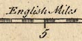
There is a scale line of 10 miles, chequered in half miles, caption:-
Scala Miliarum
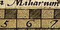
There is a pair of dividers above. The 10 miles = 83.2 mm, giving, wrongly assuming a statute mile for the map maker's mile, a map scale about:-
1 to 190000 ?
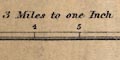
3 miles to 1 inchA better estimate can be made from town positions, comparing known town-town distances. The map scale is about:-
1 to 240000
4 miles to 1 inchThe map maker's mile is an:-
Old English Mile = 1.22 statute miles
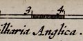
Printed lower left in a slightly restrained strapwork cartouche is a:-
Scala MiliariumThe 50 miles is divided at 1/2 miles, labelled at 5 mile intervals. Above the scale is a splendid pair of dividers with a scroll draped on them:-
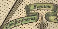
Christophorus Saxton descripsit.In a cartouche below the scale is:-
Augustinus Ryther Anglus Sculpsit. Ano. Dni~. 1579.Augustine Ryther was a Fleming emigrant to England, proud to call himself 'Anglus'. He engraved 5 of the county maps in Saxton's set of counties.
The map has three scale lines:-
English leagues 20 in a degreewith 7 numbered divisions,
Spanish leagues [17 1/2] in a degreewith 6 numbered divisions,
Dutch leagues [15] in a degreewith 5 numbered divisions. These are presented in a strapwork cartouche lower left.
(The size of the original map is given as 19.5 x 12.75 inches, sheet or map not stated, and I make no attempt to calculate a scale from the copied reproduction.)
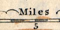
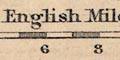
Printed lower centre is a scale line of:-
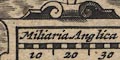
Miliara AnglicaThe 100 miles are chequered in 5 mile intervals, labelled at 10 mile intervals.
Printed lower left in a strapwork cartouche, below one of the coats of arms, is:-
The Scale of Leagues, every league co~teining 3 miles Ro: Adamo AuthoreThe scale line is graduated in leagues, labelled 1,2..5, 10, 15, ...50. The 50 leagues = 91.1 mm. Making an [unwarranted] assumption that a league = 3 nautical miles of 6080 feet then the map scale is 1 to 3051345; the map scale is about:-
1 to 3000000
50 (land) miles to 1 inchPrinted below the scale line:-
Augustinus Ryther SculpsitOther estimates of the map scale can be got from measuring between some towns:-
London - Bristol = 105mm (174.1Km)giving a scale 1 to 1658095, say 1 to 1600000
London - York = 99mm (280.6Km)giving a scale 1 to 2834343, say 1 to 2800000
As is pretty clear from its appearance, the map is much too long E-W.
The map has two scale lines:-
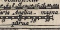
Miliaria Anglica magnachequered at 2 mile intervals, 22 miles = 29.2mm is 1 to 1212519 assuming a statute mile, ie about:-
1 to 1200000and:-
parvachequered at 1 mile intervals, 20 miles = 24.1mm is 1 to 1335555, ie about:-
1 to 1300000making the same bad assumption. The map scale is about:-
20 miles to 1 inchUsing the latitude scale, 2 degrees latitude = 129.6mm is 1 to 1731985, about:-
1 to 1700000
27 miles to 1 inch
There is no small scale line on the map.
There is an overall grid of squares in the borders which are believed to be in miles, chequered at half mile intervals.
Printed at the foot of the table of hundreds it says:-
The scale of miles goeth rounde about the Mapp
All four map borders are chequered to show miles, west-east and north-south; the origin of the scales is top left. Each two miles is labelled across top and bottom, 2, 4, 6, ... 48. The labelling on the sides runs down a, b, c, ... x (no 'i' or 'u'). Besides being scale lines the scales and the grid printed across the map in fine lines make an index grid. John Norden's provision of an index grid is an innovation in map making.
The scale can be estimated from the scale line:-
48 miles = 400.5 mmWrongly assuming a modern statute miles this gives a scale 1 to 192880; the map scale is about:-
1 to 190000
3 miles to 1 inchA better estimate of scale has been estimated from the positions of towns, also providing a value of the 'old english mile' used in Norden in 1595. The map scale is about 1 to 241379, say:-
1 to 240000
4 miles to 1 inchNorden uses an:-
Old English Mile = 1.24 statute miles
A strapwork cartouche lower centre has a scale of:-
Milliaria AnglicanaThis has 60 miles chequered in 5 mile intervals, labelled at 10 miles intervals. Above is a pair of dividers.
In the lower of the title cartouches is a scale line 10 miles, chequered in miles, labelled:-
Sala Miliarum
10 miles = 18.8mm, wrongly assuming a modern statute mile - the scale is thus 1 to 856034. The map scale is about:-
1 to 860000
14 miles to 1 inchA better estimate of the scale is made from town positions, comparing to known town-town distances. The map scale is about:-
1 to 1100000
16.5 miles to 1 inchThe map maker's mile is an:-
Old English Mile = 1.25 statute miles
The scale line of 10 miles is chequered in half miles. The 10 miles = 66.4 mm, giving a scale 1 to 243300, on the bad assumption of a modern statute mile. The map scale is about:-
1 to 240000
4 miles to 1 inchAn estimate of scale can be made from town positions, comparing known town-town distances. The map scale is about:-
1 to 380000
6 miles to 1 inchThe map maker's mile is an:-
Old English Mile = 1.24 statute miles
Printed lower left is a scale line in a strapwork cartouche decorated with cherubs holding a globe and dividers, with a banner:-
Performed by John SpeedeIn the cartouche labelled:-
The Scale of Milesare two scales. The upper is chequered in 5 miles intervals labelled in tens, for:-
Common :Mill.which has 80 miles = 57.1 mm giving a scale 1 to 2254773, a map scale about:-
1 to 2300000
36 miles to 1 inchThese are the map maker's miles which seem to be about 1.4 statute mile, which had not become statute at that period. The map provides an estimate of the common Old English Mile = 1.4 statute mile, greater than the usual range of values for this obscure historical unit.
The lower scale is:-
By Degreeswhich has 100 miles in the place of 80 common miles. This gives a scale about:-
1 to 2800000
44 miles to 1 inchand I don't know how to imterpret this!
It would be possible to get a good estimate of the map's scale by measuring the positions of a couple of dozen towns and comparing their distances from each other with their known distances - a fair bit of work.
Printed lower right is a scale of:-
Miliaria Anglicain a strapwork cartouche. This has 30 miles chequered in 2 mile intervals, labelled in 10 mile groups. The 30 miles = 17.1 mm giving a scale 1 to 2823410 on the bad assumption that the mile is a modern statute mile. The map scale is about:-
1 to 2800000
45 miles to 1 inch
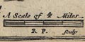
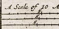
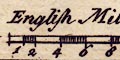
Printed below the title, upper left, is:-
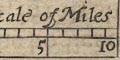
A Scale of MilesThe scale has 10 miles, marked at 1 mile intervals, labelled at 5 and 10 miles. The 10 miles = 19.8 mm gives a scale 1 to 812800 on the improper assumption of a modern statute mile, the map scale is about:-
1 to 810000
13 miles to 1 inchA better estimate of the map's scale can be got from the positions of a number of towns. Using DISTTAB.exe to do the sums this gives a scale 1 to 1057911; the map scale is about:-
1 to 1100000
16.5 miles to 1 inchand the map's 'mile' is an:-
Old English Mile = 1.31 statute miles
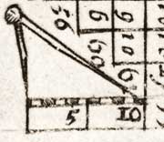
A scale line of ten miles, chequered in miles, is given. This is fitted into the table neatly, so it is at a peculiar angle to the map; it is still useable.
Estimating from the scale line, 10 miles = 11 mm, and making the bad assumption that the mile is a modern statute mile, the map scale is roughly:-
1 to 1500000
23 miles to 1 inch.A pair of compasses are drawn over the scale line. These are distorted; to make them fit the space one leg is much longer than the other.
Another estimate of the scale can be made from town positions, comparing known town-town distances. The map scale is about:-
1 to 1600000
25.5 miles to 1 inchThe map maker's mile is an:-
Old English Mile = 1.10 statute milesAs the map is so tiny, this is a poor estimate of the old english mile.
There are two scale lines printed lower right; french, german miles, eg:-
Miliaria Gallica Sive horae itineris 20 in uno Gradu.chequered and labelled in minutes. The 'miles' are leagues. The 30 miles = 132.4 mm gives a scale 1 to 1259717, assuming a league of 3 nautical miles of 6080 feet. The chart scale is about:-
1 to 1260000
6 leagues to 1 inch
20 statute miles to 1 inch
Printed lower left are three scale lines; dutch miles, spanish miles, and english and french miles. The english/french scale has:-
Engels. en Frans. mylen 20 in een Graadtgraduated in miles. This is a mistake; for miles read leagues. The 16 miles = 161.2 mm gives a scale 1 to 551817, assuming 'mile' to be a league of 3 nautical miles of 6080 feet. The chart scale is about:-
1 to 550000
2.5 leagues to 1 inch
9 statute miles to 1 inch
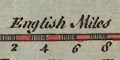
Printed below the title lower right is a scale of:-
English Mileschequered in miles, labelled at 5 miles intervals. The 20 miles = 84.8 mm giving a scale 1 to 379401 wrongly assuming that the miles are statute miles. The map scale is (wrongly):-
1 to 380000
6 miles to 1 inchA much more reliable estimate is got from measuring the positions of towns and comparing these to known positions.
The map scale is about 1 to 456826 +-8%. The map scale is about:-
1 to 460000
7 miles to 1 inchThe measurement provides an estimate of the miles used in the map, the Old English Mile:-
1 map mile = 1.21 statute miles
The map has a scale line of 4 miles, chequered iin quarter miles:-
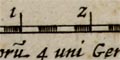
Mill. Angl. quoru~ 4 uni Germanico aequip.The scale line 4 miles = 37.1mm, gives a scale 1 to 173589 wrongly assuming a modern mile this is about:-
1 to 170000 ?
3 miles to 1 inchThe map size is:-
wxh, plate: 516x420mmA much better estimate is got by comparing the positions of a number of towns with their known positions (assumed from NGR values); the processing was done with a computer program, DISTTAB.exe. From this the map scale is 1 to 218129, ie about:-
1 to 220000
3.5 miles to 1 inchand we get an estimate of Blaeu's map miles, an:-
Old English Mile = 1.26 statute mile
Printed upper right is a scroll cartouche with two scale lines:-
Milliari Anglica.
Milliari Germanica.english miles and german miles, the latter being 4 english miles each.
The english scale line is chequered and labelled at 1 mile intervals. 6 miles = 47.5mm (561 pixels at 300dpi) giving a map scale 1 to 203294 on the bad assumption of an english statute mile. The map scale is about:-
1 to 200000 ?
3 miles to 1 inchA more reliable estimate of the scale is got by comparing the positions of a selection of places with their known positions. From this procedure the map scale is 1 to 249721, about:-
1 to 250000 ?
4 miles to 1 inchThe map's english mile is:-
old english mile = 1.23 statute miles
Printed lower right are three scale lines; dutch, spanish, english and french. For example:-
Eng: en Fr: mijlen 20 in een graad / Frensh and English miles 20 to a degreegraduated in 1s to 10, then in 5s, labelled in 5s. The 35 miles = 169.7 mm, assuming a 'mile' is a league of 3 nautical miles of 6080 feet, this gives a scale 1 to 1146637. The chart scale is about:-
1 to 1100000
5 leagues to 1 inch
18 statute miles to 1 inch
Printed with the coat of arms is a scale line.
Printed lower centre is:-
A Scale of 10 Mileschequered and labelled in miles. The 10 miles = 65.1mm gives a scale 1 to 247211 on the bad assumption of a statute mile. The map scale is about:-
1 to 250000
4 miles to 1 inchA better estimate of the map scale, with a note about the Old English Mile, has been made.
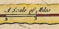
Printed in a scroll cartouche lower left are three scale lines, headed:-
A Scale of MilesEach is chequered in miles, marked at 5 miles and labelled at 10 mile intervals, and has 50 miles in the scale. They are labelled:-
Vulgar Computed Miles 23 in an Inch
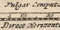
Direct Horizontal Miles 26 in an Inch
Dimensurated Road Miles 29 in an I.The direct horizontal miles would seem to be the map's 'proper' scale, its 50 miles = 48.7 mm gives a scale 1 to 1652304 ie 26.1 miles to 1 inch. John Ogilby declares, elsewhere, that his mile is 1760 yards, a statute mile. The map scale is about:-
1 to 1700000
26 miles to 1 inchJohn Ogilby's vulgar miles are larger, 1.12 statute miles according to his scale line. This is perhaps his estimate of an Old English Mile?
The measured road miles provides an estimate of the twistiness of a road? A mile by road achieving only 0.9 miles directly.
The positions of places in Hampshire on the map can be compared to their known places, using DISTTAB.exe software, which gives a different estimate of the map scale, 1 to 1755918, 27 miles to 1 inch. It is unfair to measure such a small part of the map; the confidence in these measurements is small (+-18%).
The scale line is 10 miles, chequered in miles; 10 miles =10.4mm gives a scale about 1 to 1547446 assuming a modern statute mile. Ie the map scale is about:-
1 to 1550000
24 miles to 1 inch.There is a pair of dividers above the scale line.
Another estimate of scale can be made from town positions, comparing known town-town distances. The map scale is about:-
1 to 1800000
27.5 miles to 1 inchThe map maker's mile is an:-
Old English Mile = 1.15 staute milesbut this is such a small map that this is not a good measure of the old english mile.
The scale line of 10 miles is chequered at one mile intervals, labelled at 5 and 10 and:-
MilesThe length is 10.3mm, assuming a statute mile the scale is 1 to 1562470, ie a map scale about:-
1 to 1600000 ?
25 miles to 1 inchwhatever the miles might be.
The sheet has been trimmed recently, perhaps by a map dealer? It is not possible to tell if the Hampshire map was alone on a sheet or accompanied by another map - but, the trimming might have been occasioned by separating two maps from one sheet.
wxh, sheet = 6x8.5cm
wxh, map = 56x58mm, excluding the top and bottom caption areas.
There is a scale line, chequered in miles:-
A Scale of 4 MilesThe 4 miles of the scale line are about 9 1/2 miles! A better estimate of the map scale is got by measuring town positions and comparing these to known positions, now. This was done with DISTTAB.exe, giving a map scale 7.73 statute miles to 1 inch, 1 to 489761. The scale is about:-
1 to 490000 ?
7.5 miles to 1 inchThe map's mile is 2.4 statute miles. It is more likely that the scale line is incorrectly labelled; it is an 8 mile scale not a 4 mile scale. Assuming this then the map mile is an:-
Old English Mile = 1.21 statute miles
Printed upper centre are four scale lines; dutch miles, english and french leagues, spanish leagues, and 'suetsche' miles. The english/french scale has:-
Lieues de France de 20 de Degre. - English Leagues 20 for Degreechequered and labelled in leagues; the first league chequered in thirds, ie nautical miles. The 24 leagues = 186.8 mm giving a scale 1 to 714289 assuming a league of 3 nautical miles of 6080 feet. The chart scale is about:-
1 to 710000
3 leagues to 1 inch
11 statute miles to 1 inch
Printed lower right are three scale lines, labelled:-
MILES
Magna
Mediocra
Parvaeach chequered in miles for 10 miles, then graduated at 5 miles intervals, labelled at 10 mile intervals.
The large miles have 30 miles = 50.6 mm giving a scale 1 to 1577788, a map scale about:-
1 to 1600000
25 miles to 1 inchThe middle miles have 35 miles = 52.1 mm giving a scale 1 to 1081133, a map scale about:-
1 to 1100000
17 miles to 1 inchThe small miles have 40 miles = 55.2 mm giving a scale 1 to 1166191, a map scale about:-
1200000
18 miles to 1 inch
There is a scale of:-
English Leagueschequered at 2 league intervals, labelled 2,4,6,8,10,20. The 20 leagues = 46.1 mm gives a scale 1 to 2411953; the map scale is about:-
1 to 2500000
38 miles to 1 inch
11 leagues to 1 inchassuming a league = 3 nautical miles of 6080 feet.
As original.
Printed below the dedication on the left is:-
A Scale of MilesThe line is chequered and labelled in miles, 1..6; 6 sea miles = 106.9mm. Assuming these are sea miles, 6082.95ft at this latitude, the map scale is 1 to 104065; the map scale is about:-
1 to 100000
1 1/2 sea miles to 1 inch
The chart has a scale line of 6 miles = 107.6mm. Assuming a sea mile 6082.93ft the scale of the chart is 1 to 103387, ie scale about:-
1 to 100000
1.4 sea miles to 1 inch
1.6 miles to 1 inch
A scale line:-
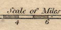
Scale of Mileshas ten miles, chequered at the first mile and at two mile intervals. 1 to miles is 26.4mm giving a scale 1 to 609600, wrongly assuming a modern statute mile. The map scale is about:-
1 to 610000
10 miles to 1 inchA better estimate of scale can be made from town positions, comparing known town-town distances. Measured from another copy of the same map the map scale is about:-
1 to 830000
13 miles to 1 inchThe map maker's mile is an:-
Old English Mile = 1.26 statute miles
There are two scale lines, each 10 miles divided into miles. The two scales, from the scale lines, are 1 to 197708 and 1 to 216601 using the bad assumption of a modern statute mile. The map scale is about:-
1 to 200000 or 220000
3 or 3.5 miles to 1 inchA better estimate of the scale can be made from town positions, comparing known town-town distances. The map scale is about:-
1 to 30000
5 miles to 1 inchThe map maker's miles are an:-
Old English Mile = 1.23 or 1.13 statute miles
Printed lower right is:-
A Scale of English & French Leagues for ye General Chartchequered in leagues, labelled at 5 league intervals. The 20 leagues = 129.4 mm gives a scale 1 to 858282, assuming a league of 3 nautical miles of 6080 feet. The chart scale is about:-
1 to 860000
4 leagues to 1 inch
13.5 statute mile to 1 inch
3 scale lines, each 10 miles with divisions at 1 mile intervals, marked at 5 and 10.
A Scale of 10 Miles / Great / Midle / Smal10 Great Miles=38.4mm, scale 1 to 419100; 10 Midle Miles=36.2mm, 1 to 444570; 10 Smal Miles=34.1mm, 1 to 471948; all on the bad assumption of a modern statute mile; average scale about:-
1 to 445000
7 miles to 1 inch
The map has three scale lines:-
A Scale of English Milesin a foliage cartouche. Each is chequered in miles to 5 then at 5 mile intervals, labelled variously in 10s or 5s.
English Miles 60 to a Degreehaving 40 miles = 61.1 mm giving a scale 1 to 1053580, a map scale about:-
1 to 1050000
16.5 miles to 1 inch
Measur'd English Miles 69 1/2 to a Degreehaving 50 miles = 65.0 mm giving a scale 1 to 1237957, a map scale about:-
1 to 1200000
19.5 miles to 1 inch
Scotch Miles 50 to a Degreehaving 35 miles = 63.8 mm giving a scale 1 to 882869, a map scale about:-
1 to 880000
14 miles to 1 inch
There is a scale line printed upper right:-
A Scale of 60 computed MilesThe first 10 miles is chequered in miles, then the scale has graduations and labels at 10 miles intervals.
The map has a scale of:-
Miles of Great Britain 60 in One degreechequered in 1 mile intervals to 5 then in 5 mile intervals, labelled in 5s to 30 then in 15s. The 60 miles = 99.8 mm giving a scale 1 to 967541 assuming a statute mile. The map scale is about:-
1 to 970000
15 miles to 1 inch
Printed upper right of centre is:-
A Scale of Mileschequered and labelled in miles; 8 miles long. Notice that these are nautical miles, each is 1 latitude degree long. The scale of the chart is about 1.5 nautical miles to 1 inch.
A scale of
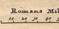
Romana Milliariais printed upper left, marked and labelled at 10 miles intervals. The 80 roman miles = 52.4 mm giving a scale about:-
39 roman miles to 1 inch.A better estimate of scale can be made from town positions, comparing known town-town distances. The map scale is about:-
1 to 3500000
55 miles to 1 inchThe map maker's miles are a:-
roman mile = 1.41 statute miles
Printed on the right is a scale line of:-
English Mileschequered and labelled in miles. The 6 miles = 26.1mm gives a scale 1 to 369164 assuming a modern statute mile. The map scale is about:-
1 to 370000
6 miles to 1 inchAn estimate of scale can be made from town positions, comparing known town-town distances. The map scale is about:-
1 to 400000
6.5 miles to 1 inch
Printed on the right, along the 54d N parallel, is a scale line of
Mileschequered at 5 mile intervals, labelled in blocks of 20 miles. The 85 miles = 52.8 mm giving a scale 1 to 2590800; the map scale is about:-
1 to 2600000
41 miles to 1 inch
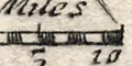
There is a scale line of 10 miles, chequered in miles, labelled:-
English MilesThe scale line is 10 miles = 21.4mm, assuming a modern mile the scale is about:-
1 to 750000 ?
12 miles to 1 inchThe maps scale can also be estimated from the positions of places. This has been done, using the '21' old market towns of the county.
From these calculations the map scale is about:-
1 to 870000
13.5 miles to 1 inchComparing the map's scale line gives:-
1 map mile = 1.17 statute mile
The map has a scale line of:-
English Mileschequered and labelled at 2 mile intervals. 10 miles = 18.8mm gives a scale 1 to 856034 assuming a statute mile. The map scale is about:-
1 to 860000
14 miles to 1 inch
There is a scale line:-
English MilesSix miles chequered at one mile intervals. 6 miles = 24.6 mm, assuming a modern mile this gives a scale 1 to 392522. The map scale is about:-
1 to 390000
6 miles to 1 inch
The map has a scale line, 10 miles chequered in miles, labelled:-
Miles10 miles = 29.8mm is 1 to 540048, the scale is about:-
1 to 540000
9 miles to 1 inchIt is also possible to estimate scale from town positions.
From this the map scale is about:-
1 to 610000
9.5 miles to 1 inch
Printed lower right is a scale of:-
English and French Leagues 20 in one Degreegraduated in 1 league then 10 league intervals, labelled at 10 league intervals. The 80 Leagues = 185.9 mm giving a scale 1 to 2392491 assuming a league is 3 nautical miles of 6080 feet. The map scale is about:-
1 to 2400000
40 (statute) miles to 1 inch
11 leagues to 1 inchThere are also:-
Duytsche myles 15 in een graadtwith 60 myles = 185.8 mm
and:-
Leagues de Spania 17 1/2 un gradawith 70 leagues = 186.8 mm
Printed lower left is a scale line of:-
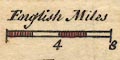
English Mileschequered at 2 miles intervals, labelled at 4 miles intervals. The 8 miles = 18.2 mm gives a scale 1 to 707404 assuming a statute mile. The map scale is about:-
1 to 710000
11 miles to 1 inch
Lower right there is a scale line of:-
English Milesten miles, chequered at 2 mile intervals. 10 miles = 29.7 mm, assuming a statute mile this is a scale 1 to 541867. The map scale is about:-
1 to 540000
8 miles to 1 inchAn estiamte of scale can be made from town positions, comparing known town-town distances. The map scale is about:-
1 to 560000
9 miles to 1 inch
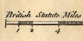
The map has a chequered scale line of 15
British Statute Miles15 miles = 43.5mm, assuming a modern statute mile gives the scale 1 to 554946; the map scale is about:-
1 to 550000
9 miles to 1 inch.An estimate of the scale can be made from town positions, comparing known town-town distances. The map scale is about:-
1 to 700000
11 miles to 1 inchDespite the late date, and declaring "British Statute Miles", the map maker's mile appears to be an:-
Old English Mile = 1.26 statute miles
There is a scale line of 12 miles, chequered at 1/4 then 1/2 then 1 mile intervals. Labelled:-
British Statute Miles 69 to a Degree.The 12 miles = 100.4mm giving a scale 1 to 192352 assuming a modern mile, scale about:-
1 to 190000
3 miles to 1 inchAnother estimate of scale can be made from town positions, comparing known town-town distances. The map scale is about:-
1 to 190000
3 miles to 1 inch
Printed upper left of centre is a scale line of:-
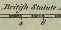
British Statute Mileschequered in miles, labelled at 3 mile intervals. The 12 miles = 30.2 mm giving a scale 1 to 639474; the map scale is about:-
1 to 640000
10 miles to 1 inch
Printed at the sides the scale of latitude is accompanied by a second scale labelled:-
Echelle de Lieus Marine de France et d'Angleterre de 20 au Degrea scale of nautical leagues. The scale is marked in quarter leagues, which get out of step with the chequered latitude divisions; 1 league = 3 minutes, 1/4 league = 3/4 minute. From the scale line 11.5 leagues = 496.8 mm giving a scale 1 to 128693. The chart scale is about:-
1 to 130000
Printed lower right is a scale of:-
British Statute Mileschequered and labelled in miles, the first half mile chequered and labelled 1/2, 12 miles long. The map studied is a facsimile, nominally a 1:1 reproduction but this cannot be precisely known. (How useful it would be if reproductions carried a scale line of cm and mm whose reproduced size could be checked against a true measure.) The map scale is roughly:-
4 inches to 1 mile
Same as Kitchin; but tinted. The scale line was measured from the map, the 10 miles = 37.5 mm gives a scale 1 to 429158 assuming a statute mile. The map scale is about:-
1 to 430000
7 miles to 1 inch
The map has a scale line of:-
British Statute Miles 69 to a DegreeThe scale line is chequered progressively; 10 miles = 37.7mm gives a scale 1 to 426882. The map scale is about:-
1 to 430000
7 miles to 1 inch
Printed upper centre, under the title, is a:-
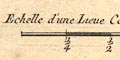
Echelle d'une Lieue Commune de Francechequered and labelled in quarter leagues (which I take it to be). The 1 league = 48.1 mm, if a league is 3.18 nautical miles of 6080 feet, then the map scale is about:-
1 to 120000
2 miles to 1 inch
Printed lower left is a scale line; chequered in miles, labelled at 1, 2 then even mile. Labelled:-
British Statute MilesThe 12 miles = 45.0 mm gives a scale 1 to 429158, assuming the miles are statute miles. The map scale is about:-
1 to 430000
7 miles to 1 inchEstimating a scale from the positions of towns gives a scale 1 to 404764, ie the map scale is about:-
1 to 400000
6.5 miles to 1 inchand an estimate of the map maker's mile = 0.95 statute miles.
Printed lower left is a scale line; chequered at 1 and 6 miles intervals labelled to match 2, 6, 12. The 12 miles = 42.6 mm gives a scale 1 to 453336. The map scale is about:-
1 to 450000
7 miles to 1 inchWhat miles are used has not been checked.
Printed lower left is a scale of:-
British Statue Miles.chequered in quarter miles for the first mile, then in half miles, labelled at mile intervals. 10 miles = 100.0 mm gives a scale 1 to 64374. The map scale is about:-
1 to 64000
1 inch to 1 mile.
Printed upper right is a scale of:-
British Statute Mileschequered at 10 mile intervals, labelled at 20 mile intervals. The 60 miles = 32.1 mm giving a scale 1 to 1 to 3008120. The map scale is about:
1 to 3000000
47 miles to 1 inch
Printed lower left are two scale lines:-
English Miles 60 to a Degreechequered and labelled at 20 mile intervals. The 60 miles = 38.2 mm gives a scale 1 to 2527765 assuming a statute mile. The map scale is about:-
1 to 2500000
40 miles to 1 inchand:-
Scotch Miles 50 to a Degreechequered and labelled at 10 mile intervals. The 50 scottish miles = 37.4 mm.
Below the title, upper centre, is a:-
SCALE OF MILES.this has 8 furlongs marked and numbered to the left, and two miles marked and numbered to the right. 3 miles = 65.1 mm gives a scale 1 to 74163 assuming a statute mile. The map scale is about:-
1 to 74000
1.2 miles to 1 inch.
There is a scale line at the bottom of the chart, labelled:-
Milles MarineThe line is 10 nautical miles = 785.5mm gives scale, assuming the french nautical mile is like ours, about:-
1 to 24000 ?
3 ins to 1 nautical mile
There is a scale line:-
British Statute Miles20 miles chequered in miles, then at 5 mile intervals. 20 miles = 49.6 mm is 1 to 648929, assuming the modern mile, ie about:-
1 to 650000
10 miles to 1 inchAn estimate of the scale can be got from town positions, comparing known town-town distances. The map scale is about:-
1 to 660000
10.5 miles to 1 inch
Printed lower right is a scale line:-
British Statute Miles 69 1/2 to a Degree.The scale line is chequererd and labelled in miles; length 10 miles = mm, giving a map scale 1 to . The map scale is about:-
1 to
miles to 1 inch
The map has a scale line of 10 miles, chequered at two mile intervals, except the first two miles at one mile intervals. Labelled:-
British Statute Miles 69 to a degree10 miles = 49.5mm gives a scale, assuming a statute mile, 1 to 325120, about:-
1 to 330000
5 miles to 1 inch
There is a scale line:-
Statute Miles 69 1/2 to a Degree of Latitude.There are 10 miles, chequered and labelled in miles; length 82.4mm is 1 to 195309, so the scale is about:-
1 to 200000
3 miles to 1 inch
Printed lower right are two scale lines:-
Deutsche oder geographische Meilen 15 auf einem Grad.
Europaische Seemeilen 20 auf einem Grad.each chequered in quarters, labelled 1/4, 1/2, 1. The european scale is of leagues not nautical miles, the 1 league = 3 nautical miles = 50.8 mm gives a scale 1 to 109440; the map scale is about:-
1 to 110000
1.5 nautical miles to 1 inch
(2 miles to 1 inch)
There is a scale line of 10 miles chequered in miles, length 80.4mm. The scale calculated from this is about 1 to 200167; the map scale is about:-
1 to 200000
3 miles to 1 inchAnother estimate of scale can be made from town positions, comparing known town-town distances. The map scale is about:-
1 to 200000
3 miles to 1 inch
There is a chequered scale line of 30 miles, length 49.2mm. The scale calculated from this is 1 to 981307; the map scale is about:-
1 to 980000
15 miles to 1 inch
Printed lower right is a scale line; chequered in miles, labelled at 2 mile intervals. The 10 miles = 34.4 mm gives a scale 1 to 467824 assuming a modern mile. The map scale is about:-
1 to 470000
7 miles to 1 inch
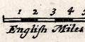
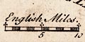
There are two scale lines printed on the right, a:-
SCALE of Six English MILES.chequered and labelled at mile intervals, 0..6, with a leftward mile chequered and labelled at 4 and 8 furlongs. The 6 miles = 60.2 mm giving a scale 1 to 160400. The map scale is about:-
1 to 160000
2.5 miles to 1 inchUsing positions of a selection of towns, processed by DISTTAB.exe the map scale is estimated at 1 to 156194; not much different; map scale:-
1 to 160000
2.5 miles to 1 inchThe second scale line is a:-
Scale of Six Thousand FathomsThis is chequered and labelled at 1000 fathom intervals and has a leftward extension of a fathom chequered and labelled at 500 and 1000 fathoms. The 6000 fathoms = 68.4 mm giving a scale 1 to 160421 - which is the same within the errors of my measurement.
There is a scale line of 9 miles or 3 leagues, chequered at 1 mile then 3 mile intervals. 9 miles = 130.4mm gives a scale of 1 to 127965 assuming a nautical mile 6082.93 ft at this latitude. Ie a scale about:-
1 to 128000
1.75 nmiles to 1 inch
2 land miles to 1 inch.
Printed lower right (with the north point) is a:-
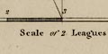
Scale of 2 Leagueschequered and labelled in:-
MilesThe 6 nautical miles = 125.7 mm gives a scale 1 to 88500 taking the length of a nautical mile at 50d 43m N as 6082.93 ft. The chart scale is roughly:-
1 to 89000 ?
1 nautical mile to 1 inch
(1.5 miles to 1 inch)
Printed lower left is a:-
Scale of One Leaguechequered in quarter miles then miles, labelled at 1 mile intervals. The 1 league = 3 nautical miles of 6082 feet = 138.8 mm gives a scale 1 to 40068. The map scale is about:-
1 to 40000
1 1/2 inches to 1 [land] mile
Printed lower left is a scale line:-
Statute Mileschequered and labelled at 5 mile intervals. 10 miles = 13.4 mm gives a scale 1 to 1201002; the map scale is about
1 to 12000000
19 miles to 1 inch
Printed lower right is a scale line:-
Scale / MilesThere are divisions at 2 mile intervals. 10 miles = 18.3 mm giving a scale 1 to 879423 assuming a modern statute mile. The maps scale is about:-
1 to 880000
14 miles to 1 inch
The scale of the map is indicated by a scale line 0..13 miles, with quarter miles in a segment -1..0. The scale line is 45.1mm, the map scale is thus 1 to 463891 or about:-
1 to 460000
7 miles to 1 inch
Printed lower right is a:-
Scale of MilesThe scale,line is chequered in miles labelled at 5 and 10, then chequered and labelled at 10 mile intervals. The 70 miles = 86.0 mm giving a scale 1 to 1309931. The map scale is about:-
1 to 1300000
21 miles to 1 inch
Printed in the bottom border is a:-
Scale of Statute Milesmarked and labelled in miles, with a left extension marked and labelled in furlongs. The 5+1 miles = 149.1 mm gives a scale 1 to 64676. The nominal map scale is:-
1 to 63360
1 inch to 1 mile
Printed upper left is a:-
Scale of Mileschequered and labelled in 2 miles intervals. The 8 miles = 14.2mm giving a scale 1 to 906673. The map scale is about:-
1 to 960000
14 miles to 1 inch.
Printed lower right is a scale of:-
British Statute Milesgraduated and labelled at 5 miles intervals. From the scale line the scale is about 1 to 1306285. The map scale is about:-
1 to 1300000
21 miles to 1 inch
Printed lower right is a scale line of:-
British Statute Miles.chequered and labelled at one mile intervals. The 10 miles = 39.8 mm gives a scale 1 to 404358 assuming a statute mile; the map scale is about:-
1 to 400000
6.5 miles to 1 inch
Printed lower left is a scale line.
Printed lower left is a:-
Scale. / Mileschequered and labelled in miles from 0..10, with a left extension of 1 mile chequered in quarter miles and labelled at 1/2 mile. The 11 miles = 63.5 mm gives a scale 1 to 278916 assuming a statute mile. The map scale is about:-
1 to 280000
4 miles to 1 inch
Printed lower centre is a scale line of:-
English Mileschequered in miles to 5 miles, then 5 then at 10 miles intervals, labelled at 5, 10, 20, 30. The 30 miles = 40.3 mm gives a scale 1 to 1198023; the map scale is about:-
1 to 120000
19 miles to 1 inch
Printed on the left is a scale line of:-
British Statute Mileschequered and labelled at 5 mile intervals, the 60 miles = 101.4 mm on the reproduction; the reproduction map scale is about:-
1 to 950000
15 miles to 1 inch
Printed upper left below the title is a:-
Scale of Statute Mileschequered in miles up to 5 miles then at 5 mile intervals. The length 10 miles = 24.2mm giving a scale 1 to 665018, ie the map scale is about:-
1 to 670000
10 miles to 1 inch
Printed lower left is a:-
SCALE OF STATUTE MILES.chequered in miles, marked in quarter miles, labelled at miles, with a left extension. The 7+1 miles = 198.9 mm gives a scale 1 to 64730. The map scale is about:-
1 to 65000
1 inch to 1 mileUsing the scale of latitude another estimate can be got; 7 minutes latitude = 202.1 mm gives a scale 1 to 64261. The map scale is perhaps:-
1 to 64000
1 inch to 1 mileYet another estimate can be got from town positions, comparing to known town-town distances. The map scale is about:-
1 to 64000
1 inch to 1 mile
Printed bottom centre in a simple cartouche is a:-
Scalechequered and labelled in miles, the 10 miles = 42.1mm gives a scale 1 to 382267 assuming a statute mile. The map scale is about:-
1 to 380000
6 miles to 1 inchAnother estimate of scale can be made from town positions, comparing known town-town distances. The map scale is about:-
1 to 400000
6.5 miles to 1 inch
Printed lower left is a:-
SCALE OF MILESchequered and labelled in miles. The 10 miles = 55.3 mm gives a scale 1 to 291021 assuming a statute mile. The map scale is about:-
1 to 291000
4.5 miles to 1 inch
Printed lower right, below the title is a scale of:-
Statute Miles 69.1 = One DegreeThe scale has a leftward portion of 10 miles marked at 1 mile intervals, labelled 0,5,10, and the main portion marked and labelled at 5 mile intervals. The 10+30 miles= 83.9 mm gives a scale 1 to 767268. The map scale is about:-
1 to 770000
12 miles to 1 inch
Printed upper left under the title is a:
SCALEchequered in miles, labelled at 1..5, 10,15 miles. The 15 miles = 85.4 mm gives a scale 1 to 282672 assuming a statute mile. The map scale is about:-
1 to 280000
4.5 miles to 1 inchThe scale can also be estimated from the latitude scale, 1 degree latitude = 397mm gives a scale 1 to 280399. The map scale is about:-
1 to 280000
Printed lower left is a:-
Scale of Mileschequered in miles to 5, then in 5 mile intervals. The 10 miles = 21.1 mm gives a scale 1 to 762722 assuming a statute mile. The map scale is about:-
1 to 760000
12 miles to 1 inch
Printed lower centre is a:-
Scale of Mileschequered in miles, labelled at 5 mils intervals; The 20 miles = 75.4 mm gives a scale 1 to 426882 assuming a staute mile. The map scale is about:-
1 to 430000
7 miles to 1 inch
Printed lower left is a:-
Scale of Mileslabelled at 1 mile intervals; 6 miles = 47.3 mm giving a scale 1 to 204145 assuming a modern statute mile; the map scale is ablout:-
1 to 200000
3 miles to 1 inch
Printed lower centre is a:-
SCALEchequered and labelled at 1 mile intervals. The 15 miles = 87.2 mm giving a scale 1 to 276837 assuming a statute mile. The map scale is about:-
1 to 280000 ?
4 miles to 1 inchA scale can be estimated from the scale of latitude, 40 mins lat = 267mm gives 1 to 277948, which agrees with the above.
Printed lower left is a scale of:-
English Mileschequered in miles, labelled at 2 mile intervals. The 14 miles = 43.9 mm, giving a scale 1 to 513230 assuming a statute mile. The map scale is about:-
1 to 510000
8 miles to 1 inch
Printed upper left, beneath the title is a scale of:-
English Mileschequered in miles to 2 miles, then at 2 mile intervals, labelled 1, 2, 4, 6, ... The 16 miles = 41.3 mm gives a scale 1 to 623475 assuming a statue miles. The map scale is about:-
1 to 620000
10 miles to 1 inch
Printed lower right is a:-

Scale of Mileschequered and labelled at 1 mile intervals. The 7 miles = 52.9 mm giving a scale 1 to 212957; the map scale is about:-
1 to 210000
3 miles to 1 inch
Printed bottom centre in a cartouche in the border is a:-
Scale of Mileschequered in miles, labelled 1,2,4,6,8 10 miles. The 10 miles = 19.1 mm giving a scale 1 to 842588 assuming a statute mile. The map scale is about:-
1 to 840000
13 miles to 1 inchUsing the scale of latitude another estimate of the scale can be got. 1 degree latitude = 129.2mm gives a scale 1 to 861597. The map scale is about:-
1 to 860000A good estimate of the real scale of the map can be made by reading the positions of a number of towns and comparing these to their known positions. DISTTAB.exe software is used to do the sums. The map scale is calulated as:-
1 to 870000The accuracy of the scale line is estimated:-
1 map mile = 1.05 statute miles
There is a:-
Scale of English Miles.chequered at 2 mile intervals, 10 miles = 30.5 mm gives a scale 1 to 527654 assuming a statute mile. The map scale is about:-
1 to 530000
miles 8 to 1 inchAn estimate of scale can be made from town positions, comparing known town-town distances. The map scale is about:-
1 to 520000
8 miles to 1 inch
The map has a scale line, chequered and labelled in miles, with one mile chequered in halves, labelled:-
Scale of Miles8 miles = 46.7mm gives a scale 1 to 275691 assuming a statute mile, ie the map scale is about:-
1 to 280000
4 miles to 1 inch
Printed below the title is a:-
SCALEchequered at mile intervals to 5 miles then in 5 mile intervals, the 15 miles = 84.3 mm gives a scale 1 to 286360; the map scale is about:-
1 to 290000
4.5 miles to 1 inch
Both sheets have a scale line:-
Scale of English MilesThe scale is divided and labelled at 1 mile intervals. The 10 miles = 57.6 mm and 57.2 mm on the two sheets, giving an averaged scale 1 to 280374 assuming a statute mile, ie the map scale is about:-
1 to 280000 ?
4.5 miles to 1 inch
The map has a scale line:-
Scale of English Milesa line with mile marks, laballed 1..5, 5 miles = 24.4 mm, giving a scale 1 to 329784, ie the map scale is about:-
1 to 330000
5 miles to 1 inch
Printed lower right is a:-
Scale of Mileschequered at 2 miles intervals; on this 10 miles = 11.9mm, giving a scale 1 to 1352390, ie the map scale, perhaps E-W only, is about:-
1 to 1400000
21 miles to 1 inchBut, the map is distorted, stretched out in N-S direction. The latitude scale gives a quite different estimate of scale, 40 minutes latitude = 77.1mm, giving 1 to 962545, the map scale N-S is about:-
1 to 960000
15 miles to 1 inch
Printed lower left is a:-
Scalechequered and labelled at mile intervals, with a leftward mile chequered in quarter miles, labelled at half. The 10+1 miles = 64.2 mm gives a scale 1 to 275744, assuming a statute mile. The map scale is about:-
1 to 280000
4.5 miles to 1 inch
Printed upper left is a:-
Scale of Mileschequered and labelled at 2 mile intervals. The 12 miles = 41.8 mm giving a scale 1 to 462013. The map scale is about:-
1 to 460000
7 miles to 1 inch
Printed lower right is a:-
SCALE OF MILES.chequered and labelled at miles, with a leftward mile chequered and labelled at 4 and 8 furlongs. The 6+1 miles = 71.0 mm gives a scale 1 to 158668 assuming a statute mile. The map scale is about:-
1 to 160000
2.5 miles to 1 inchThe map scale has also been estimated from measured positions of towns.
The map scale is about:-
1 to 150000
2.4 miles to 1 inch
At the lower left is a scale line in a shaded cartouche:-
SCALEThe scale line is chequered in miles, 10 miles = 93.3mm, gives a scale of 1 to 172491 assuming a statute mile, ie the map scale is about:-
1 to 170000
3 miles to 1 inchThe latitude scale provides another indicator of scale. 40 minutes of latitude = 413 mm gives a scale 1 to 179691. The map scale is about:-
1 to 180000
3 miles to 1 inch
Printed lower left is a scale of:-
English Mileschequered and labelled in miles. The 8 miles = 52.1 mm giving a scale 1 to 241716. The map scale is about:-
1 to 240000
4 miles to 1 inchThe scale has been estimated from the position of mrket towns using DISTTAB.exe software to do the sumes. This gives a scale 1 to 246603. The map scale is ablout:-
1 to 250000
4 miles to 1 inch
Printed lower left os a:-
Scale of 3 Miles to one Inchgraduated and labelled in miles from 0 to 9, and a leftward part graduated in quarter miles, labelled 1/2 and 1. The 9+1 miles = 82.1 mm giving a scale 1 to 196022 assuming a statute mile; the map scale is about:-
1 to 200000
3 miles to 1 inchFrom measuring the position of the 21 towns in Hampshire and comparing them with their 'correct' positions, it is possible to get other estimates of the scale. This process uses DISTTAB.exe software. The map scale is about 1 to 193103, that is:-
1 to 190000
3 statute miles to 1 inchor using the scale line, 1 to 196364, that is:-
1 to 190000
3.10 map miles to 1 inch
map mile = 0.98 statute mileThe correlation between town to town distances on the map to 'correct' distances is 1.00.
Printed lower right is a:-
SCALE OF MILESchequered in miles to 5 then in 5 mile intervals , labelled 0..5 then in 5s. The 20 miles = 71.4 mm giving a scale 1 to 450797 assuming a statute mile. The map scale is about:-
1 to 450000
7 miles to 1 inch
There is a scale line of
ENGLISH MILESThe line is chequered at 1 mile intervals. 14 miles = 43.9mm, giving a scale of 1 to 513230. The map scale is about
1 to 510000
8 miles to 1 inch.
Printed lower left is a:-
Scale of Mileschequered in miles to 5 then at 5 miles intervals. The 10 miles = 21.4 mm gives a scale 1 to 750030 assuming a statute mile. The map scale is about:-
1 to 750000
12 miles to 1 inch
Printed lower left on each sheet is a scale of:-
British Statue Miles.marked 1..5 then 10 miles. The 10 miles = 85.4 mm gives a scale 1 to 188448. The map scale is about:-
1 to 190000
3 miles to 1 inch
Printed on the right below the title etc is a:-
SCALEdivided and labelled at 10 mile intervals. The 30 miles = 62.5 mm giving a scale 1 to 772485 assuming a statute mile. The map scale is about:-
1 to 770000
12 miles to 1 inch
Printed upper left is a scale of:-
English MilesThis has 10 miles marked at 2 mile intervals, with the first half and 1 mile marked as well. 10 miles = 45.2 mm gives a scale 1 to 356050; the map scale is about:-
1 to 360000
5 1/2 miles to 1 inch
Printed below the title cartouche, upper right, is a scale of:-
English Mileschequered in 5 then 10 miles intervals, labelled at 5, 10, 20, etc. The 50 miles = 88.8 mm gives a scale 1 to 906162. The map scale is about:-
1 to 900000
14 miles to 1 inch
Printed lower left is a scale of:-
English Milesmarked at 1,2 then at 2 mile intervals. The 8 miles = 24.7 mm gives a scale 1 to 521245. The map scale is about:-
1 to 520000
8 miles to 1 inch
Printed upper left, below the title, is a:-
SCALE OF MILESchequered and labelled in miles. The 10 miles = 40.5 mm giving a scale 1 to 397369 assuming a statute mile. The map scale is about:-
1 to 400000
6 miles to 1 inch
Printed upper left is a scale of:-
English Mileschequered and labelled in miles, with a left extension divided in furlongs. The 12+1 miles = 77.6 mm giving a scale 1 to 269607 assuming a statute mile. the map scale is about:-
1 to 270000
4 miles to 1 inch
Printed upper left under the title is a scale line of:-
English Milesmarked at 1 mile intervals. The 10 miles = 29.7 mm giving a scale 1 to 541867; the map scale is about:-
1 to 540000
8.5 miles to 1 inch
Printed lower centre is a scale line of:-
British Statute Mileschequered and labelled at 5 mile intervals. The 60 miles = 99 mm, roughly, gives a scale 1 to 974769. The map scale is about:-
1 to 970000
15 miles to 1 inchMeasuring the position of the towns in Hampshire a second estimate of scale, for the south central region, was made, 1 to 970976. The map scale is about:-
1 to 970000
15 miles to 1 inch
Printed below the title and table of symbols is a:-
Scale of Statute Miles.The scale has 30 miles marked at 10 mile intervals, plus 10 miles leftwards divided at miles, marked at 5 miles intervals. The 30+10 miles = 99.7 mm gives a scale 1 to 645675; the map scale is about:-
1 to 650000
10 miles to 1 inch
Printed lower left, under the title, is a:-
Scale of Milesa graduated line labelled at mile intervals. The 10 miles = 39.0 mm gives a scale 1 to 412652 assuming a statute mile; the map scale is about:-
1 to 410000
6.5 miles to 1 inchMeasuring the position of 21 towns on the map and comparing the town to town distances with the 'correct' values it is possible to get other estimates of the map's scale. This procedure uses DISTTAB.exe software. The map scale is about 1 to 412236, that is:-
1 to 410000
6.5 statute miles to 1 inchFrom the scale line the scale is about 1 to 410540; the same within errors, so the scale line has:-
1 map mile = 1 statute mileThe correlation between the town to town distances on the map and the 'correct' values is 1.00.
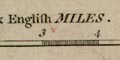
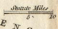
Printed in the title cartouche is a scale of:-
Statute Milesmarked 0, 5, 10, 20, 30. The 30 miles = 37.9 mm giving a scale 1 to 1273887. The map scale is about:-
1 to 1300000
20 miles to 1 inch
There is a scale line of
British Miles50 miles = 38.2mm is a scale 1 to 2106471, the map scale is about:-
1 to 2100000
33 miles to 1 inch
Printed lower right there are three scale lines:-
Geographical Miles. 60 = 1 degree.
English Statute Miles. 69.16 = 1 degree.
French Kilometres 111.3 = 1 degree.The scale of statute miles is chequered and labelled at 10 miles intervals, with a left extension chequered in miles, labelled at 5 and 10. The 40+10 miles = 65.9 mm giving a scale 1 to 1221050. The map scale is about:-
scale: 1 to 1200000
19 miles to 1 inch
A scale line is printed on the table of symbols page preceding the road map pages, a:-
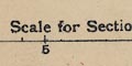
Scale for Sectional Mapsmarked in miles to 5 then at 5 mile intervals. The 15 miles = 63.5 mm gives a scale 1 to 380160. The road map scale is about:-
1 to 380000
6 miles to 1 inch
Printed lower left is a scale line; marked and labelled at 1/4, 1/2 and 1 mile. The 1 mile = 6.6 mm gives a scale 1 to 243840 assuming a statute mile. the map scale is about:-
1 to 240000
4 miles to 1 inch
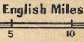
The maps have scale lines for miles, yards and kilometres in the bottom border of each sheet, horizontal, for east-west distances. The style varies from printing to printing. On the HMCMS example of sheet 132 the scale line for miles is chequered and labelled in miles, and has a left extension chequered and labelled in furlongs. The 5+1 miles = 151.8 mm giving a scale 1 to 63610. In the right border a plainer vertical scale of miles, north-south, is 4+1 miles = 127.2 mm giving a scale 1 to 63260. The map scale is nominally:-
1 to 63360
1 inch to 1 milePrinted above the bottom scale line:-
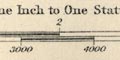
Scale of One Inch to One Statute Mile 1/63360Apart from the inevitable stretch and shrink of paper with change of relative humidity these maps are reliably accurate in their scale. The map's projection has associated errors which are not significant in these small scale maps.
Printed lower right is a scale line of:-
English Mileschequered and labelled at 5 mile intervals. The 15 miles = 37.4 mm gives a scale 1 to 645459. The map scale is about:-
1 to 650000
10 miles to 1 inch(agreeing with the scale given on the list of maps).
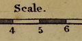
scale line |
|||||||||||||||||||||||||||||||||
| scale line |  |
|
|
|
|
|
|
|
|
|
|
|
|
|
|
|
|
|
|
|
|
|
|
|
|
|
|
|
|
|
|
|
|
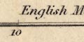
| scale lines, different units |  |
 |
|
 |
 |
|
|
|
|
|
|||||||||||||||||||||||
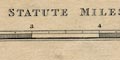
| chequered | |
|
|
|
|
|
|
|
|
|
|
|
|
|
|
|
|
|
|
|
|
|
|
|
|
|
|
|
|
|
|
|
|
| left extension | |
|
|
|
|
|
|
|
|
|
|
|
|
|
|
||||||||||||||||||
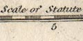
| "statute" | |
|
|
|
|
|
|
|
|
|
|
|
|
|
|
|
|
||||||||||||||||
| dividers | |
|
|
|
|
|
|
|
 |
|
|
|
|
||||||||||||||||||||
