Relief, Hills
Harrison's Hampshire 1788
- important or isolated hills
- steep scarp
- uneven ground, hilliness
- high ground, ie altitude
- watersheds
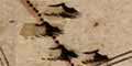
The drawing of hills has to compete with the placing other information on the limited map space. We do not know what priority was given to hills; it would be interesting to know in what order symbols were engraved on the printing plate. Harrison's hill symbols are all very similar, grouped, small lumpy hillocks shaded to the east.
No hills are named, except Brotherhill which has no hill symbol (this is Butser Hill), and the two beacon hills, Selbone Beacon and Lomer Beacon.
The significant scarp north of Portsmouth, Portsdown, is missed off his map.


