latitude and longitude
Harrison's Hampshire 1788and
Longitude

Harrison's map of Hampshire 1788 has latitude and longitude scales printed in the borders; chequered at 1 minute intervals, labelled at 5 minute intervals. A latitude and longitude grid, a graticule, is printed across the map at 5 minute intervals.
Calculations from the positions of the scale marks show that the ratio of latitude to longitude scales is about 1.16. This is not the necessary value, 1.58, latitude of Hampshire, for a 'square' plot.
The angle of the 1 degree W meridian is about 2.7 degrees E of N and is quite apparent on the map. The 51 degree N parallel is horizontal on the page.
Summary
Sheared rectangular latitude and longitude scales, 2.7 degrees E of N.
Parallels are aligned horizontally on the page.
The graticule would stretch the county 37 percent E-W; 1 mile x 1 mile becoming 1.37 units x 1 unit.
These figures make no inference about the positions of places on the map. It is likely that Harrison copied a map and applied lat and long scales to it. No attempt has been made to see how well he fitted the scales. Both Kitchin 1751 large and Harrison 1788 might have been copied from the same source map.
Note that map north, declared by compass rose and the latitude and longitude grid, and present day NGR north agree quite closely. Map north is not aligned exactly with the map sheet; NGR north is about 3.4 degrees E of sheet north, understanding that as the paper orientation.
Measured Values
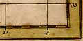
Measurements in pixels from an image at 150dpi.

Corners                  A = (127,2103)
                         B = (109,99)
                         C = (2941,97)
                         D = (2950,2098)

Longitude, top           2d 00m = 309
                         1d 00m = 1819
                         0d 20m = 2830

Longitude, bottom        2d 00m = 217
                         1d 00m = 1741
                         0d 15m = 2883

Latitude, left           50d 35m = 2029
                         51d 00m = 1044
                         51d 20m = 258

Latitude, right          50d 35m = 2026
                         51d 00m = 1052
                         51d 20m = 265
Calculated Values
1 degree longitude, top = 1513
1 degree longitude, bottom = 1523
same
1 degree longitude = 1518

1 degree latitude, left = 1771
1 degree latitude, right = 1761
same
1 degree latitude = 1766
adjusted for angle = 1768

ratio lat/long = 1.16

angle of 1 degree meridian = 2.7 degrees E of N

angle of 51 degree parallel = 0.1 degrees N of E, = 0.0 degrees


