| Roads
Harrison's Hampshire 1788
|
|

|
click for feature map of principal roads,
annotated with 'Ogilby' routes.
|
|
|
click for feature map of all roads.
|
Main roads
and
Lesser roads
|
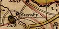
Harrison's map of Hampshire shows a network of roads at
two levels; more important routes are drawn wider and
coloured yellow, lesser routes are narrower and uncoloured.
There are numerous roads and the density of both major and
minor roads is worth consideration. Is Harrison carefully
showing roads which fit within two well defined bands
of importance? It would not be all that easy to measure
what is important, estimate what was, and come to any sort
of conclusion. We do not intend to analyse transport patterns
from the roads on this map. Our study so far would suggest
that mistakes have been copied from earlier maps. There are many inaccuracies in the positioning of settlements, and
this makes us suspicious of the apparent course of some
roads.
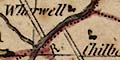
There are some other oddities. The road SE from Andover
meets the River Test distinctly offset from what looks like
its continuation towards Winchester. What is missing is
the zigzag of the road alongside and across the braids of the Test in its broad valley. How this leaves the 18th
century traveller we can only guess; confident that
there's bound to be a way across?
|
Ogilby
Routes
|
As the route maps published by Ogilby one hundred years
earlier, 1675, are of particular interest, a comparison
between Ogilby's routes and Harrison's roads has been
made. It is superficial; there is not enough accurate
detail to allow close matching. Ogilby's routes are
referred to by their plate numbers; routes 25, 26, 30,
32, 39, 51, 53, 81, 83, 97, which are the plates with
segments of road in Hampshire.
|
| Ogilby 25
|
Ogilby route 25 can be followed as a major road entering from
Surrey at Blackwater, via Hertford Bridge,
to Basingstoke. But Harrison's road continues through
Wootton instead of Worting, and keeps well
north of the river Test to Whitchurch.
Between Whitchurch and Andover, Hurstbourne
Priors occurs as two settlements, Down Husborn, which
was Ogilby's name for it, on a minor road, and
Husbourne Priors on a major road further south.
|
| Ogilby 26
|
Ogilby route 26 is seen to leave Andover as a major
road via Abbots Ann and Middle Wallop,
going SW to the Wiltshire border.
|
| Ogilby 30
|
Ogilby route 30 appears as a major road entering from Surrey
near Liphook, but Harrison's road then stays just
inside Hampshire. He follows Ogilby's road through
Petersfield, southwards via Harndon and
Cosham, and this major road continues all the way
to Portsmouth.
|
| Ogilby 32
|
Ogilby route 32 starts here as a minor road from
Andover, via Monxton but it passes well
north of Greatley on its way to the Wiltshire
border. Harrison's major route is more northerly, going
to Weyhill before turning SW.
|
| Ogilby 39
|
Ogilby route 39 can be followed as a major road from
Petersfield westwards through Langridge
and Bramdam, to Winchester. How close Ogilby
and Harrison are across Magdalen Down is hard to tell.
|
| Ogilby 51
|
Ogilby route 51 appears as a major road entering from Farnham,
Surrey, via Bentley, to Alton, then a minor
road to Alresford. From here it appears as a major
road via Morested and passing close to Twyford,
crossing the Itchin near Albrook House, and
entering Southampton from the NE. The continuation
north west to Rumsey is shown as a major road.
|
| Ogilby 53
|
Ogilby route 53; the first part of this route SW from
Basingstoke appears to be shown by a minor road
going SW to Cold Waltham, but it passes on the wrong
side of Steventon. It joins a major road through
Cranborn and Sutton and continues to
Stockbridge. From here it soon becomes a minor
road going SW to cross the Wiltshire border.
|
| Ogilby 81
|
Ogilby route 81 shows as a major road entering from
Berkshire across the Auborn River near
Kingsclere, before turning SE to Basingstoke.
A major road continues to Petersfield via
Alton, then E to the Surrey border, but
the segment shown by Harrison between Basingstoke
and Alton does not match Ogilby's route well.
|
| Ogilby 83
|
Ogilby route 83 has a small segment in Hampshire, shown by
a minor road through South Tidworth.
|
| Ogilby 97
|
Ogilby route 97 between Alresford and Winchester, on
Ogilby's survey, consists of segments of two other
routes, starting on the Southampton road, then taking
the Petersfield to Winchester road; it also passes
Magdalen House. On Harrison's map you have
to choose between the minor road passing
through Magdalen or the two road segments, which are
main roads. Beyond Winchester it shows as a
main road through Hursley, to Rumsey,
continues SW via Ragged Row and Malwood
to Ringwood and from there to the Dorset
border.
The extra part of route 97 from Poole eastwards to
Christ Church, then Lymington, shows as
a major road.
The extra part from Southampton northwards to
Winchester, entering via St Crois, is
also shown as a major road.
|
|
|
Road diagrams from maps of 1675 onwards.
|
|
|
Ogilby's influence on Harrison's roads.
|


