 Kennet and Avon Canal Kennet and Avon Canal |
 |
|
|
|
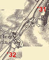
MILE 31
|
Froxfield and Little Bedwyn, Wiltshire : KAC31.00=KAC32.00 |
|

|
KandAC mile 31
|
|
|
|
KandAC mile 31 - OS 1inch map, early 19th century
|
|
|
... a babbling tumble of river accompanies the quiet canal down the
valley of the Dun ...
|
|
|
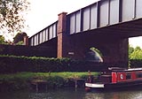
The Kennet and Avon Canal from mile 31 to 32 is climbing up the valley
of the River Dun. The Great Western Railway line to the south west is
on the north side of the canal. The towpath is on the south side.
|
|
|
Parish boundary Froxfield - Little Bedwyn runs approximately alongside
the canal: SU29606654 (to) & SU29796690
|
|
|
|
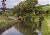
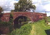
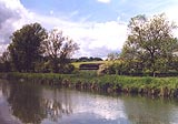
Canal eastward of Fore Bridge.
|
|
|
Oak Hill lies to the south of the canal.
|
|
|
|
Canal eastward of Fore Bridge.
|
|
|
|
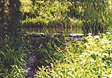
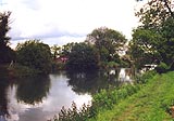
East of Fore Bridge there is an overflow from the canal running into
the River Dun.
|
|
|
|
Fore Bridge, Little Bedwyn
|
|
|
North of Fore Bridge is a level crossing over the railway, and
Crossing Farm.
|
|
|
|
Canal side buildings westward of Fore Bridge.
|
|
|
|
Fisherman mending his gear by Fore Bridge. He was mending the same
stuff when we walked back an hour later.
|
|
|
|
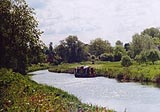
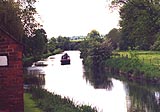
Boat approaching Fore Bridge from the westward.
|
|
|
|
A passenger train, diesel loco plus two Motorail vans and two coaches,
going west.
|
|
|
|
Just westward of Fore Bridge; is this a winding point?
|
|
|
|
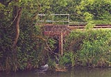
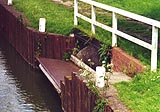
Another outfall of water into the canal, east of Little Bedwyn, having
passed under the railway.
|
|
|
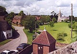
Little Bedwyn village is neat and rural romantic; there's a post
office (now?) and shop. St Michael's Church lies at the east of the
village, flint and stone with a small spire, about 12th century.
|
|
|
|
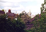
Little Bedwyn village green, and St Michael's Church, from the railway
footbridge.
|
|
|
|
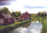
Little Bedwyn from the canal lock.
|
|
|
Manor Farm, large and imposing, with stables nowadays, lies to the
south of the canal at Little Bedwyn.
|
|
|
|
An outfall of water into the canal? just below Little Bedwyn Lock.
|
|
|
|
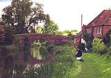
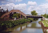
Little Bedwyn Footbridge, Little Bedwyn
|
|
|
|
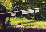
Little Bedwyn Lock, Little Bedwyn
|
|
|
|
Little Bedwyn Bridge, Little Bedwyn
|
|
|
The Harrow Inn and a shop are on the road south of the canal.
|
|

|
Kennet and Avon Scrapbook 2000
|
|