 Kennet and Avon Canal Kennet and Avon Canal |
 |
|
|
|
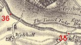
MILE 35
|
Grafton, Wiltshire : KAC35.00=KAC36.00 |
|

|
KandAC mile 35
|
|
|
|
KandAC mile 35 - OS 1inch map, early 19th century
|
|
|
... the canal found this route long since; the upstart railway
followed along ...
|
|
|
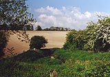
The Kennet and Avon Canal from mile 35 to 36 rises through the Crofton
Flight of locks to its summit level. The Great Western Railway line to
the south west is on the north side of the canal; and it and the canal
are crossed by the disused route of the Midland and South Western
Junction Railway. The towpath is on the south side.
|
|
|
|
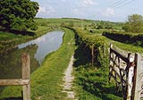
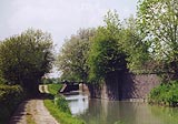
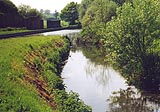
Canal eastwards from Freewarren Bridge; notice the five bar gate.
|
|
|
|
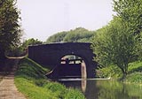
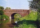
Freewarren Bridge, Grafton
|
|
|
|
A high speed train passing lock 58.
|
|
|
|
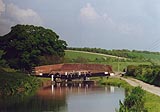
Sam Farmer's Lock, Grafton
|
|
|
At about 35m 10ch you can see the piers of a railway bridge. The
bridge carried the Grafton Curve from the Berks and Hants Extension
Railway, Grafton East Junction, north of the canal, to the Midland and
South Western Junction Railway, MSWJR, Grafton South Junction, south
of the canal. The curve was built 1905, and was made for operational
reasons, not used for regular through running. The Berks and Hants
line was part of the Great Western Railway system.
|
|
|
|
Grafton Curve railway bridge.
|
|
|
|
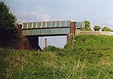
Present day railway bridge, plate girder bridge, on the Great Western
Railway by the canal.
|
|
|
|
KandAC lock 57
|
|
|
|
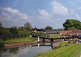
KandAC lock 56
|
|
|
|
A high speed train passing by lock 56.
|
|
|
|
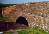
Wolfhall Fields Bridge, Grafton
|
|
|
|
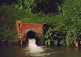
Excess water from the Crofton Feeder overflows into the canal pound
below Crofton Top Lock. As the summit pound was low I think this
overflow was not meant to be, something had got clogged in the sluice
above.
|
|
|

|
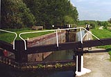
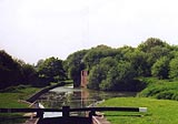
Crofton Top Lock, Grafton
|
|
|
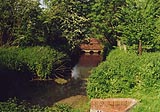
The Crofton Feeder, a lade from Crofton Pumping Station feeding the
summit pound, enters just above the lock.
|
|
|
|
Crofton Feeder comes from the pumping station on the north side of the
railway, turns towards the canal, and ...
|
|
|
|
... crosses under the railway to approach the canal, with an overflow
weir at the side, ...
|
|
|
|
... then flows out into the canal above Crofton Top Lock, into the
summit pound.
|
|
|
|
KandAC winding point 35.47
|
|
|
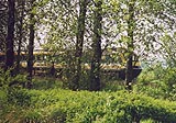
The remains of two earlier railway bridges, in one, are just westward
(actually north) of the winding point at 35 miles 47 chains. Remember
that alongside the railway there was already the Berks and Hants
Extension Railway alongside the canal on the north side, running along
Pewsey Vale, with a branch to Marlborough taken off at Savernake.
|
|
|
The more westerly part of this bridge carried the Swindon Marlborough
and Andover Railway, SMAR, from the BandHR, Wolfhall Junction, north
of the canal to run south across the canal on its way to Andover. The
Swindon line of the original SMAR linked to the BandH Marlborough
branch just south of Marlborough, ran on its competitors rails to
Savernake Junction, along their main line until leaving at Wolfhall
Junction. The SMAR opened about 1883.
|
|
|
The lack of cooperation between railways (just like today?) prompted
the building of a 'cut off' from Marlborough via a new Savernake
Station to cross the canal at a slightly higher level which used the
more easterly part of this bridge, down to Grafton South Junction on
the existing line. With the addition of this line, the Marlborough and
Grafton Railway, open 1898, the SMAR was renamed the Midland and South
Western Junction Railway, MSWJR. All very complicated.
|
|
|
|
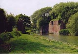
The remains of the MSWJR railway bridge, from the eastward side.
|
|
|
Savernake Forest is visible to the north.
|
|
|
|
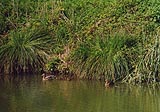
Mallard, Anas platyrhynchos, mum and ducklings.
|
|
|
|
Wolfhall Bridge, Grafton
|
|
|
|
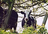
Inquisitive friesian cow in the field by the towpath.
|
|
|
Bartholomew, David: 1982: Midland and South Western Junction Railway
(vol.1): Wild Swan Publications:: ISBN 0 906867 08 8
|
|

|
Kennet and Avon Scrapbook 2000
|
|