 Kennet and Avon Canal Kennet and Avon Canal |
 |
|
|
|
MILE 44
|
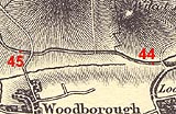
Wilcot and Woodborough, Wiltshire : KAC44.00=KAC45.00 |
|

|
KandAC mile 44
|
|
|
|
KandAC mile 44 - OS 1inch map, early 19th century.
|
|
|
... there's always wild flowers on the towpath; this time these, other
times those ...
|
|
|
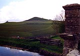
The Kennet and Avon Canal from mile 44 to 45 is part of the Fifteen
Mile Pound which roughly follows a contour line on the side of Pewsey
Vale. The towpath is on the north side until a roving bridge at the
eastward end of the mile.
|
|
|
|
Picked Hill, height 202m, north of the canal.
|
|
|
There is an OS triangulation point on the top of Picked Hill.
|
|
|
Parish boundary Wilcot - Woodborough: SU12366068
|
|
|
|
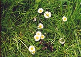
Daisies, Bellis perennis, welcoming the sun after some showers.
|
|
|
|
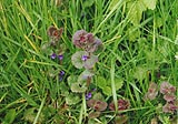
A little mint.
|
|
|
|
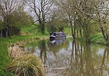
Boat coming, westwards, round the corner near the culvert over the
stream from Picked Hill.
|
|
|
|
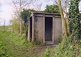
Why is a cast concrete prefabricated 'bush shelter' standing by the
canal? The only idea I have is that it could be a shelter for a water
bailiff?
|
|
|
|
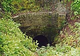
KandAC culvert 44.30
|
|
|
|
Lambit Swing Bridge, Woodborough
|
|
|
The wood parallel to the canal, to the south, is Lambit Copse.
|
|
|
|
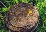
Great Western Railway, GWR, boundary marker in the rough ground north
of Woodborough Fields Bridge.
|
|
|
GREAT [ ERN R]AI[LW]AY Cos. / BOUN[D ]
|
|
|
The GWR bought the canal in 1852; these boundary markers are later,
about 1910s.
|
|
|
|
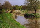
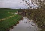
The canal eastwards from Woodborough Fields Bridge.
|
|
|
|
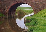
Woodborough Fields Bridge, Woodborough
|
|

|
Kennet and Avon Scrapbook 2000
|
|