 Kennet and Avon Canal Kennet and Avon Canal |
 |
|
|
|
MILE 46
|
Stanton St Bernard, Wiltshire : KAC46.00=KAC47.00 |
|

|
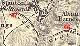
KandAC mile 46
|
|
|
|
KandAC mile 46 - OS 1inch map, early 19th century.
|
|
|
... a contour canal wanders gracefully along the side of its valley,
parallel the hillfoots ...
|
|
|
The Kennet and Avon Canal from mile 46 to 47 is part of the Fifteen
Mile Pound which roughly follows a contour line on the side of Pewsey
Vale. The towpath is on the south side.
|
|
|
|
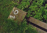
Milepost 46, collapsed.
|
|
|
|
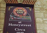
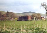
Barge Inn, Woodborough
|
|
|
|
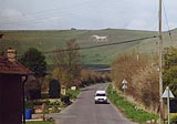
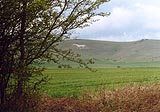
Alton Barnes White Horse, Alton
|
|
|
|
All along this stretch of canal you catch glimpses of the Alton Barnes
White Horse to the north.
|
|
|
The hill right of the horse is Walker's Hill; a young lady walking
here one summer near Adam's Grave, a barrow, heard an army of horsemen
which stopped as she passed the tumulus.
|
|
|
Alton Barnes Airfield, Alton
|
|
|
|
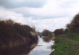
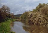
Eastwards of Stanton Bridge, Kennet and Avon Canal.
|
|
|
|
Stanton Bridge, Stanton St Bernard
|
|
|
|
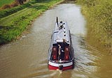
Boat passing westwards under Stanton Bridge.
|
|
|
|
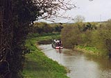
Boat on the Kennet and Avon Canal westwards of Stanton Bridge.
|
|
|
|
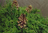
Butterbur, Petasites hybridus, on the towpath.
|
|
|
|
The canal westwards from near Stanton Bridge; blackthorn, Prunus
spinosa, in flower.
|
|
|
|
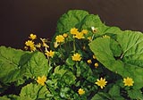
Celandine, Ranunculus ficaria? on the towpath, nearly in the water.
|
|
|
|
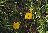
Dandelions, Taraxacum officinale, and a bee, in the bank of the
towpath.
|
|
|
|
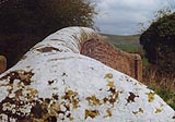
Another pillbox; this is the largest type, made to house a 2 pounder
anti-tank gun (?).
|
|
|
|
England's Bridge, Stanton St Bernard
|
|
|
|
KandAC culvert 46.72
|
|
|
|
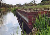
An ugly piece of brickwork in the canal bank looks as if it is an
overflow, feeding into one of the brooks from Stanton St Bernard.
|
|
|
KandAC culvert 47.00
|
|
|
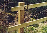
Parish boundary Woodborough - Stanton St Bernard: SU10076162
|
|

|
Kennet and Avon Scrapbook 2000
|
|