 Kennet and Avon Canal Kennet and Avon Canal |
 |
|
|
|
MILE 61
|
Semington and Hilperton, Wiltshire : KAC61.00=KAC62.00 |
|

|
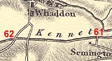
KandAC mile 61
|
|
|
|
KandAC mile 61 - OS 1inch map, early 19th century.
|
|
|
... straight and uneventful ...
|
|
|
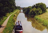
The Kennet and Avon Canal from mile 61 to mile 62 continues parallel
the Semington Brook into the Avon Valley, without a lock. The towpath
is on the north side.
|
|
|
KandAC culvert 61.10
|
|
|
KandAC culvert 61.18
|
|
|
Parish boundary Semington - Hilperton: ST88686072 (?)
|
|
|
The parish boundary runs along the towpath side of the canal from this
point westwards?
|
|
|
|
KandAC winding point 61.32
|
|
|
The area to the north of the canal is Whaddon; Whaddon Grove Farm and
Whaddon Farm, with Whaddon Church, are about half a mile north of the
towpath.
|
|
|
|
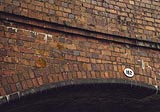
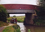
Whaddon Grove Bridge, Hilperton
|
|
|
|
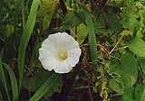
Bindweed, Calystegia sepium, climbing in the water reeds.
|
|
|
|
Looking eastward from Whaddon Bridge; Whaddon Grove Bridge in the
distance.
|
|
|
|
Whaddon Bridge, Hilperton
|
|
|
|
Just by Whaddon Bridge is a chicken farm; you can tell quite clearly
if the wind is off that direction.
|
|
|
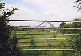
It's a nice modern gate.
|
|
|
|
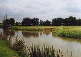
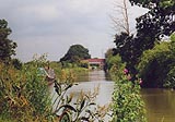
The canal westward of Whaddon Bridge.
|
|
|
There is an overflow weir at about 61m71ch; and a plug at about
61m74ch.
|
|
|
Parish boundary Hilperton - Semington: ST87616071 (?)
|
|
|
The parish boundary runs along the towpath side of the canal up to
this point from eastwards?
|
|
|
KandAC culvert 61.78
|
|
|
|
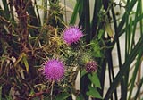
Thistles, Cirsium sp, by the towpath.
|
|

|
Kennet and Avon Scrapbook 2000
|
|