 Kennet and Avon Canal Kennet and Avon Canal |
 |
|
|
|
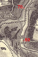
MILE 69
|
Winsley, Wiltshire : KAC69.00=KAC69.75;
Somerset : KAC69.75=KAC70.00 |
|

|
KandAC mile 69
|
|
|
|
KandAC mile 69 - OS 1inch map, early 19th century.
|
|
|
... more woods and seclusion, till the excitement of an aqueduct ...
|
|
|
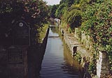
The Kennet and Avon Canal from mile 69 to mile 70 continues down the
Limpley Stoke Valley alongside the River Avon, until it crosses the
river to the other side of the valley by Dundas Aqueduct. The towpath
is on the south side (the west side, as the canal is heading north).
|
|
|
|
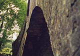
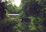
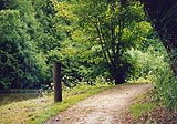
Limpley Stoke Bridge, Winsley
|
|
|
|
Westwards from Limpley Stoke Bridge.
|
|
|
|
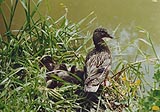
Proud and wary mother mallard and ducklings.
|
|
|
The woods on the hillside on the east (north side) side are Conkwell
Wood. The canal, railway, river, and minor road from Bradford-on-Avon
are joined by the A36, coming from Frome, miles to the south, going
towards Bath which is just the other side of Claverton Down, the hill
to the west (south side).
|
|
|
|
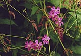
Red campion, Silene dioica, on the towpath.
|
|
|
|
Frame of the wince for a plug in the canal bed, at about 69m 28ch.
|
|
|
|
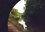
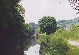
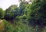
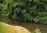
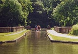
Canal, looking eastward (south).
|
|
|
|
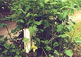
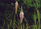
Hoary plantain, Plantago media, on the towpath.
|
|
|
|
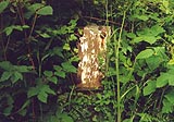
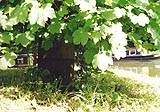
Milepost 69 II; numberless and hiding.
|
|
|

|
Canal narrowed for a stank?
|
|
|
The valley to the west (south side) is made by the Midford Brook which
joins the River Avon. To the north of this a road comes down a steep
hill off Claverton Down, called Brassknocker Hill.
|
|
|
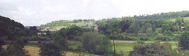
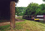
View up the valley of the Midford Brook towards Monkton Combe. The
viaduct in view takes the A36 over the valley of the Midford Brook;
and, to the right, you can see boats moored in the new marina on the
arm of the Somerset Coal Canal.
|
|
|
Along this section there is another plug at about 69m49ch.
|
|
|
|
KandAC winding point 69.52
|
|
|
|
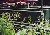
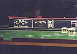
Boat, Celt; different canal boat painting.
|
|
|
|
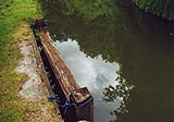
Canal narrowed for stop gates at about 69m 65ch.
|
|
|
Stop gates are arranged to swing free. If there is a sudden flow of
water from a canal blow out, a major leek in the canal bed or bank,
the gates should slam shut by themselves, isolating the leaky stretch.
|
|
|
|
Stop gate still in place.
|
|
|
|
The stop gates are tied up, which defeats their purpose.
|
|
|
|
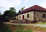
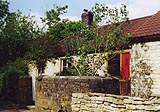
Lengthsman's cottage, now extended into a private house?
|
|
|
|
Lengthsman's cottage, older part.
|
|
|
Just before the aqueduct the canal, running north, turns sharply west
to cross the valley.
|
|
|
At this corner there was an incline tramroad to transport stone from
Conkwell Quarry in the woods to the east. The quarry was opened by the
canal company 1801. The stone from Conkwell was as defective as stone
any already being used on the canal, which was causing Rennie serious
problems and putting up costs. In 1803 John Rennie was advising the
company to cut their losses, to use brick instead of faulty stone.
There was plenty of suitable clay available around Devizes.
|
|
|
|
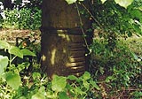
Cast iron rubbing post on the sharp bend.
|
|
|
|
This large rubbing post has a tree growing up its middle.
|
|
|
|
Further round the corner is a smaller cast iron rubbing post.
|
|
|
|
The smaller rubbing pots foreground, and the larger with its tree
behind.
|
|
|
The idea of rubbing posts is to take the tow rope round the bend
safely. The posts show plenty of rope marks, grooves cut in by the
grit in the wet and grubby hemp. The two posts are said to have been
iron pipes from Claverton Pumping Station, originally used to convey
water from that pump to the canal above.
|
|
|
There is (private?) mooring just before the aqueduct.
|
|
|
|
Boat, Natterjack, moored eastward of the aqueduct.
|
|
|
|
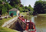
Dundas Aqueduct, Winsley
|
|
|
County boundary Winsley, Wiltshire - Somerset (there is a reorganised
name): ST78476257
|
|
|
|
KandAC winding point 69.78
|
|
|
The Somerset Coal Canal, a narrow canal, abandoned 1898, met the
Kennet and Avon Canal here. The entrance lock and an arm are now a
marina. This canal opened 1805, planning to carry coal to Bath and
Bristol. It was originally surveyed by John Rennie, 1793, and planned
to reach Paulton and Radstock in the Somerset coalfields. The canal
had to overcome a steep climb immediately into the valley of the
Midford Brook, for which there were some intriguing solutions; a
caison lock (terrifying), an inclined plane, then a flight of locks.
A:-
|
|
|
Navigable Canal with certain Rail Ways, and Stone Roads, from several
Collieries, in the County of Somerset, to communicate with the
intended Kennet and Avon Canal, in the Parish of Bradford in the
County of Wilts.
|
|
|
|
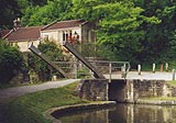
Lift bridge at the entrance to the new marina. This bridge is
aluminium recycled from the Alcan Works, near Banbury on the Oxford
Canal.
|
|
|
|
The narrow lock at the entrance to the Somserset Coal Canal is now
permanently open. When it was excavated during restoration work it was
found to have half a rounded bottom - the bottom was built for a broad
lock.
|
|
|
|
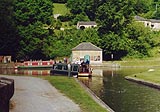
Dundas Wharf (Somerset)
|
|
|
Elton, Arthur: 1963: Pre-History of Railways ...: Proceedings of the
Somerset Archaeological and Natural History Society:: pp.31-59; notes
about problems with stone
|
|

|
Kennet and Avon Scrapbook 2000
|
|