|
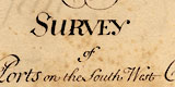
Title, Address and Orders:
Four text pages; includes the extent of the survey.
|

|
Rye, East Sussex:
Text and chart for Rye and the mouth of River Rother in Rye Bay, and extending west to Winchelsea and inland to Appledore.
|

|
Pevensey, East Sussex:
Text and chart for Pevensey and the mouth of Pevensey Haven, at Pevensey Bay.
|

|
Cuckmere Haven, East Sussex:
Text and chart for mouth of the Cuckmere River, and inland to beyond Westdean.
|

|
Newhaven, East Sussex:
Text and chart for the River Ouse at Newhaven.
|

|
Shoreham, West Sussex:
Text and chart for the River Adur at Shoreham, and inland to Bramber.
|

|
Arundel, West Sussex:
Text and chart for Arundel down to the mouth of the River Arun at Littlehampton.
|
|
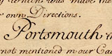
Portsmouth, Hampshire and Chichester, West Sussex:
Text only about the coast from Chichester Harbour to the Solent.
|

|
Southampton &c., Hampshire:
Text about Southampton Water.
The chart shows Southampton Water and
the Solent, the coast from Hurst Castle to Hill Head, including Burseldon,
Beaulieu and Lymington; also the coast of the Isle of Wight from Cowes
to the Needles.
|

|
Burseldon, Hampshire:
Text and chart for Bursledon down to the mouth of the River Hamble running into Southampton Water.
The text also mentions Cowes on the River Medina.
|

|
Beauley, Hampshire:
Text and chart for Beaulieu down to the mouth of the Beaulieu River running into the Solent.
|

|
Lymington, Hampshire:
Text and chart for Lymington to Jack in the Basket in the Solent, at the mouth of the Lymington River.
|

|
Christchurch, Dorset:
Text and chart for Christchurch Harbour, also the Rivers Avon and Stour.
|

|
Poole and Purbeck, Dorset:
Text and chart for Poole, the River Frome and Poole Harbour.
|
|
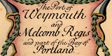
Weymouth and Melcombe Regis, Dorset:
Text and chart for Weymouth and Melcombe Regis at the mouth of the River Wey, including Weymouth Bay and Portland Harbour.
|

|
Exmouth, Devon:
Text and chart of the mouth of the River Exe, including Starcross, Exmouth and Orcombe Rocks.
|

|
Dartmouth, Devon:
Text and chart for Dartmouth, inland along the River Dart to Dittesham, and out to Mew Stone off the coast.
The text also mentions Plymouth.
|

|
Fowey, Cornwall:
Text and chart for Fowey and the mouth of the River Fowey.
The text also mentions Plymouth.
|

|
Falmouth and Helford, Cornwall:
Text and chart for Falmouth and the Carrick Roads, inland on the River Fal beyond the confluence with the River Truro.
The text also describes Helford.
|
|
Summary:
Two text pages.
|
|

|
Harbour locations
|

|
Historical context
notes by Adrian Webb |

|
Chart of The Solent by Greenvile Collins, 1693
|

|
The south coast, Robert Morden 1695.
|

|
Text page transcriptions
|

|
Museum inventory notes and chart transcriptions
|

|
Chart features for Hampshire ports (and Christchurch)
|
|

|
All Old Hampshire Mapped Resources
|
|
 Edited by Jean and Martin Norgate: 2002