

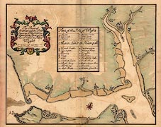
report by Edmund Dummer and Thomas Wiltshaw
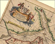
scroll cartouche
foliage cartouche
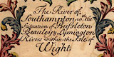
The title cartouche is in scrolls of foliage, coloured red, blue, green and yellow; centre bottom is a bearded face. The title is:-
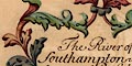
The River of Southampton wth: the Scituation of Bussleton Beauley & Lymington Rivers within the Isle of Wight
Printed in the middle of the map is a table linking letters on the map to an explanation.
compass rose
up is NNW

In the sea, The Solent, is a compass rose. This has four arrow pointers for the cardinal and half cardinal points coloured in red, pink, grey, blue and a yellow fleur de lys marking north. Up on the sheet is about NNW.
sandbanks
foreshore
rocks
The sea is uncoloured. Major sandbanks are marked and tinted pale brown, and some labelled with a letter keying to the table of particulars.
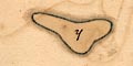
y - BrambleThe sands west of the Isle of Wight are shown but not named.
x - Middle in Southampton River
z - Middle Grounds
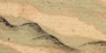
The coastal foreshore is drawn, between the tides? coloured pale brown. River channels are clearly drawn through these flats.
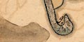
At Hurst Point there is a darker area which could be mistaken for the Shingles sandbank; it ?is a stain on the paper. Hurst Beach, pebbly, is indicated clearly.
Rocks on the foreshore are shown by scattered + signs; for example on the NW edge of the Isle of Wight.
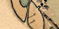
Three large pillars off the island are labelled

a - Needles
At the entrance to the River Meon where Titchfield Lake is marked, are drawn two features which could be taken to be marker posts for the channel.
and west of Calshot.
coastal defence

m - Calshott CastleSome are not, Netley castle and the castles in Yarmouth and West Cowes.
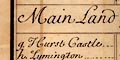
g - Hurst Castle
bridges
lakes
River channels are clearly drawn through foreshore areas and inland. Rivers are not drawn above their estuary, and are not named, but can be identified from an adjacent settlement. Except:-
d - Newton Creekeon the Isle of Wight is labelled, having no settlement.
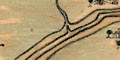
Bridges are drawn by a double line crossing the river at Beaulieu and Redbridge.
A pool is drawn at the boggy area of the River Meon's estuary at Titchfield Haven, labelled:-
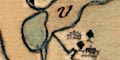
v - Titchfield Lakelake in Hampshire is much used as a term for a river course.
hillocks
Little relief is shown on the map except the clear distinction of sea/foreshore/land and the coast appearance of low cliffs. A few hillocks, some wooded, are drawn on the Isle of Wight, as navigation aids?

Trees are drawn in settlements, coloured emerald green, but other woods are not shown except on a ridge of hills on the island. The spit down to Hurst seems to be covered in bushes.
town walls
town gates
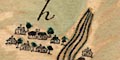
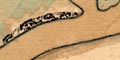
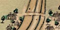
Settlements along the coast are shown by clusters of little houses - look at these magnified, they are nicely done, the rooves tinted slate blue. The size of the cluster matches, sort of, the size of the place.
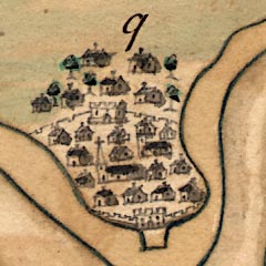
Southampton has town walls, town gates at north and south, and two churches. Other villages and towns have a church drawn with tower or steeple - which seem mostly to match what is there now.
Most places are labelled by a letter keying to the table of particulars, qv.
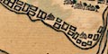
Salterns are shown by a series of rectangular ponds along the coastal land west of the Lymington River.
Collins 1693
Dummer 1698
Click images to enlarge
rotated by 24 degrees, and by Dummer and Wiltshaw 1698.
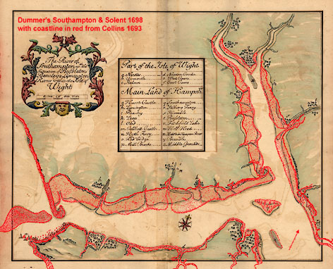
Click for large image
The coastline from Greenvile Collins' 1693 chart (rotated) has been added in red.
report by Edmund Dummer and Thomas Wiltshaw