

report by Edmund Dummer and Thomas Wiltshaw
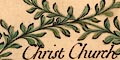
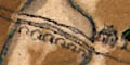
wreath cartouche
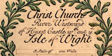
title
The title cartouche bottom centre is a wreath of leaves, tinted green, tied with a red ribbon. The title is:-
Christ Church River Westward of Hurst Castle wth:out ye. Isle of Wight'without' not meaning lacking but outwith (outside).
The cartouche contains:-
scale
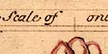
A Scale of one Milewith divisions at quarter miles. The 1 mile = 72.1mm; assuming a modern statute mile this gives a scale 1 to 22290; or, if a sea mile of 6082.95 feet, 1 to 25715. The map scale is about:-
1 to 22000 or 1 to 25000
2.5 or 3 inches to 1 mile
compass rose
up is NW

The map has a compass rose. There are four star points for the cardinal directions, tinted red/pink, and four more for the half cardinal directions, tinted grey/blue. North is marked by a yellow fleur de lys. Up on the sheet is NW.
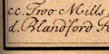
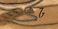
Left and right at the bottom, in plain rectangular cartouches, are explanations of letters used to mark features on the map. Eg:-
cc. Two Mills
rocks
sandbanks
coast appearance
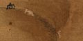
The sea is plain. Off shore at the river mouth are the outlines of rocks or sandbanks, tinted grey, looking like a hazard to navigation. The shore at the river mouth is drawn with circles, perhaps indicating a pebbly shore.
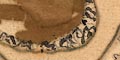
The coast to westward is drawn with the appearance of low cliffs.
harbours
a. Peer now makingfor the harbour.
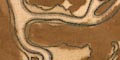
Inland the river is a confusion of channels and creeks and mud flats. It divides into two main arms:-
d. Blandford RiverThe rivers are being described, not named - a pernickety distinction perhaps. They are the River Stour and River Avon respectively.
e. Salisbury River
On a pool by a creek half a mile inland is:-
b. Store-housePresumably a harbour warehouse.
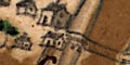
then a smaller one of 2 arches nearer the town, carry a road into Christchurch from the eastward, over two arms of the River Avon.
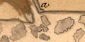
The land area is tinted a muddy brown, with a little green. Westward of the town low hills are suggested in profile, with smaller hillocks west of the river mouth.
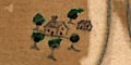
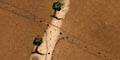
There are a few trees drawn about the land area, tinted emerald green. Most trees are clustered around settlements, or along roads.
streets
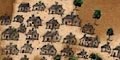
Settlements are drawn by groups of buildings, roofs tinted grey. Christchurch is not labelled, but is implied by the map's title. It has a fine array of buildings drawn along streets.
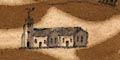
Christchurch Priory is drawn as a great church.
water mills
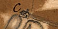
cc. Two Mills
g. Road to PoolAnd eastward out of the town, crossing the River Avon on fine bridges, is:-
f. Road to Lymington
A turning off this road goes by a few houses, southwards to the coastal area.
report by Edmund Dummer and Thomas Wiltshaw