

report by Edmund Dummer and Thomas Wiltshaw
title

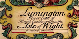
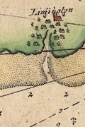
The map's title cartouche bottom centre is a panel surrounded by foliage scrolls tinted in reds, greens and yellows. Top centre is a ?helmet with spears and flags to each side. The title is:-
Lymington River East of Hurst Castle within the Isle of WightThe central item above the cartouche could be a cresset - perhaps the basket of Jack?
The cartouche contains:-
scale
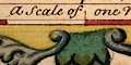
A Scale of one MileThe 1 mile = 72.1mm; assuming a modern statute mile this gives a scale 1 to 22290, or if a sea mile of 6082.96ft then 1 to 25715. The map scale is about:-
1 to 22000 or 1 to 25000
25. or 3 inches to 1 mile
compass rose
up is NW

The map has a compass rose. There are four star points for the cardinal directions, tinted red/pink, and four more for the half cardinal directions, tinted grey/blue. North is marked by a yellow fleur de lys. Up on the sheet is NNW.
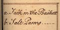
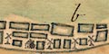
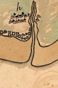
There are tables at left and right at the bottom of the map, in plain rectangular cartouches. These explain letters used to mark some features of the map. Eg:-
b. Salt Panns
foreshore
sea marks
The sea is plain, uncoloured. The expanse of sand or mud flats at the mouth of the Lymington River is tinted sandy brown and is drawn with many creeks off the main channel.
The outer marker of the channel into the river is a post with triangle and circle at the top, named:-
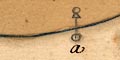
a. Jack in the BaskettThe land is tinted pale green.
harbours
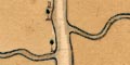
The navigable channel in the river is marked all the way up by posts, the circle at the top tinted dark green.
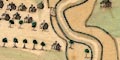
Lymington is by a meander, where there is a landing stage at the harbour.
Settlements are drawn by groups of houses, roofs tinted grey-blue, with groups of trees, tinted emerald green. Lymington, a town, has a church with a tower, and a turret? on that, and is not named. It has a landing stage at the river's edge.
Other settlements are small and unnamed, except:-
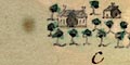
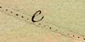
c. Bucklandwhere is drawn a great house.
e. Road to Beauleyrunning westward from Lymington, and:-
d. Road to Christ Churchrunning northward parallel the river.
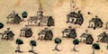
windpumps
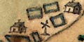
b. Salt Panns
Many rectangular ponds are drawn, tinted blue at their edges, and some windpumps, and some buildings.
Collins 1693
Dummer 1698
Click images to enlarge
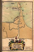
Dummer and Wiltshaw's chart of Lymington has details not shown in the chart by Greenvile Collins.
report by Edmund Dummer and Thomas Wiltshaw