|
FA1998.91:-
|
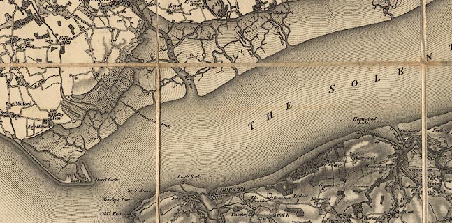
Map, uncoloured engraving, One inch map Old Series, sheet 10, Isle of Wight
and part of Hampshire, scale 1 mile to 1 inch, published under direction of
LtCol Mudge, by the Ordnance Survey, 1810.
|
|
Includes the whole of the Isle of Wight, and the coastal part of Hampshire,
Lymington, Fareham, Gosport, Portsmouth, Havant, etc. To show the whole island
the sheet does not 'fit' with other Hants sheets.
|
|
map feature:-
|
not coloured & sectioned for folding & meridian & scale line &
coast form lines & rivers & woods & forests & parks & relief
& hill hachuring & settlements & roads |
|
inscription:- |
printed -on- top
ORDNANCE SURVEY OF THE ISLE OF WIGHT AND PART OF HAMPSHIRE
|
|
inscription:- |
printed -on- bottom left
-- Published 1st. June 1810, by Lt.Col. Mudge, Tower. |
|
inscription:- |
printed -on- bottom right
Engraved at the Drawing Room in the Tower by Benj. Baker & Assistants. - The
Writing by Ebenr. Bourne.
|
|
inscription:- |
printed -on- bottom edge
Meridian of Dunnose / Latitude 50[].37[].8[] / Longitude 1[].11[].36[]
West
-- with line her and at top edge |
|
inscription:- |
printed -on- top and left borders
[Junction Line with finished Hampshire]
|
|
dimension:- |
scale = 1 to 63360 (nominal) |
 |
|
|
reference:- |
Harley, J B (intro) & O'Donoghue, Yolande (intro): 1981: Old Series Ordnance
Survey Maps of England and Wales & South-central England: Margary, Harry (Lympne
Castle, Kent): vol.3: ISBN 0 903541 03 3 |

|
Map Group -- OS 1810s Old Series -- with Research Notes
|
 |
|

| top of page |
| MN: 30.1.2004 |


