 Map Group BERTIUS 1616


The map studied is in the Map Collection of Hampshire CC Museums Service, item HMCMS:FA2000.7.


title cartouche
strapwork cartouche
TAB. VI. ENGLIAE, IN QUA WARWICUM &c.Map 6, England, in which Warwickshire etc.
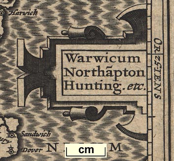
Printed right centre is a strapwork cartouche:-

Warwicum / Northa~pton / Hunting. etc.
up is N
labelled borders

The map is printed with north at the top. The map borders are labelled:-
SEPT
ORIENS
MERI.
OCCIDENSfor septentriones - north, east, meridies - south, and west.

Latitude and longitude scales for a rectangular projection are printed in the borders of the map; divided at 6 degree intervals ie tenths of a degree, marked at degrees. The Latitude runs from 50d 36m N to 53d 6m N. The lngitude scale runs from 18d 3m E to 24d 6m E with London at 20d 42m E. The prime meridian for longitude is about 20d 47m W of Greenwich. (This does not seem to be either the Canaries or Cape Verde Islands?)
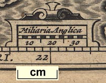
scale

Miliaria Anglicain a strapwork cartouche. This has 30 miles chequered in 2 mile intervals, labelled in 10 mile groups. The 30 miles = 17.1 mm giving a scale 1 to 2823410 on the bad assumption that the mile is a modern statute mile. The map scale is about:-
1 to 2800000
45 miles to 1 inch
coast shaded

The sea is engraved in a moire effect pattern; the sea area south of Hampshire is labelled:-
Oceanus Britannicus
coast shaded

Rivers are shown by wiggly lines tapering inland. Hampshire has:-
River Stour
River Avon
River Bourne
River Test
River Itchen
River Hamble
River Wey [northern]
Blackwater River
River Loddon
River Enborneas well as can be judged. Not all are drawn in correct relationship to the county boundary.
hillocks

Hillocks are used to suggest relief. On this small scale the relief is somewhat notional. Perhaps it is reasonable to recognise parts of the:-
South Downs
North Hampshire Downs
forests

Overlarge tree symbols suggest woodland, again difficult to judge what is eaningful. Perhaps it is possible to recognise:-
Chute Forest.

County boundaries are drawn by dotted lines. Counties are labelled; in the Hampshire area:-
Wiltonia
Berceria
Surria
Sout sexiaand
Southamtonia
A very careful study might show that a limited number of stamps were used when engraving to mark places, and perhaps other features.
Places in Hampshire are:-

Aulton
Basyngstoke
Havant
Kingesclere
Lemrington
Petersfeldt
Southa~ton
Winchester


Published in an enlarged edition of Petrus Bertius's miniature world atlas, 'Petri Bertii Tabularum geographicarum contractarum libri septem.' 1616 (Netherlands?)
Published in an edition of Camden's Britannia abridged by Vitellius: 'Guili. Camdeni Viri Clarissimi Britannia, sive florentiss. Regnorum Angliae, Scotiae, Hiberniae Insularumq. adiacentium ex intima antiquitate descriptio. In epitomem contracta a Regnero Vitellio Zirizaeo, & tabulis Chorographicis illustrata. Amsterdami, Apud Guilielmum Blaeu, MDCXXXIX' 1639.


