 Map Group BILL 1626


Published in 'The abridgment of Camden's Britan~ia. With the Maps of the seuerall Shires of England and Wales. Printed by John Bill Printer to the Kings most Excellent Maiestie, 1626'.


Sizes: wxh, sheet = 19x15cm; wxh, plate = 126x92mm; wxh, map = 119x86mm.


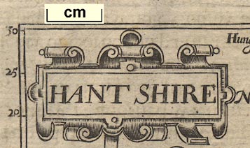
strapwork cartouche

Printed upper left is a strapwork cartouche with the title:-
HANT SHIRE
up is N

The left and bottom map borders have latitude and longitude scales; assumed to be for a rectangular projection. The scales are labelled at 5 minute intervals. Latitude runs up; 40, 45, 50, 55, 51, 5, 10, ... 30. The 51 is 51 degrees. Longitude runs eastward, left to right on the sheet; 10, 15, ... 55, 23, 5, 10, ... 55, 24, 5, 10. The 23 and 24 are marked with a degree sign and a prime, and the 23 is accompanied by 0 minutes. Winchester is about 23d 10m E of the map's prime meridian; it is 1d 19m W of Greenwich. The map's prime meridian is somewhere out in the Atlantic, probably the Cape Verde Islands which were one of the places used for the prime meridian before Greenwich was accepted internationally.
scale
old english mile

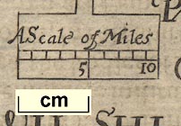
Printed below the title, upper left, is:-
A Scale of MilesThe scale has 10 miles, marked at 1 mile intervals, labelled at 5 and 10 miles. The 10 miles = 19.8 mm gives a scale 1 to 812800 on the improper assumption of a modern statute mile, the map scale is about:-
1 to 810000
13 miles to 1 inchA better estimate of the map's scale can be got from the positions of a number of towns. Using DISTTAB.exe to do the sums this gives a scale 1 to 1057911; the map scale is about:-
1 to 1100000
16.5 miles to 1 inchand the map's 'mile' is an:-
Old English Mile = 1.31 statute miles
sea moire effect

The sea is engraved with a moire effect pattern.
coast shaded
castles

Hurst Castle
Calshot Castle
St. Andrews Castle
bridges

Two bridges are drawn, by a double line across the river, at Stockbridge and Andover.
forests

Some of the old forests are shown by groups of relatively large tree symbols. None are labelled, but it is easy to recognise several: New Forest, Buckholt Forest, Chute Forest, West Bere Forest, Pamber Forest, East Bere Forest, and Woolmer Forest.

The county boundary is a fine dotted line. There are two visible lines; a lighter, less definite, continuous line as well as the bolder dotted line. Perhaps the indefinite line is a rough guide line scratched on the plate before engraving the boundary proper? There are other faint trace lines under/by some rivers.
The detached part of Hampshire to theneast is not included.
Adjacent counties are labelled in various styles, lareg and perhaps swash lettering, eg:-
PART OF WILT SHIREA few towns are also marked and labelled in the adjacent counties around the Hampshire border.

Winchester

Alton
Basingstock

Okeley


