 Map Group BLOME 1681


title
map maker
engraver

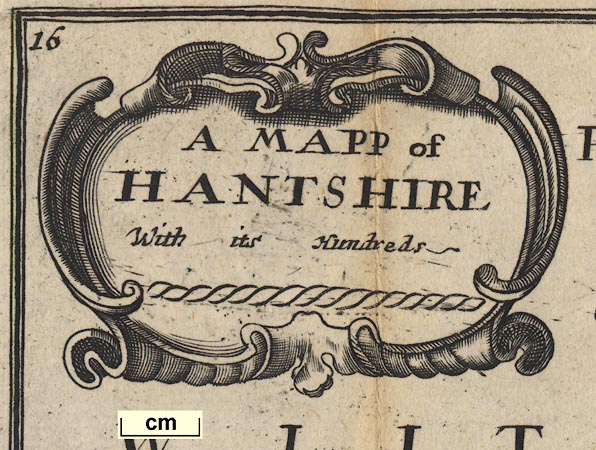
There is a scroll cartouche at the title upper left:-
A MAPP of HANTSHIR With its HundredsLike much of the rest of the map the engraving leaves something to be desired.
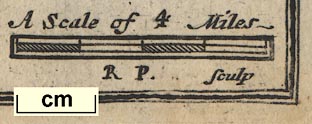
Bottom right is:-
R. P. SculpThis is Richard Palmer; the map maker is Richard Blome.
compass rose

The map's orientation is given by a compass rose. This has star points for the cardinal and half cardinal points; stubby star points for the false points; north is marked by a fleur de lys. Map north is up on the sheet.
scale
old english mile

A Scale of 4 MilesThe 4 miles of the scale line are about 9 1/2 miles! A better estimate of the map scale is got by measuring town positions and comparing these to known positions, now. This was done with DISTTAB.exe, giving a map scale 7.73 statute miles to 1 inch, 1 to 489761. The scale is about:-
1 to 490000 ?
7.5 miles to 1 inchThe map's mile is 2.4 statute miles. It is more likely that the scale line is incorrectly labelled; it is an 8 mile scale not a 4 mile scale. Assuming this then the map mile is an:-
Old English Mile = 1.21 statute milesSource data:-
see:- BLM2DIS.txt
DISTTAB.exe results
sandbanks
ships
THE BRITISH SEAThe sandbank off Hayling is drawn in outline with a dotted line and labelled:-

Y Mackett

A single ship decorates the sea; round bodied, one square sail; it might be possible to make more guesses about the type of ship but these would be very rough - it's a carrack.
coast shaded
cliffs
harbours
Cliffs are labelled east of Christchurch:-

Black cliffA couple of harbours are labelled:-
Hamble haven
Titchfield ha
castles

Calshott Cast
St Andrews Cast
Ruyns of hasel wroth cast
South Castle
bridges


Rivers are shown by wiggly lines tapering inland. An estuary might be shaded, for example the reaches towards Fareham, or have form lines, for example in the Beaulieu river. The drawing of estuaries is not at all to scale. River braiding is shown, for example on the Test south of Stockbridge. Most rivers are not labelled. Labelling on the map is poorly positioned, so:-
Kings Brookenear a stream at Up Somborne, may refer to the stream or to the two hamlet symbols nearby.
The relationship between rivers and roads can only be described as 'messy' engraving.

It is possible that two bridges are drawn at Beaulieu, and 1 more certainly at Fordingbridge - neither is there for a road. There is a clearly drawn bridge on the upper part of the Lymington River. There is also a clear bridge across the Enborne at Newtowne; the road from Kingsclere towards Newbury crosses elsewhere.
hillocks

There is some indication of relief, shown by hillocks. Examples on the Dorset border west of Ringwood, around Hale, the Sussex border east of Clanfield, and near Popham etc. There is no serious attempt to portray the relief of the county.
[ ]eaconis engraved south of Bistoke; it is not clear what the label attaches to. It could be part of a longer label for Toothill Beacon?
woods

There are tree symbols on the map. The woods New Forest has many; there are a few around Subberton where East Bere Forest could be, some around Braughton which could be Buckholt Forest. But they feel a bit 'accidental'.

Parksouth of Lyndhurst. A lot of parks are not drawn. The fences are in need of repair.

The county boundary is a dotted line; pretty blobby engraving. The surrounding counties are labelled, eg:-
PART OF BARK SHIREHardly anything is engraved in the surrounding counties (this is not unusual). Roads and rivers are continued just over the border. Farnham in Surrey is shown.
table of hundreds

hundred boundaries are slightly finer dotted lines. The hundred areas are numbered, keyed to a table of hundreds:-
Hundreds in Hant= Shire

WINCHESTER

Odyam
Stokbridg

Littleton
Crawley

Owselbury
Butser hill has a line
Sidmanton has a half cross
Harbridg has a decorated cross
It might be possible to interpret the map maker's intentions; but it might not repay the effort?


Roads are drawn by a double line; the spacing is variable, the lines get tangled in rivers and text labels, etc. It may be that they were engraved last, or were even a late addition. Many of the road segments which are expected on a map of this period are shown; but not all. For example, while the London to Lands End road manages to find its way across the county, the London to Portsmouth road does not.

Several road segments are labelled with a number in a circle, which could be the road distance in miles. It is not made clear where the segments begin and end.
The routes shown, modern place names, are:-
from Surrey, about the Golden Farmer; then Blackwater, Hartfordbridge, Basingstoke, Whitchurch, Andover, Over Wallop, Hampshire; into Wiltshire. [Ogilby plates 25, 26; Lands End road]
branch from Andover, Hampshire; into Wiltshire. [Ogilby plate 32; Barnstable road]
branch from Basingstoke, through Sutton Scotney, Stockbridge, Hampshire; then Lopcombe Corner, Wiltshire and beyond. [Ogilby plate 53; Weymouth road]
branch from Basingstoke, through Kingsclere, Hampshire; into Berkshire. [part of Ogilby plate 81; Oxford to Chichester road, missing from Alton onwards]
branch from Surrey, about the Golden Farmer; across a corner of Hampshire; Farnham, Surrey; then Alton, New Alresford, Twyford, to Southampton, Hampshire AND from Southampton, through Romsey; into Wiltshire. [Ogilby plate 51; Southampton and Salisbury road]
from outside New Alresford, through Winchester, Romsey, Ringwood, Hampshire; into Dorset AND from Dorset through Christchurch to Lymington, Hampshire. [Ogilby plate 97; Poole road, and to Lymington, the section Southampton to Winchester missed]
from West Sussex; through Petersfield, Bramdean, to Winchester, Hampshire. [Ogilby plate 39; branch off Chichester road at Midhurst]
from Petersfield, through Horndean, Cosham, to Portsmouth, Hampshire. [part of Ogilby plate 30; Portsmouth road, missing road to Petersfield]
[Ogilby plate 83 missed, only crosses a corner of Hampshire by Shipton Bellinger]


Published in a second edition 'Speed's Maps Epitomiz'd ... London, Printed and Sold by Sam Lownes over against Exeter Exchange in the Strand. 1685.'
Published in 'England Exactly Described Or a Guide to Travellers In a Compleat Sett of Mapps of all the County's of England being a map; for each County where every Town & Village in each County is Perticulerly Expressed with the Names and Limits of every Hundred &c. Very Usefull for all Gentlemen and Travellers being made fitt for the Pockett; Printed Coloured and Sold by Tho: Taylor at ye Golden Lyon in Fleetstreet where are Sold all Sorts of Mapps and fine French Dutch and Italian Prints.' 1715.
Published in 'England Exactly Described Or a Guide to Travellers In a Compleat Sett of Mapps of All the Counties of England; being a Map for each County, Wherein every Towne and Village is Particularly Express'd with the Names and Limits of every Hundred, and the Roads and Distances in Measured Miles according to Mr. Ogilby's Survey. Very Usefull for Gentlemen and Travellers being made fit for the Pockett. Printed Coloured and Sold by Tho: Taylor ...' 1717.
Published in 'England Exactly Described ... Sold by Tho: Bakewell, next ye Horn Tavern in Fleet Street.' about 1731.


Blome, Richard: 1716 (2nd edn): England Exactly Described: (London)
England Exactly Described; Or, a Guide to Travellers In a Compleat Sett of Mapps of All the County's of England ...
engraved by R. Blome and W. Hollar
London Printed Coloured and Sold by Tho. Taylor at ye Golden Lyon in Fleet Street 2nd edition 1716


