 Map Group BOWEN 1755


The map studied is in the Map Collection of Hampshire CC Museums Service, item HMCMS:FA2000.47.
The map size is: wxh, sheet = 24.5x20cm, wxh, plate = 205x182mm, wxh, map = 197x173mm.


scroll cartouche
map maker
publisher

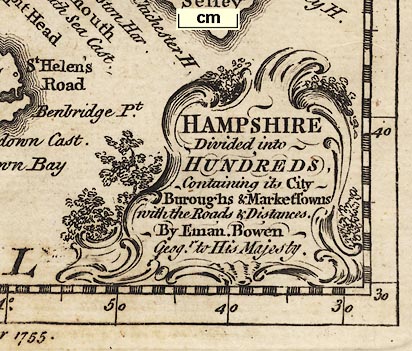
Printed lower right is a scroll cartouche with leafy decoration:-
HAMPSHIRE Divided into HUNDREDS, Containing its City Buroughs & Market Towns with the Roads & Distances. By Eman. Bowen Geogr. to His Majesty.Printed at the bottom is:-
Engrav'd for the General Magazine of Arts & Sciences for W. Owen at Temple Bar 1755.
compass rose
up is N

Printed on the right is a simple compass rose, a circle with lines for the four cardinal directions, north marked by a fleur de lys, east by a cross. The map has north at the top of the page.
scale

British Statute Mileschequered in miles, labelled at 3 mile intervals. The 12 miles = 30.2 mm giving a scale 1 to 639474; the map scale is about:-
1 to 640000
10 miles to 1 inch

The map borders have rectangular latitude and longitude scales, chequered at 1 minute intervals, labelled at 10 minute intervals. The map covers 0d 30m to 2d 5m W, 50d 30m to 51d 25m N. The bottom scale states:-
West Longitude from LondonThe:-
longitude, Winchester = 1d 14 or 1d 15m Wsuggesting a prime meridian about 4 degrees W of Greenwich, perhaps St Paul's?
Explanation.
[circle, buildings and tower, two stars] Borough Towns.
[circle, buildings and tower] Market Towns.
[upright line with a U symbol] Post Stages.
sea plain
ENGLISH CHANNEL
coast form lines
headlands
harbours

The coast line is emphasised by form lines which continue into harbours and estuaries in a wonderful pattern round islands.
Some headlands are noticed, eg:-
Hengistbury Hd.
Spit HeadMost harbours are not named, but see:-
Langston Harb.and a couple more.
castles
fortifications

Hurst C.
Calshot C.
St. Andrews C.
Worth C.
South Sea Cast.and at Portsmouth there is, labelled:-
A Fort

Rivers are drawn by wiggly lines tapering inland. Some are labelled, eg:-
Stour R
Tees R.
Itchin R.The major river systems are shown in part, with some tributaries. A little braiding is shown. Bridges are not drawn; in the drawing rivers tend to overrun roads where they cross! see, for example, at Ringwood.
hillocks

Little hillocks, scattered liberally, are used to indicate relief.
forests

East Bere Forest
New Forest
Buckholt Forest
Chute For
West Bere For

Parks are drawn by a ring of paling fence. None are labelled.

The county boundary is a dotted line. Adjoining counties are labelled, eg:-
P. OF WILTSHIREA few close-by places outside the county are drawn, eg:- Poole, Ludgershall, Downton, Farnham and Chichester ... The detached part of Hampshire on Sussex is not shown.
table of hundreds

Hundred boundaries are dotted lines. The ares are labelled with a letter which keys them to a table of hundreds printed upper left:-
Hundreds.
A. Pastrow
BBB. Evinger
C Kingsclear
...The list runs A..Z without J and V, a..p without j. The multiple letters indicate in a hundred in so many parts; Evinger is in 3 parts for instance.
post stages

WINCHESTER

Stockbridge
HavantSouthampton has italic block caps.

Wunston
Blendworth
It is not possible to be certain from the map, but the post stages on the London to Exeter route are:-
... Basingstoke, Whitchurch, Andover ...on the London to Southampton route:-
... Alton, Winchester, Southampton ...on the London to Poole route:-
... Alton, Winchester, Romsey, Ringwood ... Christchurch, Lymingtonon the London to Portsmouth route:-
... Portsmouth.
road distances

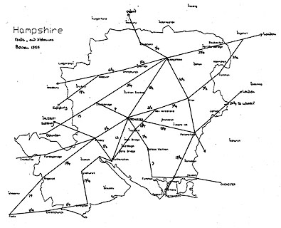
Roads are drawn by double lines, solid or dotted to indicate fenced or unfenced stretches. The roads include all the Ogilby routes plus a few bits more, missing the small piece of his route pl.83 that crosses the county near Shipton Bellinger. The extra routes are: Basingstoke to Winchester; Winchester to Stockbridge, but not onwards; Southampton to Lymington; Romsey to Fordingbridge; Winchester through Bishops Waltham, Fareham, Cosham, Havent to Chichester.
Routes out of the county are labelled with their destination, eg:-

to Oxford
to Salisbury
to Londonthough some routes are continued outside the county, for example to Poole, Chichester, and through Farnham. The out of county destinations are upside down on the left of the map, on their side across the top: they are all up the right way if you rotate the map anticlockwise from upside down!
Road distances between towns are given by figures alongside the road segment, eg:-
21 1/4for Basingstoke to Stockbridge. Some distances are missing; it is not always clear what distance is being given.


Published in 'The Natural History Of England; Or, A Description of each particular County, In regard to the Curious Productions of Nature and Art. Illustrated by a Map of each County, and Sculptures of Natural Curiosities. Vol.I. Containing ... By Benjamin Martin. London: Printed and sold by W. Owen, Temple-Bar, and by the Author, at his House in Fleet-street, MD CC LIX.' ie 1759.


