 Map Group BOWLES 1780


oval cartouche
map maker

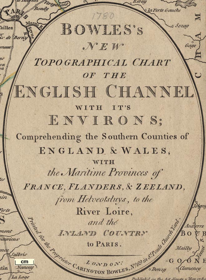
Printed in an oval title cartouche, lower right:-
BOWLES'S NEW TOPOGRAPHICAL CHART OF THE ENGLISH CHANNEL WITH IT'S ENVIRONS; Comprehending the Southern Counties of ENGLAND & WALES, WITH The Maritime Provinces of FRANCE, FLANDERS, & ZEELAND, from Helveotsluys, to the River Loire, and the INLAND COUNTRY to PARIS.
LONDON: Printed for the Proprietor CARINGTON BOWLES, No.69 in St. Pauls Church Yard.Printed below the title, in the corner of the chart is:-
Published as the Act directs, 2 Mar. 1780.Notice the phrase 'topographical chart'. This item is both a chart, of the English Channel, and a map, of coastal regions of England and France.
compass rose
rhumb lines
up is N
magnetic variation

Printed on the left, in the English Channel, is a compass rose; no circle, star points for cardinal, half cardinal, and false points, lines for by points, North marked by a fleur de lys. The map is printed with North at the top of the sheet.
Rhumb lines are drawn across sea areas from the compass rose and four other centres; bold solid lines for cardinal and half cardinal directions, dotted lines for false points, solid lines for by points. The centres are not arranged in any circle; the crossings of rhumb lines can be confusing in places.
At one of the centres, south of Wight, the vertical North line is labelled:-
True NorthA line to the west, left, is labelled:-
Magnetic Meridianand the angle labelled:-

Variation 21[d].(I would take issue with the word meridian.)
scale

Nautical Leagues 20 to a Degreeand numbering as:-
...2, 3, 4, 5, 10, 15, 20, ...Measuring 3 degrees latitude is 60 leagues is 180 nautical miles = 276.1 mm, gives a scale 1 to 1208747. The map scale is about:-
1 to 1200000
16.5 nautical miles to 1 inch
(19 miles to 1 inch)
The prime meridian runs through central London, perhaps St Paul's Cathedral, not Greenwich. Roughly:-
longitude, Winchester = 1d 12m WThe bottom scale of longitude is labelled:-

Longitude West from London.
Longitude East from London.The chart includes from 4d 10m E to 7d 15m W, 47d 10m to 52d 20m N; roughly southern England and wales from Cardigan Bay to Orford Ness.
sea plain
depth soundings
tides
sandbanks
ENGLISH CHANNEL
Spit Head

Depth soundings, in fathoms, are printed over the sea areas. Most of these do not come close to the coasts, and only become interesting in the channels of clusters of sandbanks in the narrows between England and France, the Thames estuary, and the islands off the Flanders coast.

Tidal streams are marked by arrows, or darts. And times of high water are given by roman numbers, eg:-

XI 1/2This is explained lower left:-
The small figures express the depth of water in fathoms.
The Roman figures indicate the time of High water, or rather the end of the Stream setting Eastward on the New & Full Moon.
The Darts shew the direction of the currents produced by the Tides.Some sandbanks are shewn as dotted areas, perhaps, labelled. Relevant to Hampshire for example:-
Shinglesand less easily read:-
Middle BankNotice the:-

Sea Owers labelled south of Selsey. Rocks might be shewn by crosses (X) as at:-
Barn Rockseast of Selsey.
coast shaded
foreshore
headlands
lighthouses
harbours

The coast line is shaded for emphasis, and foreshore areas are shown dotted. Some headlands are labelled, eg:-
St. Albans Hd.
Selsea BillA lighthouse might be shown, eg:-

Eddistone / Light Houseon a rock. And harbours might be labelled, eg:-
Pool Harb.Hampshire's large harbours can be recognised, but are not labelled.
castles
Hurst Cas.
Calshot
St. Andrews C.

Tees R.
Itchin R.
Avon R.
Bourn R. [tributary of Avon]

County boundaries are a dotted line. The county areas are labelled, eg:-
HAMP- / SHThe detached part of Hampshire in Sussex is drawn, but not labelled.

WINCHESTER

Alton
AndoverExcept
SOUTHAMPTONin italic block caps.

Sutton [Scotney]
Popham Lane
Horndean

Roads are drawn by a double line; only major routes being shown at this scale. The routes through Hampshire are listed below.


Alton
Andover
Basingstoke
Waltham
Christchurch
Fareham
Fordingbridge
Gosport
Havant
Kingsclear
Lymington
Alresford
Odiham
Petersfield
Portsmouth
Ringwood
Rumsey
Southampton
Stockbridge
Whitchurch
Winchester


from London; through Bagshot, Surrey; then Basingstoke, Overton, Whitchurch, Andover, Hampshire; on through Salisbury, Wiltshire; and west towards Lands End.
branch from Andover, Hampshire; through Ambresbury, Wiltshire; and west.
branch from Basingstoke, through Popham Lane, Sutton [Scotney], Stockbridge, Hampshire; joining the Lands End road at [Lopcomb Corner], Wiltshire.
branch from Popham Lane, through Winchester, Rumsey, Ringwood, Hampshire; to Pool, Dorset.
branch from Bagshot, Surrey; across a corner of Hampshire; through Farnham, Surrey; then Alton, Alresford, Winchester, to Southampton, Hampshire.
branch from Alton, through Warnford, Fareham, to Gosport, Hampshire.
from London; through Godalming, Surrey; then Lippock, Petersfield, Horndean, to [about Cosham, no room to draw the bit to Portsmouth].


