 Map Group BRANNON 1859


The map size is: wxh, sheet = 50x62.5cm; wxh, map = 464x583mm. Note: although the map includes the Isle of Wight, these notes mostly refer just to Hampshire.


map maker
engraver
publisher

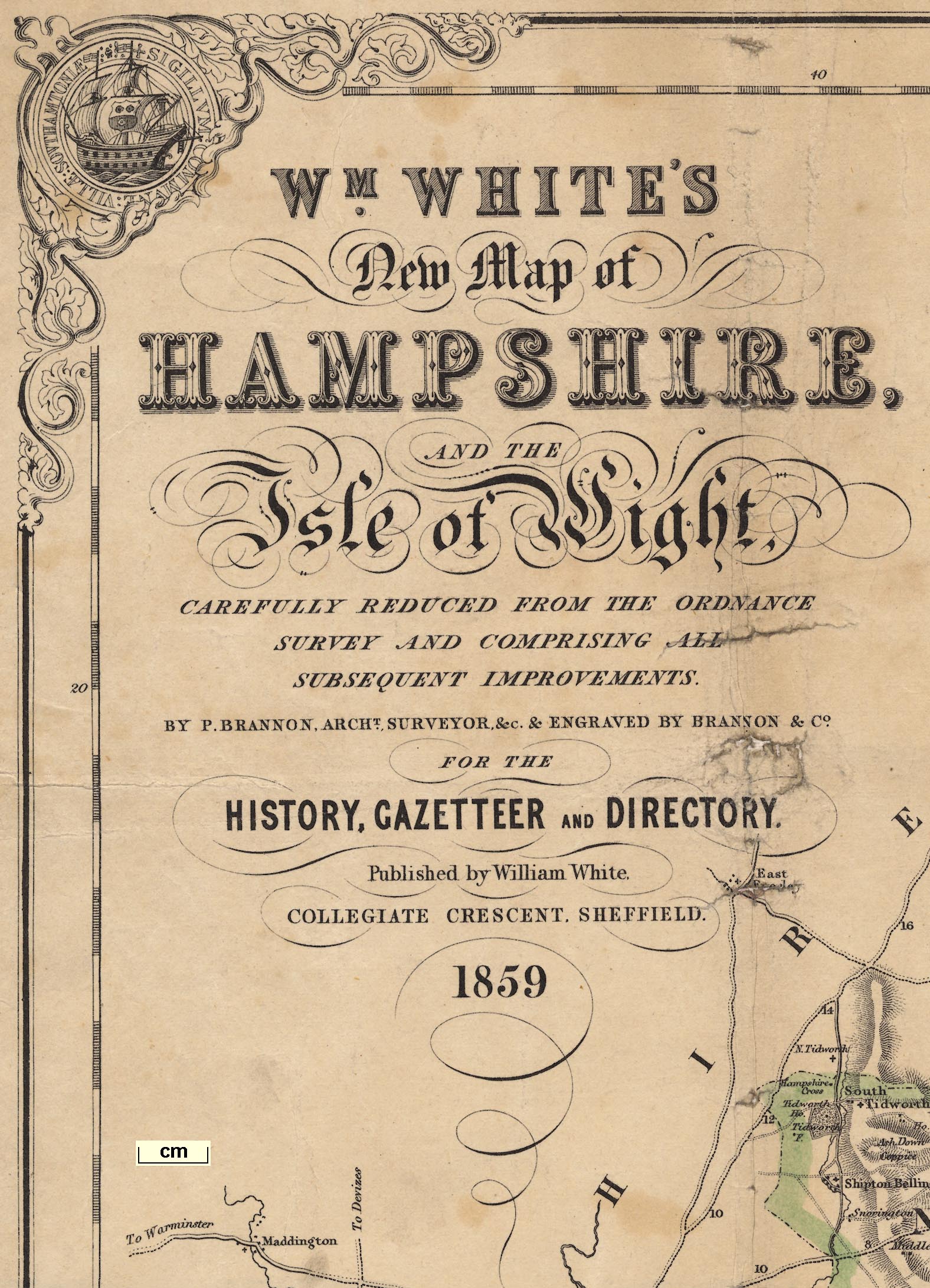
Printed upper left is:-
WM. WHITE'S New Map of HAMPSHIRE, AND THE Isle of Wight, CAREFULLY REDUCED FROM THE ORDNANCE SURVEY AND COMPRISING ALL SUBSEQUENT IMPROVEMENTS. BY P. BRANNON, ARCHT. SURVEYOR, &c. & ENGRAVED BY BRANNON & Co. FOR THE HISTORY, GAZETTEER AND DIRECTORY, Published by William White, COLLEGIATE CRESCENT, SHEFFIELD, 1859.

Printed upper centre is a royal coat of arms, supporters, mottoes, and all. They are the arms used by George III from 1816, with the inescutcheon of the House of Hanover surmounted by a crown. Victoria, ruling since 1837, had no inescutcheon. Her arms were like those the queen uses today.
Printed in the border corners are roundels with design and caption:-
Upper left:-
SIGILLUM COMMUNE VILLAE SOUTHAMTONIAE
three masted warship, arms of Southampton on the main sailUpper right:-
SIGILLUM COMMUNE DE PORTEMUTHA
ancient one masted ship, single sail furled, sailors working on yardsLower right:-
Signium commie ville de niuport in Insula de Wight
ancient single masted ship with one main sailLower left:-
SEAL OF THE MAYOR, ALDERMEN & CITIZENS OF THE CITY & SOKE OF WINCHESTER
coat of arms of Winchester, and:-
GUL: IV / JAN 1858
WINCHESTER CATHEDRALlower right:-
OSBORNE HOUSE
compass rose
up is N
scale

Scale of 3 Miles to one Inchgraduated and labelled in miles from 0 to 9, and a leftward part graduated in quarter miles, labelled 1/2 and 1. The 9+1 miles = 82.1 mm giving a scale 1 to 196022 assuming a statute mile; the map scale is about:-
1 to 200000
3 miles to 1 inchFrom measuring the position of the 21 towns in Hampshire and comparing them with their 'correct' positions, it is possible to get other estimates of the scale. This process uses DISTTAB.exe software. The map scale is about 1 to 193103, that is:-
1 to 190000
3 statute miles to 1 inchor using the scale line, 1 to 196364, that is:-
1 to 190000
3.10 map miles to 1 inch
map mile = 0.98 statute mileThe correlation between town to town distances on the map to 'correct' distances is 1.00.
sandbanks
ENGLISH CHANNEL
SPITHEAD
Stokes BaySome sandbanks are indicated by dotted outline. The Bramble can be recognised; or there might be a label, eg:-

The Horse Sand and Tail
coast form lines
coast appearance
headlands
foreshore
sea marks
lighthouses
lightships
harbours

The coast line is emphasised by form lines out to a line for the foreshore; perhaps the low tide mark, also showing channels in harbours and estuaries. From this line form lines continue seawards conforming to the new line. The effect is very attractive.
Some headlands are labelled, eg:-
Hengistbury Head
Gilkicker Pt.and along the coasts of Poole and Christchurch Bays there are labels for a series of chines, cliffs and bunnys.
The coast appearance, low cliffs, is drawn on the shore of Christchurch Bay. A line of hill hachures continues this suggestion, low rising land from the coast, from Lymington to Exbury.
Some lighthouses are indicated, for example at Hurst Spit:-
Lightsand at Southsea:-
Southsea Cas. & Lt.Also notice some lightships. In the entrance to Southampton Water is a ship with a single mast labelled:-

Calshot Lt.and off the east end of the Isle of Wight is a two masted ship:-
Nab LightA few harbours are labelled:-
Key haven
LANGSTON HARBOUR
PORTSMOUTH HARBOURChannels are shown in the larger harbours, and small islands are shown, perhaps labelled, eg:-

Pewit Is.
castles
fortifications

Hurst Castle
Fort Gomer
Monckton Fort [star shape]
Blockhouse [squarish with four bastions]
[Fortifications around Gosport]

[fortification around the Royal Dockyard and town, Portsmouth]
Southsea Cas. ... [star shape]
Lumps
Fort Cumberland [angular fort]
ponds
bridges

Rivers are drawn by wiggly double lines, perhaps with form lines, narrowing upstream to a single tapering wiggly line (!). As well as rivers, numerous channels, 'lakes', are shown in foreshore areas and harbours. Braiding is shown; there is a splendid lot of this at Ringwood.
All the major river systems are shown, with numerous tributaries. Some rivers are labelled, small as well as large (but not all the large rivers), eg:-
Dark water Brook
River Test
RIVER ENBOURNE
BLACKWATER RIVER
Bramshaw Brook
Holy Water [Woolmer]Where appropriate, rivers are continued outwith the county area.
A number of ponds are shown, with form lines. These might be labelled, eg:-
Woolmer Pond
Sowley PondBridges do not seem to be marked especially, but might be labelled, eg:-
Knights Br.
Eversley Bre.
Ram bridgeOthers are implied by roads or railways crossing, and interrupting, streams, for example see Northam Bridge.
hill hachuring

Magdalen Hill
St. Catherines Hill
Easton Down
Flower Down
Compton Down
Worthy Down
Twyford Downaround Winchester.
Near Exton thre is a hill named:-
Beacon Hillelsewhere I have seen little sign of beacons.
forests
trees

A lot of woodland is indicated by little tree symbols, with bushes and dotted lines for undergrowth. Some of these have an outline boundary. A number are labelled, eg:-
Doles Wood
Basely Copse
Highden Woodas well as the larger:-
FOREST OF BERE [East Bere Forest]
Woolmer Forest [correctly lacking trees]
Alice Holt ForestAn individual tree might be labelled, eg:-
Marplit Oakby a road W of Boldre, without a tree symbol.

Twyford Park
Cadland Parkas well as the more ancient:-
Hackwood Park
Dogmersfield ParkThe park may contain house, roads, ponds, etc, for example at Highclere, whereis:-
Highclere Castleand:-
in each case the house labelling the park.

The county boundary is a chain doted line; dot dot dash. Similar lines divide the adjacent counties which are labelled, eg:-
SUSSEXThe detached part of Hampshire in Sussex is not shown.
street map

WINCHESTER

ANDOVER
LYMINGTONor in one case, larger block caps:-
SOUTHAMPTON

Lower Wallop
Milton

Middle Wallop
ArnewoodThis style of lettering is used generally for other features.
road distances
turnpike gates

A comprehensive network of roads is drawn by double lines; solid or dotted for fenced and unfenced. Main roads are broader, and mostly have light bold lines; lesser roads are narrower.
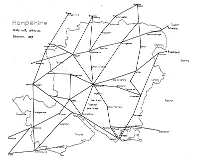
Figures along some roads, at 2 mile intervals, give distances from town to town. You have to look carefully to know what town. This distance numbering is another clue to what the map maker regarded as the major road network.
There are clues to turnpike gates along some roads. Eg:-
Gate [at Vernhams Dean]A junction might be labelled, eg:-
Lobcombe Corner
Bordon Cross [SW of Froxfield]

The Bell [S of Bramshaw]
Deluge Hut [halfway from Winchester to Stockbridge]
Horse and Groom [N of East Tisted]
Nth. Camp
Sth. Campand notice:-
The Queens Pavilion
hillforts
Ancient Entrenchment
Iron Minesand at Sowley, below what looks to be a dammed pond:-
Sowley Forge
Salt Works
Queenwood College [SW of Broughton]
Winchester Race CourseW of Stockbridge:-
Stockbridge Race GroundN of Lyndhurst:-
Race Course
Gibbet [SW of Ringwood]
Monumenton Farley Mount is labelled, and on Portsdown is:-
Nelsons Monument
Folly Hilland more directly, at North Waltham is:-
Folly


Railways are drawn by a bold smooth line sweeping across the landscape, passing under and over roads. This line is not added over everything else willy-nilly as on some maps; it is part of the original engraving. Some railways are named. The following railways can be recognised (the 'modern' names are the identifying names used in Old Hampshire Gazetteer), date order:-
SOUTHAMPTON AND LONDON RAILWAY
BASINGSTOKE AND READING RAILWAY
SOUTH COAST RAILWAY
READING AND REIGATE RAILWAY
ALTON BRANCH
PORTSMOUTH DIRECT RAILWAY
REDBRIDGE AND ANDOVER RAILWAY (late Andover Canal)still drawn as the canal.
BERKS AND HANTS OR GREAT WESTERN RAILWAY
GREAT WESTERN RAILWAY


Canals are mostly shown by a triple line, light bold light, perhaps labelled.
REDBRIDGE & ANDOVER RAILWAY (late Andover Canal)
Tunnelloop around Dogmersfield Park; leaves county at Aldershot; labelled:-
Basingstoke Canal
Arundel and Portsmouth Canal
Salisbury Canal partly filled upthe segment from Redbridge to Southampton not shown.


hundreds
electoral data
EXPLANATION
The Police Divisions are distinctly coloured.

The broad blue belt is the boundary of the Northern and Southern Divisions.
The thin blue lines are the Boundaries of the Parliamentary Boroughs.
Railways & Stations [bold line, circles beside line]The Police Divisions have dashed boundaries which are tinted differently. The areas are numbered, keyed to a table of data:-
THE PETTY SESSIONAL & POLICE DIVISIONS
are coloured distinctly, and the LARGE FIGURES near the centre of each correspond with the FIGURES in the following List if these Divisions, so that their names may be readily ascertained on the Map.
1 Alton
2 Andover
3 Basingstoke
4 Droxford
5 Fareham
6 Kingsclere
7 New Forest and Lymington
8 Odiham
9 Petersfield
10 Ringwood
11 Romsey
12 Southampton
13 Winchester
14 Isle of Wight
The 38 HUNDREDS and 12 LIBERTIES into which Hampshire is divided were amalgamated and arranged in the above named DIVISIONS in 1834.Printed on the right is more descriptive text and tables:-
HAMPSHIRE AND THE ISLE OF WIGHT had 405,370 inhabitants in 1851: they extent over 1070,200 acres: the rateable annual value of their lands and buildings is about L1,514,100.
PARLIAMENTARY DIVISIONS & BOROUGHS
The broad blue belt extending across the county is the boundary of the NORTHERN and SOUTHERN DIVISIONS, each of which sends two Members to Parliament. THE ISLE OF WIGHT sends one member as a separate county or division. The BOROUGHS are WINCHESTER CITY, PORTSMOUTH, SOUTHAMPTON, ANDOVER, LYMINGTON and NEWPORT each sending two, and Christchurch and Petersfield each sending one member.
COUNTY POLLING PLACES.
NORTHERN DIVISION
WINCHESTER, Alton, Whitchurch, Andover, Bishopstoke, Bishops Waltham, Kingsclere, Odiham, New Alresford, Petersfield
SOUTHERN DIVISION
SOUTHAMPTON, Fareham, Gosport, Havant, Lymington, Portsmouth, Ringwood, Romsey
FOR THE ISLE OF WIGHT,
Newport, Cowes and Ryde.


Printed in parts of the map borders that are not obscured by decoration, coat of arms, and extremities of the county spilling over the frame, are scale of latitude and longitude; chequered in minutes, labelled at 10 minute intervals. The bottom scale is labelled:-
Longitude West from GreenwichAs well as can be judged the:-
longitude, Winchester = 1d 18.5m W
1d 00m = 4248 and y = 216
0d 52m = 4808
1d 00m = 4412 and y = 6890
0d 52m = 4998
51d 00m = 3506 and x + 226
51d 10m = 2371
51d 00m = 3492 and x = 5437
51d 10m = 2358
about equal
ie 0 within errors


HISTORY, GAZETTEER AND DIRECTORY OF THE COUNTY OF HAMPSHIRE INCLUDING THE ISLE OF WIGHT, AND COMPRISING A General Survey of the County AND SEPARATE HISTORICAL, STATISTICAL AND TOPOGRAPHICAL DESCRIPTIONS OF ALL THE HUNDREDS, PARISHES, TOWNSHIPS, CHAPELRIES, TOWNS, PORTS, VILLAGES, HAMLETS, & UNIONS; THE DIOCESE OF WINCHESTER; THE SEATS OF ALL THE NOBILITY AND GENTRY; MAGISTRATES AND OFFICERS; AND A GREAT VARIETY OF OTHER ARCHAEOLOGICAL, ARCHITECTURAL, AGRICULTURAL, BIOGRAPHICAL, BOTANICAL AND GEOLOGICAL INFORMATION. SECOND EDITION. BY WILLIAM WHITE, AUTHOR OF SIMILAR WORKS FOR LEICESTERSHIRE, RUTLAND, LINCOLNSHIRE, NORFOLK, SUFFOLK, ESSEX, YORKSHIRE, AND MANY OTHER COUNTIES. PROCE - CLOTH, 30s.; HALF-BOUND, 35s.
SHEFFIELD: WILLIAM WHITE, 18 & 20 BANK STREET. LONDON: SIMPKIN, MARSHALL, & CO. 1878. ENTERED AT STATIONERS' HALL.
WHITE'S New Map of HAMPSHIRE, AND THE Isle of Wight, CAREFULLY REDUCED FROM THE ORDNANCE SURVEY AND COMPRISING ALL SUBSEQUENT IMPROVEMENTS. FOR THE HISTORY, GAZETTEER AND DIRECTORY. Published by William White, 18 & 20 BANK STREET, SHEFFIELD. 1878.


